タグ

永久凍土

14 件の記事

The patterned ground below Mugi Hill on Mount Kenya lies in an area of seasonal frost.[1]

パターン地(Patterned Ground)の形成メカニズムと多様な幾何学形態

パターン地周氷河地形凍結融解サイクル永久凍土
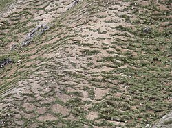
Garland-like solifluction formed in the Swiss National Park

ソリフラクション(土流)のメカニズムと地形的特徴

ソリフラクション土流周氷河地域凍結融解作用
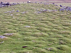
Earth hummocks in England

ハモック(小丘)の地質学的分類と形成メカニズム

ハモック地質学氷河地形周氷河作用
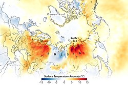
Surface Temperature Anomaly (°C) June 18–25 of 2021 compared to average temperatures of the same time period 2003-2013

2021年ロシア大規模森林火災シベリアを襲った未曾有の危機と環境への影響

ロシア森林火災シベリア気候変動ヤクティア
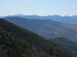
The Adirondack Mountains of Upstate New York form the southernmost part of the Eastern forest-boreal transition ecoregion, constituting part of the world's taiga biome.

タイガ北半球に広がる亜寒帯針葉樹林の生態系と現状

タイガ亜寒帯針葉樹林バイオーム北極圏
The relative magnitude of the top 6 climate change feedbacks and what they influence. Positive feedbacks amplify the global warming response to greenhouse gas emissions and negative feedbacks reduce it.[1] In this chart, the horizontal lengths of the red and blue bars indicate the strength of respective feedbacks.

気候変動フィードバックのメカニズムと地球温暖化への影響

気候変動フィードバック正のフィードバック負のフィードバック気候感度
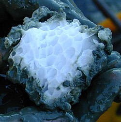
Methane clathrate block embedded in the sediment of hydrate ridge, off Oregon, USA

クラスレート水和物の構造と可能性氷に似た結晶が秘めるエネルギーと環境への影響

クラスレート水和物ガスハイドレートメタンハイドレート結晶構造
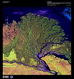
Lena River Delta: False-color satellite image from the NASA / USGS "Earth as Art" collection

レナ川シベリアを貫くロシア最長の雄大な大河

レナ川シベリアロシア北極海
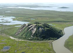
Ibyuk pingo near Tuktoyaktuk, northern Canada

ピンゴ(氷丘)の形成メカニズムと世界的な分布

ピンゴ氷丘永久凍土周氷河地形
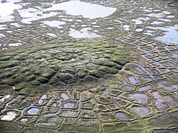
Example of a periglacial landscape with both pingos and polygon wedge ice near Tuktoyaktuk, Northwest Territories, Canada

周氷河環境のメカニズムと地形的特徴

周氷河永久凍土凍結融解作用周氷河地形
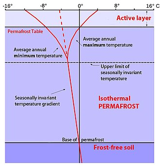
Permafrost temperature profile. Permafrost occupies the middle zone, with the active layer above it, while geothermal activity keeps the lowest layer above freezing. The vertical 0 °C or 32 °F line denotes the average annual temperature that is crucial for the upper and lower limit of the permafrost zone, while the red lines represent seasonal temperature changes and seasonal temperature extremes. Solid curved lines at the top show seasonal maximum and minimum temperatures in the active layer, while the red dotted-to-solid line depicts the average temperature profile with depth of soil in a permafrost region.

永久凍土の正体と地球環境への影響気候変動がもたらすリスクと科学的視点

永久凍土気候変動メタン放出能動層
A snowy landscape of Inari located in Lapland (Finland)

北極圏の地理と生態系極限環境がもたらす自然と文化

北極圏北極海ツンドラ永久凍土