地球の最北端に位置する北極圏(Arctic)は、北極点を取り囲む極寒の地域です。その名称は古代ギリシャ語で「熊」を意味する言葉に由来しています。この地域は単なる氷の世界ではなく、複数の国家にまたがる広大な陸地と、複雑な海域から構成されるダイナミックなエコシステムを形成しています。
地理的には、ノルウェー、スウェーデン、フィンランド、ロシア、アメリカ合衆国(アラスカ)、カナダ、デンマーク(グリーンランド)、そしてアイスランドの一部が含まれます。これらの地域は、北極海およびそれに隣接する海域によって結ばれています。
Key Facts
- 定義:北極圏(Arctic Circle)より北に位置する極地帯。
- 地質的特徴:地表が凍結したままの永久凍土と、樹木が生えないツンドラ地帯が広がる。
- 主要国:ロシア、カナダ、アメリカ、デンマーク、ノルウェー、スウェーデン、フィンランド、アイスランド。
- 環境課題:地球温暖化による海氷の減少と、遠方からの汚染物質の流入。
- 戦略的価値:北西航路や北東航路などの新たな海上輸送ルートの開拓。
北極圏の自然環境と生態系
過酷な気候と地形
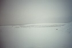
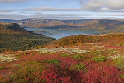
北極圏の陸地は、季節によって雪や氷に覆われるのが特徴です。特にツンドラと呼ばれる地域では、地下に永久凍土(一年中凍結している地層)が存在するため、高い樹木が育たず、低い植生が中心となります。
適応した動植物
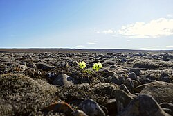
この極限環境においても、独自の進化を遂げた生命が息づいています。植物では、厳しい寒さに耐える北極ポピーなどが知られています。
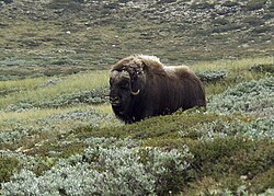
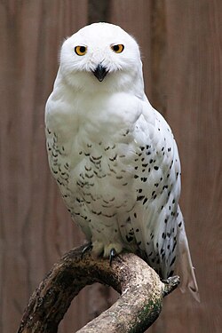
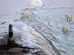
動物界では、陸上のムスクox(ジャコウウシ)や、空を舞うシロフクロウ、そして海氷を拠点とするホッキョクグマなど、寒冷地への高度な適応能力を持つ種が生存しています。また、海洋生態系を支えるプランクトンから、魚類、海棲哺乳類に至るまで、複雑な食物連鎖が構築されています。
人間社会と文化的適応
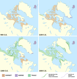
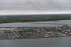
北極圏には、古くからこの過酷な環境に適応して生活してきた先住民たちが暮らしています。彼らは独自の文化を築き、自然と共生する知恵を継承してきました。歴史的には、ドーセット文化からトゥーレ文化への移行など、人口分布や文化圏の変遷が見られます。
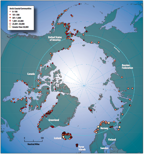
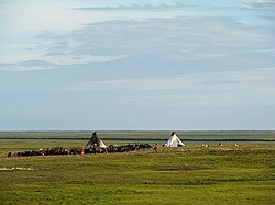
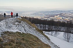
現代においても、ロシアのネネツ人によるトナカイ遊牧などの伝統的な生活様式が維持されている一方で、ムルマンスク(ロシア)のような北極圏最大の都市が発展するなど、多様な居住形態が存在しています。
地政学的な重要性と環境問題
航路の開拓と資源争奪
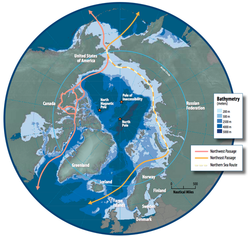
地球温暖化に伴い海氷が減少したことで、北極海を通る新たな航路への注目が集まっています。具体的には、カナダ北岸を通る北西航路と、ロシア北岸を通る北東航路(およびその一部である北極海航路)があり、輸送時間の短縮が期待されています。
環境破壊と気候変動の危機
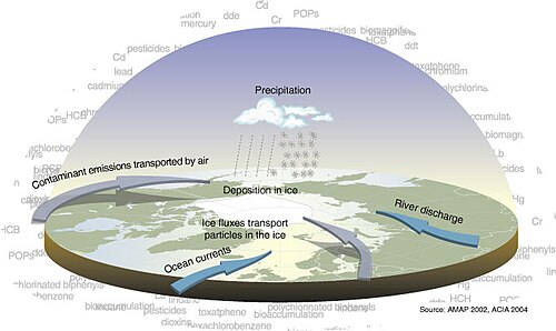
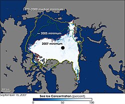
北極圏は地球上の他の地域よりも温暖化の影響を強く受けています。海氷の面積は劇的に減少しており、これが海洋生態系や気候パターンに深刻な影響を与えています。また、遠く離れた工業地帯からの汚染物質が気流に乗って運ばれる「長距離輸送汚染」も大きな課題となっています。
![The shrinking Arctic: Parts of Norway north of the Arctic Circle has a temperate climate with the 1991–2020 normals, such as Skrova near Svolvær with mean annual temperature of 6 °C (43 °F), four months above 10°C and no month below 0 °C (32 °F).[64]](/images/30/dd/30ddea908bd9c6870a93a1eeb168f74f00b9ff8c04459f030a8d478b8691b4ab.jpg)
北極圏の主要地域まとめ
| 地域・島嶼名 | 所属国・自治体 | 特徴 |
|---|---|---|
| グリーンランド | デンマーク王国 | 世界最大の島、広大な氷床 |
| アラスカ | アメリカ合衆国 | 北米北西部の広大な州 |
| ヌナブト / ユコン | カナダ | 北極諸島を含む広大な準州 |
| シベリア / ムルマンスク | ロシア | 世界最大の北極圏陸地面積 |
| スヴァールバル諸島 | ノルウェー | 北極点に近い研究拠点 |
| ラップランド | フィンランド / スウェーデン / ノルウェー / ロシア | サーミ人の伝統的な居住地域 |
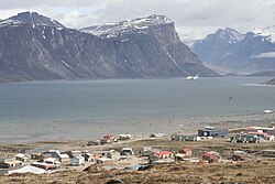
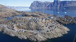
北極圏の景観は、バフィン島やウマンナク島に見られるように、切り立った岩壁と氷河が織りなす荘厳な美しさに満ちています。
Frequently Asked Questions
北極圏とは具体的にどこからどこまでを指しますか?
一般的に、北緯66.5度付近にある北極圏(Arctic Circle)より北の地域を指します。これには北極海だけでなく、ロシア、カナダ、アメリカ、北欧諸国などの北端部分が含まれます。
ツンドラと永久凍土の違いは何ですか?
ツンドラは、寒冷な気候のため樹木が生えない「植生帯(地表の様子)」を指します。一方、永久凍土は、地中の土壌が2年以上連続して氷点下にある「地層の状態」を指します。
なぜ北極圏の温暖化は深刻なのですか?
北極圏では、氷が溶けて地面や海面が露出すると、太陽光を反射せずに吸収しやすくなるため、さらに温度が上昇するという正のフィードバックが働くためです。
北極圏に住んでいる人々はどのような生活をしていますか?
イヌイットやサーミなどの先住民は、伝統的に狩猟や漁業、トナカイの遊牧などで生計を立ててきました。現在は近代的な都市生活と伝統的な生活が共存しています。
北西航路と北東航路は何が違うのですか?
北西航路はカナダの北側を通って大西洋と太平洋を結ぶルートであり、北東航路はロシアの北側を通るルートです。どちらも海氷の減少により、船舶の航行可能性が高まっています。
References
- The word was originally pronounced without the /k/ sound, but the pronunciation with the /k/ sound is nowadays very common. The c was added to the spelling for etymological reasons and then began to be pronounced.
📸 フォトギャラリー