タグ

マリネリス峡谷

8 件の記事

Topographic map of Mars showing the highland-lowland boundary marked in yellow, and the Tharsis rise outlined in red (USGS, 2014).[1]

火星の地質構造とテクトニクス二分された惑星の謎に迫る

火星テクトニクス北半球低地南半球高地
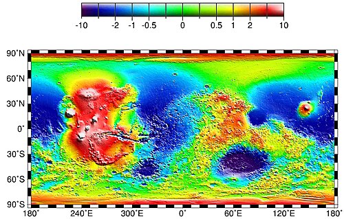
Global topography of Mars based on MOLA data. The Tharsis bulge is the large area at left (shown in shades of red and white). Amazonis and Chryse Planitiae are the blue areas left (west) and right (east) of Tharsis, respectively. In this image, the higher average elevation of the southern hemisphere (zonal spherical harmonic degree 1) has been removed to highlight the elevation contrast of Tharsis with the rest of the planet.

タルシス地域火星最大級の火山台地とその地質学的謎

火星タルシス火山オリンポス山
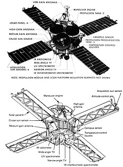
A schematic of Mariner 8/9, showing the major components and features

マリナー9号火星周回軌道への初到達と赤い惑星の真の姿

マリナー9号火星探査NASAオリンポス山
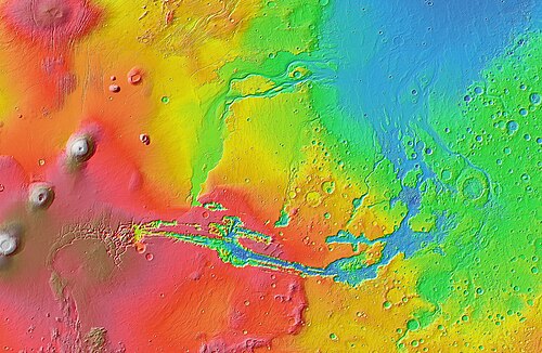
Topographic map of Valles Marineris with its associated outflow channels and their surroundings, based on MOLA altimetry data

マリネリス峡谷火星に刻まれた太陽系最大の巨大裂け目

マリネリス峡谷火星太陽系最大タルシス膨隆
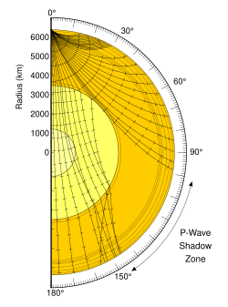
Illustration of the shadow zone of a P-wave for Earth. S-waves don't penetrate the outer core

火星地震(マーズクエイク)の正体赤い惑星の内部構造を解き明かす

火星地震マーズクエイクInSightSEIS
Generalised geological map of Mars[1]

火星の地質学赤い惑星の構造と歴史を解き明かす

火星地質学アレオロジータルシス
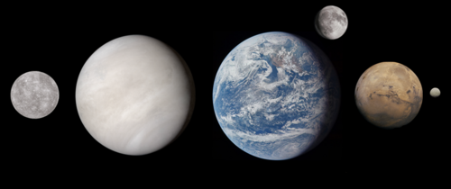
Mars depicted to scale alongside the planetary-mass objects of the Inner Solar System. From left: Mercury, Venus, Earth, the Moon, Mars and Ceres.

火星の全貌赤い惑星の地質、環境、そして人類の挑戦

火星赤い惑星太陽系オリンポス山
Mars depicted to scale alongside the planetary-mass objects of the Inner Solar System. From left: Mercury, Venus, Earth, the Moon, Mars and Ceres.

火星の全貌赤い惑星の地質、環境、そして人類の挑戦

火星太陽系オリンポス山マリネリス峡谷