タグ
オスマン帝国
13 件の記事

イスラム教の象徴とシンボリズム色・旗・図像の歴史的意味
イスラム教シンボル三日月シャハーダ
![Flag used by the Ottoman Empire between c. 1480 and 1780.[8][9][10][11][12][13][14][15][16][17][18][19][20][21]](/images/b2/48/b248434e6c28840faf8f0362e05c6f8049f6b56963a85807417b3898dcdb5a2d.png)
オスマン帝国の国旗三日月と星の象徴が辿った変遷
オスマン帝国国旗三日月と星トルコ国旗
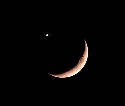
星と三日月のシンボル古代から現代に至る歴史と意味の変遷
星と三日月オスマン帝国イスラム教 シンボル国旗 歴史
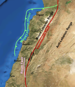
ガリラヤ地震(1837年)死海変換断層がもたらした悲劇と地質学的分析
ガリラヤ地震1837年死海変換断層サフェド
![Some henges at Göbekli Tepe were erected as far back as 9600 BC, predating those of Stonehenge by over seven millennia.[48]](/images/cf/4a/cf4a428df8e5eb9aa40afb2dc72e049042d63e9670c57d7728428c82a23f3817.jpg)
トルコ共和国アジアと欧州を繋ぐ歴史と文化の十字路
トルコTürkiyeイスタンブールオスマン帝国
![Europe during the Last Glacial Maximum, c. 20,000 years ago. Anatolia was connected to the European mainland until c. 5,600 BCE,[8][9][10] when the melting ice sheets caused the sea level in the Mediterranean to rise around 120 m (390 ft),[9][10] triggering the formation of the Turkish Straits.[8][9][10] As a result, two former lakes (the Sea of Marmara and the Black Sea)[8] were connected to the Mediterranean Sea, which separated Anatolia from Europe.](/images/0c/3a/0c3a43a34ef3cca3945a6876e6c008ad62d9eae75dddd4f285cf2d7910af47d2.png)
アナトリア半島文明の交差点としての地理と歴史
アナトリア小アジアトルコ地理ヒッタイト
📖
ヴォイオス地域の地名変遷と歴史的背景
ヴォイオスアノ・ヴォイオスカト・ヴォイオスカスタノホリア
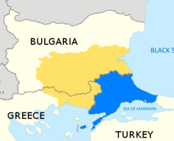
東トラキア(欧州側トルコ)の地理・歴史・文化的な重要性
東トラキアトルコ欧州側トルコイスタンブール
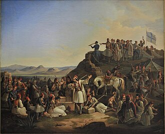
ゲオルギオス・カライスカキスとギリシャ独立戦争の軌跡
ゲオルギオス・カライスカキスギリシャ独立戦争ルメリミソロンギ
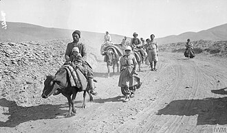
アッシリア人ジェノサイドオスマン帝国における悲劇の歴史
アッシリア人ジェノサイドオスマン帝国サイフォ
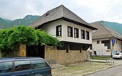
イヴォ・アンドリッチオスマン帝国時代のボスニアを描いたノーベル賞作家
イヴォ・アンドリッチノーベル文学賞ボスニア・ヘルツェゴビナドリナの橋
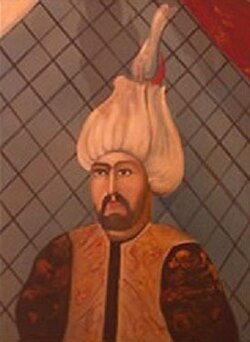
ドリーナ川の橋イヴォ・アンドリッチが描いたバルカンの歴史と悲劇
ドリーナ川の橋イヴォ・アンドリッチノーベル文学賞ユーゴスラビア