タグ

地質学

596 件の記事

📖

火星の岩石命名ルールと探査機が発見した注目個体

火星岩石NASA探査機
📖

ティンティナ岩が明かす火星の水分履歴と地質学的意義

ティンティナ火星キュリオシティゲールクレーター
refer to caption

扇状地(Alluvial Fan)の形成メカニズムと地理的特性

扇状地堆積地形土石流河川地形
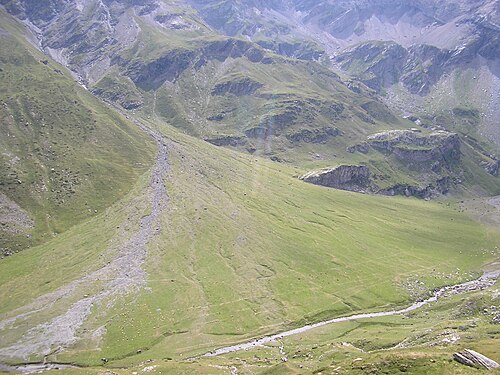
Scientists believe that groundwater sapping created these gullies in Noachis Terra on Mars.[citation needed] NASA image.

地下水サッピングによる地形形成のメカニズムと特徴

地下水サッピング地形学シアターヘッドU字谷
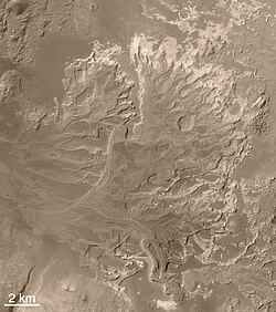
The Eberswalde delta, seen by MGS. Note the meanders with cutoffs, now seen in inverted relief.

火星の谷ネットワーク形成メカニズムと古代気候の謎

火星谷ネットワーク古代気候液体の水
📖

マアディム谷火星に刻まれた巨大な水の痕跡

マアディム谷火星流出チャネルグセフクレーター
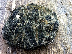
Serpentinite from the Maurienne valley, Savoie, French Alps

サーペンティナイト(蛇紋岩)の科学形成から生命の起源、産業利用まで

サーペンティナイト蛇紋岩蛇紋岩化作用超塩基性岩
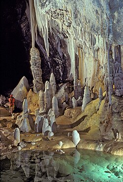
Lechuguilla Cave, New Mexico, United States

洞窟の科学と神秘形成プロセスから人類史への影響まで

洞窟スペレオロジーカルスト地形鍾乳洞
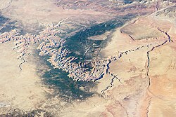
Image of the Grand Canyon and surrounding area taken from the International Space Station

グランドキャニオンの地質と歴史コロラド川が刻んだ地球の記憶

グランドキャニオンコロラド川アリゾナ州地質学
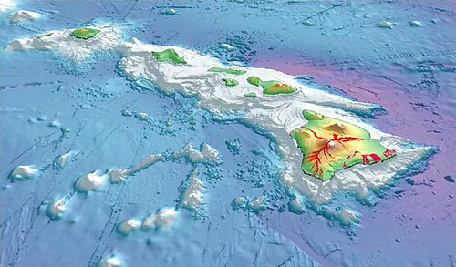
To illustrate Mauna Kea's dry prominence, imagine raising the sea level of the Pacific Ocean to submerge the top of Mauna Kea. Then slowly lower it again. The first thing to appear is the peak of Mauna Kea. Then Mauna Loa and peaks of the surrounding Hawaiian Islands will emerge from the ocean. If the ocean drains further, the island around Mauna Kea will grow and merge with the adjacent islands. Continue draining until a land bridge forms between the Hawaiian Islands and a continent so that it is possible to walk all the way there without getting wet. Stop draining at this point, and this bridge is the key col of a dry Mauna Kea, connecting it to Mount Everest. Mauna Kea's peak stands 30,610 ft (9,330 m) above this key col.

マウナケア山の全貌ハワイの最高峰が持つ地質学的価値と天文学的重要性

マウナケアハワイ楯状火山天文台
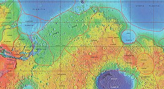
MOLA map showing boundaries for Arabia Terra and other nearby regions.

アラビア・テラ火星最古の地層に刻まれた火山と水の記憶

アラビア・テラ火星地質学スーパーボルケーノ
📖

アマゾニス平原火星の地質学的若さとアイスランドとの類似性

アマゾニス平原火星地質学溶岩流