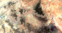
Image of the Grand Canyon and surrounding area taken from the International Space Station
← ホームへ戻る
グランドキャニオンコロラド川アリゾナ州地質学国立公園

グランドキャニオンの地質と歴史コロラド川が刻んだ地球の記憶

🗓 2026年8月11日

アメリカ合衆国アリゾナ州に位置するグランドキャニオンは、地球の悠久の歴史を視覚的に体験できる世界最大級の峡谷です。コロラド川の絶え間ない浸食作用によって形成されたこの地は、単なる観光地ではなく、地質学的なタイムカプセルとしての価値を持っています。

宇宙からもその巨大な姿を確認できるこの峡谷は、訪れる者に自然の圧倒的な力を突きつけます。
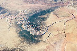
Image of the Grand Canyon and surrounding area taken from the International Space Station

主要な事実(Key Facts)

  • 所在地: アメリカ合衆国アリゾナ州
  • 形成要因: コロラド川による浸食作用
  • 推定年齢: 約500万〜600万年前から形成開始
  • 規模: 長さ約446km、幅は約6.4kmから29kmに及ぶ
  • 底部の標高: 約800m(2,600フィート)

地球の層を読み解く地質学と水文学

グランドキャニオンの最大の特徴は、露出した地層にあります。ここでは、数億年にわたる地球の堆積記録が垂直に積み重なっており、地質学者はこれらの岩層を分析することで、かつての地球環境を復元しています。
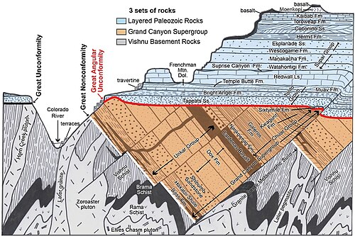
Diagram showing the placement, age and thickness of the rock units exposed in the Grand Canyon

峡谷の形成には、コロラド川の強力な流れが決定的な役割を果たしました。川が岩盤を深く削り取る一方で、崖崩れなどの質量 wasting(物質移動)が起こり、峡谷の幅を広げてきました。
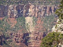
Rockfalls in recent times, along with other mass wasting, have further widened the canyon

また、地表に現れる水は川だけではありません。地下水が地表に到達して形成されるリボンフォールズのような滝は、この地域の複雑な水文学的構造を示しています。
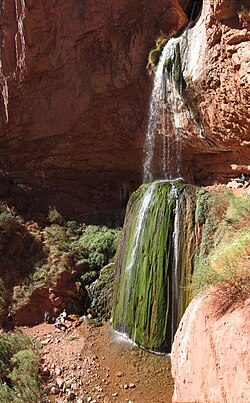
Ribbon Falls, near the North Kaibab Trail, represents ground water reaching the surface

上空から見ると、コロラド川が蛇行しながら大地を切り裂くダイナミックな光景が広がっています。
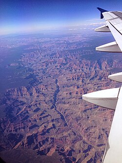
The Grand Canyon from an airplane, with the Colorado River visible
Grand Canyon, Arizona, Nevada, Lake Powell to Lake Mead, June 27, 2017, Sentinel-2 true-color satellite image. Scale 1:450,000.

人類の足跡と探検の歴史

この険しい地には、古くから先住民族が暮らしていました。ナンコウィープ・クリークに見られる先住プエブロ族の穀物倉庫などは、彼らがこの過酷な環境に適応して生活していた証拠です。
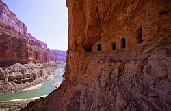
Ancestral Puebloan granaries at Nankoweap Creek

ヨーロッパ人の到達は後年になります。1540年から1542年にかけて、フランシスコ・バスケス・デ・コロナド率いるスペイン探検隊がこの地に足を踏み入れ、ガルシア・ロペス・デ・カルデナスが初めて峡谷を望んだと伝えられています。
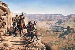
La conquista del Colorado (2017), by Augusto Ferrer-Dalmau, depicts Francisco Vázquez de Coronado's 1540–1542 expedition. García López de Cárdenas can be seen overlooking the Grand Canyon.

その後、19世紀に入るとアメリカによる本格的な探検が始まりました。1872年のウィラー遠征隊による写真記録や、ジョン・ウェズリー・パウエルによる大胆な川下り探検は、グランドキャニオンの全貌を世界に知らしめることとなりました。
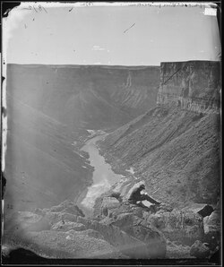
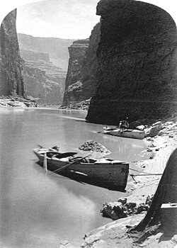
William Bell's photograph of the Grand Canyon, taken in 1872 as part of the Wheeler expedition
Noon rest in Marble Canyon, second Powell Expedition, 1872

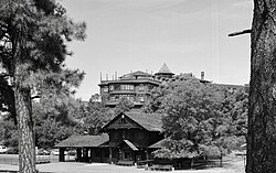
20世紀に入ると、観光開発が進み、グランドキャニオン・ビレッジやエル・トバー・ホテルなどの施設が整備され、多くの人々が訪れる国立公園としての体制が整いました。
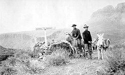
David Rust, c. 1910
Railway Station and El Tovar Hotel, Facing WNW, Grand Canyon Village. 1994 photo, HAER
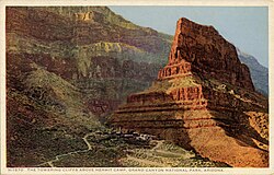
Fred Harvey postcard, The Towering Cliffs above Hermit Camp

多様な生態系と気候の変動

グランドキャニオンは、標高差が激しいため、多様な「ライフゾーン(生命帯)」が存在します。底部の低地から頂上の高地まで、ソノラ砂漠のような乾燥地帯から、寒冷なカナディアン・ハドソニアン帯まで、異なる気候帯が共存しています。
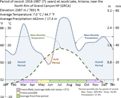
Grand Canyon Climate Summary Chart (NPS)

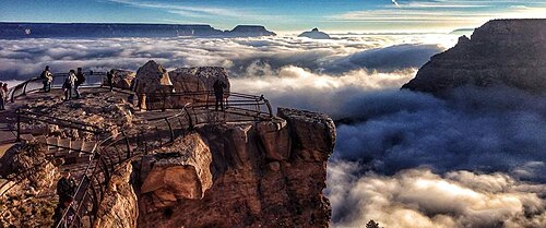
季節によっては、峡谷全体が雪に覆われたり、気温逆転現象によって幻想的な霧が立ち込めたりすることもあります。
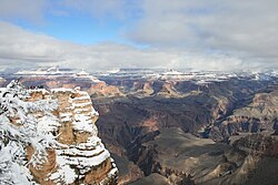
Grand Canyon covered with snow
Natural fog sometimes fills the canyon, during temperature inversions

また、森林管理の一環として行われる計画的な野焼き(処方火災)は、生態系の維持に不可欠な役割を果たしています。

Smoke from prescribed fires on the South Rim, as seen from Yavapai Point, April 2007.[94]

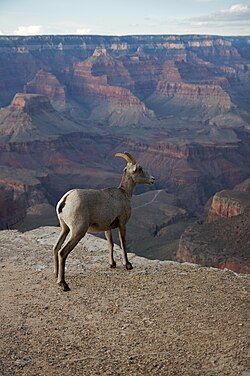
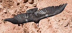
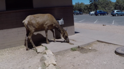
動物相も非常に豊かです。絶滅危惧種のカリフォルニアコンドルや、断崖絶壁に生息するビッグホーンシープ、そして広大な森を歩くエルクなど、多様な野生動物がこの地を棲みかとしています。
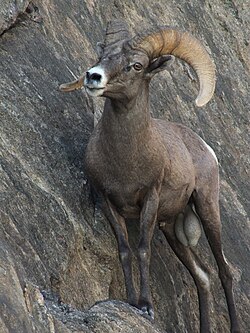
A bighorn ram perched on a cliff in the Grand Canyon
A bighorn ewe at the Grand Canyon, 2008
A California condor in flight, photographed from Navajo Bridge at Marble Canyon, 2008. Wild condors are numbered to aid wildlife researchers. As of April 2009, there were 172 wild California condors known.
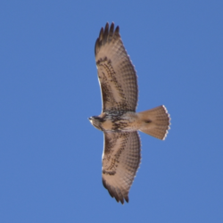
Red-tailed Hawk flying at the south rim of Grand Canyon
An elk searching for water at Grand Canyon National Park in 2018

現代の観光と安全な利用

現在、グランドキャニオンではラフティングやハイキングなど、多彩なアクティビティが楽しまれています。しかし、急激な気温変化や険しい地形は、時に重大な事故を招きます。
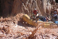
Rafters in the Grand Canyon pass one of the rapids of the Colorado River

救助活動にはヘリコプターが導入されるなど、安全対策が講じられていますが、訪問者には十分な準備と注意が求められます。
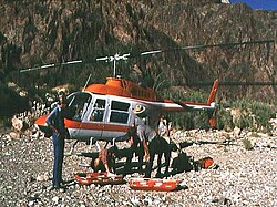
Grand Canyon rescue helicopter, 1978

地域全体の地理的状況を把握することで、この壮大な自然のスケールをより深く理解できるでしょう。
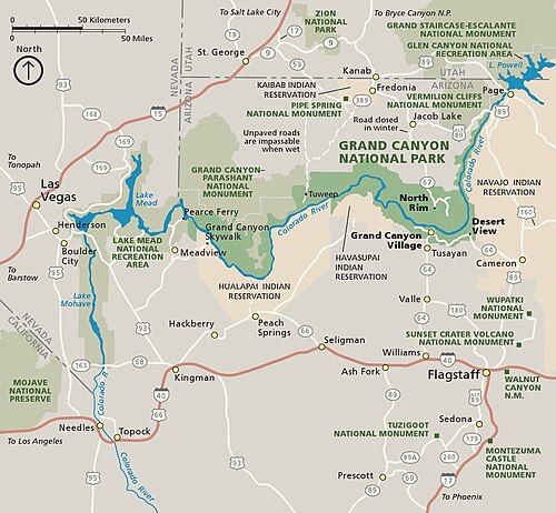
Grand Canyon regional map
グランドキャニオンの基本データまとめ
項目 詳細内容
主要河川 コロラド川
地質学的年齢 約500万〜600万年前(峡谷形成)
最大幅 約29km
主な野生動物 カリフォルニアコンドル、ビッグホーンシープ、エルク
主な歴史的人物 ジョン・ウェズリー・パウエル、コロナド

Frequently Asked Questions

グランドキャニオンはどのようにしてできたのですか?

主にコロラド川による浸食作用によって形成されました。川の流れが長い年月をかけて岩盤を深く削り、同時に崖崩れなどの現象が横方向への拡大を促したことで、現在の巨大な峡谷となりました。

地層から何がわかるのですか?

露出した地層は地球の歴史を記録した本のようなものです。堆積した岩石の種類や順序を分析することで、かつてここが海だった時代や、乾燥した陸地だった時代など、数億年前からの環境変化を知ることができます。

どのような動物に会える可能性がありますか?

希少なカリフォルニアコンドルをはじめ、ビッグホーンシープやエルク、レッドテイルホークなどの鳥類など、多様な野生動物が生息しています。

訪問する際に注意すべき点はありますか?

極端な気温差や険しい地形によるリスクがあります。特に夏季の猛暑や、十分な水分補給なしでのハイキングは危険であり、安全管理と適切な装備が不可欠です。

先住民族との関わりはありますか?

はい。ハバスパイ族やフアラパイ族など、古くからこの地域に居住していた先住民族がおり、彼らの文化や遺構(穀物倉庫など)が今も残されています。

References

  1. : Öngtupqa, : Wi:kaʼi:la, : Bidááʼ Haʼaztʼiʼ Tsékooh, : Paxa'uipi, Spanish: Gran Cañón or Gran Cañón del Colorado

📸 フォトギャラリー

Image of the Grand Canyon and surrounding area taken from the International Space Station
The Grand Canyon from an airplane, with the Colorado River visible
Grand Canyon, Arizona, Nevada, Lake Powell to Lake Mead, June 27, 2017, Sentinel-2 true-color satellite image. Scale 1:450,000.
Diagram showing the placement, age and thickness of the rock units exposed in the Grand Canyon
Rockfalls in recent times, along with other mass wasting, have further widened the canyon
Ribbon Falls, near the North Kaibab Trail, represents ground water reaching the surface
Ancestral Puebloan granaries at Nankoweap Creek
La conquista del Colorado (2017), by Augusto Ferrer-Dalmau, depicts Francisco Vázquez de Coronado's 1540–1542 expedition. García López de Cárdenas can be seen overlooking the Grand Canyon.
William Bell's photograph of the Grand Canyon, taken in 1872 as part of the Wheeler expedition
Noon rest in Marble Canyon, second Powell Expedition, 1872
David Rust, c. 1910
Railway Station and El Tovar Hotel, Facing WNW, Grand Canyon Village. 1994 photo, HAER
Fred Harvey postcard, The Towering Cliffs above Hermit Camp
Grand Canyon covered with snow
Smoke from prescribed fires on the South Rim, as seen from Yavapai Point, April 2007.[94]
Natural fog sometimes fills the canyon, during temperature inversions
Grand Canyon Climate Summary Chart (NPS)
A bighorn ram perched on a cliff in the Grand Canyon
A bighorn ewe at the Grand Canyon, 2008
A California condor in flight, photographed from Navajo Bridge at Marble Canyon, 2008. Wild condors are numbered to aid wildlife researchers. As of April 2009, there were 172 wild California condors known.
Red-tailed Hawk flying at the south rim of Grand Canyon
An elk searching for water at Grand Canyon National Park in 2018
Grand Canyon regional map
Rafters in the Grand Canyon pass one of the rapids of the Colorado River
Grand Canyon rescue helicopter, 1978