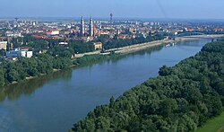
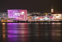
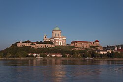
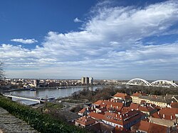
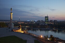
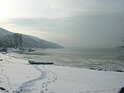
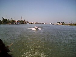
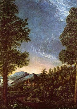
ヨーロッパ大陸を東西に貫くドナウ川は、単なる水路ではなく、多様な文化と歴史を繋ぐ生命線です。ドイツの黒い森から始まり、黒海へと注ぐこの大河は、世界でも稀に見る多くの国境を越える国際河川として知られています。その壮大な流れは、険しい峡谷から広大なデルタ地帯まで、多彩な景観を創り出しています。
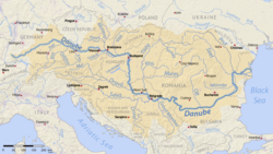
Key Facts
- 全長:約2,850kmに及び、欧州で2番目に長い河川です。
- 流域国:ドイツ、オーストリア、スロバキア、ハンガリー、クロアチア、セルビア、ブルガリア、ルーマニア、ウクライナの計10地域(モルドバを含む)に影響を及ぼします。
- 河口:ルーマニアとウクライナにまたがる広大なドナウ・デルタを経て黒海へ流入します。
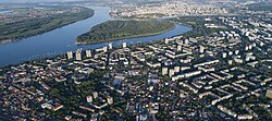
- 主要都市:ウィーン、ブダペスト、ベオグラードなど、複数の首都を通過します。
- 流域面積:約801,463平方キロメートルという広大な範囲をカバーしています。
河川の始まりから終点まで:地理的構造
源流と上流の旅
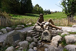
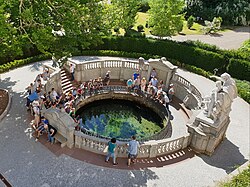
ドナウ川の始まりには、地理的な視点と象徴的な視点の2つの源流が存在します。地理的な最上流は、ドイツのフルトヴァンゲンにあるブレグ川の源流(標高1,078m)とされています。一方、ドナウエシンゲンにあるドナウ川の象徴的な源流は、ブリガッハ川とブレグ川が合流して正式に「ドナウ」となる地点として親しまれています。
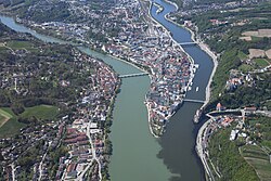
上流地域では、パッサウにおいてイン川とイルツ川が合流し、川幅と水量が増加します。この地点では、合流する川によって水の色が異なる「三色の合流」が見られることで有名です。
中流から下流への展開
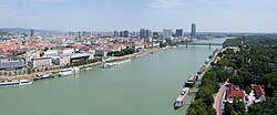
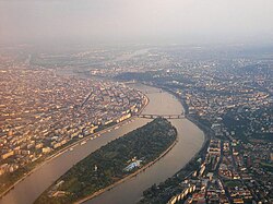
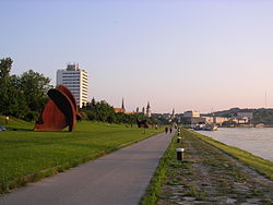
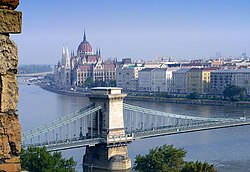
中流に進むと、川はウィーンやブダペストといった大都市を通り、欧州の政治・経済の中心地を繋ぎます。特にハンガリーのブダペストでは、15もの橋が川に架かり、都市の象徴的な景観を形成しています。
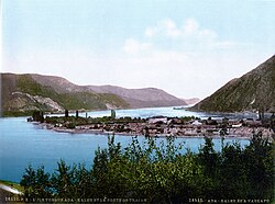
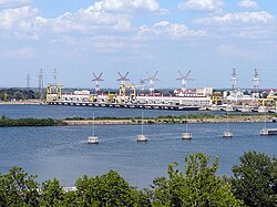
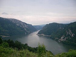
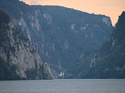
さらに下流へ向かうと、セルビアとルーマニアの国境付近に「アイアン・ゲート(鉄門)」と呼ばれる険しい峡谷地帯が現れます。ここは古くから航行の難所でしたが、現在は水力発電所が建設され、エネルギー供給の拠点となっています。
黒海への到達とドナウ・デルタ
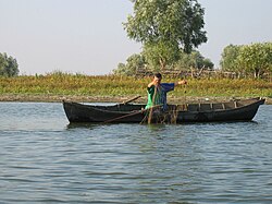
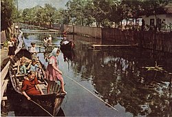
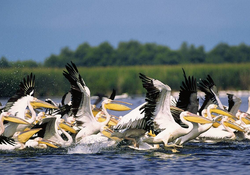
旅の終着点は、ルーマニアとウクライナにまたがるドナウ・デルタです。ここでは川がいくつもの分流に分かれ、豊かな湿地帯を形成しています。ペリカンなどの希少な野生動物が生息し、生物多様性の宝庫として世界的に重要視されています。
ドナウ川の基本データまとめ
ドナウ川の物理的特性と流域の構成を以下の表にまとめます。
| 項目 | 詳細内容 |
|---|---|
| 全長 | 2,850 km |
| 流域面積 | 801,463 km² |
| 平均流量(河口) | 約 6,452 m³/s (1931-2020年平均) |
| 最大流域国 | ルーマニア (流域面積の29%) |
| 主要支流 | ティサ川(最長)、サヴァ川、イン川 |
歴史・文化と現代の活用
歴史的な衝突と交易
ドナウ川は古来より、ローマ帝国からオスマン帝国に至るまで、軍事的な境界線や交易のルートとして利用されてきました。17世紀のブダ包囲戦や、19世紀のクリミア戦争におけるロシア・トルコ軍の衝突など、欧州の歴史を左右する戦いの舞台となってきました。

レジャーと観光の発展
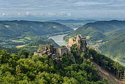
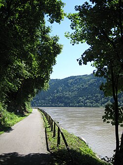
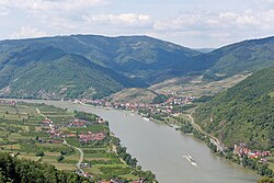
現代では、自然を堪能する観光ルートとして「ドナウ・バイクトレイル」が整備されています。ドイツのドナウエシンゲンから黒海まで続くこのルートは、サイクリストに絶大な人気を誇ります。また、オーストリアのヴァッハウ渓谷のような美しい景観地は、世界遺産としても評価されています。
Frequently Asked Questions
ドナウ川の源流はどこにありますか?
地理的な最上流はドイツのフルトヴァンゲンにあるブレグ川の源流ですが、一般的に象徴的な源流としてはドナウエシンゲンが知られています。
ドナウ川が流れる国はいくつありますか?
ドイツ、オーストリア、スロバキア、ハンガリー、クロアチア、セルビア、ブルガリア、ルーマニア、ウクライナの9カ国に接しており、流域にはモルドバも含まれます。
「アイアン・ゲート」とは何ですか?
セルビアとルーマニアの国境にある険しい峡谷のことで、自然公園として保護されているとともに、大規模な水力発電所が建設されている地域です。
ドナウ・デルタにはどのような特徴がありますか?
黒海に注ぐ直前の広大な三角州で、非常に豊かな生態系を持っており、ペリカンなどの野生動物や伝統的な漁業文化が残っていることで知られています。
ドナウ川の流域で最も面積が広い国はどこですか?
ルーマニアであり、全流域面積の約29%を占めています。
References
- "Danube River". Encyclopædia Britannica (Online ed.). Retrieved 30 April 2022.
- "ICPDR".
- "Long-term Morphological Development of the Danube in Relation to the Sediment Balance".
- Bondar, Constantin. "Hydromorphological balance of the Danube River Channel on the Sector between Bazias (km 1072.2) and Danube Delta Inlet (km 80.5)" (PDF). . Retrieved 30 April 2022.
- "Republic Hydrometeorological Service of Serbia".
- "THE DANUBE RIVER AND ITS DELTA, HYDROGEOGRAPHYC CHARACTERISTICS-ACTUAL SYNTHESIS".
- "Points of view expressed by the Romanian authorities and scientific research on the Ukraine's document "Annotated Report on Scientific Research – Complex Environmental Monitoring for the Danube – Black Sea Deep Water Navigation Canal operation in 2017–2018. The Sea Approach Canal Zone"" (PDF). unece.org. Retrieved 30 April 2022.
- Gâştescu, Petre; Țuchiu, Elena (2012), "The Danube River in the Pontic Sector – Hidrologycal Regime" (PDF), in Gâştescu, Petre; Lewis William Jr, William; Breţcan, Petre (eds.), Water resources and wetlands: Conference Proceedings, Tulcea, Romania, p. 18,
{{}}: CS1 maint: location missing publisher () - Water, Connor Brighton 1 February 2023 in Bodies of (1 February 2023). "10 Longest Rivers In Europe". WorldAtlas. Retrieved 30 March 2026.
{{}}: CS1 maint: numeric names: authors list () - "Danube River | Map, Cities, Countries, & Facts | Britannica". Encyclopedia Britannica. Archived from the original on 30 December 2025. Retrieved 30 March 2026.
📸 フォトギャラリー