The Danube basin
← ホームへ戻る

ドナウ川欧州を貫く大河の地理と歴史

🗓 2026年8月10日

ヨーロッパ大陸を東西に貫くドナウ川は、ドイツの黒い森から始まり、黒海へと注ぐ壮大な国際河川です。多くの国境を越え、数々の首都や歴史的な都市を結ぶこの川は、古来より交通の要衝として、また文化の交流路として重要な役割を果たしてきました。

流域面積は約80万平方キロメートルに及び、欧州の多様な景観を映し出しながら流れます。その流れは単なる自然の境界線ではなく、経済的な動脈として、そして豊かな生態系を育む生命線として機能しています。
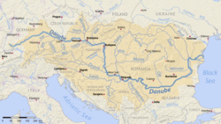
The Danube basin

主要な事実(Key Facts)

  • 全長:約2,850kmに及び、欧州で2番目に長い河川である。
  • 通過国:ドイツ、オーストリア、スロバキア、ハンガリー、クロアチア、セルビア、ブルガリア、ルーマニア、モルドバ、ウクライナの10カ国。
  • 河口:ルーマニアとウクライナにまたがる広大なドナウ川デルタを経て黒海へ流入する。
  • 主要都市:ウィーン、ブラチスラヴァ、ブダペスト、ベオグラードなど4つの首都を通過する。
  • 最大支流:ティサ川が最も長い支流として知られる。

河川の成り立ちと地理的特徴

源流から中流域まで

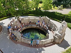
ドナウ川の始まりは、ドイツのバーデン=ヴュルテンベルク州にあります。水文学的な源流はフルトヴァンゲンにあるブレグ川ですが、一般的に象徴的な源流とされるのはドナウエシンゲンで、ここでブレガッハ川とブレグ川が合流します。
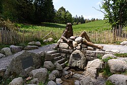
The hydrogeographical source of the Danube at St. Martin's Chapel in Furtwangen im Schwarzwald Germany: the Bregquelle, the source of the Danube's longest headstream, the Breg, where the Danube is symbolized by the Roman allegory for the river, Danuvius.
The symbolical source of the Danube in Donaueschingen: the source of the Donaubach (Danube Brook), which flows into the Brigach.

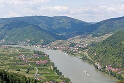
上流から中流域にかけては、パッサウのような三つの川が合流する地点や、オーストリアの美しいヴァッハウ渓谷など、観光地としても名高い景観が広がっています。また、リンツやウィーンといった都市を通り、川幅を広げながら東へと進みます。
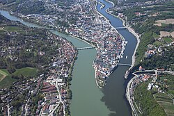
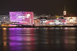
3-color confluence of (from left to right) Inn, Danube, and Ilz in Passau
Danube in Linz, Austria
Wachau Valley near Spitz, Austria

下流域と黒海への旅

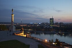
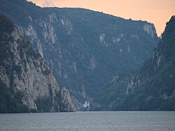
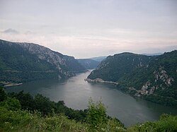
ハンガリーのブダペストを通過すると、川はさらに広がり、セルビアのベオグラード付近でサヴァ川などの大きな支流を迎え入れます。特にセルビアとルーマニアの国境に位置する「アイアン・ゲート(鉄門)」と呼ばれる狭い峡谷地帯は、険しい岩壁に囲まれたダイナミックな景観が特徴です。
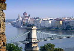
The Danube in Budapest
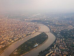
Aerial view of Margaret Island, Budapest, Hungary. There are 15 bridges over the Danube in Budapest.
Confluence of river Sava into the Danube beneath Fortress in Belgrade, capital of Serbia
Iron Gates, Serbia-Romania border
The Iron Gate, on the Serbian-Romanian border (Iron Gates natural park and Đerdap national park)

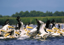
最終的に、川はルーマニアの広大なデルタ地帯に到達します。ここでは水流が複雑に分かれ、ペリカンなどの希少な野生動物が生息する生物多様性の宝庫となっており、最終的に黒海へと注ぎ込みます。
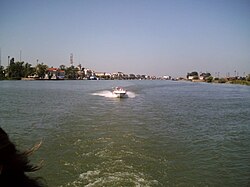
The Danube in Sulina, Romania
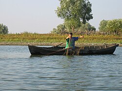
Fisherman in the Danube Delta
Pelicans in the Danube Delta, Romania

歴史的背景と文化的影響

ドナウ川は歴史的に、ローマ帝国の北限の防衛線として機能していました。中世から近世にかけては、オスマン帝国と神聖ローマ帝国の激しい衝突の舞台となり、ブダなどの都市を巡る攻防戦が繰り広げられました。
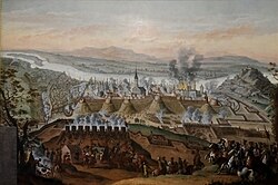

The Holy League took Ottoman-held Buda after a long siege in 1686.
Combat between Russian and Turkish forces on the Danube in 1854, during the Crimean War (1853–1856)

また、軍事的な側面だけでなく、交易の路としても発展しました。河川沿いにはアグシュタイン城のような要塞や、地域の権力を象徴する大聖堂が点在しており、今もなお当時の面影を留めています。
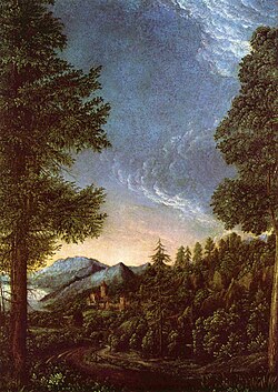
16th-century Danube landscape near Regensburg, by Albrecht Altdorfer – a member of the Danube school
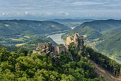
The ruins of Aggstein Castle above the Danube
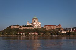
Basilica of Esztergom, Hungary
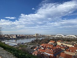
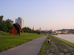
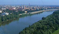
Petrovaradin Fortress overlooking the Danube and Novi Sad, regional capital of Vojvodina in Serbia

現代の利用と観光

今日、ドナウ川は重要な輸送ルートであるとともに、レジャーの拠点となっています。特に「ドナウ・バイク・トレイル」は、サイクリストに人気のルートであり、自然豊かな風景の中を走行できます。
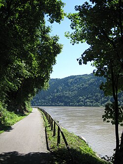
The Danube Bike Trail running along the Schlögener Schlinge, a water gap in the Bohemian Massif
The Danube Bike Trail leading through the city of Linz
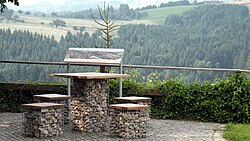
Resting area along the Donausteig hiking trail near Bad Kreuzen

また、水力発電などのエネルギー利用も進んでおり、アイアン・ゲートなどの地点では大規模なダム施設が運用されています。一方で、環境保護の観点から多くの国立公園や自然保護区が設定され、生態系の維持に努めています。
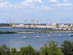
Iron Gate II Hydroelectric Power Station, Romania-Serbia
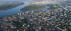
Great War Island in Belgrade, Serbia. It is located at the confluence of the Sava and Danube.
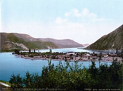
Ada Kaleh island in today's Romania was forgotten during the peace talks at the Congress of Berlin in 1878. It was submerged during the construction of the Iron Gates hydroelectric plant in 1970.

伝統的な漁法や文化も残っており、下流域ではリポヴァンと呼ばれるロシア系住民のコミュニティなどが、川と共に生きる独自の生活様式を維持しています。
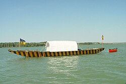
Fishing from a Zille on the Danube in Lower Austria, 1982
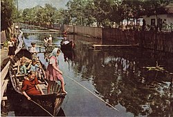
Russian-speaking Lipovans in the Danube Delta
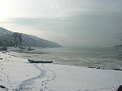
Danube at Nikopol, Bulgaria in winter
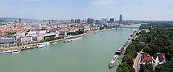
The Danube in Bratislava, Slovakia
The Tisza is the longest tributary of the Danube.

ドナウ川の基本データまとめ

項目 詳細
全長 約2,850 km
流域面積 801,463 km²
平均流量(河口) 6,452 m³/s
最大水深(アイアン・ゲート 90 m
通過する首都 ウィーン、ブラチスラヴァ、ブダペスト、ベオグラード

よくある質問(FAQ)

ドナウ川はいくつの国を流れていますか?

ドイツ、オーストリア、スロバキア、ハンガリー、クロアチア、セルビア、ブルガリア、ルーマニア、モルドバ、ウクライナの計10カ国を流れています。

ドナウ川の源流はどこにありますか?

水文学的な最長支流の源流はドイツのフルトヴァンゲンにあるブレグ川ですが、一般的にはドナウエシンゲンでの合流地点が象徴的な源流とされています。

「アイアン・ゲート」とは何ですか?

セルビアとルーマニアの国境付近にある、非常に狭い峡谷地帯のことです。自然の要塞のような地形であり、現在は大規模な水力発電所が建設されています。

ドナウ川デルタにはどのような特徴がありますか?

黒海に注ぐ直前の広大な湿地帯で、世界的に重要な生物多様性の拠点です。ペリカンなどの鳥類や希少な魚類が生息し、ユネスコの世界遺産にも登録されています。

ドナウ川沿いで人気の観光アクティビティは何ですか?

リバークルーズのほか、川沿いに整備された「ドナウ・バイク・トレイル」でのサイクリングや、歴史的な古城巡りが非常に人気です。

References

  1. "Danube River". Encyclopædia Britannica (Online ed.). Retrieved 30 April 2022.
  2. "ICPDR".
  3. "Long-term Morphological Development of the Danube in Relation to the Sediment Balance".
  4. Bondar, Constantin. "Hydromorphological balance of the Danube River Channel on the Sector between Bazias (km 1072.2) and Danube Delta Inlet (km 80.5)" (PDF). . Retrieved 30 April 2022.
  5. "Republic Hydrometeorological Service of Serbia".
  6. "THE DANUBE RIVER AND ITS DELTA, HYDROGEOGRAPHYC CHARACTERISTICS-ACTUAL SYNTHESIS".
  7. "Points of view expressed by the Romanian authorities and scientific research on the Ukraine's document "Annotated Report on Scientific Research – Complex Environmental Monitoring for the Danube – Black Sea Deep Water Navigation Canal operation in 2017–2018. The Sea Approach Canal Zone"" (PDF). unece.org. Retrieved 30 April 2022.
  8. Gâştescu, Petre; Țuchiu, Elena (2012), "The Danube River in the Pontic Sector – Hidrologycal Regime" (PDF), in Gâştescu, Petre; Lewis William Jr, William; Breţcan, Petre (eds.), Water resources and wetlands: Conference Proceedings, Tulcea, Romania, p. 18,  {{}}: CS1 maint: location missing publisher ()
  9. Water, Connor Brighton 1 February 2023 in Bodies of (1 February 2023). "10 Longest Rivers In Europe". WorldAtlas. Retrieved 30 March 2026.{{}}: CS1 maint: numeric names: authors list ()
  10. "Danube River | Map, Cities, Countries, & Facts | Britannica". Encyclopedia Britannica. Archived from the original on 30 December 2025. Retrieved 30 March 2026.

📸 フォトギャラリー

The Danube basin
The hydrogeographical source of the Danube at St. Martin's Chapel in Furtwangen im Schwarzwald Germany: the Bregquelle, the source of the Danube's longest headstream, the Breg, where the Danube is symbolized by the Roman allegory for the river, Danuvius.
The symbolical source of the Danube in Donaueschingen: the source of the Donaubach (Danube Brook), which flows into the Brigach.
The Tisza is the longest tributary of the Danube.
3-color confluence of (from left to right) Inn, Danube, and Ilz in Passau
Danube in Linz, Austria
The Danube in Bratislava, Slovakia
Basilica of Esztergom, Hungary
Petrovaradin Fortress overlooking the Danube and Novi Sad, regional capital of Vojvodina in Serbia
Confluence of river Sava into the Danube beneath Fortress in Belgrade, capital of Serbia
Danube at Nikopol, Bulgaria in winter
The Danube in Sulina, Romania
Aerial view of Margaret Island, Budapest, Hungary. There are 15 bridges over the Danube in Budapest.
Great War Island in Belgrade, Serbia. It is located at the confluence of the Sava and Danube.
Ada Kaleh island in today's Romania was forgotten during the peace talks at the Congress of Berlin in 1878. It was submerged during the construction of the Iron Gates hydroelectric plant in 1970.
The Danube in Budapest
Fisherman in the Danube Delta
Russian-speaking Lipovans in the Danube Delta
Pelicans in the Danube Delta, Romania
Iron Gates, Serbia-Romania border
Iron Gate II Hydroelectric Power Station, Romania-Serbia
The Iron Gate, on the Serbian-Romanian border (Iron Gates natural park and Đerdap national park)
Combat between Russian and Turkish forces on the Danube in 1854, during the Crimean War (1853–1856)
The Holy League took Ottoman-held Buda after a long siege in 1686.
Fishing from a Zille on the Danube in Lower Austria, 1982
The ruins of Aggstein Castle above the Danube
Wachau Valley near Spitz, Austria
The Danube Bike Trail running along the Schlögener Schlinge, a water gap in the Bohemian Massif
The Danube Bike Trail leading through the city of Linz
Resting area along the Donausteig hiking trail near Bad Kreuzen
16th-century Danube landscape near Regensburg, by Albrecht Altdorfer – a member of the Danube school