タグ

水氷

20 件の記事

📖

線状谷底堆積物(LVF)が明かす火星の氷河地形と「脳状地形」の謎

火星線状谷底堆積物LVF氷河
📖

火星のローブ状デブリエプロン(LDA)氷の貯蔵庫としての地質学的価値

火星ローブ状デブリエプロンLDA水氷
📖

コロレフ・クレーター火星の北極圏に眠る巨大な氷の貯蔵庫

コロレフ・クレーター火星水氷マレ・ボレウム
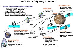
Summary of Mars Odyssey mission start

Mars Odyssey火星の地下水と地質を解き明かす長寿探査機の軌跡

Mars Odyssey火星探査機NASAエアロブレーキング
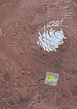
Site of south polar subglacial water body (reported July 2018)

プラヌム・アウストラレ火星南極の氷と地下湖の謎

プラヌム・アウストラレ火星南極冠地下湖
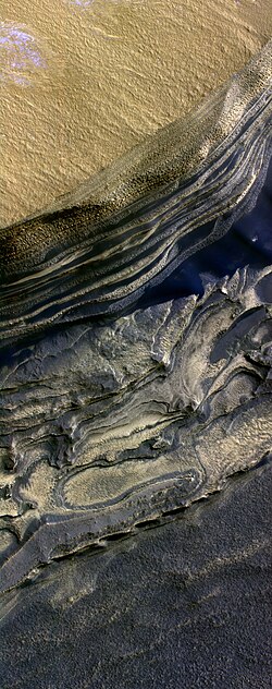
False color HiRISE image of a side of the Chasma Boreale, a canyon in the polar ice cap. Light browns are layers of surface dust greys and blues are layers of water and carbon dioxide ice. Regular geometric cracking is indicative of higher concentrations of water ice.

プラヌム・ボレウム火星北極冠の地質と神秘的な気象現象

プラヌム・ボレウム火星北極冠カズマ・ボレアーレ
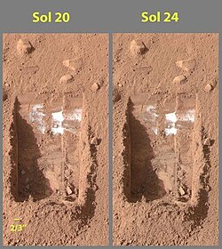
Side-by-side images of a trench dug by Phoenix's robotic arm, showing the sublimation of material – three whitish clumps in the lower left corner of the trench – presumed to be water ice, over the course of four days (Sol 20 to Sol 24).

フェニックス火星着陸機北極圏の氷と生命の痕跡を追った旅

フェニックス火星着陸機NASA水氷
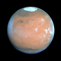
1995 photo of Mars showing approximate size of the polar caps

火星の極冠水氷とドライアイスが織りなすダイナミックな世界

火星極冠ドライアイス水氷

An artificially colored mosaic constructed from a series of 53 images taken through three spectral filters by Galileo's imaging system as the spacecraft flew over the northern regions of the Moon on 7 December 1992. The colors indicate different materials.

月資源の可能性と現地利用(ISRU)の最前線

月資源ISRU現地資源利用ヘリウム3
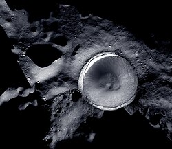
The lunar south pole at the center of this image, situated on the rim of Shackleton Crater. Mosaic image created by LROC (Lunar Reconnaissance Orbiter) and ShadowCam

月南極の科学的価値と探査の最前線

月南極水氷永久影シャクルトンクレーター
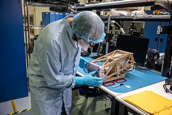
Engineers prepare the Mass Spectrometer Observing Lunar Operations (MSolo) instrument

Nova-C月面着陸機とIM-2ミッション月南極の氷探索と次世代インフラの展開

Nova-CIntuitive Machines月南極シャックルトンクレーター
First photo by ShadowCam, Shackleton crater[29]

KPLO搭載の科学観測機器とShadowCamによる月面探査

KPLOShadowCam月探査永久影