地球の唯一の天然衛星である月は、地球とは全く異なる地質学的特性を持っています。大気がほとんど存在せず、液体の水による浸食もないため、月面は数十億年にわたる宇宙の記憶をそのままに留めています。地球のようなプレートテクトニクス(地殻変動)も確認されておらず、その地形を形作っているのは主に外部からの隕石衝突と、かつて盛んだった内部の火山活動です。
月の地質研究は、地上からの観測だけでなく、探査機によるデータ、そしてアポロ計画やソ連のルナ計画、中国の嫦娥5号によってもたらされた貴重な月面サンプルの分析によって進展してきました。これらの研究により、月が単なる岩石の塊ではなく、複雑な分化プロセスを経て形成されたことが明らかになっています。
Key Facts
- 大気の欠如: 風化や浸食がほとんどなく、微小隕石による緩やかな摩耗のみが進行している。
- 内部構造: 地殻、マントル、そして半径約450km以下の小さな鉄の核(コア)で構成される。
- 火山活動の歴史: かつては広大な溶岩流が「海」を形成したが、最新の研究では5,000万年前まで活動していた可能性が示唆されている。
- 表面の層: 長年の衝突により岩石が粉砕され、「レゴリス」と呼ばれる細かい堆積層が月面を覆っている。
月の形成と初期の進化
月の地質学的歴史の始まりは、天体全体が溶融状態にあった「ルナ・マグマオーシャン(月のマグマ海)」の結晶化から始まります。深さ500km以上に及んだとされるこのマグマの海では、まず密度が高いカンラン石や輝石が結晶化して底へと沈み、マントルを形成しました。
結晶化が約75%まで進むと、密度が低い斜長石(アノーサイト)が海面に浮上し、厚さ約50kmの地殻を作り上げました。このプロセスにより、月は内部の組成が分かれた「分化天体」となりました。
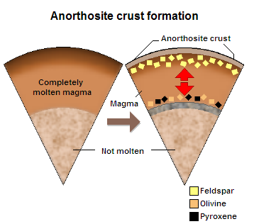
この結晶化の最終段階で、不適合元素(結晶に入りにくい元素)や熱生成元素が濃縮された「KREEP(クリープ)」と呼ばれる特殊なマグマが生成されました。この物質は主にプロセラルム海やインブリウム盆地付近に集中し、後の火山活動に影響を与えたと考えられています。
月面の組成と地質学的特徴
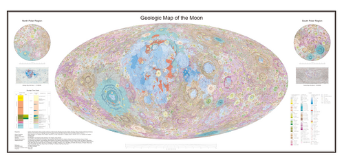
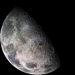
月の表面は、大きく分けて明るい「高地」と暗い「海」の2つの領域に分かれています。高地は主に斜長石を多く含むアノーサイトで構成されており、非常に古く、クレーターが密集しています。一方、「海」は後世に噴出した玄武岩質の溶岩で満たされた低地です。
これらの領域の化学組成には明確な差があり、特に海では鉄やチタンの含有量が高くなっています。
| 化合物 | 化学式 | 海 (Maria) | 高地 (Highlands) |
|---|---|---|---|
| 二酸化ケイ素 | SiO2 | 45.4% | 45.5% |
| 酸化アルミニウム | Al2O3 | 14.9% | 24.0% |
| 酸化カルシウム | CaO | 11.8% | 15.9% |
| 酸化鉄(II) | FeO | 14.1% | 5.9% |
| 酸化マグネシウム | MgO | 9.2% | 7.5% |
| 二酸化チタン | TiO2 | 3.9% | 0.6% |
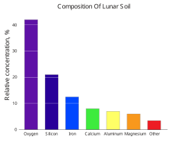
月面の詳細な地質構造は、軌道上からの多波長観測によって可視化されています。偽色画像を用いることで、鉱物組成の違いを明確に判別することが可能です。

地形を形作る地質プロセス
火山活動と溶岩地形
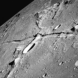
月の「海」は、30億年から35億年前を中心とした大規模な玄武岩質の噴火によって形成されました。これらの溶岩は地球のものより粘性が低く、広範囲に広がったのが特徴です。また、火山ドームや、溶岩の流路が残った「リル(溝)」、地殻の圧縮で生じた「しわ状の嶺(リンクルリッジ)」などの特徴的な地形が見られます。
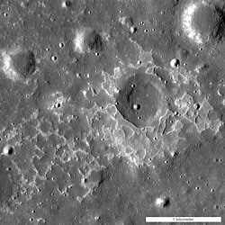
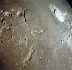
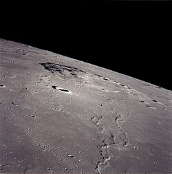
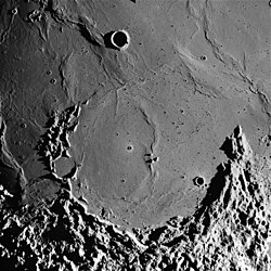
さらに、地殻が引っ張られてできた「地溝(グラベン)」などの構造線も確認されており、内部応力の変化を物語っています。
衝突クレーターとレゴリス
月面で最も支配的な地質プロセスは、隕石や彗星による衝突です。巨大なサウスポール・エイトケン盆地(直径約2,500km)から、小さな穴のようなピットまで、あらゆるサイズのクレーターが存在します。クレーターの重なり具合(累重の法則)を分析することで、地表の相対的な年代を推定することができます。
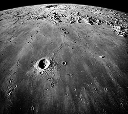
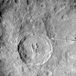
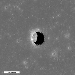
数十億年にわたる絶え間ない衝突は、岩石を粉々に砕き、月面を厚さ数メートルから数十メートルの「レゴリス(月表土)」で覆いました。この層の下には、激しく破砕された基盤岩である「メガレゴリス」が存在します。
![A map of the Moon coloured in terms of crust thickness and its types of regions marked: the KREEP rich magma terrane is hatch-marked and labeled on the left map hemisphere, the near side of the Moon, in its most prominent part as the Mare Procellarum KREEP Terrane (PKT); on the right (the far side), the gray circle marks the South Pole-Aitken Terrane (SPAT); on each hemispheres the 12 crater basins with crustal thinng larger than 200 km (120 mi) are marked with black circles; the rest is Felspathic Highlands Terrane (FHT), with the region of high-thickness (in red and white) being the inner FHT.[36]](/images/6c/79/6c791592361846be5ccd2a1f7fa76f46b6c94bcf8ed0ce8b8f37e5512847aef6.jpg)
内部構造と物理的特性
月の内部は、密度分布から見てほぼ完全に固体であると考えられています。中心部には小さな鉄の核があり、その半径は月全体の約4分の1程度と、地球などの他の惑星に比べて非常に小さいのが特徴です。また、この核は現在も液体状態にあることが、回転のわずかな揺れ(秤動)の観測から示唆されています。
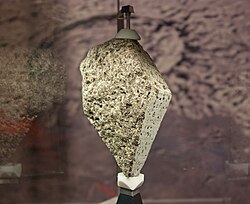
地殻の厚さは平均して約50kmですが、裏側の方が表側よりも平均して15kmほど厚いという非対称性を持っています。アポロ計画で回収されたカンラン石を含む玄武岩などのサンプルは、こうした内部構造を裏付ける重要な証拠となりました。
Frequently Asked Questions
月の「海」には水があるのですか?
いいえ、地質学的な意味での「海」であり、実際には玄武岩質の溶岩が固まってできた平原です。水が存在しないため、地球のような海洋ではありません。
月面で火山活動はまだ続いているのでしょうか?
かつては10億年前に終了したと考えられていましたが、近年の研究では5,000万年前という地質学的にごく最近まで、小規模な火山活動があった証拠が見つかっています。
レゴリスとは具体的にどのようなものですか?
隕石の衝突によって岩石が粉砕され、堆積してできた細かい砂や塵の層のことです。月面全体を覆っており、場所によって厚さが異なります。
月の地殻が表と裏で違うのはなぜですか?
詳細な理由は研究中ですが、地殻の厚さや組成(KREEPの分布など)に大きな偏りがあり、裏側の方が厚く、玄武岩質の「海」が少ないことが分かっています。
KREEPとは何のことですか?
カリウム(K)、希土類元素(REE)、リン(P)が濃縮された物質のことで、マグマオーシャンの最終段階で形成された特殊な組成を持つ領域を指します。
References
- Kenneth R. Lang (2003). The Cambridge Guide to the Solar System. Cambridge University Press. p. 170. .
- , p. 91.
- , p. 93.
- , p. 13.
- Scientific and Technical Information Branch (1986). Status and Future of Lunar Geoscience. . p. 13. .
- Imster, Eleanor (12 October 2014). "Active moon volcanos in geologically recent times". earthsky.org. . Archived from the original on 25 January 2023. Retrieved 25 January 2023.
- , p. 10.
- Taylor, S. Ross (1982). Lunar Geoscience: A Collected View from Apollo. Pergamon Press.
- "Lunar Rocks and Soils from Apollo Missions". NASA. Archived from the original on 23 July 2011. Retrieved 21 November 2022.
- Ivankov, A. "Luna 16". National Space Science Data Center Catalog. . Archived from the original on 24 May 2019. Retrieved 13 October 2018.
The drill was deployed and penetrated to a depth of 35 cm before encountering hard rock or large fragments of rock. The column of regolith in the drill tube was then transferred to the soil sample container... the hermetically sealed soil sample container, lifted off from the Moon carrying 101 grams of collected material
📸 フォトギャラリー