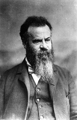
アメリカ西部の未知なる領域に挑み、その地質学的・文化的な正体を明らかにした人物にジョン・ウェズリー・パウエルがいます。彼は単なる冒険家ではなく、軍人、地質学者、そして人類学者として、現代のアメリカにおける国土管理や民族研究の基礎を築いた多才な科学者でした。特に、政府公認として初めてグランドキャニオンを縦断した功績は、地理学の歴史に深く刻まれています。
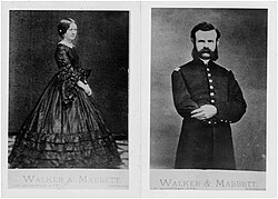
パウエルの人生は、困難への挑戦の連続でした。南北戦争での軍務を経て、彼は西部の未踏の地に惹かれ、自然科学への情熱を注ぎ込みます。彼の視点は常に、単なる地図の作成にとどまらず、その土地の環境が人間にどのような影響を与えるかという、先見的な洞察に満ちていました。
Key Facts
- グランドキャニオンの初縦断: 1869年、政府の支援を受けてコロラド川を航行し、グランドキャニオンの全貌を初めて公式に記録した。
- USGSの指導者: アメリカ地質調査所(USGS)の第2代所長を務め、国家規模の地質調査を指揮した。
- 民族学の先駆者: スミソニアン協会の民族学局(Bureau of Ethnology)の初代局長として、北米先住民の言語分類に尽力した。
- 乾燥地帯への警鐘: 西部の乾燥した土地における水資源の重要性を説き、現実的な開発政策を提言した。
未知なる河川への挑戦:コロラド川探検
パウエルの名声を決定づけたのは、1860年代後半から始まった一連の西部探検です。1867年には妻のエマと共にロッキー山脈へ向かい、パイクスピークへの登頂を果たすなど、地質調査の基礎を固めました。
![First camp of the John Wesley Powell expedition [second Colorado River expedition], in the willows, Green River, Wyoming, 1871.](/images/0f/59/0f593776442065328602066f6bd5469271e233a0ae8862407365b72a5bf100c3.jpg)
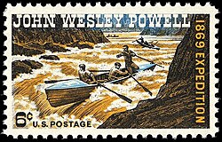
そして1869年、彼は10人の隊員と4隻のボートを率いて、ワイオミング州のグリーンリバーから出発しました。激流が渦巻くコロラド川を突き進み、3ヶ月にわたる過酷な旅の末にグランドキャニオンを突破。この快挙は、当時のアメリカ社会に大きな衝撃を与え、西部の地理的理解を劇的に塗り替えました。
その後、パウエルは議会から予算を得て、さらに詳細な調査(パウエル調査)を継続しました。1871年から72年にかけての第2次遠征では、より学術的な視点から地域の地質を分析し、後の地質学的な知見の蓄積に寄与しました。
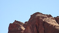
彼の功績は地名にも残っており、ユタ州のグレンキャニオン国立レクリエーションエリアには、彼にちなんで名付けられた「パウエルの横顔(Powell's Profile)」という岩石形成が存在します。
科学的リーダーシップと行政への貢献
探検家としての活動を経て、パウエルは行政的な指導者としての道を歩みます。1881年、ジェームズ・ガーフィールド大統領によってアメリカ地質調査所(USGS)の第2代所長に任命されました。彼はここで、バラバラだった西部の地質調査を統合し、体系的な国家プロジェクトへと昇華させました。
特に彼が重視したのは、西部の「乾燥地帯」における土地利用です。彼は、水資源が限られた地域で無理な入植を強行することの危険性を指摘し、流域に基づいた管理体制を提案しました。この考え方は、当時の政治的な流れとは対立することもありましたが、環境科学的な視点からは極めて正確な予測であったと評価されています。
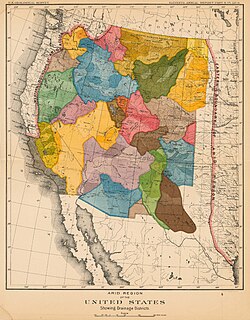
1894年に所長を退任するまで、彼は予算削減や政治的な圧力に直面しながらも、科学的な根拠に基づいた国土計画を追求し続けました。
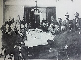
人類学と先住民研究への情熱
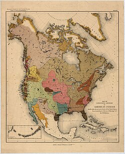
パウエルの関心は地質学にとどまらず、その地に住む人々、特に北米先住民の文化と言語にも向けられていました。彼はスミソニアン協会の民族学局の初代局長を務め、言語学的なアプローチから先住民の系統を分類する画期的な研究を行いました。
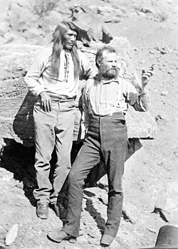
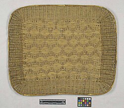
彼は実際にコロラド高原の先住民の間で時間を過ごし、彼らの言語や社会構造を詳細に記録しました。彼が収集したホピ族のパン用トレイなどの工芸品は、現在も国立自然史博物館に寄贈され、貴重な資料となっています。
彼の言語研究の集大成である『メキシコ以北のアメリカ先住民言語族』は、後の北米人類学における重要な参照点となりました。
晩年と不朽の遺産
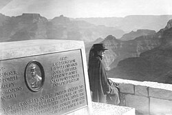
晩年のパウエルは、大学での講義や著書の執筆に時間を費やしました。身体的な不調に悩みながらも、科学的な探究心を失うことはありませんでした。1902年、彼は静かにその生涯を閉じ、アーリントン国立墓地に埋葬されました。
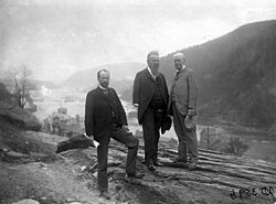
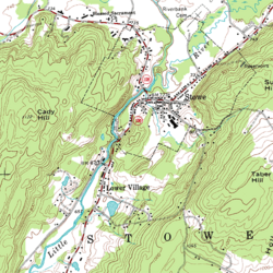
彼の遺した地図作成技術や地形図の概念は、現代のUSGSが使用する等高線地図の基礎となっており、その影響は今もなお生きています。
また、彼の不屈の精神と科学への貢献は、1969年には記念切手として発行されるなど、アメリカの国民的な英雄として称えられています。
まとめ:ジョン・ウェズリー・パウエルの足跡
| 分野 | 主な役割・功績 | 重要ポイント |
|---|---|---|
| 探検 | コロラド川・グランドキャニオン縦断 | 政府公認の初縦断を達成し、地理的知見を拡大 |
| 地質学 | USGS 第2代所長 | 西部の地質調査を統合し、乾燥地帯の管理を提言 |
| 人類学 | 民族学局 初代局長 | 北米先住民の言語分類と文化研究を主導 |
| 軍事 | アメリカ陸軍 少佐 | 南北戦争に従軍し、リーダーシップを培う |
Frequently Asked Questions
パウエルがグランドキャニオン探検で最も重視したのは何ですか?
彼は単なる冒険ではなく、未知の地域の地理的・地質学的な詳細を記録し、地図を作成することを目的としていました。これにより、アメリカ政府が西部の国土を正確に把握することを目指しました。
「乾燥地帯の報告書」で彼はどのような主張をしましたか?
西部の乾燥した地域では、水資源が限られているため、東部のような小規模な農場分割(ホームステッド法)は不適切であると主張しました。代わりに、流域(ウォーターシェッド)に基づいた合理的な土地利用を提言しました。
人類学の分野でどのような貢献をしましたか?
北米先住民の言語を体系的に分類し、言語的なつながりから民族の移動や歴史を解明しようと試みました。これは当時のアメリカにおける民族学研究の基礎となりました。
パウエルの探検記録にはどのような議論がありましたか?
後に公開された隊員の日記により、パウエルの著書には一部誇張が含まれていたことや、第2次遠征の内容が第1次遠征のものとして記述されていたことなどが指摘されています。
USGS(アメリカ地質調査所)における彼の役割は何でしたか?
第2代所長として、それまで個別に活動していた複数の地質調査チームを統合し、組織的な国家調査体制を確立させました。
References
- McNamee, Gregory. "John Wesley Powell". britannica.com. Encyclopædia Britannica. Retrieved December 9, 2019.
- Powell, J.W. (1891). Indian Linguistic Families of America North of Mexico. Washington, D.C.: United States Government Printing Office. Archived from the original on August 27, 2010. Retrieved August 10, 2026.
- Hunter, Cathy. "John Wesley Powell: Soldier, explorer, scientist, and National Geographic founder". National Geographic. Archived from the original on December 8, 2014. Retrieved December 5, 2014.
- Stegner, Wallace (1992) [First published 1954]. Beyond the Hundredth Meridian: John Wesley Powell and the second opening of the West. Penguin. .
- Powell, John Wesley (2001). DeBuys, William (ed.). Seeing Things Whole: The essential John Wesley Powell. Washington, DC: Island Press.
- Catalogue of the Columbian College in the District of Columbia. W. Force. 1898–1901. Retrieved 9 June 2018 – via HathiTrust.
- (2001). A River Running West: The Life of John Wesley Powell. Oxford University Press. .
- , sec. 1.
- "Greek Lettered Organizations". Illinois College. Retrieved August 25, 2024.
- Kemp, Bill (17 January 2009). "'Conqueror of the Grand Canyon' returned to Bloomington in 1896". . Bloomington, IL. Retrieved 17 January 2009.
{{}}: CS1 maint: deprecated archival service ()
📸 フォトギャラリー