アメリカ合衆国モンタナ州に根を下ろすクロウ族(自称:アプサールケ / Apsáalooke)は、「鴉(カラス)の子供たち」を意味する名を持つ、北米平原の誇り高き先住民族です。彼らは独自の言語と深い精神性を持ち、広大な大草原で馬を操り、自然と共生する文化を築き上げてきました。
かつては広大な領土を支配し、交易の要衝として栄えた彼らですが、その歴史は隣接する部族との激しい抗争や、アメリカ政府との複雑な交渉、そして領土の喪失という困難の連続でもありました。本記事では、彼らの起源から現代に至るまでの歩みを詳しく解説します。
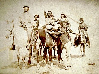
Key Facts
- 正式名称:アプサールケ(Apsáalooke)
- 主な居住地:アメリカ合衆国モンタナ州(クロウ族保留地)
- 言語:クロウ語(スー族言語のミズーリ川流域分派)、英語、平原手話
- 宗教:キリスト教、クロウの伝統的な道(Crow Way)、タバコ結社
- 人口:登録市民は約12,000〜14,000人
起源と北平原への移動
クロウ族のルーツは、ヒダツァ族との分立にあります。伝説によれば、リーダーである「ノー・インテスティンズ(内臓なき者)」が神聖なタバコを求める啓示を受け、一団を率いて西へと旅に出たことが始まりとされています。彼らは最終的にモンタナ州南東部に定住し、ロッキー山脈の麓やイエローストーン川上流、ビッグホーン山脈周辺を拠点とするようになりました。
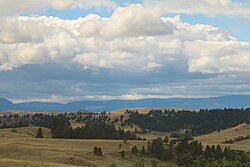
彼らはこの地で、馬を巧みに操る文化を発展させ、広大な領土を維持しました。特に1851年のフォートララミー条約では、現在のモンタナ州およびワイオミング州にまたがる広範な地域が彼らの領土として認められていました。
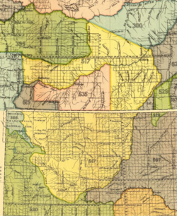
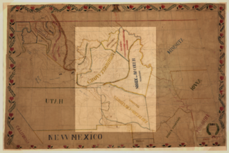
対立と同盟の歴史
クロウ族の歴史において、最大の敵対関係にあったのがラコタ・スー族(シウー族)です。19世紀初頭から両者の衝突は激化し、互いのキャンプを襲撃し合う血塗られた抗争が続きました。一方で、かつての敵であったグロスベントル族とは1860年代に一時的な友好関係を築くなど、戦略的な同盟を組むこともありました。
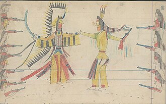
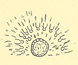
1860年代後半になると、ラコタ・スー族がボーズマン・トレイル(モンタナの金鉱山へ向かうルート)周辺の支配権を巡ってアメリカ軍と衝突(レッドクラウド戦争)。この結果、クロウ族の伝統的な領土の多くがスー族の支配下に入り、彼らは次第に追い詰められていきました。
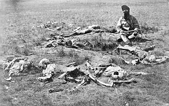
アメリカ軍との協力とリトルビッグホーンの戦い
スー族による絶え間ない攻撃にさらされていたクロウ族は、共通の敵に対抗するため、アメリカ軍に協力する道を選びました。1876年の「グレート・シウー戦争」では、地元の地形に精通していたクロウ族の戦士たちが軍のスカウト(偵察兵)として雇用されました。
![Crooks army before battle of the Rosebud. The Crow and Shoshone scouts and the Army are crossing Goose River on the way to the Rosebud in 1876. The equestrian woman may be either the Crow berdache Finds-them-and-kills-them or the Crow amazon The-other-magpie.[83]: 228](/images/70/37/70373c6012e4a13307f56504ea8e5faa78e4c27a05662215a8eae0fad7877317.jpg)
有名なカスター中佐率いる軍隊が敗北したリトルビッグホーンの戦いにおいても、クロウ族のスカウトたちは重要な役割を果たしました。最終的にスー族とシェイエン族は敗北し、彼らはカナダへ逃れるか、遠方の保留地へと強制移住させられることとなりました。
伝統的な生活様式と文化
クロウ族は、バッファロー(バイソン)を中心とした狩猟採集生活を送っていました。彼らは「バッファロー・ジャンプ」と呼ばれる、崖から獲物を追い落とす効率的な狩猟法を用いていました。
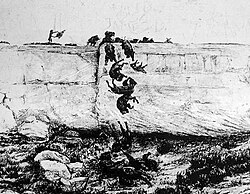
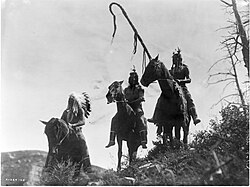
住居には、バッファローの皮で作られたティピー(円錐形テント)を使用し、移動生活に適応していました。また、馬の導入により、狩猟や交易の効率が飛躍的に向上し、平原の覇者としての地位を確立しました。
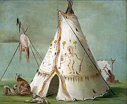
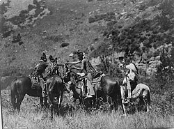
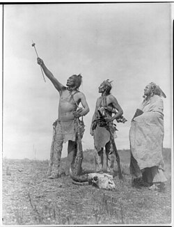
精神面では、自然界への深い敬意と、神聖な儀式を重視しました。例えば、矢にバイソンの肉を捧げて誓いを立てる儀式などが、彼らの強い結束力と信仰心を表しています。
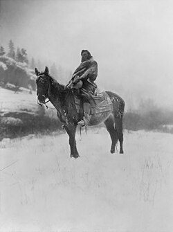
現代のクロウ族と統治体制
現在、モンタナ州中南部に位置するクロウ族保留地は、アメリカで5番目に大きな規模(約230万エーカー)を誇ります。中心地であるクロウ・エージェンシーを中心に、伝統を守りながら現代社会に適応した生活を送っています。
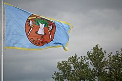
政治体制は、かつての直接民主主義的な「一般評議会」から、2001年の新憲法制定により、立法・行政・司法の三権分立に近い体制へと移行しました。しかし、この憲法制定プロセスを巡っては、手続き上の不備を指摘する論争が今なお続いています。
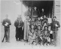
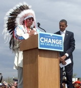
また、彼らは外部社会とも積極的に交流しており、2008年にはバラク・オバマ氏(後の大統領)が、大統領候補として初めて彼らのコミュニティを訪問し、部族に迎え入れられたという歴史的な出来事もありました。
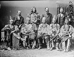
クロウ族の概要まとめ
| 項目 | 詳細 |
|---|---|
| 自称 | アプサールケ(Apsáalooke) |
| 主要言語 | クロウ語、英語 |
| 伝統的拠点 | モンタナ州、ワイオミング州(ビッグホーン山脈周辺) |
| 主要な敵対部族 | ラコタ・スー族(シウー族) |
| 現代の統治 | 三権分立体制(2001年憲法に基づく) |
Frequently Asked Questions
クロウ族という名前の由来は何ですか?
彼らの自称である「アプサールケ」は、英語で「Children of the Raven(鴉の子供たち)」を意味します。これが転じて、英語圏では「Crow(クロウ)」と呼ばれるようになりました。
なぜクロウ族はアメリカ軍に協力したのですか?
最大の敵であったラコタ・スー族が、クロウ族の伝統的な領土に侵入し、キャンプを襲撃していたためです。生存戦略として、共通の敵を持つアメリカ軍と同盟を結び、自らの土地を守ろうとしました。
リトルビッグホーンの戦いでの役割は何でしたか?
クロウ族の戦士たちは、アメリカ軍のスカウト(偵察兵)として参加しました。彼らは地元の地形を熟知していたため、軍にとって不可欠なガイドおよび情報提供者の役割を果たしました。
現在のクロウ族の言語状況はどうなっていますか?
登録市民は約12,000〜14,000人いますが、2007年の推計ではクロウ語を話せる人は約3,000人と減少しており、言語の保存が重要な課題となっています。
クロウ族の保留地はどのくらいの大きさですか?
モンタナ州に位置し、面積は約230万エーカー(約3,600平方マイル)に及びます。これは全米のインディアン保留地の中で5番目に大きな規模です。
References
- "Crow Tribe of Montana". National Indian Law Library. Retrieved April 23, 2016.
- "Crow (Apsáalooke)". Omniglot. Retrieved October 14, 2019.
- "Crow Tribe of Indians". Crow Tribe. Retrieved October 14, 2016.
- Clark, Patricia Roberts (October 21, 2009). Tribal Names of the Americas: Spelling Variants and Alternative Forms, Cross-Referenced. McFarland. p. 10. .
- Or Absahrokee, Absaraka, Absarako, Ab-sar-o-ka, Absaroke, Absaroki, Absoroka.
- Johnson, Kirk (July 24, 2008), "A State That Never Was in Wyoming",
- William C. Sturtevant, Handbook of North American Indians: Southwest (1979, ), page 714: "Among other tribes the Crow are most commonly designated as 'crow' or 'raven'."
- "Crow Expressions". Western Heritage Center. Retrieved October 19, 2021.
- Pritzker, Barry (2000). A Native American Encyclopedia: History, Culture, and Peoples. Oxford: Oxford University Press. p. 313. .
- Phenocia Bauerle, The Way of the Warrior: Stories of the Crow People, Lincoln: University of Nebraska Press,
📸 フォトギャラリー