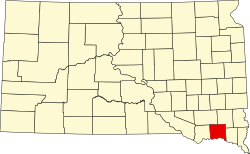
アメリカ合衆国サウスダコタ州の東端、ミズーリ川のほとりに位置するヤンクトンは、「ダコタの母なる街(Mother City of the Dakotas)」という愛称で知られています。この街は単なる地方都市ではなく、かつてのダコタ準州の最初の州都として、地域の政治的・経済的発展の礎を築いた歴史的な重要拠点です。
ヤンクトンという名は、この地に住んでいた先住民ヤンクトン・スー族に由来しており、ダコタ語で「端の村(I-hank-ton-wan)」を意味しています。現在は人口約1万5千人の穏やかな街ですが、その歩みはアメリカ西部の開拓史そのものと言えるでしょう。
主要な事実(Key Facts)
- 歴史的地位: ダコタ準州の初代州都であり、地域の発展を牽引した。
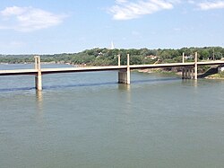
- 地理的特徴: ミズーリ川沿いに位置し、ネブラスカ州と橋で結ばれている。
- 人口規模: 2020年時点で15,411人を数え、州内で7番目に大きな都市。
- 文化イベント: 毎年8月に開催される「リバーボート・デイズ」には約13万5千人が訪れる。
- 教育拠点: ベネディクト会系のマウントマーティ大学が所在している。
開拓時代の記憶と州都としての歩み
ヤンクトンの歴史は、ヨーロッパ人入植者が到着する前から始まっていました。1804年にはルイス・クラーク探検隊がこの地を訪れ、ミズーリ川の崖(カルメット・ブラフ)でヤンクトン・スー族と接触したことが記録されています。その後、1858年のヤンクトン条約によって土地が開拓され、街の基礎が築かれました。
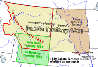
1861年にはダコタ準州の州都となり、地域の行政中心地として機能しました。当時の街は、ミズーリ川を利用した蒸気船の寄港地として急速に発展し、特にブラックヒルズで金が発見されると、物資や人員を運ぶ重要な拠点として繁栄を極めました。
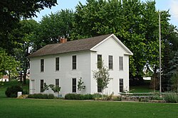
また、激動の時代を象徴する出来事もありました。1862年のダコタ戦争の際には、住民を守るために大規模な防御壁(ストックエイド)が建設され、周辺地域の避難所となりました。さらに、伝説的なガンマン「ワイルド・ビル・ヒコック」を殺害したジャック・マッコールが、この街で裁判を受け、1877年に処刑されたという衝撃的な事件も記録されています。
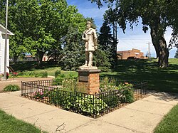
ミズーリ川の航行を支えた象徴的な人物として、蒸気船船長のグラント・マーシュが挙げられます。彼はこの川で最も有名な船長の一人であり、現在も彼にまつわる史跡が街に残されています。
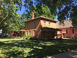
自然環境と都市の変遷
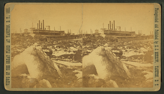
ヤンクトンの地理的特性は、その発展と困難の両方をもたらしました。川沿いの立地は貿易に有利でしたが、1881年には大規模な洪水に見舞われるなど、自然の脅威とも戦ってきました。
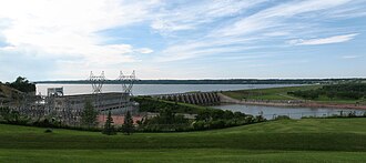
現代では、1950年代に建設されたガビンスポイントダムによって水資源の管理と発電が行われており、ダムによって形成されたルイス・アンド・クラーク湖は、レクリエーションの場として親しまれています。
気候の特徴
この地域の気候は、夏季は非常に暑く、冬季は厳しい寒さに見舞われる大陸性気候です。年間の平均降水量は約728mmで、特に春から夏にかけて雨が多くなります。冬には積雪もあり、10月には平均して38インチ(約97cm)もの雪が降る月があるなど、季節による変動が激しいのが特徴です。
教育・文化と現代の生活
教育面では、1881年に設立されたヤンクトン大学が、準州初の私立高等教育機関として100年以上にわたり街の知的中心地となりました。現在は閉校していますが、そのキャンパス跡地は連邦刑務所として利用されています。
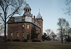
現在は、カトリック系のマウントマーティ大学がその役割を担っており、2020年には大学(University)へと移行し、博士課程などの高度な教育プログラムを提供しています。
文化的なハイライトは、毎年8月の第3週末に開催される「リバーボート・デイズ」です。リバーサイドパークを舞台に、150人以上のアーティストや50以上のフードベンダーが集まり、ロデオやパレードなど、街を挙げての祝祭が行われます。
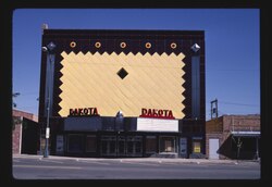
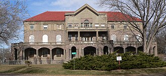
また、街の歴史を保存する取り組みも盛んで、多くの歴史的地区が国家歴史登録財に指定されています。かつての商業地区や住宅地区、そして将来的にダコタ準州博物館となる予定のミード・ビルディングなど、至る所に歴史の断片が残っています。
ヤンクトンの基本データまとめ
| 項目 | 詳細 |
|---|---|
| 設立 / 法人化 | 1858年 / 1869年 |
| 人口 (2020年) | 15,411人 |
| 面積 | 約8.91平方マイル (23.08 km²) |
| 標高 | 1,243フィート (379 m) |
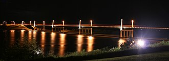
| 主要交通路 | 国道81号線、ディスカバリー橋 |
| 主要産業・施設 | マウントマーティ大学、ガビンスポイントダム |
よくある質問(FAQ)
ヤンクトンが「母なる街」と呼ばれるのはなぜですか?
ダコタ準州の最初の州都であり、現在のサウスダコタ州とノースダコタ州が分かれる前の地域の行政・経済の中心的役割を果たしたためです。
街の主な観光スポットはどこですか?
リバーサイドパークにあるダコタ準州議事堂のレプリカや、ミズーリ川に架かるディスカバリー橋、そして歴史的な商業地区などが人気です。
リバーボート・デイズとはどのようなイベントですか?
毎年8月に開催される大規模な地域祭りで、アート、食、ロデオ、パレードなどが楽しめ、州内外から多くの観光客が訪れます。
ヤンクトンの気候で注意すべき点はありますか?
夏は最高気温が40度を超えることがあり、冬は氷点下20度を下回る極寒となるため、訪れる際は季節に合わせた十分な装備が必要です。
教育機関としてどのような学校がありますか?
現在は私立のベネディクト会系大学であるマウントマーティ大学があり、学士から博士課程まで提供しています。
References
- "SD Towns" (PDF). . Archived (PDF) from the original on February 10, 2010. Retrieved February 17, 2010.
- "Boards and Committees". City of Yankton. Archived from the original on December 24, 2017. Retrieved December 16, 2025.
- "City Manager". Archived from the original on February 13, 2010. Retrieved March 12, 2010.
- "ArcGIS REST Services Directory". United States Census Bureau. Retrieved October 15, 2022.
- U.S. Geological Survey Geographic Names Information System: Yankton, South Dakota
- "Census Population API". United States Census Bureau. Retrieved October 15, 2022.
- "U.S. Census website". . Retrieved January 31, 2008.
- "Explore Census Data". . Retrieved July 21, 2022.
- Riggs, S.R., The Reverend (1852) – Smithsonian Contributions to Knowledge: Grammar and Dictionary of the Dakota Language. Smithsonian Institution/G.P. Putnam, New York, N.Y. pp. 297, 336.
- "City of Yankton, South Dakota". South Dakota Magazine. Archived from the original on July 22, 2014. Retrieved April 20, 2013.
📸 フォトギャラリー