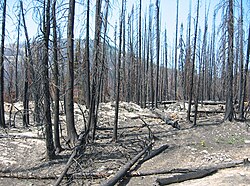
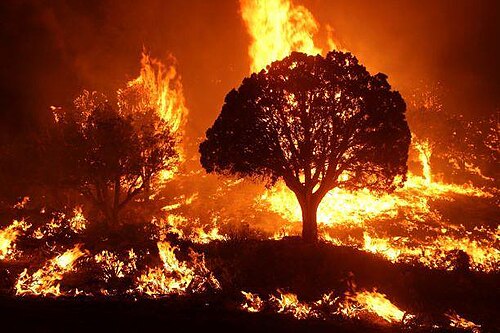
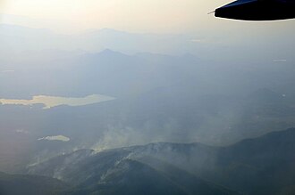
Wildfire burning in the Kaibab National Forest, Arizona, United States, in 2020. The Mangum Fire burned more than 70,000 acres (280 km2) of forest.
← ホームへ戻る

野火(ワイルドファイア)のメカニズムと環境への影響

🗓 2026年8月9日

野火(ワイルドファイア)とは、森林や草原などの可燃性植生エリアで発生し、制御不能となった火災を指します。地域によって森林火災ブッシュファイア、ブラシファイアなどと呼ばれますが、いずれも自然界や人間社会に甚大な影響を及ぼす現象です。一方で、一部の生態系においては、野火が自然なサイクルの一部として機能し、種の更新や環境維持に寄与している側面もあります。

現代の森林管理では、あえて計画的に火を放つ計画燃焼prescribed burns)が行われています。これは、蓄積した可燃物をあらかじめ除去することで、将来的な大規模火災のリスクを軽減し、自然な森林サイクルを促進することを目的としています。しかし、これらの管理火災が封じ込めラインを越えて広がると、結果的に制御不能な野火へと発展する危険性も孕んでいます。
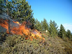
A small fire on the slope of a hill. The hill features small, green shrubbery and some trees. A person in light-colored clothing in seen in the background, some distance from the flames.

Key Facts

  • 野火は自然発生的な原因と人間活動の両方によって引き起こされる。
  • 気候変動による乾燥と高温のサイクルが、火災の激甚化を招いている。
  • 煙による健康被害だけでなく、土壌や水質の汚染など広範な環境影響がある。
  • 衛星モニタリングやセンサーネットワークによる早期検知が不可欠となっている。
  • 一部の植物や生態系は、火災後の更新プロセスに依存している。

野火の発生要因と拡大のメカニズム

出火の原因

野火の火種は大きく分けて2つのルートがあります。一つは落雷などの自然現象であり、特に乾燥した夏季に頻発します。もう一つは人間による活動で、不注意な火の扱いから意図的な放火まで多岐にわたります。
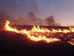
Lightning-sparked wildfires are frequent occurrences during the dry summer season in Nevada.

火災の激しさを決める要因

火災の規模や深刻度は、燃料となる植生量、地形、そして気象条件の組み合わせで決まります。特に、湿潤な時期に植物が大量に成長し、その後に深刻な干ばつと猛暑が訪れるという気候サイクルが、壊滅的な大火災の前兆となることが多いとされています。
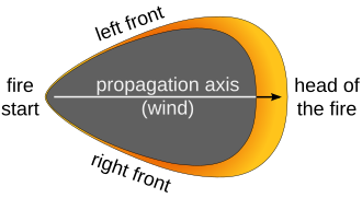
A dark region shaped like a shield with a pointed bottom. An arrow and the text "propagation axis (wind)" indicates a bottom-to-top direction up the body of the shield shape. The shape's pointed bottom is labeled "fire starter". Around the shield shape's top and thinning towards its sides, a yellow-orange region is labeled "left front", "right front", and (at the top) "head of the fire".

火災の種類と挙動

火災は、地表の落ち葉などが燃える「地表火」から、樹木の梢まで燃え広がる「樹冠火」まで、その形態によって被害の程度が異なります。また、昼夜の温度差や湿度変化によって、火の勢いは変動します。
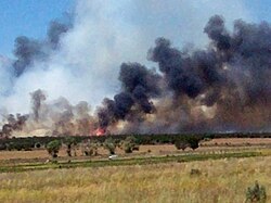
Flat expanse of brown grasses and some green trees with black and some gray smoke and visible flames in the distance.

Mountainous region with blackened soil and trees due to a recent fire.

気候変動との相互作用

地球温暖化に伴う気候変動は、野火のリスクを増大させています。気温の上昇と降水パターンの変化は、植生を乾燥させ、より燃えやすい状態を作り出します。また、一度発生した大規模な火災は大量の二酸化炭素を放出するため、それがさらなる温暖化を招くという正のフィードバック(悪循環)を形成しています。

Over recent decades, "forest disturbance" (damage) by fire has increased in most of the planet's forest zones.[77] The increase in area, frequency, and severity of forest fires creates a positive feedback that increases global warming.[77]

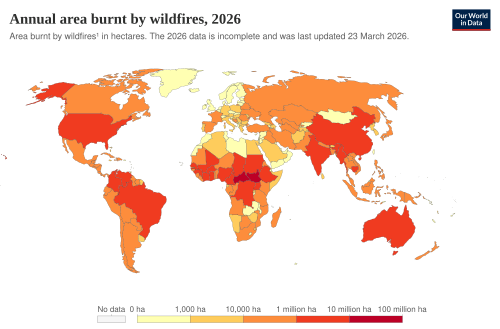
世界的に見ても、ロシアのシベリア、アメリカ(カリフォルニア、ワシントン、オレゴン、テキサス、フロリダ)、カナダ、オーストラリアなどで甚大な被害が報告されており、火災の頻度と面積は増加傾向にあります。
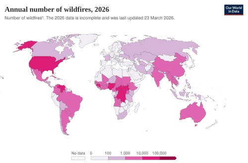
Annual number of fires

Annual area burnt by wildfires

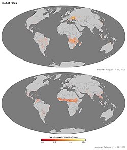
Two illustrations of the earth, one above the other. The seas are dark gray in color and the continents a lighter gray. Both images have red, yellow, and white markers indicating where fires occurred during the months of August (top image) and February (bottom image) of the year 2008.

検知から抑制までの対策

早期検知システム

被害を最小限に抑えるためには、迅速な発見が不可欠です。地上に設置された局所的なセンサーネットワークに加え、NASAのMODISやVIIRSなどの衛星データを用いた広域モニタリングが行われており、ほぼリアルタイムで火災地点を特定することが可能です。
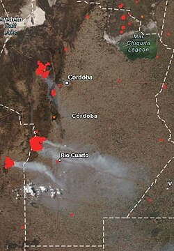
The 2020 Córdoba wildfires imaged by NASA's FIRMS

消火と抑制活動

消火活動には、地上部隊による防火帯の構築や、ヘリコプターや航空機による消火剤・水の散布が用いられます。また、物理的な障壁(未舗装路など)が火の広がりを止める防波堤として機能する場合もあります。
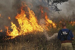
A Russian firefighter extinguishing a wildfire

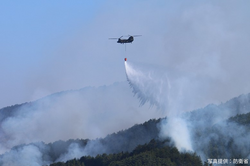
A JSDF helicopter dropping water at a wildfire

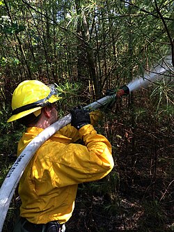
Wildland firefighter working a brush fire in Hopkinton, New Hampshire, US

Wildfire burning in the Kaibab National Forest, Arizona, United States, in 2020. The Mangum Fire burned more than 70,000 acres (280 km2) of forest.

A dirt road acted as a fire barrier in South Africa. The effects of the barrier can clearly be seen on the unburnt (left) and burnt (right) sides of the road.

予防的なアプローチ

物理的な消火以外にも、山羊などの家畜に植生を食べさせることで燃料となる草木を減らす「放牧プログラム」などの生物学的な予防策も導入されています。
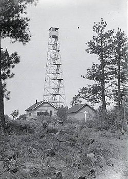
A four-legged tower with a small at the top, next to two one-story buildings. The tower is four stories tall. Trees are at either side, and in the foreground, there are rocks, some vegetation, and a rough trail.

環境および人間への影響

自然生態系への打撃と再生

野火は森林を破壊し、野生動物の生息地を奪いますが、同時に古い植生をリセットし、新たな種の定着を促す「生態遷移」のきっかけにもなります。しかし、あまりに頻繁で激しい火災は、土壌の浸食や水質の汚染を引き起こし、河川や海洋生態系にまで悪影響を及ぼします。
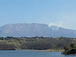
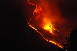
Forest fires visible from a distance in Dajti National Park, Tirana, Albania

A wildfire in Venezuela during a drought

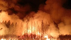
Wildfire near Yosemite National Park, United States, in 2013. The Rim Fire burned more than 250,000 acres (1,000 km2) of forest.

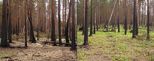
Two photographs of the same section of a pine forest; both show blackened bark at least halfway up the trees. The first picture is noticeably lacking in surface vegetation, while the second shows small, green grasses on the forest floor.

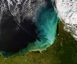
Sediment off the Yucatán Peninsula

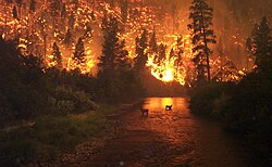
Elk Bath, an award-winning photograph of elk avoiding a wildfire in Montana

人間社会へのリスク

都市部と野生地域が接する「野生地域・都市インターフェース(WUI)」では、住宅の焼失などの直接的な財産被害が深刻です。また、火災によって発生する大量の煙は、広範囲にわたって大気質を悪化させます。
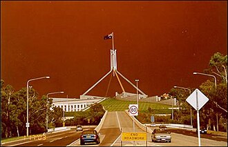
2003 Canberra bushfires, visible from Parliament House

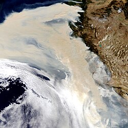
Wildfire smoke in the atmosphere off the U.S. West Coast in 2020

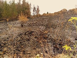
Charred shrubland in suburban Sydney (2019–20 Australian bushfires)

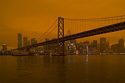
Smoke from the 2020 California wildfires settles over San Francisco

健康被害

煙に含まれる微粒子や一酸化炭素は、呼吸器系に深刻な影響を与えます。特に喘息などの持病がある人々や高齢者、子供などのリスクグループにとって、煙の吸入は急性疾患の悪化を招く危険があります。
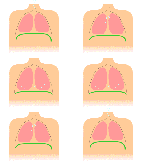
Animation of diaphragmatic breathing with the diaphragm shown in green

野火の概要まとめ

野火の特性と影響まとめ
項目 詳細内容
主な原因 落雷(自然)、不注意・放火(人間)
拡大要因 乾燥した植生、強風、高温、地形
環境影響 CO2放出、土壌浸食、水質汚染、生態系遷移
人間への影響 財産喪失、呼吸器疾患、経済的損失
対策手法 計画燃焼、衛星監視、航空消火、防火帯設置

Aerial view of deliberate wildfires on the Khun Tan Range, Thailand. These fires are lit by local farmers every year to promote the growth of a certain mushroom.

Frequently Asked Questions

野火はすべて有害なものなのでしょうか?

いいえ。一部の森林生態系では、火災が古い樹木を取り除き、種子の発芽を促すなど、自然な更新サイクルに不可欠な役割を果たしています。

気候変動はどのようにして火災を悪化させるのですか?

温暖化により蒸発量が増え、植生が乾燥しやすくなるためです。これにより、一度火がつくと燃え広がりやすく、より激しい火災が発生しやすい環境が整います。

計画燃焼(prescribed burn)とは何ですか?

管理者が意図的に小規模な火を放つことで、地面に溜まった枯れ葉などの「燃料」をあらかじめ減らし、大規模な野火が発生した際の被害を抑える予防策です。

野火の煙はどのような健康リスクがありますか?

微小粒子状物質や一酸化炭素が含まれており、喘息などの呼吸器疾患を悪化させたり、心血管系に負担をかけたりする可能性があります。

衛星による火災検知にはどのようなメリットがありますか?

地上からは見えない広大な森林地帯や、アクセス困難な地域でも、熱源を検知して迅速に特定できるため、初期消火の成功率を高めることができます。

References

  1. Cambridge Advanced Learner's Dictionary (3rd ed.). Cambridge University Press. 2008.  . Archived from the original on 13 August 2009.
  2. "CIFFC Canadian Wildland Fire Management Glossary". BBC Earth. Archived from the original (PDF) on 16 October 2015. Retrieved 13 February 2016.
  3. "Drought, Tree Mortality, and Wildfire in Forests Adapted to Frequent Fire" (PDF). UC Berkeley College of Natural Resources. Archived (PDF) from the original on 9 August 2022. Retrieved 15 March 2022.
  4. Flannigan, M. D.; Amiro, B. D.; Logan, K. A.; Stocks, B. J.; Wotton, B. M. (July 2006). "Forest Fires and Climate Change in the 21ST Century". Mitigation and Adaptation Strategies for Global Change. 11 (4): 847–859. :10.1007/s11027-005-9020-7.
  5. Graham, et al., 12, 36
  6. National Wildfire Coordinating Group Communicator's Guide For Wildland Fire Management, 4–6.
  7. "National Wildfire Coordinating Group Fireline Handbook, Appendix B: Fire Behavior" (PDF). National Wildfire Coordinating Group. April 2006. Archived (PDF) from the original on 17 December 2008. Retrieved 11 December 2008.
  8. Trigo, Ricardo M.; Provenzale, Antonello; Llasat, Maria Carmen; AghaKouchak, Amir; Hardenberg, Jost von; Turco, Marco (6 March 2017). "On the key role of droughts in the dynamics of summer fires in Mediterranean Europe". Scientific Reports. 7 (1): 81. :2017NatSR...7...81T. :10.1038/s41598-017-00116-9.  2045-2322.  5427854.  28250442.
  9. Westerling, A.L.; Hidalgo, H.G.; Cayan, D.R.; Swetnam, T.W. (18 August 2006). "Warming and Earlier Spring Increase Western U.S. Forest Wildfire Activity". Science. 313 (5789): 940–943. :2006Sci...313..940W. :10.1126/science.1128834. :10669/29855.  0036-8075.  16825536.
  10. Parmesan, C., M.D. Morecroft, Y. Trisurat, R. Adrian, G.Z. Anshari, A. Arneth, Q. Gao, P. Gonzalez, R. Harris, J. Price, N. Stevens, and G.H. Talukdarr, 2022: Chapter 2: Terrestrial and Freshwater Ecosystems and Their Services Archived 21 May 2023 at the . In: Climate Change 2022: Impacts, Adaptation and Vulnerability. Contribution of Working Group II to the Sixth Assessment Report of the Intergovernmental Panel on Climate Change Archived 28 February 2022 at the "Terrestrial and Freshwater Ecosystems and Their Services". Climate Change 2022 – Impacts, Adaptation and Vulnerability. 2023. pp. 197–378. :10.1017/9781009325844.004.  .

📸 フォトギャラリー

Wildfire burning in the Kaibab National Forest, Arizona, United States, in 2020. The Mangum Fire burned more than 70,000 acres (280 km2) of forest.
Annual number of fires
Annual area burnt by wildfires
Two illustrations of the earth, one above the other. The seas are dark gray in color and the continents a lighter gray. Both images have red, yellow, and white markers indicating where fires occurred during the months of August (top image) and February (bottom image) of the year 2008.
Lightning-sparked wildfires are frequent occurrences during the dry summer season in Nevada.
Flat expanse of brown grasses and some green trees with black and some gray smoke and visible flames in the distance.
Mountainous region with blackened soil and trees due to a recent fire.
Forest fires visible from a distance in Dajti National Park, Tirana, Albania
A dirt road acted as a fire barrier in South Africa. The effects of the barrier can clearly be seen on the unburnt (left) and burnt (right) sides of the road.
A wildfire in Venezuela during a drought
Over recent decades, "forest disturbance" (damage) by fire has increased in most of the planet's forest zones.[77] The increase in area, frequency, and severity of forest fires creates a positive feedback that increases global warming.[77]
Wildfire near Yosemite National Park, United States, in 2013. The Rim Fire burned more than 250,000 acres (1,000 km2) of forest.
A small fire on the slope of a hill. The hill features small, green shrubbery and some trees. A person in light-colored clothing in seen in the background, some distance from the flames.
A four-legged tower with a small at the top, next to two one-story buildings. The tower is four stories tall. Trees are at either side, and in the foreground, there are rocks, some vegetation, and a rough trail.
The 2020 Córdoba wildfires imaged by NASA's FIRMS
A Russian firefighter extinguishing a wildfire
A JSDF helicopter dropping water at a wildfire
Wildland firefighter working a brush fire in Hopkinton, New Hampshire, US
A dark region shaped like a shield with a pointed bottom. An arrow and the text "propagation axis (wind)" indicates a bottom-to-top direction up the body of the shield shape. The shape's pointed bottom is labeled "fire starter". Around the shield shape's top and thinning towards its sides, a yellow-orange region is labeled "left front", "right front", and (at the top) "head of the fire".
2003 Canberra bushfires, visible from Parliament House
Wildfire smoke in the atmosphere off the U.S. West Coast in 2020
Two photographs of the same section of a pine forest; both show blackened bark at least halfway up the trees. The first picture is noticeably lacking in surface vegetation, while the second shows small, green grasses on the forest floor.
Animation of diaphragmatic breathing with the diaphragm shown in green
Sediment off the Yucatán Peninsula
Charred shrubland in suburban Sydney (2019–20 Australian bushfires)
Smoke from the 2020 California wildfires settles over San Francisco
Elk Bath, an award-winning photograph of elk avoiding a wildfire in Montana
Aerial view of deliberate wildfires on the Khun Tan Range, Thailand. These fires are lit by local farmers every year to promote the growth of a certain mushroom.