Satellite image of Sardinia, acquired on 27 April 2003 by NASA's Aqua MODIS instrument
← ホームへ戻る

サルデーニャ島地中海の歴史と自然が息づくイタリアの自治州

🗓 2026年8月10日

イタリア本土の西に位置するサルデーニャ島は、独自の文化と豊かな自然、そして数千年にわたる歴史が交差する地中海最大の島の一つです。イタリアの自治州として、政治的な自律性を持ちながら、古代文明の遺構から現代のラグジュアリーリゾートまで、多様な顔を併せ持っています。
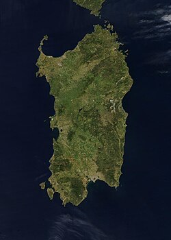
Satellite image of Sardinia, acquired on 27 April 2003 by NASA's Aqua MODIS instrument

主要な事実(Key Facts)

  • 州都: カリアリ(Cagliari)
  • 人口: 約155万人(2026年推計)
  • 公用語: イタリア語およびサルデーニャ語(その他、サッサレーゼ語やガッルレーゼ語などの少数言語が存在)
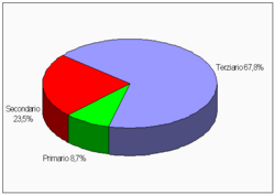
  • 経済: 第三次産業(観光・サービス業)が雇用の約67.8%を占める
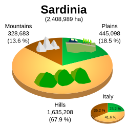
  • 地理: 面積は約24,100平方キロメートルで、地形の約67.9%が丘陵地帯

悠久の歴史:先史時代から現代まで

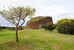
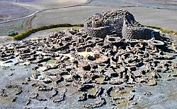
サルデーニャの歴史は、世界的に類を見ない独自の文明から始まります。特に青銅器時代に栄えたヌラーゲ文明は、島中に点在する円錐形の石造塔「ヌラーゲ」によって象徴されており、当時の高度な建築技術を今に伝えています。
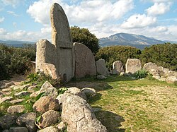
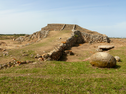
Giants' grave in Dorgali (Bronze Age)
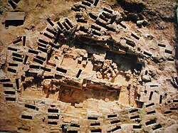
The prehistoric megalithic temple of Monte d'Accoddi
Nuraghe Losa
Su Nuraxi, Barumini

その後、島はフェニキア人、ローマ人、そしてヴァンダル族などの支配を受けました。中世には「ジュディカート」と呼ばれる独自の小王国時代を経て、アラゴン王国やスペイン、サヴォイア家による統治へと移り変わります。これらの多様な支配層の影響が、現在の建築様式や言語の多様性に反映されています。
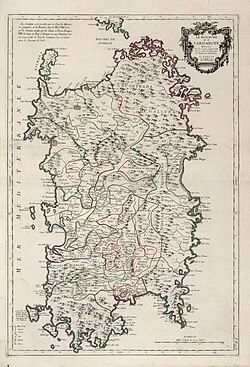
Map of Sardinia, 1779
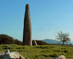
Monte Corru Tundu Menhir in Villa Sant'Antonio (5.75 meters high)
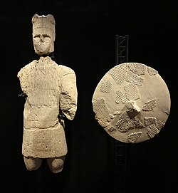
One of the so-called Giants of Mont'e Prama
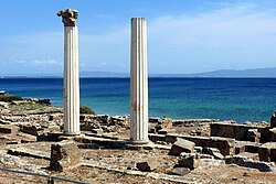
The Phoenician and subsequently Roman town of Tharros
Necropolis of Tuvixeddu, Cagliari
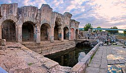
Roman thermae of Forum Traiani, in what is now Fordongianus
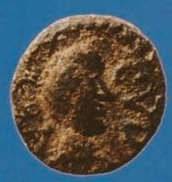
A Vandal-period coin found in Sardinia depicting Godas. Latin legend: REX CVDA.
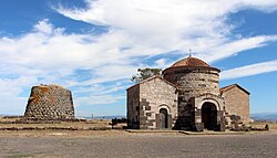
Santa Sabina Byzantine church and nuraghe in Silanus
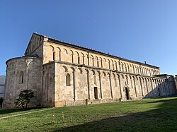
The medieval Basilica of San Gavino in Porto Torres
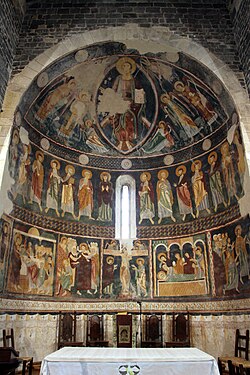
12th-century frescoes in the Basilica di Saccargia in Codrongianos
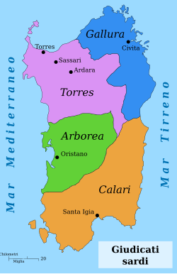
The Sardinian Judicates
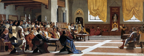
The proclamation of the Republic of Sassari. The Sassarese republic lasted from 1272 until 1323, when it sided with the new born Kingdom of Sardinia.
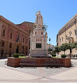
Statue of the Juighissa Eleanor of Arborea in Oristano by Ulisse Cambi
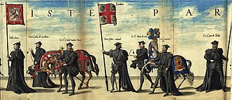
Flag of the Kingdom of Sardinia (center) at the funeral of Charles I of Spain
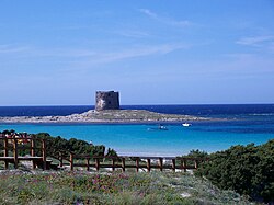
Spanish era coastal tower in Stintino called Torre della Pelosa
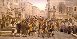
G.M. Angioy entry into Sassari

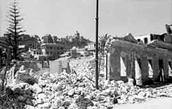
近代に入るとイタリア王国の一部となり、第二次世界大戦中には激しい空襲を受けるなどの困難を経験しました。戦後は自治州としての地位を確立し、独自のアイデンティティを保持しながら発展を続けています。
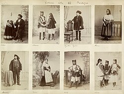
Sardinians wearing traditional ethnic garments, 1880s
Effect of Allied bombing on Cagliari during the Second World War

自然環境と地理的特徴

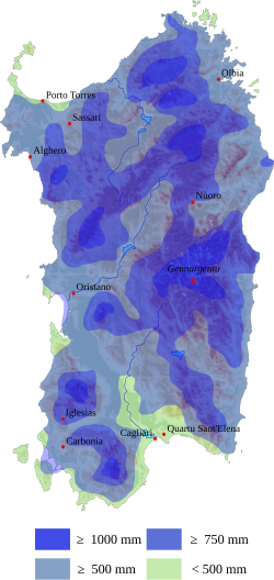
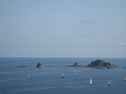
島の地形は非常に多様で、険しい山岳地帯から広大な平原、そして美しい海岸線まで揃っています。気候は典型的な地中海性気候で、夏は乾燥して暑く、冬は穏やかですが、内陸の高地では降水量が多く、異なる植生が見られます。
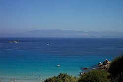
Strait of Bonifacio. The southern coast of Corsica can be seen from Santa Teresa Gallura.
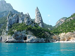
Cala Goloritzé, Baunei
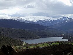
View of Gennargentu, the highest massif of Sardinia
A proportionate graph of Sardinian topography: 13.6% of the island is mountainous, 18.5% is flat, and 67.9% is hilly.
Sardinia average rainfalls

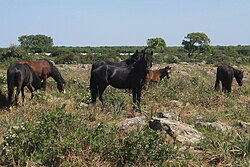
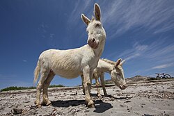
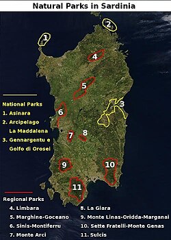
生態系も豊かで、野生のジャラ馬やアシナーラの白いロバ、そして独自の進化を遂げた野良猫などが生息しています。また、コルク樫の森などの貴重な植生が保護されており、多くの国立公園や地域公園が設置されています。
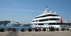
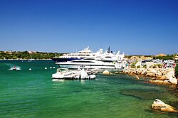
Super yachts anchored at Porto Cervo port, Costa Smeralda
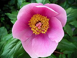
Paeonia mascula
Giara horses
Albino donkeys in Asinara
The Sardinian feral cat, long considered a subspecies of the African wildcat, are descended from domesticated cats.[135]
National and regional parks of Sardinia
Sulcis Regional Park, the largest Mediterranean evergreen forest in the Mediterranean Basin.[145]

経済構造とインフラ

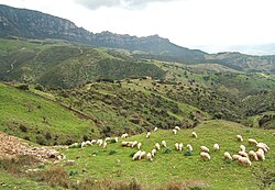
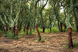
現在のサルデーニャ経済は、観光業を中心とした第三次産業が牽引しています。特にコスタ・スメラルダなどの高級リゾート地は、1960年代以降、世界中の富裕層を惹きつける重要な収入源となっています。一方で、伝統的な羊の放牧やコルク生産などの一次産業も根強く残っています。
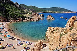
Tourism in Sardinia is one of the fastest growing sectors of the regional economy.
Percentage distribution of employees in different economic sectors in Sardinia: 8.7% the primary sector (fishing, agriculture, farming), 23.5% the secondary sector (industry, machinery, manufacturing), and 67.8% the tertiary sector (tourism, services, finance)
Sheep grazing around Lula, Nuoro
Peeled trunks of cork oaks in Tempio Pausania
Yachts in Porto Cervo. Luxury tourism has been an important source of income in Sardinia since the 1960s.

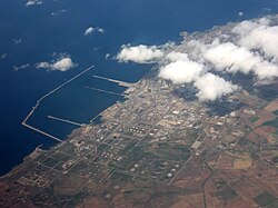
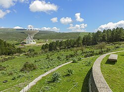
産業面では、ポルト・トーレスなどの地域で石油化学工業が展開されており、また最新の科学技術としてサルデーニャ電波望遠鏡のような世界的な研究施設も運用されています。
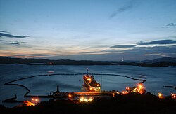
Santo Stefano's former NATO naval base
Petrochemical and Green Chemical industries in Porto Torres
Sardinia Radio Telescope

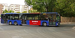
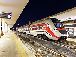
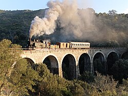
交通インフラについては、カリアリ・エルマス空港がイタリア国内でも有数の利用客数を誇り、高速フェリーによる本土や他島との接続が確保されています。島内ではバスや鉄道、そして観光鉄道が地域の足として機能しています。
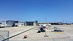
Cagliari-Elmas Airport. The 12th busiest airport in Italy in 2025
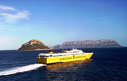
A high-speed ferry in the Gulf of Olbia
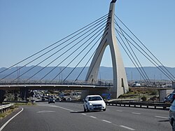
Cable-stayed bridge of the Monserrato University Campus interchange SS 554
A bus of Sardinia public transport authorities (Arst) in Sassari
ATR 365 owned by the Autonomous Region of Sardinia in Cagliari
Tourist railway between Aritzo and Belvì

文化と社会

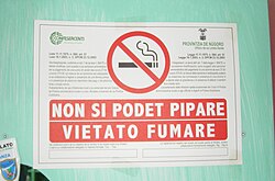
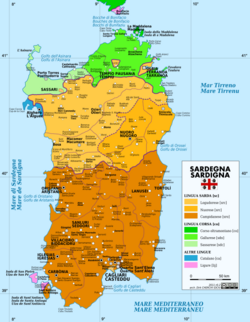
サルデーニャの文化は、外部からの影響を受けつつも、強い独立心と伝統へのこだわりによって形作られています。言語面ではイタリア語に加え、独自のサルデーニャ語が話されており、地域によってはカタロニア語などの影響も見られます。
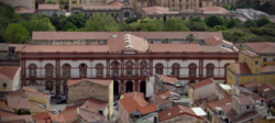
Main building of the University of Sassari (which started the university courses in 1562)
Linguistic map of Sardinia
A 'no smoking' sign in both Sardinian and Italian

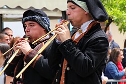
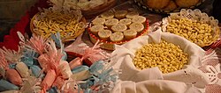
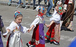
芸術面では、伝統的な民族衣装や、ラウネッダスと呼ばれる独特の管楽器を用いた音楽が受け継がれています。食文化においても、パネ・カラサウ(薄いパン)やペコリーノ・サルド(羊乳チーズ)など、土地の恵みを活かした独自の料理が発展しました。
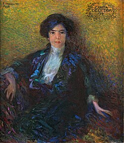
Portrait of Grazia Deledda by Plinio Nomellini, 1914
Costume from Ovodda
Launeddas players
A range of different cakes, pastries, meals, dishes and sweets which are common elements of Sardinian cuisine

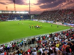
また、スポーツにおいてはサッカーやバスケットボールが人気であり、特に地域的なアイデンティティに基づいたスポーツ活動が盛んです。
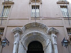
Portal of the Main Building of the University of Cagliari
Unipol Domus in Cagliari
Regatta at Santa Maria Navarrese
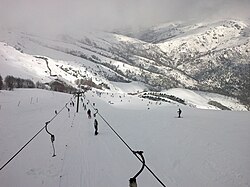
Skilifts on the Bruncu Spina

行政区画と主要都市

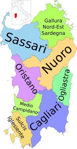
2025年以降、サルデーニャは2つの広域市(メトロポリタンシティ)と6つの県に分かれています。最大の都市カリアリを中心に、サッサリ、オルビアなどの都市が経済・文化の拠点となっています。
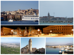
Cagliari, Alghero, Sassari, Nuoro, Oristano, Olbia
Provinces of Sardinia

また、NATOの演習場などの軍事施設も島内に存在し、地政学的な重要性も持っています。
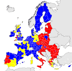
Economic classification of European regions according to Eurostat Less developed regions Transition regions More developed regions
US Artillery Live Fire Exercise in Capo Teulada 2015 during NATO exercise Trident Juncture

建築と芸術の遺産

島内には、聖クリスティーナの聖なる井戸のような古代の遺構から、中世のバジリカ、そして近代的な建築まで、多様な様式が混在しています。これらはサルデーニャが歩んできた複雑な歴史の証しです。
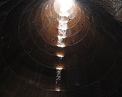
Santa Cristina holy well of Paulilatino, tholos
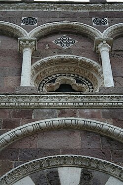
Facade of Nostra Signora di Tergu (SS)
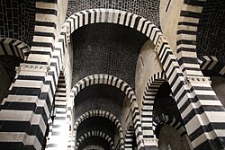
Interior of San Pietro di Sorres, Borutta (SS)
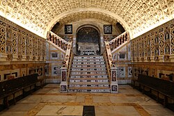
Crypt of the Cagliari Cathedral
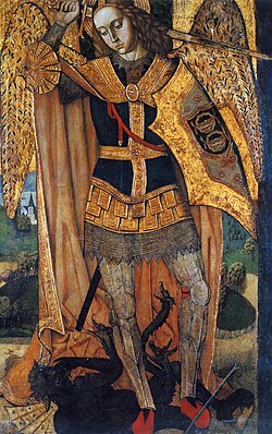
Archangel Michael by the Master of Castelsardo
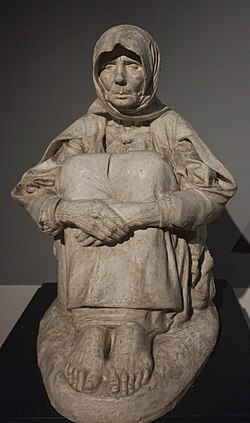
La madre dell'ucciso ("the mother of the killed") by Francesco Ciusa (1907)

サルデーニャの概要まとめ

サルデーニャ州の基本データ
項目 詳細
面積 24,100.02 km²
人口密度 64.5人/km²
主要産業 観光業、サービス業、農業(羊飼い・コルク)
地形構成 丘陵地(67.9%)、平地(18.5%)、山岳地(13.6%)
GDP (2024) 434.68億ユーロ

よくある質問(FAQ)

サルデーニャ島で話されている言語は何ですか?

公用語であるイタリア語のほか、独自のサルデーニャ語が広く話されています。また、地域によってはサッサレーゼ語、ガッルレーゼ語、アルゲーロのカタロニア語、タバルキーノのリグリア語などの少数言語が使用されています。

ヌラーゲ文明とは何ですか?

青銅器時代にサルデーニャ島で栄えた独自の文明です。その最大の特徴は「ヌラーゲ」と呼ばれる巨大な石造りの円錐形塔で、島全体に数多く点在しており、当時の社会構造や建築技術を示す重要な遺跡となっています。

島の主な産業は何ですか?

現在は第三次産業(観光、金融、サービス業)が経済の大部分を占めており、特に夏季のビーチリゾート観光が盛んです。一方で、伝統的な羊の放牧やコルク樫からのコルク生産といった一次産業も重要な役割を果たしています。

サルデーニャの気候はどのような特徴がありますか?

基本的には地中海性気候で、夏は非常に暑く乾燥し、冬は穏やかです。ただし、内陸部の高地(フォンニなど)では降水量が多く、沿岸部とは異なる寒冷な気候が見られます。

どのような自然保護区がありますか?

3つの国立公園(アシナーラ、ラ・マッダレーナ諸島など)と、10以上の地域公園が設置されています。特にスルチス地域公園は、地中海盆地で最大級の常緑樹林を有することで知られています。

References

  1. "Federalism" (PDF). idea.int. In rare cases, subnational institutions may function very differently from the national level: in Italy, for example, the national government is parliamentary, but regional institutions are basically presidential in form, with directly elected regional governors.
  2. "Superficie di Comuni Province e Regioni italiane al 9 ottobre 2011" (in Italian). .
  3. "Resident population by age, sex and marital status on 1st January 2026". demo.istat.it. . 1 January 2026. Retrieved 1 April 2026. (On the search form, choose the statistical region of the municipality in the Area section, the Region, the Province, and the name of the Municipality)
  4. "Resident population by age, sex and marital status on 1st January 2026". demo.istat.it. . 1 January 2026. Retrieved 1 April 2026.The file URL linking on technical dataset.
  5. "Statistiche demografiche ISTAT". Demo.istat.it. Archived from the original on 6 August 2017. Retrieved 26 July 2019.
  6. "EU regions by GDP, Eurostat".
  7. "Sub-national HDI – Area Database – Global Data Lab". hdi.globaldatalab.org. Retrieved 5 March 2023.
  8. "Delibera della Giunta regionale del 26 giugno 2012" (PDF). www.regione.sardegna.it. Retrieved 29 January 2026.
  9. and : Regione Autonoma della Sardegna / Regione Autònoma de Sardigna
  10. "Distance calculator for organisations - Erasmus+". erasmus-plus.ec.europa.eu (in German). 26 June 2025. Retrieved 29 January 2026.

📸 フォトギャラリー

Satellite image of Sardinia, acquired on 27 April 2003 by NASA's Aqua MODIS instrument
The prehistoric megalithic temple of Monte d'Accoddi
Map of Sardinia, 1779
Monte Corru Tundu Menhir in Villa Sant'Antonio (5.75 meters high)
Nuraghe Losa
Giants' grave in Dorgali (Bronze Age)
One of the so-called Giants of Mont'e Prama
The Phoenician and subsequently Roman town of Tharros
Necropolis of Tuvixeddu, Cagliari
Roman thermae of Forum Traiani, in what is now Fordongianus
A Vandal-period coin found in Sardinia depicting Godas. Latin legend: REX CVDA.
Santa Sabina Byzantine church and nuraghe in Silanus
The medieval Basilica of San Gavino in Porto Torres
12th-century frescoes in the Basilica di Saccargia in Codrongianos
The Sardinian Judicates
The proclamation of the Republic of Sassari. The Sassarese republic lasted from 1272 until 1323, when it sided with the new born Kingdom of Sardinia.
Statue of the Juighissa Eleanor of Arborea in Oristano by Ulisse Cambi
Flag of the Kingdom of Sardinia (center) at the funeral of Charles I of Spain
Spanish era coastal tower in Stintino called Torre della Pelosa
G.M. Angioy entry into Sassari
Sardinians wearing traditional ethnic garments, 1880s
Effect of Allied bombing on Cagliari during the Second World War
Super yachts anchored at Porto Cervo port, Costa Smeralda
Santo Stefano's former NATO naval base
Strait of Bonifacio. The southern coast of Corsica can be seen from Santa Teresa Gallura.
Cala Goloritzé, Baunei
View of Gennargentu, the highest massif of Sardinia
A proportionate graph of Sardinian topography: 13.6% of the island is mountainous, 18.5% is flat, and 67.9% is hilly.
Sardinia average rainfalls
Paeonia mascula
Giara horses
Albino donkeys in Asinara
The Sardinian feral cat, long considered a subspecies of the African wildcat, are descended from domesticated cats.[135]
National and regional parks of Sardinia
Sulcis Regional Park, the largest Mediterranean evergreen forest in the Mediterranean Basin.[145]
Main building of the University of Sassari (which started the university courses in 1562)
Portal of the Main Building of the University of Cagliari
Economic classification of European regions according to Eurostat Less developed regions Transition regions More developed regions
Tourism in Sardinia is one of the fastest growing sectors of the regional economy.
Percentage distribution of employees in different economic sectors in Sardinia: 8.7% the primary sector (fishing, agriculture, farming), 23.5% the secondary sector (industry, machinery, manufacturing), and 67.8% the tertiary sector (tourism, services, finance)
Sheep grazing around Lula, Nuoro
Peeled trunks of cork oaks in Tempio Pausania
Petrochemical and Green Chemical industries in Porto Torres
Yachts in Porto Cervo. Luxury tourism has been an important source of income in Sardinia since the 1960s.
Sardinia Radio Telescope
Cagliari-Elmas Airport. The 12th busiest airport in Italy in 2025
A high-speed ferry in the Gulf of Olbia
Cable-stayed bridge of the Monserrato University Campus interchange SS 554
A bus of Sardinia public transport authorities (Arst) in Sassari
ATR 365 owned by the Autonomous Region of Sardinia in Cagliari
Tourist railway between Aritzo and Belvì
Cagliari, Alghero, Sassari, Nuoro, Oristano, Olbia
Provinces of Sardinia
US Artillery Live Fire Exercise in Capo Teulada 2015 during NATO exercise Trident Juncture
Santa Cristina holy well of Paulilatino, tholos
Facade of Nostra Signora di Tergu (SS)
Interior of San Pietro di Sorres, Borutta (SS)
Crypt of the Cagliari Cathedral
Archangel Michael by the Master of Castelsardo
La madre dell'ucciso ("the mother of the killed") by Francesco Ciusa (1907)
Su Nuraxi, Barumini
Linguistic map of Sardinia
A 'no smoking' sign in both Sardinian and Italian
Portrait of Grazia Deledda by Plinio Nomellini, 1914
Costume from Ovodda
Launeddas players
A range of different cakes, pastries, meals, dishes and sweets which are common elements of Sardinian cuisine
Unipol Domus in Cagliari
Regatta at Santa Maria Navarrese
Skilifts on the Bruncu Spina