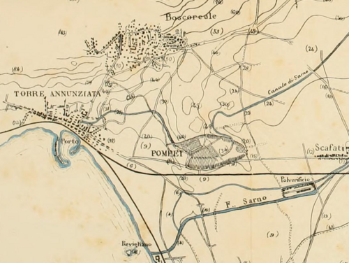
イタリアのカンパニア州、ナポリ近郊に位置するポンペイは、西暦79年のヴェスヴィオ火山の大噴火によって一瞬にして灰に埋もれた古代都市です。この悲劇的な出来事が、皮肉にも当時の街並みや人々の生活様式をほぼ完璧な状態で保存することとなりました。現在ではユネスコの世界文化遺産に登録されており、古代ローマの社会構造や文化を直接的に体感できる世界的に貴重な考古学サイトとなっています。
都市の規模は約64〜67ヘクタールに及び、当時の人口は世帯数からの推計で約11,000人から11,500人とされていました。単なる住宅地ではなく、商業、宗教、娯楽が高度に融合した都市機能を持っていたことが分かっています。
Key Facts
- 立地: イタリア、ナポリ近郊のカンパニア州。
- 滅亡: 西暦79年のヴェスヴィオ火山噴火により放棄。
- 規模: 面積は約64〜67ヘクタール、推定人口は約1.1万人超。
- 世界遺産: 1997年に「ポンペイ、ヘルクラネウム、トッレ・アンヌンツィアータの考古学地域」として登録。
- 特徴: 火山灰による保存状態で、当時の建築や壁画、生活用品がそのまま残っている。
都市の形成と変遷
ポンペイの歴史は紀元前7世紀から6世紀にまで遡ります。初期はサムニウム人の町として発展し、その後、紀元前4世紀に第1次拡張が行われました。さらに紀元前89年以降はローマの支配下に入り、ローマ様式の都市へと大きく変貌を遂げました。
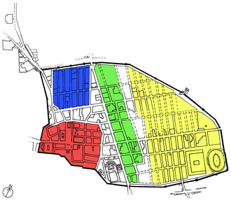
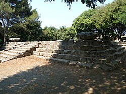
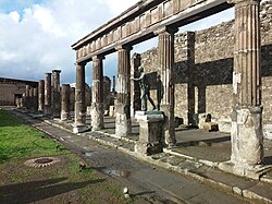
都市の構造は、ギリシャやエトルリアの影響を強く受けています。例えば、三角フォーラムにあるギリシャ・ドリス式神殿や、エトルリア様式のアポロ神殿などがその証拠です。
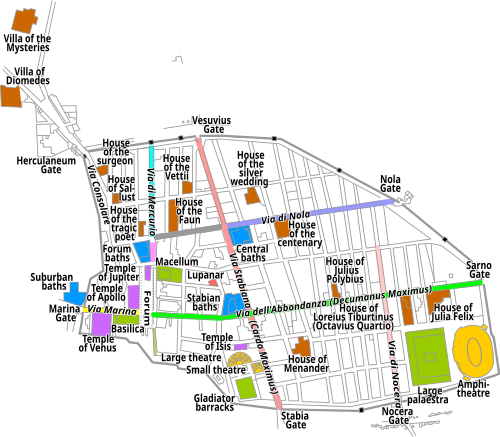
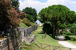
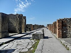
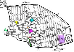
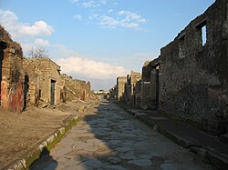
また、都市を守るための強固な市壁が築かれ、内部には計画的な道路網が整備されていました。特に「アッボンダンツァ通り」は街のメインストリートとして、多くの商店や住宅が立ち並ぶ経済の動脈となっていました。
古代ローマの都市機能と建築
公共施設と娯楽
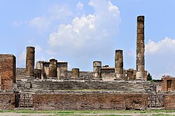
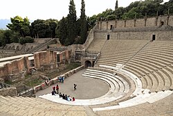
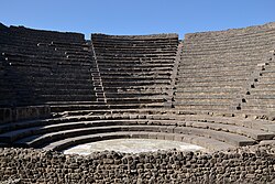
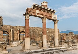
ポンペイには、市民の生活を豊かにするための多様な公共施設が存在しました。政治と経済の中心地であるフォーラム(広場)には、ジュピター神殿などの重要な宗教施設が集まっていました。また、大規模な劇場や、音楽・詩の朗読に用いられたオデオン(小劇場)があり、文化的な活動が盛んでした。
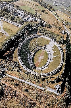
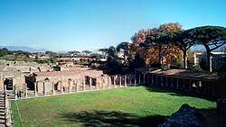
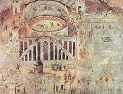
特に注目すべきは、ローマ時代最古級の形態を持つ円形闘技場(アンフィシアトル)です。ここでは剣闘士による激しい戦いが繰り広げられ、市民の最大の娯楽となっていました。闘技場に隣接して剣闘士の宿舎が設けられていたことも分かっています。
商業と日常生活
街のいたるところに、現代のファストフード店に似た「テルモポリウム(軽食店)」やパン屋などの店舗が点在していました。これらは通りに直接面しており、利便性の高い都市設計がなされていました。
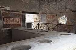
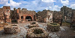
また、高度な水利システムも完備されており、フォンタナの水道橋を通じて都市全体に水が供給されていました。公衆浴場(スタビアン浴場や郊外浴場)は、単なる洗浄の場ではなく、社交の場としても機能していました。
住宅と芸術
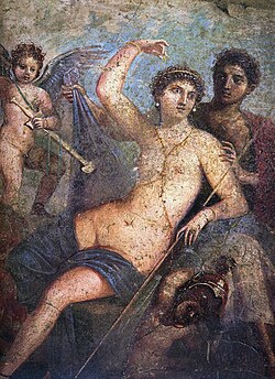
ポンペイの住宅は、富裕層の邸宅である「ドムス」から庶民の住居まで多様です。ファウヌスの家やヴェッティの家などの邸宅には、精巧なモザイク画や鮮やかなフレスコ壁画が施されており、当時の高い芸術水準を伝えています。また、都市郊外には「神秘のヴィラ」のような豪華な別荘も点在していました。
悲劇の瞬間と考古学的発見
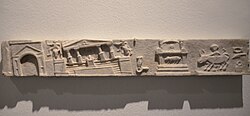
西暦62年に発生した大地震により、街は深刻な被害を受けていました。ジュピター神殿などの建物が傾くなど、噴火前の予兆とも言える状況にありましたが、人々は復興を続けていました。
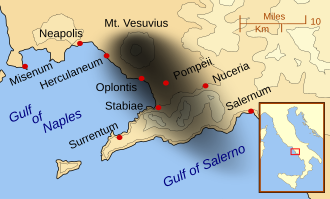
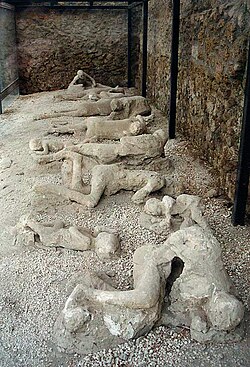
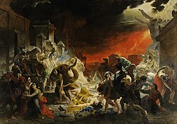
しかし、西暦79年、ヴェスヴィオ火山が猛烈な噴火を起こしました。大量の火山灰と軽石が街を覆い尽くし、逃げ遅れた人々はそのまま封印されました。現代の考古学では、遺体が分解された後の空洞に石膏を流し込むことで、当時の人々の苦悶の表情や姿勢を再現する手法が取られています。
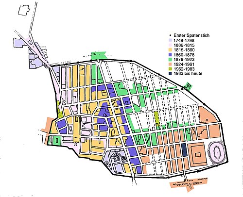
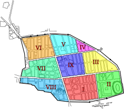
再発見後の発掘調査では、フィオリエッリによる区域分け(レギオ)などの計画的な手法が導入され、徐々に街の全貌が明らかになりました。しかし、発掘された遺構は、植物の侵食や観光客による摩耗など、保存上の課題にも直面しています。
自然と産業の調和
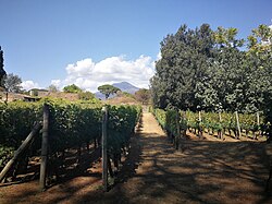
ポンペイは商業都市であると同時に、豊かな農業地帯でもありました。特にブドウ栽培が盛んであり、現代でも当時の品種を再現して再植栽するプロジェクト(マストロベルディーノとの提携など)が行われています。
また、芸術的な側面では、エロティックな壁画や彫刻が多く残されていることでも知られており、当時の自由な性文化や価値観を今に伝えています。
ポンペイの概要まとめ
| 項目 | 詳細内容 |
|---|---|
| 都市面積 | 約64〜67ヘクタール |
| 推定人口 | 11,000 〜 11,500人 |
| 主要な建築物 | フォーラム、円形闘技場、劇場、公衆浴場、各種神殿 |
| 滅亡の原因 | ヴェスヴィオ火山の噴火(西暦79年) |
| 世界遺産登録年 | 1997年 |
Frequently Asked Questions
ポンペイの街はなぜこれほど綺麗に残っていたのですか?
ヴェスヴィオ火山から噴出した大量の火山灰と軽石が、都市全体を急速に覆い尽くしたためです。これにより、酸素が遮断され、有機物や建築物が腐敗や風化から守られ、真空パックされたような状態で保存されました。
石膏の像は本物の人間なのですか?
いいえ、石膏そのものが人間ではありません。火山灰の中で遺体が分解されて空洞ができた場所に、考古学者が石膏を流し込むことで、亡くなった瞬間の形を再現した「キャスト(型)」です。
当時の人々は噴火に気づかなかったのでしょうか?
噴火前に地震などの前兆現象がありましたが、当時の人々はそれが大噴火に繋がるとは予想していませんでした。噴火が始まってからも、多くの人々が避難を試みましたが、降り注ぐ軽石と火砕流によって逃げ切ることができませんでした。
現在でも新しい発見はあるのでしょうか?
はい、現在も発掘調査は続いています。最近では、青い壁の祭壇(サクラリウム)や、当時のストリートフード店などの新しい遺構が発見されており、古代ローマの生活に関する新事実が次々と明らかになっています。
References
- , p. 83.
- "Pompeii – Archaeology, Roman, Ruins | Britannica". www.britannica.com. Retrieved 12 April 2024.
- Pompeii building site reveals ancient Roman construction methods. NBC.
- Wilson, Andrew (2011). "City Sizes and Urbanization in the Roman Empire". In Bowman, Alan; Wilson, Andrew (eds.). Settlement, Urbanization, and Population. Oxford Studies on the Roman Economy. Vol. 2. Oxford, England: Oxford University Press. pp. 171–172. .
- "Pompeii | History, Volcano, Map, Population, Ruins, & Facts | Britannica". www.britannica.com. 12 April 2024. Retrieved 12 April 2024.
- Stefano De Caro, Excavation and conservation at Pompeii: a conflicted history, The Journal of Fasti Online: Archaeological Conservation Series (ISSN 2412-5229), www.fastionline.org/docs/FOLDER-con-2015-3.pdf.
- Giovanni Longobardi, Sustainable Pompeii, Rome, Italy, L'Erma di Bretschneider, 2002. .
- "Homepage – Pompeii Sites Portale Ufficiale Parco Archeologico di Pompei". Pompeii Sites.
- "Pompeii victim crushed by boulder while fleeing eruption". BBC. 30 May 2018. Retrieved 13 June 2018.
- Squires, Nick (25 April 2018). "Skeleton of child trying to shelter from Vesuvius eruption uncovered in Pompeii". The Telegraph. Archived from the original on 11 January 2022. Retrieved 13 June 2018.
📸 フォトギャラリー