アメリカ合衆国オレゴン州の州都であるセーラムは、豊かな自然と政治の中心地としての顔を併せ持つ都市です。「チェリーシティ」という愛称で親しまれるこの街は、ウィラメット川のほとりに位置し、歴史的な建築物から現代的な都市機能までが調和しています。
もともとはカラプヤ族(Chemeketa / Chamíkiti)の土地であったこの地は、1842年に設立され、1851年にはオレゴン準州の州都となりました。その後、1857年に法人化され、地域の行政と経済の拠点として発展を遂げてきました。
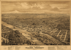
主要な事実(Key Facts)
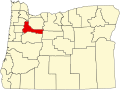
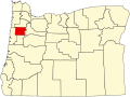
- 役割: オレゴン州の州都であり、マリオン郡とポーク郡にまたがる。
- 人口: 約18万人(2024年推計)。
- 愛称: チェリーシティ(Cherry City)。
- 主要産業: 州政府機関が最大の雇用主であり、公共セクターが経済を牽引している。
- 教育: ウィラメット大学などの高等教育機関が存在する。
都市の構造とランドマーク
政治と行政の中心地
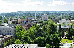
セーラムの象徴といえば、荘厳なオレゴン州議会議事堂です。この建物は州の政治の中枢であり、多くの観光客が訪れるランドマークとなっています。また、市役所や警察署、公共図書館などが集まるバーン・W・ミラー・シビックセンターのような複合施設が、効率的な都市運営を支えています。
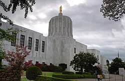
歴史を振り返ると、1935年の火災で議事堂が被害を受けた際など、困難を乗り越えて現在の姿へと再建されてきた経緯があります。
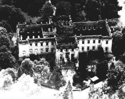
文化と教育の拠点
教育面では、名門のウィラメット大学が知られており、キャンパス内のマーク・ハトフィールド図書館などは地域の知的拠点となっています。また、ハリー・フォード美術館などの文化施設が、市民や訪問者に芸術への接点を提供しています。
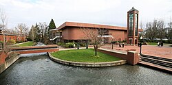
都市の景観とレクリエーション
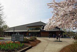
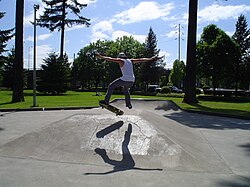
ダウンタウンには、自然と都市が融合したリバーフロントパークがあり、市民の憩いの場となっています。また、マリオン・スクエア・パークではスケートボードを楽しむ若者の姿が見られるなど、活気ある屋外活動が日常的に行われています。
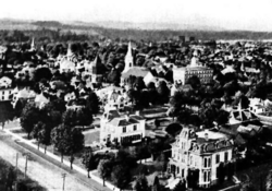
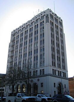
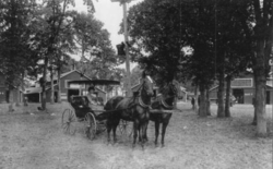
中心街の景観は時代とともに変化しており、1900年代初頭の静かな街並みから、現在は高層ビルが立ち並ぶ近代的な都市へと進化しました。
地理・気候と人口動態
自然環境と気候
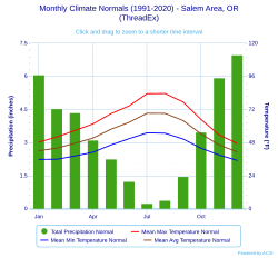
セーラムは標高約54メートルに位置し、典型的な北西太平洋岸の気候を示します。年間を通じて降水量が多く、特に冬場に集中する傾向があります。一方で、夏は温暖で過ごしやすく、農業(特にチェリーの栽培)に適した環境です。
人口の変化と多様性
1860年にはわずか902人だった人口は、2020年の国勢調査では175,535人にまで増加しました。特に近年はヒスパニック・ラティーノ系の人口比率が上昇しており、2020年時点では全人口の約23.5%を占めるなど、多文化共生が進んでいます。
経済とインフラ
雇用構造
セーラムの経済は州政府に強く依存しており、全雇用者の約26%が州政府職員です。次いでセーラム病院や教育機関、アマゾンなどの物流センターが主要な雇用を創出しています。
交通ネットワーク
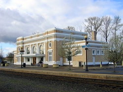
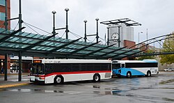
交通の要衝として、州間高速道路5号線(I-5)やオレゴン州道99Eなどが整備されています。また、1918年に建設された歴史ある旅客駅は、現在もアムトラック(Amtrak)やグレイハウンドバスの拠点として機能しています。
地域文化とイベント
セーラムでは、地域の伝統を祝うイベントが数多く開催されています。特にオレゴン州立フェアは古くから続く重要な行事であり、地域の誇りとなっています。
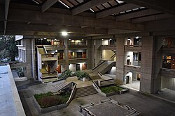
また、バーン・W・ミラー・シビックセンターの屋根付き中庭のような公共スペースは、コミュニティの交流を促進する設計となっています。
セーラムの概要まとめ
| 項目 | 詳細 |
|---|---|
| 設立年 | 1842年 |
| 人口(2024年推計) | 180,406人 |
| 主要産業 | 州政府、医療、教育 |
| 主要道路 | I-5, OR 99E, OR 22 |
| 姉妹都市 | 川越市(日本)、金海市(韓国)、セーラム(インド) |
Frequently Asked Questions
セーラムの愛称「チェリーシティ」の由来は何ですか?
この地域でチェリーの栽培が盛んに行われており、地域の特産品として親しまれているためです。
街の最大の雇用主はどこですか?
オレゴン州政府です。市内の雇用の約26.69%を占めており、州都としての経済的基盤となっています。
どのような交通手段でアクセスできますか?
州間高速道路5号線(I-5)などの主要道路のほか、アムトラックの列車やグレイハウンドバスを利用してアクセスすることが可能です。
セーラムにはどのような教育機関がありますか?
ウィラメット大学やチェメケタ・コミュニティカレッジなどの高等教育機関があり、地域の教育レベルの向上に寄与しています。
日本のどの都市と姉妹都市関係にありますか?
埼玉県にある川越市と姉妹都市関係を結んでいます。
References
- "Mayor". City of Salem, Oregon. Archived from the original on October 31, 2025. Retrieved September 8, 2025.
- "City Manager's Office". City of Salem, Oregon. Archived from the original on September 12, 2025. Retrieved September 8, 2025.
- "2025 U.S. Gazetteer Files". United States Census Bureau. Archived from the original on September 12, 2025. Retrieved September 15, 2025.
- U.S. Geological Survey Geographic Names Information System: Salem, Oregon
- "Explore Census Data". . Retrieved September 8, 2025.
- "City and Town Population Totals: 2020-2024". United States Census Bureau. Archived from the original on September 27, 2024. Retrieved September 8, 2025.
- "2020 Census Qualifying Urban Areas and Final Criteria Clarifications". www.federalregister.gov. . December 29, 2022. Archived from the original on December 30, 2022. Retrieved September 8, 2025.
- "Metropolitan and Micropolitan Statistical Areas Population Totals: 2020-2024". . March 2025. Archived from the original on March 14, 2024. Retrieved September 8, 2025.
- "2020 Census Metropolitan Statistical Area Profiles" (PDF). . Archived (PDF) from the original on February 13, 2023. Retrieved February 12, 2023.
- Maxwell, Michelle (July 28, 2008). "Salemite realizes dream of publishing book". StatesmanJournal.com. Retrieved October 2, 2013.
{{}}: CS1 maint: deprecated archival service ()
📸 フォトギャラリー