アフリカ大陸の中央南部に位置するザンビア共和国は、「One Zambia, One Nation(一つのザンビア、一つの国家)」というモットーの下、多様な民族と文化が共生する国です。内陸国でありながら、世界的に有名な大瀑布や広大な野生動物保護区、そして経済を支える豊かな鉱物資源を有しており、南部アフリカにおいて重要な役割を果たしています。
主要な事実(Key Facts)
- 首都: ルサカ(最大都市)
- 公用語: 英語(地域言語としてベムバ語、トンガ語などが広く使用される)
- 主要産業: 銅採掘(世界的な産地)、農業、観光業
- 政治体制: 単一の大統領制共和国
- 宗教: キリスト教が圧倒的多数(約95.5%)
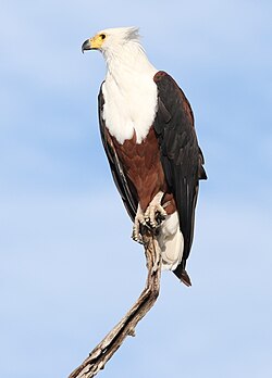
- 象徴: 国鳥はアフリカ魚鷲(African fish eagle)
地理と自然環境
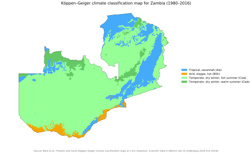
ザンビアの地形は多様で、気候はケッペンの気候区分に基づいた熱帯・亜熱帯的な特徴を持っています。国土の多くは高原地帯であり、豊かな水資源がもたらす生態系が維持されています。
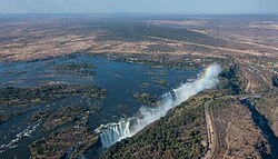
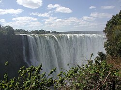
特に象徴的なのが、ザンビアとジンバブエの国境に位置するヴィクトリアフォールズ(現地名:モシ・オ・トゥニャ)です。ユネスコ世界遺産にも登録されているこの巨大な滝は、世界有数の規模を誇り、観光の目玉となっています。
また、野生動物の宝庫としても知られ、国鳥のアフリカ魚鷲をはじめとする多様な生物が息づいています。
歴史の変遷:先史時代から独立まで
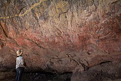
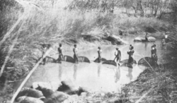
ザンビアの歴史は非常に古く、初期の人類化石が発見された地としても知られています。その後、狩猟採集民であるコイサン族やバトワ族が居住し、次第に農業と鉄器文化を持つバンツー系民族が南下して定住し始めました。
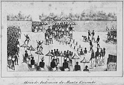
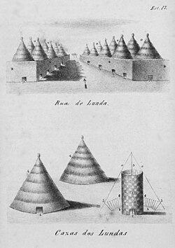
中世には、ルバ王国やルンダ王国、そしてマラヴィ連邦などの強力な国家が形成されました。これらの国家は広範な交易ネットワークを構築し、地域の政治・経済を支配しました。例えば、ルンダ王国の統治者はポルトガル人との外交交渉を行うなど、外部世界とも接触を持っていました。
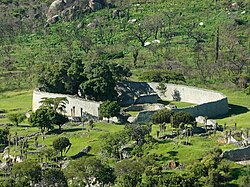
また、グレートジンバブエの遺跡に関連するカラング族やショナ族の支配層が、インゴンベ・イレデなどの交易拠点を支配していたことも分かっています。
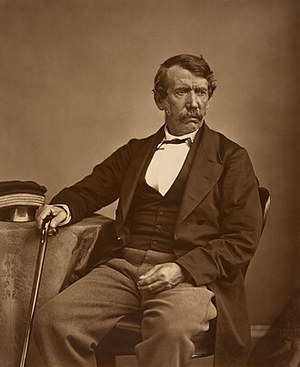
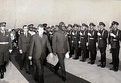
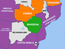
19世紀に入ると、スコットランドの探検家・宣教師であるデヴィッド・リヴィングストンがこの地を訪れ、ヨーロッパにザンビアの存在を広く知らせることとなりました。その後、イギリスの植民地支配(北ローデシア)を経て、1964年10月24日に独立を果たしました。初代大統領ケネス・カウンダのもと、国家の基盤が築かれました。
社会と文化の多様性
ザンビアは多民族国家であり、ベムバ族(約25.4%)やトンガ族(約14.9%)など、多くの民族が共存しています。言語においても、公用語の英語以外にベムバ語やニャンジャ語などの地域言語が日常的に使われています。
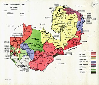
![Density map of dominant regional languages:[114] Bemba Chewa Lozi Lunda Nyanja Tonga](/images/f0/55/f0556a36ed05252388477b0552a47ad850a59fcba6f4de255600fd0054a7b071.webp)
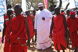
文化的な伝統は今も色濃く残っており、例えばロジ族の統治者リトゥンガが洪水時に高地へ移動する「クオンボカ儀式」や、ムワタ・カゼンベによる「ムトンボコ儀式」などは、地域のアイデンティティを象徴する重要な行事です。
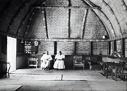
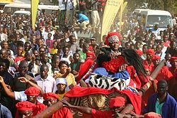
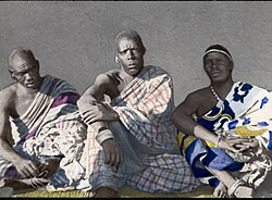
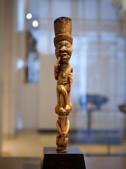
また、南アフリカのクワズールから移住してきたンゴニ族のように、歴史的な移動を経て同化した民族も存在します。現代では、伝統的な彫刻や音楽、そして1970年代に流行した「ザムロック(Zamrock)」と呼ばれる独自のロック音楽など、芸術的な表現も豊かです。
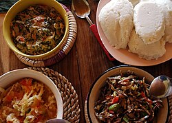
食文化においては、トウモロコシの粉を練り上げた「ンシマ(Nsima)」が主食であり、様々な副菜(レリッシュ)と共に食されるのが一般的です。
経済構造と現代の課題
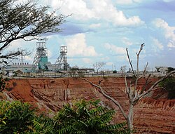
ザンビア経済の最大の柱は鉱業であり、特に銅の生産量は世界的に見ても重要です。キトウェにあるンカナ銅山のような大規模な露天掘り鉱山が、国の外貨獲得の主要な手段となっています。
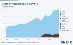
エネルギー面では水力発電への依存度が高く、電力供給の安定化が課題となっています。また、農業も重要な産業であり、多くの国民が従事しています。
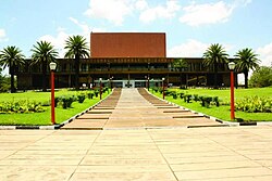
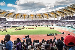
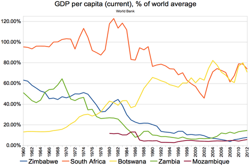
経済的な成長の一方で、所得格差(ジニ係数 51.5)や人間開発指数(HDI 0.595)の向上など、社会的な課題も抱えています。しかし、ルサカの国民議会や国立ヒーローズスタジアムなどの近代的なインフラ整備が進んでおり、発展への意欲は高く維持されています。
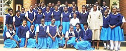
教育分野では、チップタの聖モニカ女子中等学校のように、次世代を担う若者の育成に力が入れられています。
ザンビアの基本データまとめ
| 項目 | 詳細内容 |
|---|---|
| 面積 | 752,617 km² |
| 人口(2023年推計) | 約2,021万人 |
| GDP (PPP, 2023年) | 836.87億ドル |
| 通貨 | ザンビア・クワチャ (ZMW) |
| 主要都市 | ルサカ、キトウェ、ンドラ、カブウェ |
| 主要民族 | ベムバ、トンガ、チェワ、ロジ |
Frequently Asked Questions
ザンビアの主要な産業は何ですか?
最も重要な産業は銅の採掘であり、世界的な産地として知られています。また、農業やヴィクトリアフォールズを中心とした観光業も経済の重要な柱となっています。
ザンビアで話されている言語は何ですか?
公用語は英語ですが、国内には多くの地域言語が存在します。特にベムバ語、トンガ語、ニャンジャ語などが広く話されており、多言語社会を形成しています。
ザンビアの歴史的な特徴は何ですか?
古くからバンツー系民族による王国(ルバ、ルンダなど)が繁栄し、その後イギリスの植民地時代を経て1964年に独立しました。多様な民族が共存し、「一つの国家」としての統合を重視している点が特徴です。
ザンビアの観光名所として有名な場所はどこですか?
世界遺産であるヴィクトリアフォールズが最も有名です。また、豊かな野生動物を観察できる国立公園や、歴史的な文化儀式なども観光の魅力となっています。
ザンビアの主食は何ですか?
「ンシマ(Nsima)」と呼ばれる、トウモロコシの粉を練り上げた料理が主食です。これに野菜や肉などの副菜(レリッシュ)を添えて食べるのが一般的です。
References
- "Zambia 2022 Census National Analytical Report" (PDF). Africa Albinism Network. Retrieved 11 April 2026.
- "2023 Report on International Religious Freedom: Zambia". US Department Of State. US Government. Retrieved 7 April 2025.
- "Amended Constitution of Zambia". Government of Zambia. Archived from the original on 5 November 2012. Retrieved 15 October 2016.
- United Nations Statistics Division. "Population by sex, rate of population increase, surface area and density" (PDF). Archived (PDF) from the original on 31 October 2007. Retrieved 9 November 2007.
- "Zambia". (2025 ed.). .
- "World Economic Outlook Database, October 2023 Edition. (Zambia)". . 10 October 2023. Archived from the original on 17 October 2023. Retrieved 15 October 2023.
- "Gini Index coefficient". . Archived from the original on 4 February 2021. Retrieved 24 September 2024.
- "Human Development Report 2025" (PDF). . 6 May 2025. Archived (PDF) from the original on 6 May 2025. Retrieved 6 May 2025.
- Henderson, Ian (1970). "The Origins of Nationalism in East and Central Africa: The Zambian Case". The Journal of African History. 11 (4): 591–603. :10.1017/S0021853700010471. 0021-8537. 180923. 154296266.
- Nowell, Charles E. (1982). The Rose-colored Map: Portugal's Attempt to Build an African Empire from the Atlantic to the Indian Ocean. Junta de Investigações Científicas do Ultramar. Retrieved 11 April 2026.
📸 フォトギャラリー