地球上の気候は一様ではなく、同じ緯度にあっても驚くほど降水量に差がある地域が存在します。その大きな要因の一つとなるのが雨影(レインシャドウ)と呼ばれる現象です。これは、高い山脈が障壁となり、その背後に極端に降水量の少ない乾燥地帯が形成される仕組みを指します。
通常、海洋から蒸発した水分を含む湿った空気は、卓越風(その地域で一年を通じて頻繁に吹く風)に乗って内陸へと運ばれます。しかし、この空気が高い山脈にぶつかると、斜面に沿って強制的に上昇させられます。これを地形性上昇と呼びます。上昇した空気は気圧の低下に伴い膨張し、温度が下がる「断熱冷却」を起こします。すると空気中の水蒸気が凝結して雲となり、山脈の風上側(雨側)に激しい雨や雪を降らせます。
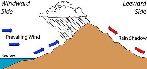
山頂を越えた空気は、今度は斜面を駆け降りるため、気圧が上がり圧縮されます。この「断熱圧縮」によって空気は急速に温められ、水分を吸収しやすい状態になります。これがフェーン現象であり、山脈の風下側には乾燥した暖かい風が吹き込むため、雲ができにくく雨がほとんど降らない「影」のような領域が生まれるのです。その結果、風下側ではステップや低木地、あるいは砂漠のような乾燥した植生が広がることになります。
Key Facts
- 雨影の定義: 山脈の風下側に形成される、降水量が著しく少ない地域のこと。
- 発生プロセス: 風上側での地形性降雨による水分の喪失と、風下側での断熱圧縮による昇温が原因。
- 気候的特徴: 風上側が湿潤な熱帯雨林や森林であるのに対し、風下側は砂漠や半乾燥地帯になりやすい。
- 影響要因: 山脈の高さ、幅、および卓越風の強さと方向によって、雨影の規模が決まる。
世界各地で見られる雨影の具体例
アジアの乾燥地帯
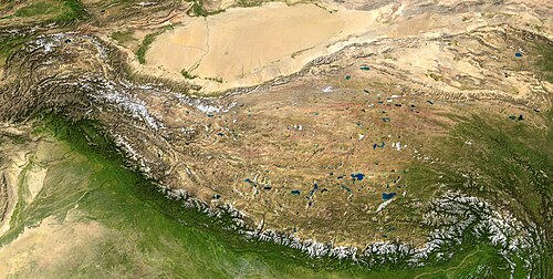
アジアでは巨大な山脈が劇的な気候差を生んでいます。例えば、ヒマラヤ山脈は南アジアからの季節風を遮断し、その北側に位置するチベット高原やタリム盆地に極端な乾燥をもたらしています。
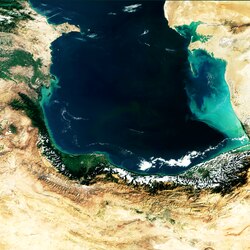
また、イランでは北部のエルブルズ山脈や西部のザグロス山脈が水分を遮るため、国内の大部分が半乾燥または乾燥気候となっており、特にダシュテ・ルートなどの地域は地球上で最も生命の少ない場所の一つとされています。
アフリカの砂漠化
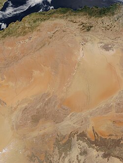
北アフリカのサハラ砂漠は、アトラス山脈による雨影効果でさらに乾燥が進んでいます。大西洋からの湿った北西風が山脈で雨を降らせるため、山を越えた南側には乾燥した空気が降りてきます。
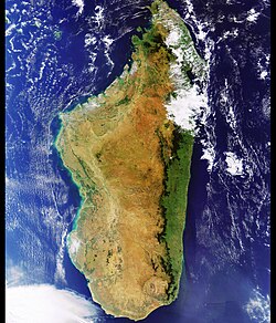
また、マダガスカル島では東側の山地が貿易風を遮るため、東岸は湿潤な熱帯気候である一方、西側や南側は乾燥した棘林や砂漠が広がっています。
北米と南米の極端な対比
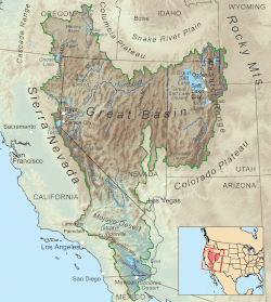
北米西海岸では、カスケード山脈やシエラネバダ山脈が太平洋からの湿った空気を遮断しています。これにより、内陸側にモハベ砂漠やグレートベースンなどの広大な乾燥地帯が形成されています。
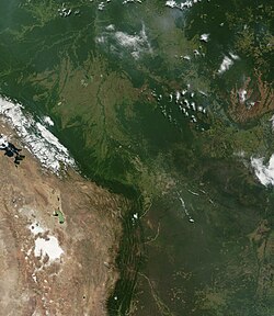
南米では、アンデス山脈がアマゾン盆地からの水分を遮るため、チリのアタカマ砂漠が形成されました。ここは非極地において世界で最も乾燥した場所として知られています。
ヨーロッパとオセアニアの事例
ヨーロッパでは、スペイン北部のカンタブリア山脈が「緑のスペイン」と呼ばれる湿潤な北岸と、乾燥した中央台地を分ける境界となっています。
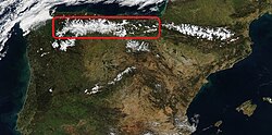
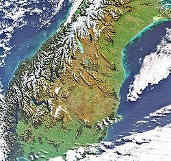
オセアニアでは、ニュージーランド南島のサザンアルプスがタスマン海からの水分を遮り、西側で激しい降雨(年最大8,900mm)を記録する一方で、わずか50km東側では降水量が激減するという極端なコントラストを生んでいます。
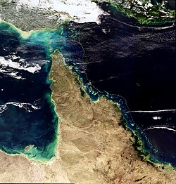
オーストラリアのクイーンズランド州でも、アザートン高原が雨影を作り出し、東側の海岸地域と西側の内陸地域で降水量に大きな差が出ています。
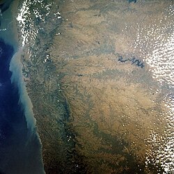
インドの西ガーツ山脈においても、東側の斜面は雨影となり、降水量が大幅に減少しています。
地域別・山脈別の雨影影響まとめ
| 山脈名 | 地域 | 風上側の特徴 | 風下側(雨影)の影響 |
|---|---|---|---|
| ヒマラヤ山脈 | アジア | 激しい季節風による降雨 | チベット高原、タリム盆地の乾燥 |
| アトラス山脈 | アフリカ | 大西洋からの湿った風 | サハラ砂漠の乾燥加速 |
| アンデス山脈 | 南米 | アマゾン盆地の湿気 | アタカマ砂漠の形成 |
| シエラネバダ山脈 | 北米 | 太平洋からの湿った空気 | モハベ砂漠などの内陸乾燥地 |
| サザンアルプス | ニュージーランド | タスマン海からの多雨 | 南島東側の著しい降水減少 |
Frequently Asked Questions
雨影現象はなぜ砂漠を作るのですか?
山脈が湿った空気を物理的に遮断し、風上側でほとんどの水分を雨として降らせてしまうためです。山を越えた後の空気は非常に乾燥しており、さらに断熱圧縮で温められるため、雲が発生しにくく、結果として砂漠や半乾燥地帯が形成されます。
「風上」と「風下」では具体的に何が違いますか?
風上側(雨側)は、湿った空気が上昇して冷却されるため、雲が多く降水量が増え、森林などの豊かな植生が発達します。一方、風下側(雨影側)は、水分を失った乾燥した空気が下降して温まるため、降水量が極端に少なく、草地や砂漠のような景観になります。
山が低くても雨影は発生しますか?
はい、発生します。例えばスウェーデン南部の高地は最高高度が377メートルほどですが、それでも東側の降水量を減少させ、夏季の気温を上昇させる効果を持っています。ただし、山が高く幅が広いほど、遮断される水分の量が増えるため、雨影効果はより顕著になります。
フェーン現象と雨影の関係は何ですか?
フェーン現象は、山を越えて下降する空気が断熱圧縮によって温まり、乾燥した風となる現象のことです。このフェーン現象が風下側で継続的に起こることで、地表の水分が蒸発しやすくなり、雨影領域の乾燥した気候が維持されます。
References
- Whiteman, C. David (2000). Mountain Meteorology: Fundamentals and Applications. Oxford University Press. .
- Glossary of Meteorology (2009). "trade winds". Glossary of Meteorology. American Meteorological Society. Retrieved 4 July 2021.
- Glossary of Meteorology (2009). "westerlies". Glossary of Meteorology. American Meteorological Society. Retrieved 4 July 2021.
- Glossary of Meteorology (2009). "roaring forties". Glossary of Meteorology. American Meteorological Society. Retrieved 4 July 2021.
- "Asti weather". weatherbase.com.
- S.A, Wirtualna Polska Media (2016-02-02). "Kujawy - najsuchsze miejsce w Polsce". turystyka.wp.pl (in Polish). Retrieved 2020-01-31.
- "UK Rainfall averages". Archived from the original on 2010-02-18.
- "Spør meteorologen!". www.miljolare.no. Retrieved 2019-05-07.
- "Dataserier med normalvärden för perioden 1991-2020" [Data series with normals for the period 1991-2020] (in Swedish). . Retrieved 9 August 2022.
- "Iberian Climatic Atlas" (PDF). , . Retrieved 24 December 2020.


📸 フォトギャラリー