米国東部の風景を象徴するポトマック川は、ウェストバージニア州、メリーランド州、バージニア州、そして首都ワシントンD.C.を貫いて流れる重要な河川です。アルゴンキン諸語で「パタウォメック(Patawomeck)」と呼ばれたこの川は、豊かな自然環境と歴史的な重要性を併せ持っています。
この河川は、単なる水路ではなく、地域の水供給源として、また多様な野生生物の生息地として不可欠な役割を果たしています。また、日本の東京都を流れる荒川とは1996年より「姉妹河川」としての関係を築いています。
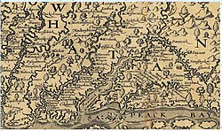
主要な事実(Key Facts)
- 総延長:約405マイル(652km)
- 流域面積:約14,700平方マイル(38,000km²)
- 河口:チェサピーク湾に流入
- 主要都市:ワシントンD.C.、アレクサンドリア、ハーパーズフェリー、カンバーランド
- 最大流量:1936年の記録的な洪水時に484,000立方フィート/秒を記録
河川の構造と地理的特性
水源と合流点
ポトマック川は、主に2つの大きな支流から始まります。一つはウェストバージニア州プレストン郡のフェアファックス・ストーン付近(標高約930m)から流れ出す北支流(North Branch)であり、もう一つはバージニア州ハイランド郡のモンテレー近郊から始まる南支流(South Branch)です。これら2つの流れはウェストバージニア州のグリーンスプリングで合流し、本流となります。
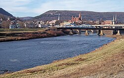
流域の展開と地形
本流は東へと進み、ハーパーズフェリーにおいてシェナンドー川と合流します。この地点は地理的にも景観的にも非常に重要なポイントとなっています。
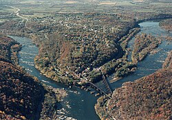
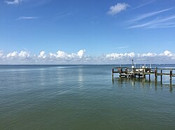
川の流れは、グレートフォールズやリトルフォールズといったダイナミックな滝や急流を経て、ワシントンD.C.へと至ります。ここから先は潮汐の影響を受ける潮汐ポトマック川(Tidal Potomac River)となり、最終的にメリーランド州とバージニア州の境界付近でチェサピーク湾へと注ぎ込みます。
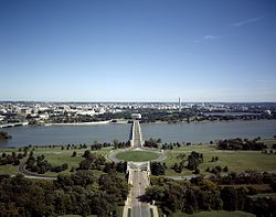
水文学と環境課題
流量の変動と歴史的洪水
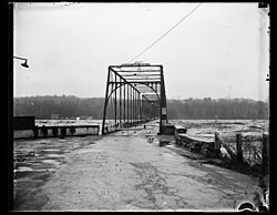
ポトマック川の流量は年によって大きく変動します。リトルフォールズでの平均流量は約11,498立方フィート/秒ですが、過去には極端な増水に見舞われたことがあります。特に1936年の洪水は壊滅的で、チェーンブリッジの構造物が激しい水流と漂流物によって破壊され、後の再建を余儀なくされました。
![This chart displays the Annual Mean Discharge of the Potomac River measured at Little Falls, Maryland for Water Years 1931–2017 (in cubic feet per second). Source of data: USGS.[2]](/images/a3/bb/a3bb95d7ef8f972abf9eec8a4c95506d5ac0cff389531879080c42133dfc00b6.jpg)
水質と生態系への影響
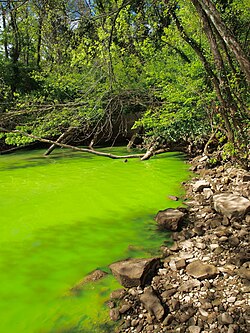
現代のポトマック川は、富栄養化という深刻な環境問題に直面しています。窒素やリンなどの栄養塩が過剰に流入することで、シアノバクテリア(藍藻類)の大発生を招き、水面が鮮やかな緑色に染まる現象が確認されています。これは水中の酸素濃度を低下させ、水生生物に悪影響を及ぼします。
多様な野生生物の宝庫
魚類と水生生物
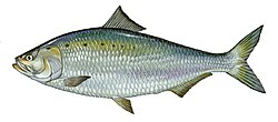
川には非常に多様な魚類が生息しています。淡水域では、スモールマウスバスやラージマウスバスなどのゲームフィッシュに加え、アメリカンシャッド(ニシンの一種)が数十年ぶりに回帰するなど、生態系の回復も見られます。また、河口付近の汽水域にはブルシャーク(ツメガザミ)などの海水魚が侵入することもあります。
哺乳類と爬虫類
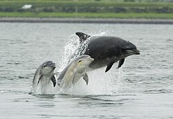
特筆すべきは、年に半年間(4月中旬から10月中旬まで)ポトマック川に滞在するハンドウイルカの群れです。母子で泳ぐ姿などが目撃されており、河川生態系の豊かさを象徴しています。
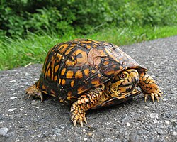
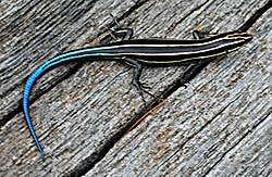
また、陸上および水辺では、ニシキヘビやカミナリガメなどの爬虫類、そしてC&O運河の沿道などでよく見られるニシキガメ(Eastern box turtle)などが生息しています。さらに、五線スケンク(Five-lined skink)のような小型のトカゲ類も確認されています。
ポトマック川の概要まとめ
| 項目 | 詳細内容 |
|---|---|
| 主要な水源 | 北支流(ウェストバージニア州)、南支流(バージニア州) |
| 主要な合流河川 | シェナンドー川、モノカシー川、アナコスティア川 |
| 主要なダム | リトルフォールズダム、ポトマック水道ダム、ジェニングス・ランドルフダム |
| 代表的な野生生物 | ハンドウイルカ、アメリカンシャッド、ニシキガメ |
| 環境上の課題 | 富栄養化によるシアノバクテリアの発生 |
Frequently Asked Questions
ポトマック川はどこからどこまで流れていますか?
ウェストバージニア州の北支流とバージニア州の南支流を水源とし、メリーランド州やワシントンD.C.を経由して、最終的にチェサピーク湾へと流れ込んでいます。
ポトマック川にイルカが住んでいるというのは本当ですか?
はい、本当です。数百頭のハンドウイルカが、例年4月中旬から10月中旬までの期間、ポトマック川に滞在しています。
川の水質にはどのような問題がありますか?
主な問題は富栄養化です。これによりシアノバクテリアが大量発生し、水が緑色に濁る現象が起きており、生態系への影響が懸念されています。
歴史的に大きな洪水はありましたか?
1936年に記録的な大洪水が発生しました。この際、チェーンブリッジなどのインフラが激しく損傷し、大規模な再建工事が必要となりました。
ポトマック川の「姉妹河川」はどこですか?
1996年より、日本の東京都を流れる荒川が姉妹河川となっています。
References
- "President Clinton: Celebrating America's Rivers". American Heritage Rivers. July 30, 1998. Archived from the original on April 28, 2014. Retrieved February 5, 2014.
- "USGS 01646500 POTOMAC RIVER NEAR WASH, DC LITTLE FALLS PUMP STA". nwis.waterdata.usgs.gov. National Weather Service (NOAA). 2019. Archived from the original on October 28, 2020. Retrieved March 23, 2019.
- "(Arakawa - Potomac sister rivers)". Interstate Commission on the Potomac River Basin. January 27, 2012. Archived from the original on December 27, 2013. Retrieved September 23, 2016.
- U.S. Geological Survey. National Hydrography Dataset high-resolution flowline data. The National Map Archived March 29, 2012, at the . Retrieved August 15, 2011
- "Facts & FAQs". Interstate Commission on the Potomac River Basin (ICPRB), Rockville, MD. September 16, 2009. Archived from the original on January 15, 2010. Retrieved February 5, 2010.
- "POTOMAC BASIN FACTS". Interstate Commission on the Potomac River Basin. Retrieved August 16, 2024.
- "Potomac River Water Trail". NRT Database. Retrieved August 20, 2024.
- "Designation of Mallows Bay-Potomac River National Marine Sanctuary". www.federalregister.gov. September 9, 2019.
- "Potomac Riverkeeper Network". www.potomacriverkeepernetwork.org. Potomac Riverkeeper Network. 2019. Archived from the original on November 19, 2020. Retrieved March 25, 2019.
- "Potomac River Basin Fact Sheet" (PDF). www.potomacriver.org. Interstate Commission on the Potomac River Basin (ICPRB). October 2015. Archived (PDF) from the original on December 16, 2017. Retrieved March 28, 2019.
📸 フォトギャラリー