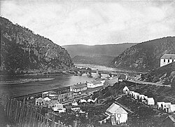
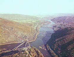
ポトマック川とシェナンドー川が合流する絶景の地に位置するハーパーズフェリーは、単なる風光明媚な町ではありません。ここはアメリカ合衆国の運命を大きく揺るがした事件の舞台であり、産業の発展と葛藤が交錯した歴史的な聖地です。現在は国立歴史公園として保存され、多くの訪問者を惹きつけています。
町の起源は18世紀に遡ります。1751年にロバート・ハーパーが土地を購入し、1761年にはポトマック川を渡る渡し船の運営権を得たことで、この地の基礎が築かれました。1763年には正式に町として設立され、その名は今も受け継がれています。
Key Facts
- 地理的特徴:ポトマック川とシェナンドー川の合流点に位置する。
- 歴史的意義:ジョン・ブラウンによる奴隷解放を目的とした襲撃事件の舞台。
- 交通の要衝:かつて運河と鉄道が交差し、物流の拠点として発展した。
- 現代の役割:アパラチアン・トレイルの重要な拠点であり、国立歴史公園として管理されている。
- 人口動態:2020年時点で人口269人と、非常に小規模なコミュニティとなっている。
産業の発展と交通網の変遷
19世紀に入ると、ハーパーズフェリーは戦略的な重要性を増しました。連邦兵器廠(アームリー)の設置により軍事的な拠点となったほか、水運と陸運の発展が加速しました。1833年にはワシントンD.C.からチェサピーク・アンド・オハイオ運河が到達し、水路による輸送が活発化しました。
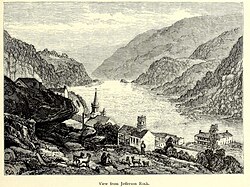
さらに、1830年代半ばからはボルチモア・アンド・オハイオ鉄道(B&O鉄道)が乗り入れ、交通の形態は劇的に変化しました。当初はメリーランド州のサンディフックを終点としていましたが、1837年にはポトマック川を渡る橋が開通し、町への直接的なアクセスが可能となりました。
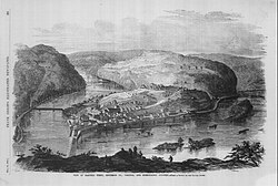
激動の時代:ジョン・ブラウンの襲撃と南北戦争
この町を世界的に有名にしたのは、奴隷制廃止論者ジョン・ブラウンによる1859年の襲撃事件です。彼は武装した支持者と共に兵器廠を占拠し、奴隷解放のための武装蜂起を企てました。この大胆な行動は、後の南北戦争へとつながる決定的な導火線となりました。
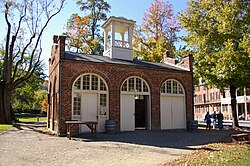
襲撃の舞台となったエンジンハウス(ジョン・ブラウンの砦)は、現在も当時の記憶を留める象徴的な建造物として保存されています。また、当時の混乱期には、逃亡奴隷たちが集まるキャンプ地が設けられるなど、自由を求める人々にとっての希望の地ともなりました。
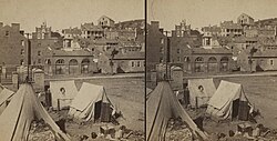
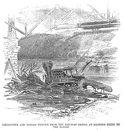
その後の南北戦争において、ハーパーズフェリーはその地理的条件から激戦地となり、町は壊滅的な打撃を受けました。鉄道施設や工場が破壊され、かつての繁栄は一時的に失われました。
戦後の復興と文化的な歩み
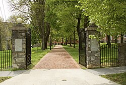
戦争の傷跡が残る中、町は新たな役割を見出します。特に注目すべきは、アフリカ系アメリカ人の教育と権利向上のための取り組みです。ストーラー大学(Storer College)の設立は、教育を通じた社会進出の足がかりとなりました。
19世紀後半から20世紀にかけては、観光地としての側面が強まりました。B&O鉄道が整備したアイランドパークなどのレジャー施設が登場し、多くの人々がこの地の自然と歴史を訪れるようになりました。
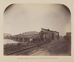
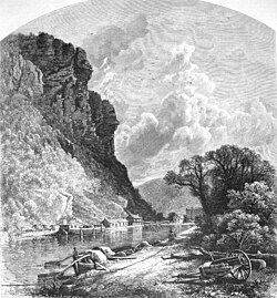
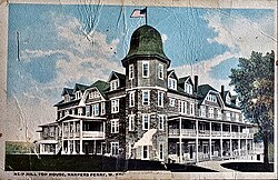
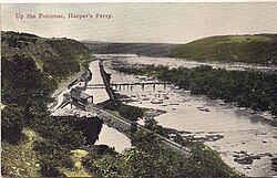
また、20世紀初頭にはW.E.B.デュボイスが主導した「ナイアガラ運動」の第2回会議が開催されるなど、公民権運動の先駆けとなる重要な議論が行われた場所でもあります。
現代のハーパーズフェリーと自然
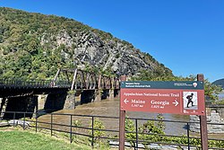
現在、この地は「ハーパーズフェリー国立歴史公園」として、歴史的建造物の保存と自然保護の両立が図られています。特に、アメリカ東海岸を縦断するロングトレイルであるアパラチアン・トレイルの心理的な中間地点として知られており、ハイカーにとって欠かせない拠点となっています。
![National Park Service map of Harper's Ferry showing the Appalachian Trail, with (1) being the scene of John Brown's raid[70]](/images/55/52/555285f09ec56c0847b2b5c79cda79bda6f3e73eba6cdaa9c855d6a9664c0c03.webp)
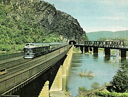
かつての鉄道の賑わいは、1949年に運行していた「コロンビアン」のような豪華列車に象徴されていますが、現在は静かな歴史の町として、訪れる人々に平和と省察の時間を提供しています。
ハーパーズフェリーの概要まとめ
| 項目 | 詳細 |
|---|---|
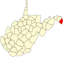
| 所在地 | ウェストバージニア州 ジェファーソン郡 |
| 設立年 | 1763年 |
| 人口(2020年) | 269人 |
| 主要河川 | ポトマック川、シェナンドー川 |
| 主な歴史的出来事 | ジョン・ブラウンの襲撃、南北戦争の激戦 |
| 現在の形態 | 国立歴史公園、アパラチアン・トレイル拠点 |
Frequently Asked Questions
ジョン・ブラウンの襲撃とはどのような事件でしたか?
1859年に奴隷制廃止論者のジョン・ブラウンが、奴隷解放を目的としてハーパーズフェリーの連邦兵器廠を襲撃した事件です。この事件は南北の対立を激化させ、南北戦争の直接的な要因の一つとなりました。
アパラチアン・トレイルとの関係は?
ハーパーズフェリーはアパラチアン・トレイルのルート上に位置しており、トレイルの管理本部のほか、ハイカーにとっての重要な休憩・補給地点および心理的な中間地点として機能しています。
現在の町の規模はどのくらいですか?
非常にコンパクトな町で、総面積は約0.63平方マイル(約1.62平方キロメートル)です。2020年の国勢調査では人口269人とされており、静かな歴史保存地区としての性格が強いです。
観光で訪れる際の見どころはどこですか?
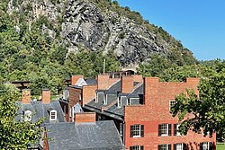
ジョン・ブラウンが立てこもった「ジョン・ブラウンの砦(エンジンハウス)」や、ポトマック川とシェナンドー川の合流点を見渡せる展望スポット、そして歴史的な街並みが保存された地区などが主要な見どころです。
References
- O'Dell, C. (1995). Pioneers of Old Frederick County, Virginia. Walsworth Publishing Company.
- (2018). "Section Ten: Municipalities". West Virginia Blue Book, 2017-2018 (PDF). Charleston, West Virginia: West Virginia Legislature. p. 981.
- "2019 U.S. Gazetteer Files". United States Census Bureau. Archived from the original on October 17, 2020. Retrieved August 7, 2020.
- U.S. Geological Survey Geographic Names Information System: Harpers Ferry, West Virginia
- "U.S. Census website". . Archived from the original on December 27, 1996. Retrieved January 24, 2013.
- "U.S. Census website". . Archived from the original on December 27, 1996. Retrieved January 31, 2008.
- "Did You Know???". www.wvlegislature.gov. Retrieved November 4, 2024.
- Velten, John J. (1931). The history and operation of the ferry formerly at Harper's Ferry. : .
{{}}: CS1 maint: location missing publisher () Thesis required for initiation into . "The writer wishes particularly to acknowledge his indebtedness to Henry T. McDonald, President of , for his generosity in giving information on this subject". - "Apostrophe Cops: Don't Be So Possessive". . March 10, 1996. p. 21. Archived from the original on August 17, 2021. Retrieved August 17, 2021.
- "Apostrophes don't always make the cut". pilotonline.com. August 27, 2013. Archived from the original on August 17, 2021. Retrieved August 17, 2021.
📸 フォトギャラリー