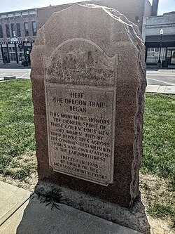
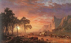
19世紀のアメリカにおいて、多くの人々が新たな生活と機会を求めて西へと向かいました。その中心となったのが、ミズーリ州インディペンデンスからオレゴン州オレゴンシティまでを結ぶオレゴン・トレイルです。もともとは毛皮商やトラッパーたちが切り拓いた細い道でしたが、やがて数万人の開拓民が馬車で旅する巨大な移動ルートへと発展しました。
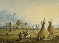
この道は単なる移動手段ではなく、アメリカの領土拡大と国家形成における重要な動脈となりました。肥沃なウィラメット渓谷を目指した人々は、険しい山々や深い川、そして未知の自然という過酷な環境に立ち向かったのです。
Key Facts
- ルート: ミズーリ州インディペンデンスからオレゴン州オレゴンシティまで。
- 総距離: 約2,000マイル(約3,200km)。
- 利用人数: 1840年から1860年の間に、主要ルートと派生ルート合わせて約26万8,000人が利用。
- 移動期間: 当初は約160〜170日かかっていたが、改善後は120〜140日まで短縮。
- 主な目的: 肥沃な農地(オレゴン)や金鉱(カリフォルニア)、信仰の地(ユタ)への移住。
トレイルの形成と発展
先駆者たちによる道づくり
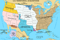
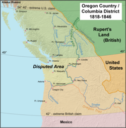
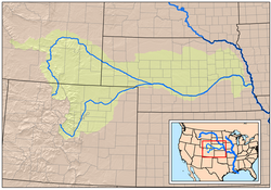
オレゴン・トレイルの原型は、1811年から1840年にかけて活動した毛皮貿易の商人やトラッパーたちによって作られました。当初は徒歩や馬でしか通行できない道でしたが、1836年頃にはミズーリ州からアイダホ州のフォート・ホールまで馬車が通れる道が整備されました。その後、さらに西へと道が拡張され、最終的にオレゴンのウィラメット渓谷に到達することで、現在のルートが完成しました。
政府の探検と地図の作成
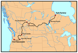
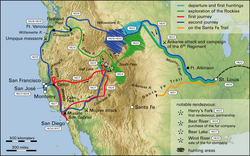
アメリカ政府の支援を受けた探検家たちも、このルートの確立に大きく貢献しました。ベンジャミン・ボンヌビル大尉は1832年から1834年にかけてプラット川からサウスパスを経てグリーン川に至るルートを調査し、その記録は後にワシントン・アーヴィングによって出版されました。また、ジョン・C・フレモントとガイドのキット・カーソンは1840年代に複数回の遠征を行い、カリフォルニアやオレゴンの詳細な地図を作成し、広く公開しました。
過酷な旅路とインフラの整備
移動手段と装備
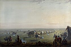
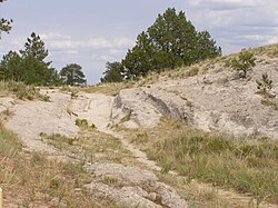
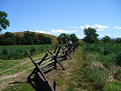
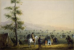
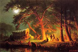
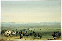
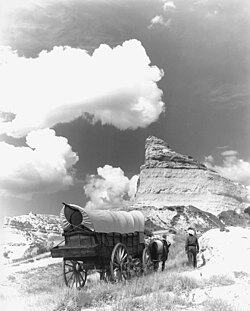
開拓民たちは、生活用品をすべて積み込んだコンストガなどの大型カバー付き馬車を使用しました。旅の速度は遅く、家畜の歩みに合わせた過酷な行軍となりました。
川渡りの克服とフェリーの役割
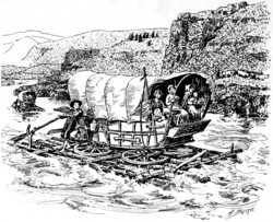
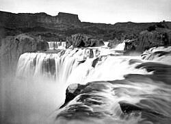
旅の最大の難所の一つが河川の横断でした。ミズーリ川、プラット川、スネーク川など、数多くの川を越える必要がありました。当初は危険な渡河を強いられましたが、次第に有料のフェリーや橋が設置されるようになりました。これにより、溺死などの事故が減り、移動時間も大幅に短縮されました。一方で、フェリーの利用料として1台あたり約30ドルの追加費用がかかることとなりました。
ルートの多様化とショートカット
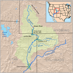
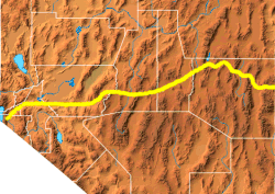
効率的に目的地へ到達するため、多くの「カットオフ(近道)」が作られました。例えば、ワイオミング州のサブレット・グリーンウッド・カットオフは距離を約70マイル短縮しましたが、水のない砂漠地帯を通過する危険を伴いました。また、1858年に政府が整備したランダー・ロードは、険しい山岳地帯を通るものの、距離を約80マイル短縮でき、多くの旅人が利用しました。
主要な派生ルートと移住の波
カリフォルニア・トレイルとゴールドラッシュ
オレゴン・トレイルから分岐し、カリフォルニア州へと向かうルートがカリフォルニア・トレイルです。特に1848年以降のゴールドラッシュにより、一攫千金を狙う人々が爆発的に増加しました。1849年から1852年にかけて、数十万人がこのルートを利用したと推定されています。
モルモン・トレイルとユタへの移住
1847年から1860年にかけて、ブリガム・ヤング率いるモルモン教徒ら約4万3,000人がユタ州へと向かいました。彼らはルート沿いにフェリーを設置するなど、後続の旅人のためのインフラ整備を行い、その対価として資金を得ていました。
![Oregon Trail pioneer Ezra Meeker erected this boulder near Pacific Springs on Wyoming's South Pass in 1906.[47]](/images/b7/10/b710d13e38c3d4a00cbe8dc641a96475629118000eeae0d5c6ad26f2c1b3b828.jpg)
旅の代償と統計
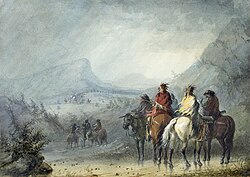
西への旅は希望に満ちていましたが、同時に極めて危険なものでした。多くの人々が病気や事故で命を落としました。特にコレラなどの感染症による死者が最も多く、次いで先住民との衝突による犠牲者が続きました。
| 死因 | 推定死亡者数 |
|---|---|
| 感染症(コレラ等) | 6,000 〜 12,500人 |
| 先住民との衝突 | 3,000 〜 4,500人 |
| 凍死 | 300 〜 500人 |
| 壊血病 | 300 〜 500人 |
| 馬車による事故 | 200 〜 500人 |
| 溺死 | 200 〜 500人 |
| 銃撃 | 200 〜 500人 |
| その他 | 200 〜 500人 |
1840年から1860年の間に、オレゴン、カリフォルニア、ユタを目指した合計人数は、統計上約30万人近くに達します。この大規模な人口移動は、アメリカ西部の人口構成を劇的に変え、後の州昇格へとつながりました。
歴史的遺産と記憶
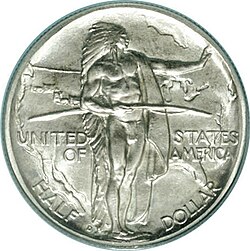
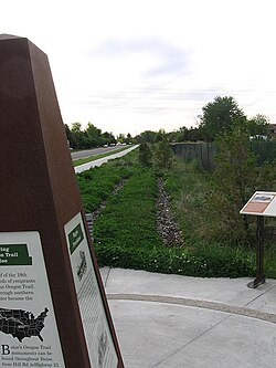
現在、オレゴン・トレイルの多くは国立公園局(NPS)によって管理されており、歴史的な道しるべや記念碑が保存されています。また、この壮大な旅は、記念コインの発行や、後の世代に影響を与えたビデオゲームなどの文化作品を通じて、アメリカ人のアイデンティティの一部として語り継がれています。
Frequently Asked Questions
オレゴン・トレイルの旅にはどれくらいの時間がかかりましたか?
初期の旅(1843年頃)では約160〜170日かかっていましたが、ルートの整備やフェリーの導入が進んだ1860年頃には、約120〜140日まで短縮されました。
なぜ多くの人がこの危険な道を選んだのですか?
主な理由は、オレゴン州の肥沃な土地での農業への期待、カリフォルニアでの金鉱発見(ゴールドラッシュ)、そして宗教的な自由を求めてユタへ向かったモルモン教徒の信仰心などがありました。
旅の間、どのような困難がありましたか?
コレラなどの深刻な病気、厳しい気候による凍死、川での溺死、そして先住民との衝突など、常に生命の危険が伴う旅でした。
オレゴン・トレイルとカリフォルニア・トレイルの違いは何ですか?
どちらもミズーリ州から始まる共通のルートを辿りますが、アイダホ州付近で分岐します。北西のウィラメット渓谷を目指したのがオレゴン・トレイルであり、南西のカリフォルニア州を目指したのがカリフォルニア・トレイルです。
どのような馬車が使われていましたか?
主に「コンストガ」と呼ばれる大型のカバー付き馬車や、後に普及したスタドベーカー製の馬車などが使用され、大量の食料や生活用品を運搬しました。
References
- "Basic Facts About the Oregon Trail". Bureau of Land Management. n.d. Archived from the original on March 4, 2016. Retrieved May 12, 2016.
- Federal Writers Project (1939). The Oregon Trail: The Missouri River to the Pacific Ocean. American Guide Series. New York: Hastings House. p. 215. Retrieved January 11, 2013 – via Open Library.
- Johnson, Randall A. "The Mullan Road: A Real Northwest Passage" (Reprint of 1995 article in The Pacific Northwesterner, Vol. 39, No. 2). History Ink. Retrieved January 12, 2013.
- "Tonquin". The Canadian Encyclopedia. Archived from the original on June 6, 2013. Retrieved May 11, 2013.
- Marsh, James H. (1999). The Canadian Encyclopedia. The Canadian Encyclopedia. .
- "Map of Astorian expedition, Lewis and Clark expedition, Oregon Trail, etc. in Pacific Northwest, etc". oregon.com. Archived from the original on February 2, 2009. Retrieved December 31, 2008.
- Rollins, Philip Ashton (1995). The Discovery of the Oregon Trail: Robert Stuart's Narratives of His Overland Trip Eastward from Astoria in 1812–13. University of Nebraska. .
- Mackie, Richard Somerset (1997). Trading Beyond the Mountains: The British Fur Trade on the Pacific; 1793–1843. UBC Press. p. 318. . Retrieved May 11, 2013.
- "Fort Colville". Nwcouncil.org. Archived from the original on May 18, 2011. Retrieved March 19, 2011.
- Red River Settlers in Oregon Archived May 25, 2017, at the , Retrieved February 22, 2009
📸 フォトギャラリー