北アメリカは、広大な面積と多様な文化、そして世界的に強力な経済力を併せ持つ大陸です。北極圏から熱帯のカリブ海まで、極めて多様な自然環境が広がっており、23の主権国家と23の非主権領土がこの地域を構成しています。本記事では、このダイナミックな大陸の地質学的特徴から、複雑な歴史的変遷、そして現代の社会経済的な状況までを詳しく解説します。
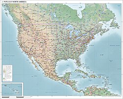
主要な事実(Key Facts)
- 総面積:約2,470万平方キロメートル(世界第3位)
- 総人口:約5億9,200万人(2021年時点)
- 経済規模:名目GDPおよび購買力平価(PPP)ともに世界第2位の経済圏
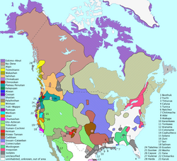
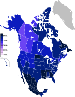
- 主要言語:英語、スペイン語、フランス語、オランダ語、デンマーク語、および多数の先住民族言語
- 宗教構成:キリスト教が約74.6%と主流であり、次いで無宗教(19.2%)が続きます
歴史的変遷:先住民から現代国家まで
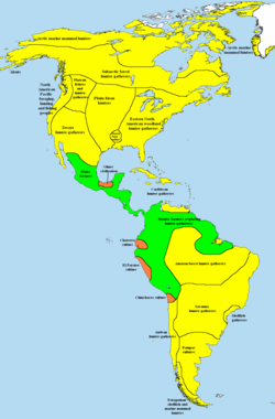
北アメリカの歴史は、ヨーロッパ人の到達以前から始まっています。先コロンブス期には、狩猟採集社会から複雑な農業社会、さらには高度な文明を持つ部族社会まで、多様な生活様式が確立されていました。
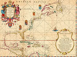
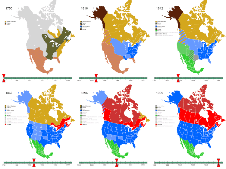
1492年以降の「接触後」の時代に入ると、ヨーロッパ諸国による植民地化が急速に進みました。1507年にはドイツの地図製作者マルティン・ヴァルトゼーミュラーによって初めて「アメリカ」という名称が使用されました。その後、イギリス、フランス、スペインなどが激しく領土を争い、七年戦争やアメリカ独立戦争を経て、現在の国家体制の基礎が築かれました。
![World map of German cartographer Martin Waldseemüller (Germany, 1507), which first used the name America[citation needed]](/images/c9/69/c969a1ce5dc74bfcc59543a2ba3965bb4b7f55e236727ee37b0442bc07b13abb.jpg)
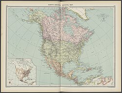
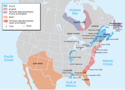
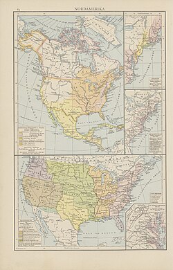
19世紀から20世紀にかけては、アメリカ合衆国の西進運動やカナダの連邦結成、パナマ運河の建設など、大陸全体の政治的・物理的な境界が確定していきました。また、非先住民による支配領域の拡大は、大陸の社会構造を根本から変えることとなりました。
地理的特徴と自然環境
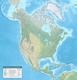
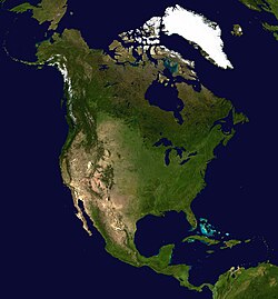
北アメリカの地形は、大きく分けてカナダ、アメリカ合衆国、メキシコの3つの主要地域で異なる特徴を持っています。カナダではカナダ楯状地や北極諸島が、アメリカではロッキー山脈や内陸平原が、メキシコではシエラマドレ山脈やユカタン半島がそれぞれ象徴的な地形となっています。
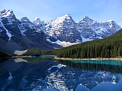
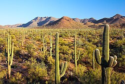
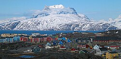
地質と気候
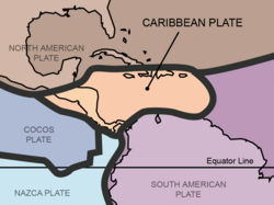
地質学的には、北アメリカプレートを中心に、太平洋プレートやカリブプレートなどの複数のプレートが相互作用しています。特に中央アメリカはカリブプレート上に位置しており、これが複雑な地形と火山活動に影響を与えています。
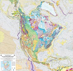
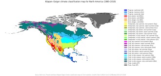
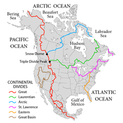
気候は、北極圏の寒冷地から、中央部の温帯、そして南部の熱帯まで、ケッペンの気候区分に基づいた極めて幅広いバリエーションが存在します。また、大陸を縦断する主要な水系が、農業や輸送の基盤となっています。
経済と社会構造
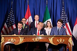
北アメリカは世界で最も豊かな地域の一つです。特にアメリカ合衆国は圧倒的なGDPを誇り、カナダとメキシコと共に強固な経済圏を形成しています。2018年には、USMCA(米国・メキシコ・カナダ協定)が署名され、貿易の枠組みが更新されました。
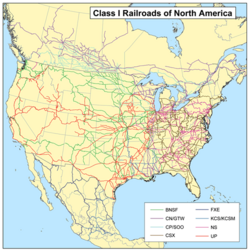
輸送インフラにおいては、広大な国土をカバーする鉄道ネットワークが物流の要となっており、都市間を結ぶ効率的な移動手段を提供しています。
人口と文化の多様性
メキシコシティ、ニューヨーク、ロサンゼルスなどの巨大都市(メガシティ)に人口が集中しています。また、移民の流入により、ニューヨークのフラッシングにあるチャイナタウンのように、多様な言語と文化が共存する地域が生まれています。
![Chinatown, Flushing in Queens, New York City has become the present-day global epicenter receiving Chinese immigration as well as the international control center directing such migration, as numerous languages have become entrenched into North American society.[131][132]](/images/f0/cc/f0cc57ddca62cddb473cee2e9152c8894a8ec884299fec6df63d5b3303aafcbe.jpg)
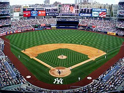
文化面では、スポーツが社会的に重要な役割を果たしています。特に野球はアメリカの「国民的娯楽」として知られ、カナダやラテンアメリカ諸国でも広く親しまれています。また、NFL(アメリカンフットボール)やNBA(バスケットボール)などのプロスポーツリーグは、莫大な収益を上げる巨大産業となっています。
北アメリカの主要データまとめ
| 項目 | 詳細データ |
|---|---|
| 総面積 | 24,709,000 km² |
| 推定人口 (2021) | 592,296,233人 |
| 名目GDP (2025予測) | 34.61兆米ドル |
| 一人当たりGDP (2025予測) | 67,000米ドル |
| 主権国家数 | 23カ国 |
Frequently Asked Questions
北アメリカに含まれる主な国はどこですか?
主にカナダ、アメリカ合衆国、メキシコの3カ国に加え、中央アメリカの諸国(グアテマラ、コスタリカ、パナマなど)およびカリブ海の島嶼国(キューバ、ジャマイカ、ドミニカ共和国など)が含まれます。
この地域の経済的な特徴は何ですか?
世界第2位の経済規模を持ち、高度に工業化されたアメリカとカナダ、そして製造業や資源に強みを持つメキシコが、USMCAなどの貿易協定を通じて密接に連携している点が特徴です。
北アメリカの地理的な多様性はどのように現れていますか?
北部の氷河地形やツンドラから、中央部の広大な平原、西部の険しい山脈(ロッキー山脈)、そして南部の熱帯雨林や砂漠(ソノラ砂漠など)まで、あらゆる気候帯と地形が揃っています。
言語的な状況はどうなっていますか?
植民地時代の歴史を反映し、英語、スペイン語、フランス語が広く話されています。また、グリーンランドのデンマーク語や、大陸各地に点在する多様な先住民族の言語が保持されています。
References
- This North American density figure is based on a total land area of 23,090,542 km2 only, considerably less than the total combined land and water area of 24.709 million km2.
- Some countries view the as a , comprising North America and .
- The of Alaska extend into the .
- The receding of oceans during successive may have enabled migrants to cross the land bridge as far back as 40,000 years.
- Descriptions of sites Erikson explored seem to correspond to , the coast near , as well as , and a site which led him to name the country ('Wineland').
- Depending on the definition, could be considered a while the (, , and ) and could be considered .
- Since the is located in the Atlantic Ocean rather than , are part of the but are not technically part of the , although the United Nations groups them with the Caribbean.
- Because of ongoing activity of the beginning in July 1995, much of Plymouth was destroyed and government offices were relocated to Brades. Plymouth remains the de jure capital.
- Panama is generally considered a North American country, though some authorities divide it at the . Figures listed here are for the entire country.
- Since the is located in the Atlantic Ocean rather than , the are part of the but are not technically part of the , although the United Nations groups them with the Caribbean.
📸 フォトギャラリー