Early Indian treaty territories in Montana
← ホームへ戻る

モンタナ州雄大な自然と歴史が交差する「ビッグスカイ・カントリー」

🗓 2026年8月10日

アメリカ合衆国北西部に位置するモンタナ州は、「ビッグスカイ・カントリー(大きな空の国)」や「トレジャー・ステート(宝の州)」という愛称で知られています。広大な大地と切り立った山々、そして澄み渡る空が特徴的なこの州は、自然愛好家にとっての聖地であり、アメリカの開拓精神が色濃く残る場所でもあります。

州のモットーである「Oro y Plata(金と銀)」が示す通り、かつては鉱山開発で栄え、その後は広大な牧草地を活かした畜産業が発展しました。現在は、世界的に有名な国立公園や、豊かな野生動物、そして静謐な田舎町の風景が調和した、唯一無二の地域として親しまれています。
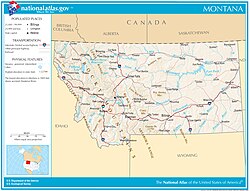
Map of Montana

主要な事実(Key Facts)

  • 州都: ヘレナ(Helena)
  • 最大都市: ビリングス(Billings)
  • 面積: 全米第4位の広さを誇る
  • 人口密度: 全米で非常に低く、広大な未開の地が残る
  • 象徴的な自然: イエローストーンおよびグレイシャーの2大国立公園を擁する
  • 最高峰: グラナイト・ピーク(標高3,903.5m)

地理と自然環境

モンタナ州の地形は非常にダイナミックです。西側には険しいロッキー山脈が連なり、東側にはなだらかな平原が広がっています。この地形的なコントラストが、州内に多様な生態系と景観を生み出しています。
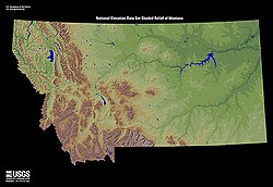
Relief map of Montana

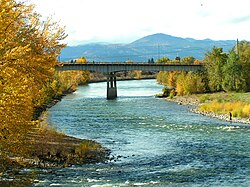
水資源も豊富で、ミズーリ川などの主要河川や、クリスタルクリアな湖が点在しています。特にグレイシャー国立公園のセントメアリー湖や、ミズーラ近郊のクラークフォーク川などは、その美しさで知られています。
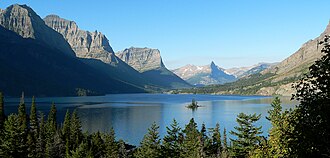
Saint Mary Lake in Glacier National Park
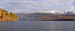
Clark Fork River, Missoula, in autumn
Whitefish Lake in Montana

また、この地は野生動物の宝庫でもあります。シンボルであるグリズリーベア(ハイイログマ)をはじめ、かつては絶滅の危機に瀕したオオカミなどの大型哺乳類が、手つかずの自然の中で共生しています。
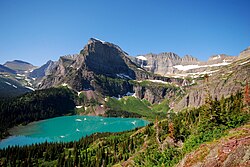
East face of Mount Gould above Grinnell Lake
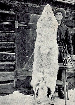
100 pound native Montana wolf taken in 1928

特筆すべきは、地質学的な変動による地形の変化です。例えば、1959年のヘブゲン湖地震に伴う地滑りによって形成されたクエイク湖は、自然の猛威と創造性を象徴するスポットとなっています。
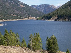
Quake Lake was created by a landslide during the 1959 Hebgen Lake earthquake.

気候の特徴

モンタナ州の気候は、内陸性気候の影響を強く受けています。夏は温暖で快適ですが、冬は非常に厳しく、多くの地域で氷点下まで気温が下がります。特に州都ヘレナなどの地域では、季節による温度差が激しいのが特徴です。
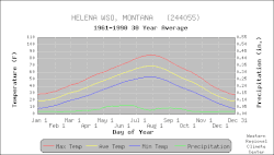
Temperature and precipitation for Montana's capital city, Helena
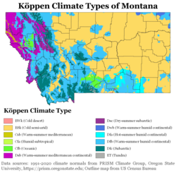
Köppen climate types of Montana, using 1991–2020 climate normals

歴史と文化の変遷

モンタナの歴史は、先住民族の時代から始まります。彼らはこの地の自然と共に生き、独自の文化を築いてきました。しかし、19世紀以降の入植者の増加に伴い、土地を巡る激しい衝突が起こりました。リトルビッグホーンの戦いなどの歴史的な出来事は、この地で起きた葛藤の記憶として刻まれています。
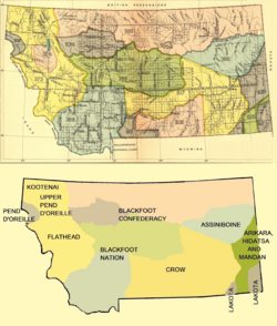
Early Indian treaty territories in Montana
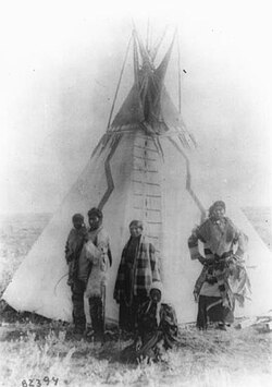
Assiniboine family, Montana, 1890–91
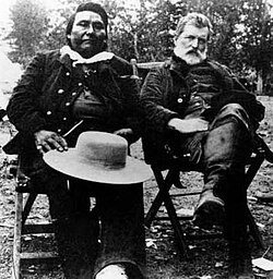
Chief Joseph and Col. John Gibbon met again on the Big Hole Battlefield site in 1889.

その後、金や銀の採掘ラッシュが起こり、多くの人々が富を求めて集まりました。1889年11月8日には、41番目の州としてアメリカ合衆国に加盟しました。開拓時代には、広大な土地を切り拓くホームステッド(自営農場)の形成や、鉄道の敷設が州の発展を加速させました。

Montana Territory in 1865[24]

軍事的な歴史においても、アフリカ系アメリカ人の兵士である「バッファロー・ソルジャーズ」が駐屯した記録があり、多様な人々がこの地の形成に関わってきたことがわかります。
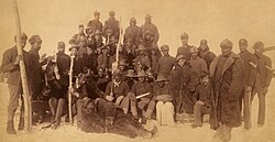
Buffalo Soldiers, Ft. Keogh, Montana, 1890. The nickname was given to the "Black Cavalry" by the Native American tribes they fought.

多様な人口構成

現代のモンタナ州は、白人層が多数を占める一方で、先住民族(ネイティブ・アメリカン)のコミュニティが強いアイデンティティを持って共存しています。また、メノナイトのような宗教的コミュニティや、様々なルーツを持つ移民たちが、州の文化的な多様性を形作っています。
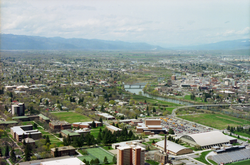
Missoula
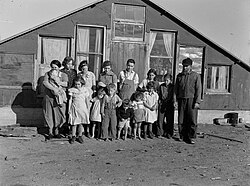
Mennonite family in Montana, c. 1937
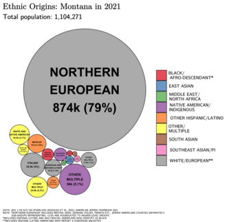
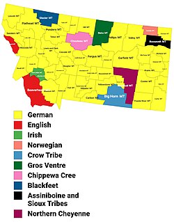
Ethnic origins in Montana
Largest alone or in any combination ethnic origin by county in Montana, per the 2020 census
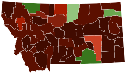
Map of counties in Montana by racial plurality, per the 2020 U.S. census Legend Non-Hispanic White 50–60% 60–70% 70–80% 80–90% 90%+ Native American 50–60% 60–70% 70–80%

人口分布を見ると、都市部よりも郡レベルでの分散が見られ、特に先住民族の予約区(リザベーション)が州内の重要な地域として存在しています。
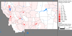
Montana population density map
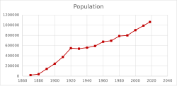
Population of Montana 1870–2018
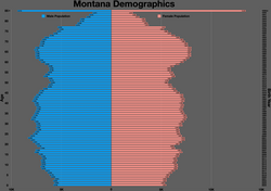
Montana population pyramid
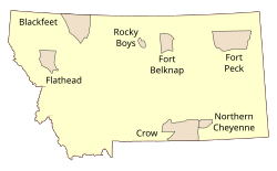
General locations of Indian reservations in Montana
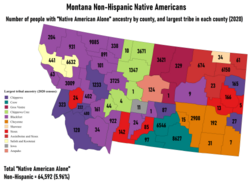
Largest Non-Hispanic Native American ancestry by county and numbers of people reporting "Native American Alone"

経済と現代のライフスタイル

伝統的な畜産業や鉱業に加え、現在は観光業が経済の大きな柱となっています。特にウィンタースポーツは盛んで、ビッグスカイ・リゾートやレッドロッジ・マウンテン・リゾートなど、世界レベルのスキー場が数多く存在します。
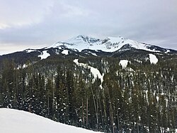
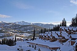
Lone Mountain at Big Sky Ski Resort
The Big Sky Resort
The Palisades area on the north end of the ski area at Red Lodge Mountain Resort

また、イエローストーン国立公園へのアクセス拠点となるウェストイエローストーンなどの町では、スノーモービルツアーなどのアウトドア・アクティビティが人気を集めています。
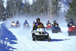
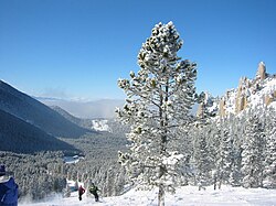
Guided snowmobile tours in Yellowstone Park
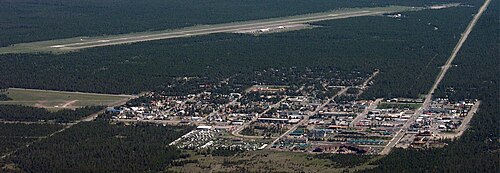
Yellowstone Airport, West Yellowstone, Montana

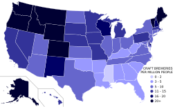
都市部では、ビリングスのファースト・インターステート・センターのような近代的なビルが立ち並ぶ一方で、クラフトビール文化が浸透しており、人口あたりの醸造所数は全米トップクラスを誇ります。
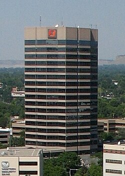
First Interstate Center, in downtown Billings, is the tallest building in Montana.
Montana ranks 3rd nationally in craft breweries per capita.

教育とインフラ

州内にはモンタナ州立大学(ボーズマン、ビリングスなど)やモンタナ大学(ミズーラ)といった教育機関が整備されており、学術的な発展を支えています。また、州内を縦断する国道93号線などの交通網が、広大な州内の移動を可能にしています。
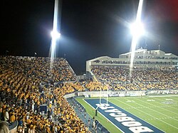
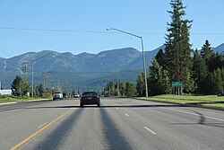
Montana State Bobcats football at Bobcat Stadium (Montana State University), Bozeman
U.S. Route 93 in Montana

州の概要まとめ

モンタナ州 基本データ
項目 詳細
ニックネーム Big Sky Country / The Treasure State
州都 ヘレナ
最大都市 ビリングス
面積ランク 全米第4位
人口(2025年推計) 約1,144,694人
主要産業 観光、畜産業、鉱業、クラフトビール
州の象徴(動物) グリズリーベア(哺乳類)、ニシマドカ(鳥)

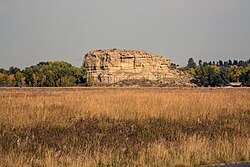
モンタナ州は、自然の驚異と人間ドラマが交錯する場所です。ポンペイズ・ピラーのような歴史的記念碑から、広大な国立公園まで、訪れる人々を圧倒するスケールの大きさが魅力です。
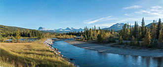
Belly River in Waterton Lakes National Park
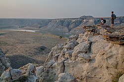
Missouri Breaks region in central Montana
Pompeys Pillar National Monument
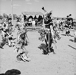
Dancers at Crow Fair in 1941
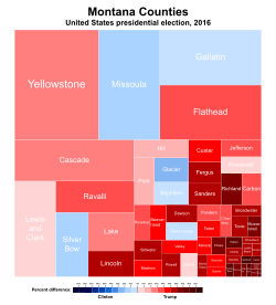
Treemap of the popular vote by county in the 2016 presidential election. Areas are in proportion to the number of votes cast in each county.

Frequently Asked Questions

モンタナ州の別名「ビッグスカイ・カントリー」とはどういう意味ですか?

これは、遮るもののない広大な平原と高い山々に囲まれ、どこまでも高く澄み渡った空が広がっている景観から名付けられた愛称です。

州内で最も有名な観光地はどこですか?

世界初の国立公園であるイエローストーン国立公園と、氷河が削り出した絶景が広がるグレイシャー国立公園が、世界中から観光客を集める二大スポットです。

モンタナ州の気候はどのような特徴がありますか?

典型的な内陸性気候で、夏は温暖ですが冬は非常に厳しく、積雪量も多い地域があります。特に山岳地帯では冬の寒さが厳しいため、冬用装備が不可欠です。

州の経済を支えている主な産業は何ですか?

歴史的には金・銀の鉱業や牛の放牧などの畜産業が中心でしたが、現在はそれらに加えて、国立公園を中心とした観光業や、近年注目を集めるクラフトビール産業などが経済を支えています。

先住民族の文化は現在どのように受け継がれていますか?

州内に複数の予約区(リザベーション)が存在し、独自の言語や伝統、儀式が大切に守られています。また、部族大学(Tribal Colleges)の設立などを通じて、教育面からも文化の継承が行われています。

References

  1. However, the grizzly bear and Canadian lynx are listed as a threatened species only for the mainland 48 states. In general, the grizzly bear and Canadian lynx are not threatened species; the IUCN lists both as "least concern".
  2. This figure refers to those who report African American and no other race.

📸 フォトギャラリー

Early Indian treaty territories in Montana
Assiniboine family, Montana, 1890–91
Montana Territory in 1865[24]
Chief Joseph and Col. John Gibbon met again on the Big Hole Battlefield site in 1889.
Buffalo Soldiers, Ft. Keogh, Montana, 1890. The nickname was given to the "Black Cavalry" by the Native American tribes they fought.
Mennonite family in Montana, c. 1937
Map of Montana
Relief map of Montana
Saint Mary Lake in Glacier National Park
Belly River in Waterton Lakes National Park
East face of Mount Gould above Grinnell Lake
Missouri Breaks region in central Montana
Whitefish Lake in Montana
100 pound native Montana wolf taken in 1928
Pompeys Pillar National Monument
Quake Lake was created by a landslide during the 1959 Hebgen Lake earthquake.
Temperature and precipitation for Montana's capital city, Helena
Köppen climate types of Montana, using 1991–2020 climate normals
Clark Fork River, Missoula, in autumn
Missoula
Montana population density map
Ethnic origins in Montana
Largest alone or in any combination ethnic origin by county in Montana, per the 2020 census
Population of Montana 1870–2018
Map of counties in Montana by racial plurality, per the 2020 U.S. census Legend Non-Hispanic White 50–60% 60–70% 70–80% 80–90% 90%+ Native American 50–60% 60–70% 70–80%
Montana population pyramid
General locations of Indian reservations in Montana
Largest Non-Hispanic Native American ancestry by county and numbers of people reporting "Native American Alone"
Montana ranks 3rd nationally in craft breweries per capita.
First Interstate Center, in downtown Billings, is the tallest building in Montana.
Dancers at Crow Fair in 1941
Montana State Bobcats football at Bobcat Stadium (Montana State University), Bozeman
Lone Mountain at Big Sky Ski Resort
The Big Sky Resort
The Palisades area on the north end of the ski area at Red Lodge Mountain Resort
Guided snowmobile tours in Yellowstone Park
Yellowstone Airport, West Yellowstone, Montana
U.S. Route 93 in Montana
Treemap of the popular vote by county in the 2016 presidential election. Areas are in proportion to the number of votes cast in each county.