南米アンデス山脈の標高高い高原地帯「アルティプラーノ」には、かつて広大な面積を誇ったタウカ湖という巨大な湖が存在していました。現在は世界的に有名なウユニ塩湖などの塩原(サラール)となっているこの地域ですが、数万年前には深い水底に覆われていた時代がありました。本記事では、この古湖の成り立ちから消滅までのダイナミックな歴史を解説します。
アルティプラーノは、ボリビア、チリ、ペルーにまたがる広大な高地です。ここにはかつて、現在のティティカカ湖やポポ湖を遥かに凌ぐ規模の湖が周期的に現れては消えていました。
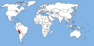
主要な事実(Key Facts)
- 存在時期: 約72,600年前から7,200年前まで(プレストセ〜ホロセ期)。
- 最大規模: 表面積は約48,000〜80,000平方キロメートルに達した。
- 最大水深: 約142メートル。
- 遺産: 湖が干上がったことで、世界最大の塩原であるウユニ塩湖が形成された。
- 位置: 南米アンデス山脈のアルティプラーノ高原。
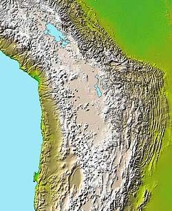
タウカ湖の地理と水文学的特徴
タウカ湖は、標高約3,660メートルから3,770メートルの高地に位置していました。その水深は平均100メートルに及び、過去10万年から13万年の間では、アルティプラーノで最大級の湖であったと考えられています。
湖への主な流入源は、氷河の融解水やデサグアデロ川、リペス大河、ラウカ川などの河川でした。一方で、流出先はピルコマイヨ川であった可能性が指摘されています。水質は非常に塩分濃度が高く、20g/Lから90g/Lという広範囲な塩分濃度が記録されており、特に塩化ナトリウムや塩素、ナトリウムなどの成分が豊富に含まれていました。
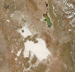
この湖の流域は非常に広大であり、現在のボリビア、チリ、ペルーの国境を越えて広がっていました。
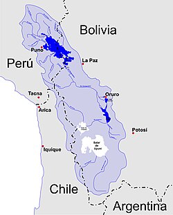
湖の変遷と時代区分
タウカ湖の歴史は単純な一つの期間ではなく、水位の変動を伴う複数のフェーズに分かれています。研究によれば、約18,500年前に水位が上昇し始め、16,000〜14,500年前頃に最大の水位(ハイスタンド)に達しました。
コイパサ・フェーズへの移行
その後、約14,200年前に一度水位が低下しましたが、再び上昇して約11,500年前まで存続しました。この後期の段階は「コイパサ・フェーズ」と呼ばれ、水位は約3,660〜3,700メートルまで低下し、面積は約32,000平方キロメートルに縮小しました。この時期、ウユニ盆地とコイパサ盆地の接続部は狭まり、多くの島々が形成されました。
消滅と塩原の形成
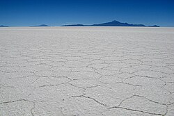
最終的に、ボリング・アレルード間氷期などの気候変動に伴い湖は干上がりました。この過程で大量の塩分が堆積し、現在のウユニ塩湖に見られる厚い塩の層(最大10メートルに達する)が形成されたのです。
気候変動と氷河の影響
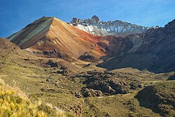
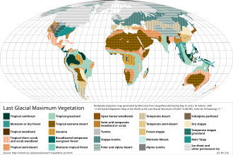
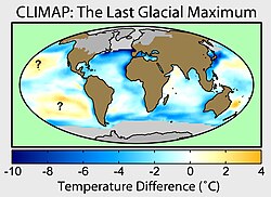
タウカ湖の形成には、降水量の増加と気温の低下が深く関わっています。最終氷期極大期(LGM)などの寒冷な時期には、氷河の発達が見られました。例えば、トゥヌパ火山などの周辺地域では、タウカ湖が存在した時期に氷河に覆われていたことが分かっています。
また、当時の植生や海水温の変化も、この地域の水文サイクルに影響を与えていたと考えられています。
先代の湖と地域の古環境
タウカ湖以前にも、アルティプラーノにはいくつかの古湖が存在していました。年代順に、エスカラ湖(最古のサイクルとされる)、オウキ湖、サリナス湖、インカ・ワシ湖、サジシ湖などが確認されています。
興味深いことに、南部の古湖が深くなる傾向にある一方で、北部のティティカカ湖の水位は低下する傾向にありました。これは、両盆地を隔てる境界が浸食され、ティティカカ湖から南部へ水が流れ込みやすくなったためだと推測されています。
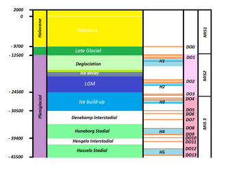
また、約46,000〜36,000年前の湿潤期には「ミンチン湖」と呼ばれる湖が存在したという説もあります。かつてはタウカ湖より大きかったと考えられていましたが、近年の年代測定により、タウカ湖の方が大規模であったことが判明しています。
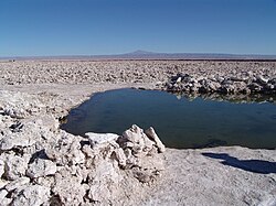
ラテンアメリカの古湖比較
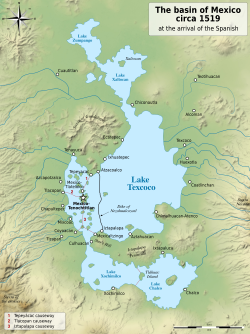
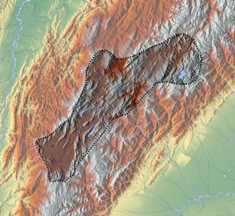
アルティプラーノの古湖は、他の地域の古湖と比較してもその規模が際立っています。メキシコ盆地のテスココ湖やコロンビアのフンボルト湖に比べ、タウカ湖を含むボリビア・アルティプラーノの系は、標高が高く、面積も圧倒的に広大でした。
| 地域 | 代表的な古湖 | 標高 | 最大面積(概算) | 関連文明 |
|---|---|---|---|---|
| メキシコ盆地 | テスココ湖 | 2,236 m | 9,738 km² | アステカ |
| クンディボヤセンセ | フンボルト湖 | 2,580 m | 25,000 km² | ムイスカ |
| ボリビア・アルティプラーノ | タウカ湖 | 3,800 m | 175,773 km² (流域全体) | インカ / ティワナク |
Frequently Asked Questions
タウカ湖はなぜ消滅したのですか?
主に気候変動による乾燥化が原因です。降水量の減少と気温の変化により、蒸発量が流入量を上回り、最終的に湖水が干上がりました。この過程で溶け込んでいた塩分が結晶化し、現在の塩原となりました。
ウユニ塩湖とタウカ湖の関係は何ですか?
ウユニ塩湖は、タウカ湖が干上がった後に残された「遺構」のようなものです。湖底に堆積した厚い塩の層が、現在の真っ白な塩原を形成しています。
タウカ湖の最大サイズはどのくらいでしたか?
推定によって幅がありますが、表面積は約48,000から80,000平方キロメートルに及び、水深は最大で142メートルに達していました。
タウカ湖の前に存在した湖はありますか?
はい。エスカラ湖、オウキ湖、サリナス湖、インカ・ワシ湖、サジシ湖など、数万年周期で異なる古湖が現れては消えるサイクルを繰り返していました。
ティティカカ湖はタウカ湖に影響を与えましたか?
はい。ティティカカ湖からデサグアデロ川を通じて大量の水が流入していたことが、タウカ湖の水位維持に重要な役割を果たしていたと考えられています。
References
- The sedimentation rate in the Uyuni basin was about 1.6–2 millimetres per year (0.063–0.079 in/year).
- The humidity above the lake has been estimated at 60%, taking into account the oxygen-18 content of carbonates deposited by the lake.
- A significant excess NaCl concentration has been inferred for Lake Tauca, possibly stemming from older salt deposits being re-dissolved in Lake Tauca.
- Precipitation of resulted in lake waters becoming progressively enriched in more soluble salts such as sulfate and chloride.
- Which was occasionally dammed by sediments, forming lakes upstream.
- Between 70% and 83% of Lake Tauca's water, an increase of between 8 and 30 times the current outflow of Lake Titicaca via the Desaguadero. A drop in the level of Lake Titicaca about 11,500 may have resulted in its outflow drying up, favouring the disappearance of Lake Tauca.
- Other estimates assume that one-third of Tauca's water came from Lake Titicaca, no more than 15%, or 4% (similar to today's five-per cent contribution from Titicaca to Lake Poopó). During the Coipasa cycle, Lake Poopó may have contributed about 13% of the water. About 53% of Lake Tauca's water came from the Eastern Cordillera.
- Complete glacier melt would need to occur in less than about a century and would not suffice to produce Lake Tauca's high water levels.
- The lake was deep enough to support planktonic diatoms, including the dominant . Other diatoms noted in Lake Tauca are the shallow-water , and , the , and , the , the , , , and , in river mouths, and , , sp., sp., sp., , , , sp., , , sp. and whose preferred positions in the water column are not stated. has also been found.
- and species
📸 フォトギャラリー