北大西洋に浮かぶグレートブリテン島は、イングランド、スコットランド、ウェールズの3つの国で構成される、ヨーロッパ最大の島です。世界的に見ても9番目に大きな面積を誇り、アジア以外では世界で最も人口密度の高い島として知られています。穏やかな海洋性気候に恵まれ、豊かな自然と深い歴史が共存するこの地は、現代においても世界に大きな影響を与え続けています。
古くは「アルビオン」とも呼ばれ、地域によっても多様な呼称が存在します。例えば、コーンウォール語では「Breten Veur」、スコットランド・ゲール語では「Breatainn Mhòr」、ウェールズ語では「Prydain Fawr」と称されます。
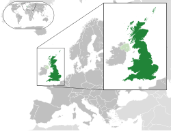
Key Facts
- 構成国:イングランド、スコットランド、ウェールズの3カ国
- 世界順位:島としての面積は世界第9位、人口は世界第3位
- 最高峰:ベン・ネビス山(標高1,345m)
- 主要都市:ロンドン(2024年時点で人口約900万人超)
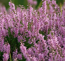
- 地理的特徴:東部・南部は緩やかな丘陵地、北部・西部は山岳地帯が中心
地理的特性と地質学的成り立ち
グレートブリテン島は、北海と英仏海峡によってヨーロッパ大陸から切り離されています。最狭部であるドーバー海峡では、大陸との距離は約34kmまで縮まります。1993年には世界最長の海底鉄道トンネルであるユーロトンネルが開通し、物理的な接続が再開されました。
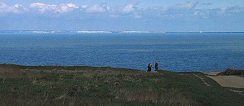
興味深いことに、約9,000年前までこの島は大陸と地続きでした。ドッガーランドと呼ばれる陸橋が存在していましたが、氷河期の終わりに海面が上昇したことで水没し、現在の島状の地形となりました。また、英仏海峡の形成には、数万年前の巨大な氷河湖の決壊による大洪水が関わっていたと考えられています。
地質学的には非常に多様で、北西部のルイス質片麻岩は少なくとも27億年前のものとされ、島内で最古の岩石です。その後、イアペトゥス海の海底に堆積した岩石が褶曲し、現在のスコットランド高地などの険しい地形を形成しました。
歴史的変遷と政治的統合
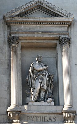
人類の居住は約3万年前まで遡ります。古代にはピュテアスのような地理学者がこの地を訪れ、その記録が後の地図作成に影響を与えました。
ローマ時代の地図作成者プトレマイオスによる記録は、当時の海岸線や道路網を伝えていますが、現代の視点からはスコットランドの形状などが不正確に描かれている点も議論の対象となっています。
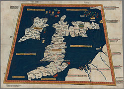
![A 1490 Italian reconstruction of the relevant map of Ptolemy who combined the lines of roads and of the coasting expeditions during the first century of Roman occupation. Two great faults, however, are an eastward-projecting Scotland and none of Ireland seen to be at the same latitude of Wales, which may have been if Ptolemy used Pytheas' measurements of latitude.[28] Whether he did so is a much debated issue. This "copy" appears in blue below.](/images/e3/15/e3154be7f1929cea3d0653e0043f6e499aafa0bffa2cf8d04e9eb133c9be056e.jpg)
政治的な統合の歴史で重要なのは1707年の合同法です。それ以前の1603年には、ジェームズ6世(スコットランド王)がイングランド王ジェームズ1世を兼ねる「王冠連合」が起きていましたが、法的な独立性は維持されていました。しかし、1707年に両国の議会が合併し、「グレートブリテン王国」という単一の国家が誕生しました。
社会・文化と多様なアイデンティティ
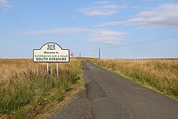
現代のグレートブリテン島では、英語が主流ですが、ウェールズ語、スコットランド・ゲール語、スコッツ語、コーンウォール語などの地域言語も大切にされており、公共の看板などで併記される光景が見られます。
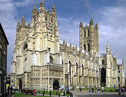
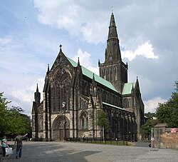
宗教面では、中世以降キリスト教が中心となってきました。特にイングランド国教会(アングリカン)が最大派閥であり、英国君主がその最高総督を務めています。また、カトリック教会や、イスラム教、ヒンドゥー教、シク教、仏教、ユダヤ教など、多様な信仰を持つ人々が共生しています。
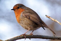
自然環境においては、コマドリが「英国で最も愛される鳥」として親しまれるなど、豊かな生態系が維持されています。
基本データまとめ
グレートブリテン島の主要な統計情報を以下の表にまとめます。
| 項目 | 詳細内容 |
|---|---|
| 総面積 | 209,331 km²(世界第9位) |
| 総人口 | 67,353,582人(2024年) |
| 人口密度 | 294人/km² |
| 主要言語 | 英語、スコッツ語、ウェールズ語、スコットランド・ゲール語、コーンウォール語 |
| 時間帯 | GMT (UTC+0) / 夏時間 BST (UTC+1) |
| 民族構成 | 白人 (82.6%)、アジア系 (8.8%)、黒人 (3.8%)、混血 (2.7%)、その他 (2.0%) |
Frequently Asked Questions
グレートブリテン島とイギリス(UK)の違いは何ですか?
グレートブリテン島は地理的な「島」の名前であり、イングランド、スコットランド、ウェールズを含みます。一方、イギリス(UK)は政治的な国家名であり、グレートブリテン島に加えて北アイルランドを含むため、地理的な範囲が異なります。
島が大陸から切り離されたのはいつ頃ですか?
約1万年前までは「ドッガーランド」という陸地でヨーロッパ大陸と繋がっていましたが、海面の上昇により紀元前6500年頃までには完全に切り離され、島となりました。
島内で最も高い場所はどこですか?
スコットランドにあるベン・ネビス山で、標高は1,345メートルです。
どのような言語が話されていますか?
公用語である英語のほか、ウェールズではウェールズ語、スコットランドではスコッツ語やスコットランド・ゲール語、コーンウォール地方ではコーンウォール語などが使用されています。
宗教的な特徴はありますか?
キリスト教が最大であり、特にイングランド国教会が大きな影響力を持っています。また、歴史的な背景からカトリックや、移民によるイスラム教、ヒンドゥー教など多様な宗教が共存しています。
References
- The term "Great Britain" in political contexts would include its off-shore islands.
- The political area of Great Britain, including offshore islands
- Scotland held its census a year later after England and Wales due to the COVID-19 pandemic. As a result, the data shown is from two separate years.
- The political definition of Great Britain – that is, England, Scotland, and Wales combined – includes a number of offshore islands such as the , , and , which are not part of the geographical island of Great Britain. Those three countries combined have a total land area of 228,948 km2 (88,397 sq mi).
📸 フォトギャラリー