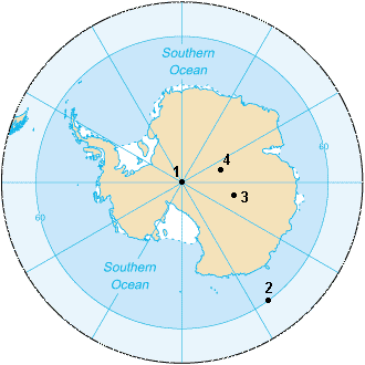
地球の自転軸が地表と交わる点、それが地理的南極点(True South Pole)です。南半球の最南端に位置し、北極点とは正反対の対蹠点にあります。ここは単なる地点ではなく、すべての経線が集まり、どの方向を向いても「北」となるという、地球上で唯一の特異な場所です。
南極点には特定のタイムゾーンが設定されていないため、運用上の都合に合わせて任意の時間を現地時間として採用しています。また、磁気的な北南を示す「磁極」とは位置が異なるため、明確に区別して呼ばれています。
Key Facts
- 位置: 南緯90度。南極大陸の氷床の上に位置する。
- 標高: 海抜約2,835mの高原にあるが、下には約2,700mの厚い氷がある。
- 気候: 年平均気温は約-49.5℃。地球上で最も過酷な環境の一つ。
- 特性: 氷床が年間に約10m移動するため、地理的な標識は毎年移動させる必要がある。
- 拠点: 1956年に設立されたアメリカの「アムンゼン・スコット南極基地」が常駐している。
地理的特性と環境
南極点は、海から約1,300km離れた内陸の荒涼とした氷の高原にあります。地表は厚さ約3.2kmの氷床に覆われており、この氷はゆっくりとウェッドル海方向へ流れています。そのため、固定された建物や標識は時間の経過とともに地理的な南極点からずれていきます。

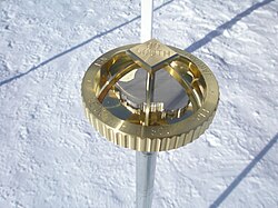
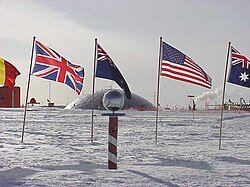
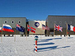
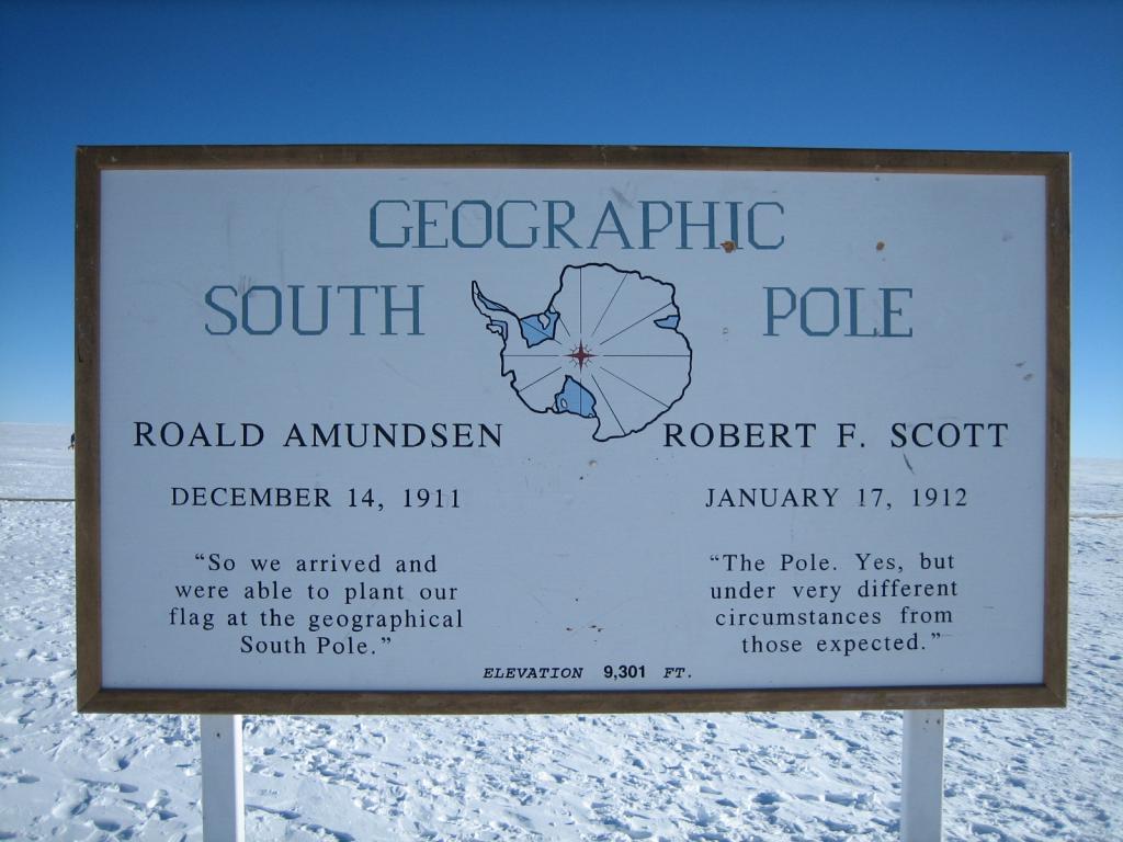
この場所では、雪が溶けないため建物が徐々に雪に埋もれていくという現象が起こります。そのため、実際の地理的南極点を示すマーカーは毎年更新され、あわせて象徴的な「儀礼用南極点」のポールと旗が設置されています。
過酷な気候と昼夜のサイクル
南極の気候は、高い標高と大陸の中央に位置するという地理的要因により、北極点よりも遥かに低温です。1年を通じて太陽の高度は低く、夏至付近でも最大で約23.5度までしか上がりません。
昼夜のサイクルは極端で、5月から8月の冬の間は完全に太陽が昇らない極夜となり、10月から2月の夏の間は太陽が沈まない白夜が続きます。気温は冬場に平均-60℃まで低下し、観測史上最低は-82.8℃(1982年)を記録しています。
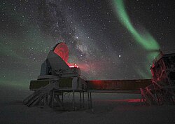
アムンゼン・スコット基地の気候データ
| 項目 | 1月(盛夏) | 7月(盛冬) | 年平均 |
|---|---|---|---|
| 平均最高気温 | -26.0℃ | -55.2℃ | -45.8℃ |
| 平均気温 | -28.4℃ | -59.8℃ | -49.5℃ |
| 平均最低気温 | -29.6℃ | -63.4℃ | -52.2℃ |
| 平均降水量 | 0.3mm | 痕跡量 | 極めて少量 |
人類による到達と探検の歴史
19世紀半ばまで南極の海岸線さえ正確に把握されていませんでしたが、1839年頃にチャールズ・ウィルクスらが南極が大陸であることを突き止めました。その後、20世紀初頭に「英雄時代」と呼ばれる激しい到達競争が繰り広げられます。
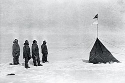
1911年12月14日、ノルウェーのロアール・アムンセン率いる隊が世界で初めて地理的南極点に到達しました。そのわずか34日後、イギリスのロバート・スコット隊も到達しましたが、スコットらは帰路に飢えと寒さで全員が命を落とすという悲劇に見舞われました。
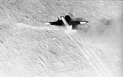
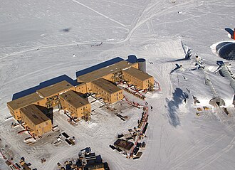
その後、1956年10月31日にアメリカ海軍のジョージ・デュフェク提督らが航空機で着陸し、現代的な拠点となるアムンゼン・スコット基地が建設されました。これにより、人類は南極点に永続的に滞在することが可能となりました。
歴史的な記念碑と記録
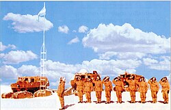
南極点周辺には、アムンセンが設営したテント(現在は氷の下に埋没)や、アルゼンチンが設置した旗竿などの歴史的遺構が存在します。また、現代では徒歩やスキーによる単独横断などの挑戦が続いており、2024年にはフランスのヴァンサン・コリヤールが海洋からの最速到達記録(22日6時間8分)を更新しています。
Frequently Asked Questions
南極点ではどの方向を向いても北なのですか?
はい。地理的南極点は地球の最南端であるため、そこからどの方向に進んでも北に向かうことになります。
なぜ南極点の標識は毎年動かさなければならないのですか?
南極点を覆っている厚い氷床が、年間に約10メートルという速度でゆっくりと移動しているため、地理的な真の南極点と標識の位置を合わせるために毎年調整が必要です。
南極点と北極点ではどちらが寒いですか?
一般的に南極点の方が寒いです。北極点は海の上に位置していますが、南極点は標高約2,800メートルの高地にある大陸であるため、気温が著しく低くなります。
南極点にはどのような時間帯が適用されていますか?
公式に割り当てられたタイムゾーンはありません。そのため、基地の運営や研究の都合に合わせて、任意の時間を現地時間として使用しています。
アムンゼンとスコットのどちらが先に到達しましたか?
ノルウェーのロアール・アムンセン隊が1911年12月14日に到達し、世界で初めて南極点に辿り着いた人類となりました。
References
- "Moving the South Pole" Archived 16 July 2011 at the , NASA Quest
- Amundsen–Scott South Pole Station Archived 14 April 2020 at the , National Science Foundation, Office of Polar Programs
- "Where is the real Pole really?". Retrieved 25 March 2008.
- Lohr, Tom (8 January 2006). "Marker makes annual move" (PDF). Antarctic Sun. : . p. 6. Archived from the original (PDF) on 28 February 2008.
- "Sign at the (ever moving) actual geographical South Pole (a few feet away from the Ceremonial Pole)". Pierre R. Schwob Physics/Astronomy. Retrieved 25 May 2013.
- Kiefer, Alex (January 1994). "South Pole Marker". Retrieved 24 March 2008.
- Mobley, George F. (18 September 2012). "Flags at the South Pole". National Geographic. Archived from the original on 15 June 2020. Retrieved 14 June 2020.
- "List of Historic Sites and Monuments approved by the ATCM (2012)" (PDF). Antarctic Treaty Secretariat. 2012. Retrieved 7 January 2014.
- Polar Record / Volume 47 / Issue 03 / July 2011
- "List of Historic Sites and Monuments approved by the ATCM (2012)" (PDF). Antarctic Treaty Secretariat. 2012. Retrieved 4 October 2013.
📸 フォトギャラリー