地球上の多くの河川は、最終的に海へと流れ込みますが、中にはどこにも出口を持たず、内陸で完結する水系が存在します。これを内陸流域(エンドレイク、または閉鎖流域)と呼びます。これらの地域では、水は外部の海や大きな河川へ流出せず、湖や湿地、あるいは地中へと集まり、主に蒸発によって水分が失われることで均衡を保っています。
内陸流域は、周囲を山脈などの地形に囲まれていることが多く、地理的な障壁によって水が閉じ込められた状態にあります。このため、流入した水に含まれるミネラルや塩分が蓄積しやすく、多くの内陸湖が塩湖となる傾向があります。
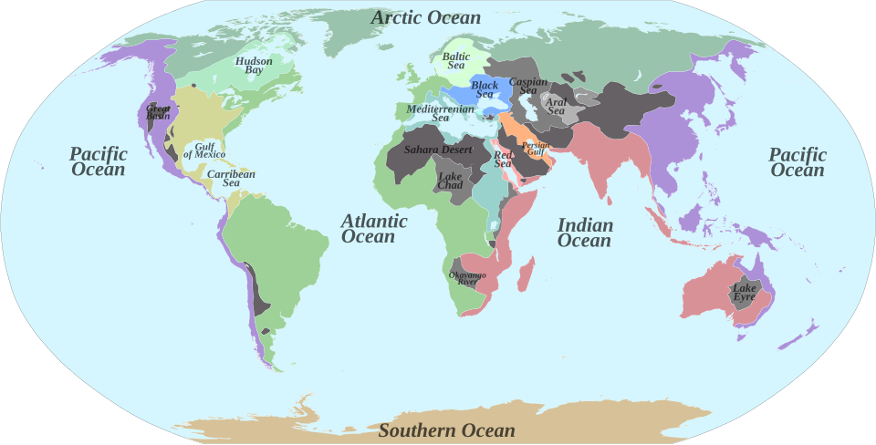
Key Facts
- 定義: 海や外部の水系へ流出しない、閉じられた排水システムのこと。
- 水分の消失: 流出した水は、蒸発または地中への浸透によってのみ減少する。
- 塩分の蓄積: 水が蒸発してもミネラルは残るため、塩湖や塩原(プラヤ)が形成されやすい。
- 分布: 乾燥地帯に多く見られるが、高地などの特殊な地形でも発生する。
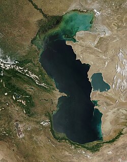
- 最大例: 世界最大の閉鎖水域はカスピ海である。
内陸流域が形成されるメカニズム
内陸流域の形成には、地殻変動による沈降と、降水量および蒸発量のバランスが深く関わっています。地盤の沈降速度が、堆積物の蓄積や水の流入速度を上回る場合、水は出口(シルレベル)に達することなく盆地に溜まり続けます。特に降水量が少なく蒸発が激しい砂漠地帯では、この傾向が顕著です。
一方で、降水量が増加すると、水流による浸食で排水路が形成されたり、水位が上昇して障壁を乗り越えたりすることで、閉鎖系から開放系(外流流域)へと変化することがあります。例えば、黒海はかつて独立した水系でしたが、地中海との接続によって現在の形態になりました。
塩原(プラヤ)の形成
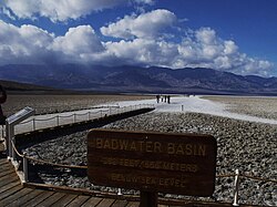
極端に乾燥した地域では、排水システムさえ形成されない「無流流域(アレイック)」と呼ばれる状態になります。ここでは水が急速に蒸発し、周囲の岩石から溶け出した塩分やミネラルが地表に白い層として残ります。こうしてできた広大で平坦な塩原(ソルトフラットやプラヤ)は、その極めて高い平坦さから、航空機の滑走路や陸上速度記録の挑戦場所として利用されることがあります。
世界各地の主要な内陸流域
アジアとアフリカ
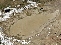
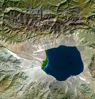
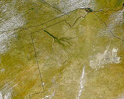
アジアの中央部は世界最大の内陸流域地帯であり、カスピ海やアラル海、中国のタリム盆地などが含まれます。特にアラル海では、流入河川の転用による急激な縮小という環境問題が顕在化しました。アフリカでは、サハラ砂漠のチャド盆地や、カラハリ砂漠に広がるオカバンゴ・デルタなどが代表的です。
南北アメリカとオセアニア
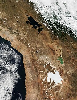
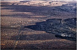
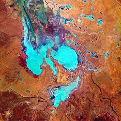
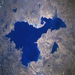
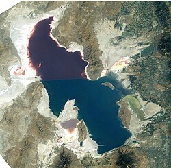
北米では、ネバダ州を中心とするグレートベースンが最大規模であり、デスバレーやグレートソルトレイクが含まれます。南米では、アンデス山脈の高地に位置するアルティプラーノ(高地平原)に、チチカカ湖やウユニ塩湖などの閉鎖的な水系が見られます。また、オーストラリアは国土の約21%が内陸流域となっており、世界で最も高い割合を誇ります。その中心となるのがアイア・ベースン(エア湖流域)です。
ヨーロッパと南極
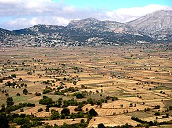
湿潤な気候のヨーロッパでは内陸流域は少ないですが、ギリシャのラシティ高原などの特殊な地形に存在します。また、南極のドライバレー(氷のない谷)にも、極めて高い塩分濃度を持つハイパーサライン湖(超塩水湖)が点在しています。
内陸流域の概要まとめ
| 地域 | 代表的な水域・盆地 | 主な特徴 |
|---|---|---|
| 中央アジア | カスピ海、アラル海 | 世界最大規模の閉鎖水域が集積 |
| 北アメリカ | グレートベースン、デスバレー | 極端な乾燥と広大な塩原の形成 |
| 南アメリカ | アルティプラーノ、ウユニ塩湖 | 高標高地における閉鎖的な水系 |
| アフリカ | オカバンゴ・デルタ、チャド盆地 | 砂漠地帯における貴重な水資源の集積 |
| オーストラリア | エア湖(Lake Eyre) | 国土の2割以上を占める高い内陸流域率 |
Frequently Asked Questions
内陸流域と普通の湖の違いは何ですか?
普通の湖(外流湖)は、河川などを通じて最終的に海へと水が流れますが、内陸流域の湖は外部への流出路を持たず、水が溜まり続けるか蒸発することでしか減少しません。
なぜ内陸湖は塩分濃度が高くなるのですか?
流入する水が岩石からミネラルや塩分を運び込みますが、出口がないため、水だけが蒸発して塩分が盆地に蓄積され続けるからです。
内陸流域は常に乾燥しているのでしょうか?
多くは砂漠地帯にありますが、必ずしもそうではありません。例えばメキシコシティ周辺のような高地では、十分な降水量があるため、湿地帯や水浸しの土壌が形成されることがあります。
「クリプトレイック(隠れた流出)」とは何ですか?
表面上は出口がないように見えますが、地下水として海へ流出しているシステムのことです。これらは厳密な意味での内陸流域(エンドレイク)とは区別されます。
過去に内陸流域だった場所はありますか?
はい。氷河期の終わりに伴う気候変動により、かつては巨大な湖だった場所が現在は乾燥した砂漠(例:デスバレー)になっているケースが多くあります。
References
- "Inland water ecosystem". Encyclopædia Britannica. Retrieved 11 June 2018.
- American Meteorological Society, Meteorology Glossary, s.v. 'endorheic lake'
- Manivanan, R. (2008). Water Quality Modeling: Rivers, Streams, and Estuaries. New Delhi: New India Pub. Agency. . Retrieved 5 January 2021.
- Vittorio Barale, "The European Marginal and Enclosed Seas: An Overview" p. 3–22 in Remote Sensing of the European Seas, 2008, p. 19
- Tundisi, J. G.; Tundisi, T. M. (2012). Limnology. Leiden, The Netherlands: CRC Press/Balkema. p. 40. . Retrieved 5 January 2021.
- (2004). "Base level". In Goudie, A.S. (ed.). Encyclopedia of Geomorphology. Routledge. p. 62. .
- "Endorheic Lakes: Waterbodies That Don't Flow to the Sea". . Archived from the original on 2007-09-27. Retrieved 2008-02-11.
- Oxford English Dictionary s.v. 'endoreism'; , 1973, s.v. endoréique
- Galat, D. L.; Lider, E. L.; Vigg, S.; Robertson, S. R. (1981). "Limnology of a large, deep, North American terminal lake, Pyramid Lake, Nevada, U.S.A.". Salt Lakes. pp. 281–317. :10.1007/978-94-009-8665-7_22. .
- "What is a watershed and why should I care?". . Archived from the original on 2008-03-09. Retrieved 2008-02-11.[]
📸 フォトギャラリー