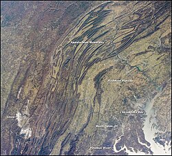
北米大陸の東側に位置するアパラチア山脈は、アラバマ州からカナダのニューファンドランド島まで、南西から北東方向へ約3,300kmにわたって延びる巨大な山系です。この山脈は単なる地形的な境界ではなく、地球のダイナミックな歴史を物語る地質学的なアーカイブとも言えます。アメリカ合衆国、カナダ、そしてフランスの海外領土であるサンピエール・ミクロンという3つの国にまたがる広大な領域を形成しています。
最高峰はノースカロライナ州のブラック山脈にあるマウント・ミッチェル(標高2,037m)で、ミシシッピ川以東で最も高い地点として知られています。
Key Facts
- 総延長: 約3,300km(アラバマ州からニューファンドランド島まで)
- 最高峰: マウント・ミッチェル(2,037m)
- 分布国: アメリカ、カナダ、フランス(サンピエール・ミクロン)
- 地質的起源: かつての超大陸パンゲアの一部であり、スコットランド高地やアトラス山脈と地質学的に関連している
- 主要資源: 無煙炭および瀝青炭の巨大な埋蔵量
名称の由来と歴史
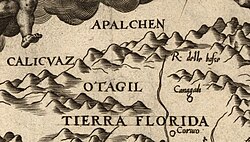
「アパラチア」という名称は、1540年のエルナンド・デ・ソトの遠征後、スペインの地図製作者たちが現地の部族名から採用したことに始まります。地図上に「Apalchen」という表記が初めて現れたのは1562年のディエゴ・グティエレスの地図であり、その後1565年のジャック・ル・モイン・ド・モルグの地図で山脈全体の名称として定着しました。
地理的構成と地域的特徴
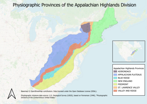
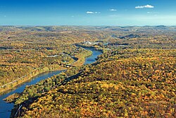
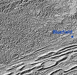
アパラチア山脈は、その広大さから複数の生理学的区分に分けられます。アメリカ国内では、緩やかな丘陵地帯であるピードモントから、険しいブルーリッジ山脈、そして複雑な谷と尾根が交互に現れる「リッジ・アンド・バレー(谷と嶺)」地帯へと構成されています。
北米各地域の山岳特性
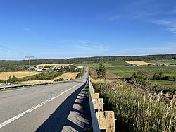
カナダ側では、ケベック州のノートルダム山脈やニューブランズウィック州の高地などが含まれます。一方、アメリカ側では州によって特徴が異なります。ペンシルベニア州では標高800mを超える山頂が60以上存在し、ウェストバージニア州では標高1,200mを超えるピークが150以上も見られます。
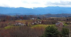
特にブルーリッジ山脈は、ペンシルベニア州のサウスマウンテンから始まり、バージニア州を経てノースカロライナ州、ジョージア州、そしてアラバマ州の最高点であるチーハ山まで続いています。バージニア州のマウント・ロジャース(1,746m)や、テネシー州とノースカロライナ州の境界にあるクウォヒ(2,025m)など、多くの高山が点在しています。
主要ピークの概要
| 地域(州・省) | 最高峰 | 標高(メートル) | 生理学的区分 |
|---|---|---|---|
| ノースカロライナ州 | マウント・ミッチェル | 2,037 | ブルーリッジ |
| テネシー州 | クウォヒ | 2,025 | ブルーリッジ |
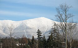
| ニューハンプシャー州 | マウント・ワシントン | 1,917 | ニューイングランド |
| バージニア州 | マウント・ロジャース | 1,746 | ブルーリッジ |
| ケベック州 | モン・ジャック=カルティエ | 1,268 | ノートルダム山脈 |
| メイン州 | マウント・カタディン | 1,606 | ニューイングランド |
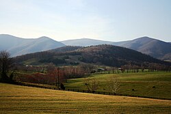
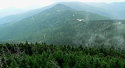
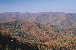
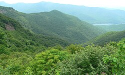
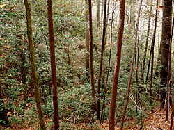
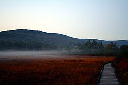
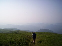
これらの山々は、単なる高さだけでなく、多様な景観を提供しています。例えば、ノースカロライナ州のブルーリッジ・パークウェイ沿いの絶景や、ウェストバージニア州のクランベリー・グレーズのような湿原保存地など、豊かな自然が広がっています。
地質学的形成プロセス
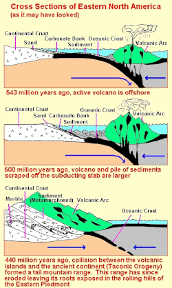
アパラチア山脈の形成は、数十億年にわたる地球の変動の結果です。その歴史は、約12億年前のグレンビル造山運動による超大陸ロディニアの形成にまで遡ります。その後、ロディニアが分裂し、イアペトゥス海が誕生しました。
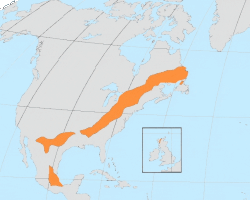
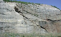
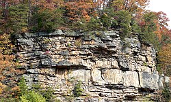
この分裂期(約6億年前〜5億6千万年前)には激しい火山活動が起こり、現在のブルーリッジ山脈に見られるマウント・ロジャースなどの山々の基礎となりました。その後、タコニック造山運動、アカディアン造山運動、そして最終的なアレゲニアン造山運動を経て、超大陸パンゲアが形成された際に、現在の山脈の骨格が完成しました。
![Paleogeographic reconstruction showing the Appalachian Basin area during the Middle Devonian period[36]](/images/65/cd/65cd5386a95ae963275d9c61f98d588d09d51d829cc1fe09d19bb1a745a826f2.gif)
資源と環境への影響
地質学的な複雑さは、豊かな鉱物資源をもたらしました。特に石炭の埋蔵量が豊富で、ペンシルベニア州北東部などの褶曲地帯では変成した無煙炭が、ウェストバージニア州やケンタッキー州などの地域では堆積岩としての瀝青炭が採掘されています。
しかし、1940年代から始まった「山頂除去採掘(Mount Top Removal)」という大規模な露天掘り手法は、生態系に深刻な打撃を与えました。これに対抗し、1960年代から70年代にかけてウェストバージニア大学などが主導して土地復旧の研究が進められ、1977年には「表面採掘管理および復旧法」が制定されるなど、環境保護への取り組みが強化されました。
生態系と生物多様性
アパラチア山脈は、標高や気候に応じて多様な植生が見られます。北部の高地やカナダ側ではレッドスプルース(赤トウヒ)やブラックスプルース(黒トウヒ)などの針葉樹が支配的です。特に南部高地では、固有種であるフレーザーモミ(Fraser fir)がレッドスプルースと共に、非常に脆弱な「南部アパラチア・スプルース・ファー森林」という独特の生態系を形成しています。
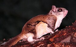
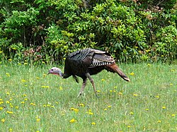
動物相も豊かで、南飛リスや東部野生七面鳥など、この地域特有の野生動物が生息しています。
Frequently Asked Questions
アパラチア山脈はどのくらいの長さがありますか?
アラバマ州からカナダのニューファンドランド島まで、約3,300km(2,050マイル)にわたって延びています。
最高峰はどこで、標高はどれくらいですか?
ノースカロライナ州のブラック山脈にあるマウント・ミッチェルで、標高は2,037m(6,684フィート)です。
この山脈はどのようにして形成されましたか?
数億年にわたる複数の造山運動(グレンビル、タコニック、アカディアン、アレゲニアン)を経て形成されました。かつての超大陸パンゲアの一部であったことが地質学的な特徴です。
どのような天然資源が有名ですか?
石炭資源が非常に豊富で、特に無煙炭と瀝青炭の2種類が主要な資源として知られています。
環境問題としてどのようなことが起きていましたか?
「山頂除去採掘」と呼ばれる大規模な石炭採掘手法により、山頂が削り取られ、広大な面積の生態系が破壊されるという深刻な問題が発生しました。
References
- Many internet sources cite 480 million years as the age of the Appalachians. This statement ignores some of the highest and most prominent features of the range that exposes scientifically-dated metamorphic rocks that are at least 1 billion years old.
- Originally the intent was that there would be two sections, the Champlain and the Northern section, however the dividing line was never officially determined
- Description used by 1911 Encyclopedia Britannica that is now in the public domain
📸 フォトギャラリー