The course of the lower Yarra River around 10,000 years ago, after the end of the last ice age, prior to the creation of Port Phillip Bay
← ホームへ戻る

ヤラ川メルボルンの歴史と自然を形作った「永遠に流れる川」

🗓 2026年8月8日

オーストラリア、ビクトリア州の州都メルボルンを象徴するヤラ川(Yarra River)は、単なる水路ではなく、この都市の誕生と成長を支えた生命線です。先住民の言葉で「永遠に流れる」を意味するこの川は、豊かな自然を湛えた上流から、近代的なビル群が立ち並ぶ都心部、そしてポート・フィリップ湾へと至る多様な表情を持っています。
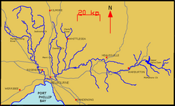
Map of Yarra River and its tributaries

主要な事実(Key Facts)

  • 全長:約242kmに及び、ヤラ山脈からホブソンズ湾へと流れる。
  • 名称:先住民のクリン言語では「ビララング(Birrarung)」と呼ばれる。
  • 地理的特徴:オーストラリアで最も西に位置する積雪供給河川である。
  • 流域面積:約4,000平方キロメートルに及ぶ広大な集水域を持つ。
  • 都市への影響:1835年のメルボルン入植の決定的な要因となった。

地質学的成り立ちと変遷

ヤラ川の現在の姿は、氷河期の終わりとともに劇的に変化しました。紀元前8000年より前、この川は現在のポート・フィリップ湾にある他の支流と共に、南のマクレー方面へ流れ、当時の陸橋(バッシア平原)を抜けて大海へと注いでいたと考えられています。
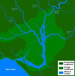
The course of the lower Yarra River around 10,000 years ago, after the end of the last ice age, prior to the creation of Port Phillip Bay

しかし、紀元前8000年から6000年にかけて海面が上昇し、下流域が浸水したことで現在のポート・フィリップ湾が形成されました。これにより、河口は50km以上内陸へと押し上げられ、現在の河川系へと再編されました。

歴史的な展開:入植から産業化まで

ヨーロッパ人の到達と都市の誕生

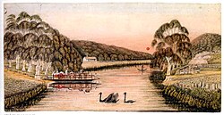
1803年にチャールズ・グライムス率いる調査隊がダイツ・フォールズまで遡上したことが、ヨーロッパ人による最初期の探索となりました。その後、1835年にジョン・バットマンがウルンダジェリ族の長老たちと土地取引を行い、川の北岸に村を建設することを決定したことで、現在のメルボルンの基礎が築かれました。
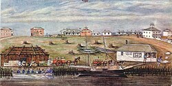
Melbourne Landing, 1840; watercolour by W. Liardet (1840)

Yarra crossing punt road, Melbourne, 1838. by W. Liardet

ゴールドラッシュと河川の改造

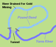
1851年、ヤラ川の支流であるアンダーソンズ・クリークで金が発見されたことで、ビクトリア州のゴールドラッシュが幕を開けました。採掘を効率化するため、川の流れを人工的に変える大規模な工事が行われました。例えば、ウォランダイテのパウンド・ベンドでは、岩盤をくり抜いた145mのトンネルを建設し、約3.85kmにわたる川底を露出させて採掘を可能にしました。
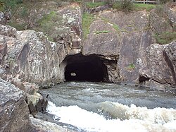
Pound Bend diversion tunnel

Map of the Pound Bend diversion tunnel in Warrandyte

また、1840年代にはダイツ・フォールズに堰が築かれ、製粉所の動力として利用されるなど、川は産業の基盤となりました。
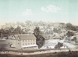
Dights Mill Abbotsford (built 1839) pictured in 1863

工業化と環境への負荷

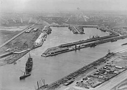
19世紀後半から20世紀にかけて、ヤラ川は物流の拠点として激変します。1880年代に建設されたクード運河により、大型船のアクセスが向上し、ビクトリア・ドックなどの巨大な港湾施設が整備されました。しかし、その一方で屠殺場や製錬所が廃棄物を川に流し込んだため、水質は著しく悪化しました。
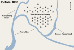
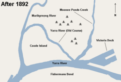
The confluence of the Yarra and Maribyrnong rivers before 1880

The creation of Coode Island after the 1880–1892 construction works

The Yarra and Victoria Docks in 1928

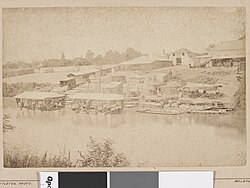
Photograph of wool washing sheds in and on banks of Yarra River in late 19th century

1957年には洪水対策としてアッパー・ヤラ貯水池が建設されましたが、これにより下流への流量は約50%に減少しました。また、1972年には排水設備の不備により、都心のエリザベス通りが激しく浸水する事態も発生しています。
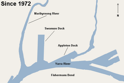
The area around Port Melbourne since the construction of Swanson Dock in 1972

現代のヤラ川:再生とレクリエーション

1960年代以降、環境保護への意識が高まり、川の生態系を回復させる活動が始まりました。かつての工業地帯であったサウスバンク地区は、1990年代以降に再開発され、現在は高級マンションや文化施設が立ち並ぶ観光の中心地へと変貌しています。
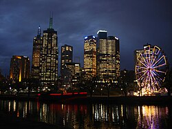
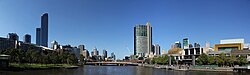
Inner-city projects, including Federation Square and Crown Casino, have focused on the advantage of the location of the Yarra River as a tourist attraction.

The development of Southbank's Promenade epitomises the recent revival of the Yarra as the capital's new Central Activities District.

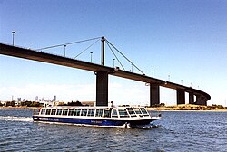
現在では、フェデレーション・スクエアやクラウン・カジノなどのランドマークが川沿いに配置され、観光客を惹きつける都市資産となっています。また、ボート競技やクルーズ、遊歩道の散策など、市民の憩いの場として親しまれています。
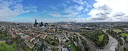
The Yarra River Birrarung meandering past South Yarra. September 2023.

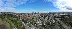
Aerial panorama of South Yarra facing the Melbourne skyline. September 2023.

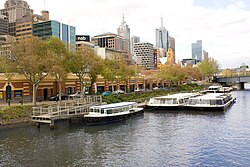
Cruise boats on the river

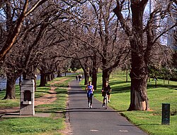
Yarra River walk paths

環境問題への挑戦

再生が進む一方で、依然として深刻な課題も残っています。特に都市部からの雨水と共に流れ込むゴミの問題は深刻で、毎日数万本のタバコの吸い殻が流入しています。これに対し、Parks Victoriaなどがゴミ回収トラップを設置し、対策を講じています。
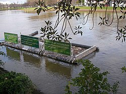
A Parks Victoria Litter trap on the river catches floating rubbish

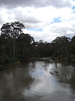
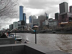
The distinctive colour of the river is easily recognisable.

また、ヤラ・リバーキーパー協会(YRKA)などの団体が、川を「メルボルン最大の自然資産」と位置づけ、持続可能な都市づくりのための政策提言や啓発活動を続けています。

地理と生態系

ヤラ川は、上流のヤラ山脈から始まり、ヤラ・バレーを経て平原へと流れ出ます。49の名称ある支流を持ち、その流域には多くの国立公園や自然保護区が広がっています。
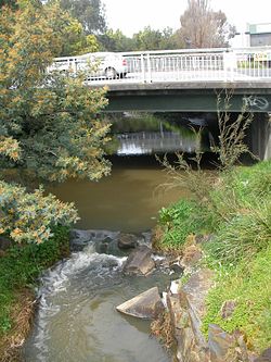
Olinda Creek at Lilydale, an upper tributary of the Yarra

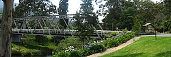
The Brisbane Bridge over the Yarra River, Warburton

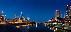
Melbourne is the largest settlement that the Yarra flows through. The Yarra at central Melbourne is shown here at night, with the central business district on the left and Southbank on the right

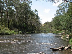
The river through Wonga Park

都心部では、多くの橋が架かっており、ウエストゲート橋やプリンセス橋などが代表的です。また、川沿いには14のゴルフコースや、ロイヤル・ボタニック・ガーデンなどの広大な公園が整備されています。
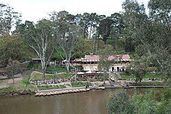
The river at Fairfield boathouse

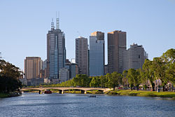
The Yarra River as it flows north-west towards central Melbourne, passing underneath the Swan Street Bridge

Yarra at the West Gate near the river mouth

The Yarra River, as seen from Kanes Bridge near the Studley Park boathouse

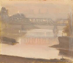
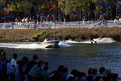
また、文化的な側面でも親しまれており、ムンバ・フェスティバルのウォータースキーなどのイベントや、芸術家による風景画の題材としても愛されてきました。
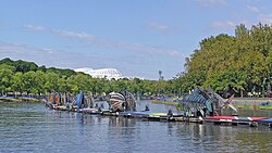
Artificial fish on the Yarra during 2006 Commonwealth Games

Clarice Beckett, The Yarra, Sunset (1930)

Moomba waterskiing

現在も、ヤラ・フラッツ公園周辺でのインフラ整備(ノースイースト・リンク工事)など、都市の発展に伴う変化が続いています。
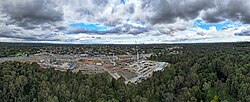
The Northeast Link works around Yarra Flats Park. April 2024.

ヤラ川の概要まとめ

ヤラ川の基本データ
項目 詳細
源流 ヤラ山脈(標高792m)
河口 ホブソンズ湾(ポート・フィリップ湾)
全長 242 km
平均流量 約63.5 m³/s(年間2,000 GL)
主要支流数 49本(名称あり)
主な利用目的 観光、レクリエーション、都市排水、歴史的物流

よくある質問(FAQ)

ヤラ川で泳いでも大丈夫ですか?

中流域(ウォランダイテ周辺など)では冬場でも水泳が行われていますが、古い採掘シャフトによる強い引き込み流があるため危険な場所があります。また、ダイツ・フォールズより下流の都心部では、汚染レベルが高く船舶の往来も激しいため、泳ぐことは推奨されていません。

「ビララング」とはどういう意味ですか?

ビララング(Birrarung)は、この地域の先住民であるクリン言語による名称です。英語の「Yarra」と同様に、川の絶え間ない流れを象徴する意味が込められています。

川の色が独特なのはなぜですか?

ヤラ川は特有の色合いを持っており、これは流域の土壌や堆積物、および都市部を流れる過程で混入する物質などの影響を受けているためです。

ゴールドラッシュ時代に川にどのような影響がありましたか?

金採掘を容易にするため、川の流れを人工的に変える「分水トンネル」の建設や、川底を露出させるためのダム建設など、大規模な地形改造が行われました。

現在の水質改善に向けた取り組みは?

ゴミ回収トラップの設置によるプラスチックやタバコの吸い殻の除去、およびヤラ・リバーキーパー協会のような市民団体による監視と政策提言が行われています。

References

  1. "Yarra River: 30146: Historical Information". Vicnames. . 2 May 1966. Archived from the original on 8 March 2014. Retrieved 8 March 2014.
  2. (1967). Aboriginal Place Names. Reed New Holland. pp. 87–88.  .
  3. "East Coastal Watersheds".
  4. "Yarra River: 30146". Vicnames. . 2 May 1966. Archived from the original on 8 March 2014. Retrieved 8 March 2014.
  5. "Map of Yarra River, VIC". Bonzle Digital Atlas of Australia. Archived from the original on 3 October 2018. Retrieved 8 March 2014.
  6. "BYGONE DAYS". . Melbourne: National Library of Australia. 15 July 1939. p. 13. Retrieved 25 January 2012.
  7. Eidelson, Meyer (1997). The Melbourne Dreaming. A Guide to the Aboriginal Places of Melbourne (Reprint 2000 ed.). Canberra: Aboriginal Studies Press. pp. 14–17.  .
  8. Dunstan, Joseph (20 March 2019). "In four years, 179 tonnes of garbage was pulled out of the Yarra". ABC News. Retrieved 16 May 2022.
  9. "Yarra Strategic Plan (Burndap Birrarung burndap umarkoo) | Melbourne Water". www.melbournewater.com.au. 11 February 2022. Retrieved 16 May 2022.
  10. Maunder, Patricia (11 January 2008). "Melbourne dreamtime a reality". The Age. Retrieved 24 April 2019.

📸 フォトギャラリー

The course of the lower Yarra River around 10,000 years ago, after the end of the last ice age, prior to the creation of Port Phillip Bay
The confluence of the Yarra and Maribyrnong rivers before 1880
Photograph of wool washing sheds in and on banks of Yarra River in late 19th century
Melbourne Landing, 1840; watercolour by W. Liardet (1840)
Dights Mill Abbotsford (built 1839) pictured in 1863
Pound Bend diversion tunnel
Map of the Pound Bend diversion tunnel in Warrandyte
The Yarra and Victoria Docks in 1928
The creation of Coode Island after the 1880–1892 construction works
The area around Port Melbourne since the construction of Swanson Dock in 1972
The Yarra River Birrarung meandering past South Yarra. September 2023.
Inner-city projects, including Federation Square and Crown Casino, have focused on the advantage of the location of the Yarra River as a tourist attraction.
The development of Southbank's Promenade epitomises the recent revival of the Yarra as the capital's new Central Activities District.
Aerial panorama of South Yarra facing the Melbourne skyline. September 2023.
The Northeast Link works around Yarra Flats Park. April 2024.
A Parks Victoria Litter trap on the river catches floating rubbish
The distinctive colour of the river is easily recognisable.
Map of Yarra River and its tributaries
Olinda Creek at Lilydale, an upper tributary of the Yarra
Melbourne is the largest settlement that the Yarra flows through. The Yarra at central Melbourne is shown here at night, with the central business district on the left and Southbank on the right
The Brisbane Bridge over the Yarra River, Warburton
The river through Wonga Park
The river at Fairfield boathouse
The Yarra River as it flows north-west towards central Melbourne, passing underneath the Swan Street Bridge
Yarra at the West Gate near the river mouth
Yarra crossing punt road, Melbourne, 1838. by W. Liardet
The Yarra River, as seen from Kanes Bridge near the Studley Park boathouse
Artificial fish on the Yarra during 2006 Commonwealth Games
Clarice Beckett, The Yarra, Sunset (1930)
Moomba waterskiing
Cruise boats on the river
Yarra River walk paths