私たちの周囲にある「風」とは、惑星の表面に対して気体(主に空気)が相対的に移動する自然現象を指します。数十分で消える雷雨に伴う突風から、数時間持続する局地的なそよ風、そして地球の気候帯ごとの太陽エネルギー吸収差によって生じる地球規模の循環まで、そのスケールは極めて多様です。こうした風の挙動を専門的に研究する学問はアネモロジー(風学)と呼ばれています。
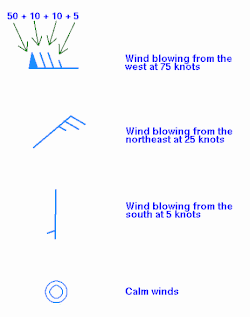
風の方向を表現する場合、気象学では「どこから吹いてくるか」を基準にする慣習があります。例えば「西風」とは、西から東へ向かって吹く風のことを指します。これは直感とは異なる場合がありますが、世界共通の定義となっています。
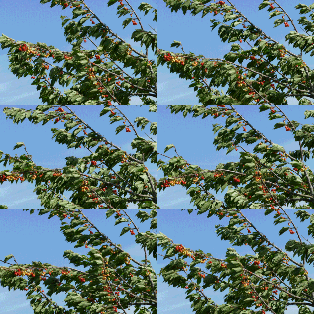
Key Facts
- 発生原因:赤道と極地方の加熱差および、惑星の自転によるコリオリ効果が主因となる。
- 分類基準:空間的な規模、風速、風向、発生原因、およびもたらす影響によって分類される。
- 測定指標:風速(速度)、ガスの密度、および風エネルギーなどが重要な指標となる。
- 宇宙規模の風:地球以外にも惑星風や太陽風が存在し、ブラックホールの降着円盤では光速の3%に達する超高速風が観測されている。
風が発生する根本的な理由
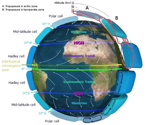
大規模な大気循環を引き起こす最大の要因は、赤道付近と極地方の間で太陽光による加熱量に差があることです。この温度差によって気圧の勾配が生じ、空気が移動します。さらに、惑星が自転していることでコリオリ効果(回転する物体の上で運動する物体に働く見かけ上の力)が加わり、風の方向が曲げられます。
地域的な風のメカニズム
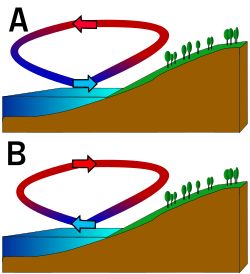
地形や地表の性質によっても、特有の風が発生します。熱帯や亜熱帯では、高原や陸地の加熱による熱的低気圧が季節風(モンスン)を駆動します。また、海岸線では陸地と海洋の比熱差により、昼は海から陸へ吹く「海風」、夜は陸から海へ吹く「陸風」というサイクルが生まれます。
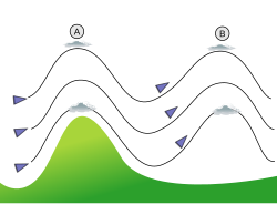
山岳地帯では、地形に沿った風の流れが複雑な挙動を示します。風が山にぶつかると上下に振動し、その頂点にレンズ雲が形成されることがあります。また、山と谷の間で温度差が生じることで、山谷風と呼ばれる局地風が吹きます。
風の測定と分類
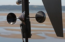
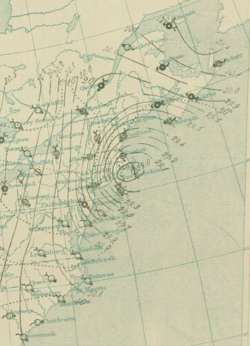
風の強さを定量的に把握するため、さまざまな手法が用いられています。遠隔地の気象観測所ではカップ型風速計などが設置され、航空分野ではピトー管などが利用されます。また、気象図(ステーションモデル)では、特定の記号を用いて風向と風速が視覚的にプロットされます。
ビューフォート風力階級
フランシス・ビューフォートによって考案されたこのスケールは、海上の状態などの視覚的な観察に基づいて風速を定義した経験的な指標です。当初は0から12の13段階でしたが、後に18段階まで拡張されました。一般的に、28ノット(約52km/h)から55ノット(約102km/h)の範囲は「強風(gale)」と呼ばれ、さらに激しいものは「嵐(storm)」や「ハリケーン(hurricane)」と区別されます。
| ビューフォート階級 | 風速 (km/h) | 一般名称 | 熱帯低気圧の分類(例:北西太平洋/JMA) |
|---|---|---|---|
| 0 | < 2 | 静穏 (Calm) | 低圧部 / 熱帯低気圧 |
| 4 | 20–30 | 和風 (Moderate breeze) | - |
| 8 | 63–74 | 強風 (Fresh gale) | 強い熱帯低気圧 |
| 12 | 119–133 | 暴風 (Hurricane) | 台風 |
| 17 | 198–211 | 超暴風 | 猛烈な台風 |
地球規模の風のパターン
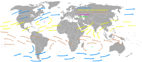
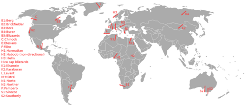
地球上の風は、緯度によって大きく3つのパターンに分かれます。低緯度地域では貿易風が吹き、中緯度地域では偏西風が支配的です。そして極地方では極東風が吹いています。これらの流れは地球全体の熱輸送を担っており、気候の安定に寄与しています。
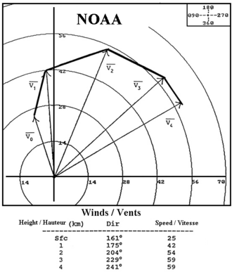
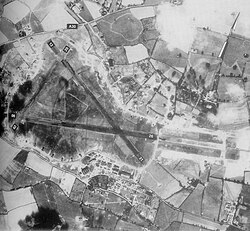
また、上空ではウィンドシア(高度による風向・風速の変化)が発生します。これは航空機の離着陸に大きな影響を与えるため、空港の滑走路は風向きに合わせて設計されることが一般的です。ホドグラフと呼ばれる図を用いて、対流圏内の垂直方向の風の構造を分析します。
社会と自然界への影響
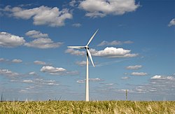
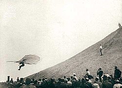
風は人類にとって、古くから輸送手段(帆船)や冶金(送風による製鉄)に利用されてきました。現代では、風力タービンを用いて持続可能な電力を生成する重要なエネルギー源となっています。
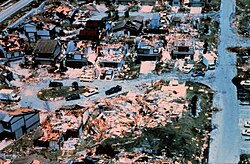
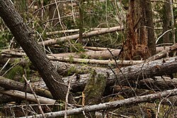
一方で、自然界における風の力は破壊的な側面も持ちます。強力なハリケーンやサイクロンは甚大な被害をもたらし、森林では強風による倒木(ウィンドスロー)が林冠に穴を開け、下層植物に光を届けるという生態学的な役割も果たしています。
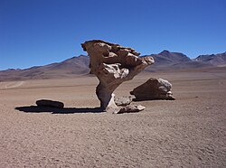
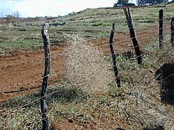
また、風は地表の形状を変える要因にもなります。風食によって削られた奇岩や、砂漠の砂塵を数千キロメートル先まで運ぶ現象などがその例です。植物は強風に適応して形態を変化させ、動物は風を利用して渡りを行います。
宇宙における「風」
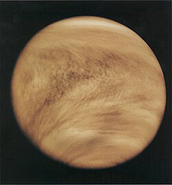
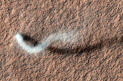
風という現象は地球に限ったものではありません。太陽から放出されるプラズマの流れである「太陽風」や、金星のような他惑星の大気循環が存在します。火星では、NASAの観測により「ダストデビル(塵旋風)」のような局地的な渦巻きが確認されています。
さらに極端な例として、ブラックホール IGR J17091-3624 の降着円盤では、時速約3,200万km(光速の約3%)という、宇宙で最も速い部類の風が記録されています。
Frequently Asked Questions
風向きの「西風」とはどちらに吹く風のことですか?
気象学の定義では、風が「吹いてくる方向」で名称を決めます。したがって、西風は西から東に向かって吹く風を指します。
コリオリ効果とは具体的にどのような影響を風に与えますか?
地球の自転によって生じる見かけ上の力であり、北半球では移動する空気を右向きに、南半球では左向きに曲げる働きをします。これにより、単純な低気圧への直線的な流れではなく、渦を巻くような大気循環が形成されます。
ビューフォート階級と現代の風速計の違いは何ですか?
ビューフォート階級は、海面の波の状態や木の揺れなど、目に見える現象から風速を推定する経験的な指標です。一方、現代の風速計(アネモメーター)は、物理的な回転数や圧力差を用いて数値を直接的に測定します。
ウィンドシアが航空機にとって危険な理由は何ですか?
ウィンドシアは短距離で風向や風速が急激に変化する現象です。これにより、飛行機が急激に揚力を失ったり、逆に過剰な揚力を得たりすることがあり、特に離着陸時の安定性に重大な影響を及ぼすため危険視されています。
地球以外の惑星にも風はありますか?
はい、存在します。例えば金星には強力な惑星風があり、火星では砂塵を巻き上げるダストデビルが観測されています。また、太陽から放出される粒子流である太陽風は、地球の磁気圏に影響を与え、オーロラなどの現象を引き起こします。
References
- "Anemology". . Accessed 23 November 2024.
- JetStream (2008). "Origin of Wind". Southern Region Headquarters. Archived from the original on 2009-03-24. Retrieved 2009-02-16.
- Makarieva, Anastassia; V. G. Gorshkov; D. Sheil; A. D. Nobre; B.-L. Li (February 2013). "Where do winds come from? A new theory on how water vapor condensation influences atmospheric pressure and dynamics". . 13 (2): 1039–1056. :1004.0355. :2013ACP....13.1039M. :10.5194/acp-13-1039-2013. Retrieved 2013-02-01.
- "Geostrophic wind". Glossary of Meteorology. . 2009. Archived from the original on 2007-10-16. Retrieved 2009-03-18.
- "Thermal wind". Glossary of Meteorology. American Meteorological Society. 2009. Archived from the original on 2011-07-17. Retrieved 2009-03-18.
- "Ageostrophic wind". Glossary of Meteorology. American Meteorological Society. 2009. Archived from the original on 2011-09-17. Retrieved 2009-03-18.
- "Gradient wind". Glossary of Meteorology. American Meteorological Society. 2009. Archived from the original on 2008-05-28. Retrieved 2009-03-18.
- "How to read weather maps". JetStream. National Weather Service. 2008. Archived from the original on 2012-07-05. Retrieved 2009-05-16.
- "Wind vane". Glossary of Meteorology. American Meteorological Society. 2009. Archived from the original on 2007-10-18. Retrieved 2009-03-17.
- "Wind sock". Glossary of Meteorology. American Meteorological Society. 2009. Archived from the original on 2012-05-14. Retrieved 2009-03-17.
📸 フォトギャラリー