アメリカ合衆国北西部に位置するワシントン州は、豊かな森林と多様な地形から「エバーグリーン・ステート(常緑の州)」という愛称で親しまれています。太平洋に面した海岸線から、険しい山脈、そして広大な内陸の高原まで、劇的な景観の変化が特徴的な州です。州都はオリンピアですが、経済と文化の中心地は最大都市のシアトルです。
主要な事実(Key Facts)
- 州都: オリンピア
- 最大都市: シアトル
- 人口: 約800万人(2025年推計)
- 最高峰: レニエ山(標高4,390m)
- 主要産業: 航空宇宙、テクノロジー、農業(リンゴなど)
- 州への加入: 1889年11月11日(第42番目の州)
地理と自然環境
ワシントン州の地形は、カスケード山脈によって大きく東と西に分かれています。西側は湿潤で緑豊かな森林が広がり、東側は乾燥した半砂漠地帯や高原が支配的です。この地理的断絶が、州内に多様な生態系と気候をもたらしています。
州内には、オリンピック国立公園やマウント・レーニア国立公園など、世界的に有名な自然保護区が点在しており、黒尾ジカなどの野生動物が生息しています。
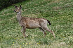
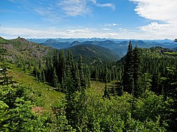
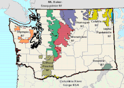
また、州の象徴ともいえる広大な国立森林地帯は、地域の環境維持だけでなく、観光資源としても重要な役割を果たしています。
気候の多様性
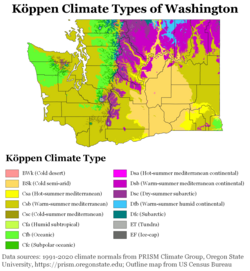
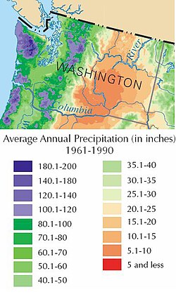
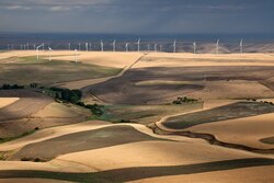
気候は地域によって極めて対照的です。太平洋の影響を強く受ける西海岸地域は、年間を通じて降水量が多く、穏やかな気温で推移します。一方、山脈の東側では降水量が激減し、夏季は高温、冬季は極寒となる大陸性気候の傾向が強まります。
こうした乾燥地帯での農業は、時に激しい砂嵐を引き起こすなど、環境的な課題を抱えることもあります。
![Dryland farming caused a large dust storm in arid parts of Eastern Washington on October 4, 2009. Courtesy: NASA/GSFC, MODIS Rapid Response.[81]](/images/bf/2a/bf2a844a5d2f0b060d1bfb50179854a7c48aaa5a06f76115debfde919c9f5d33.jpg)
歴史的変遷
初期のワシントン州は、毛皮交易の拠点として発展しました。19世紀半ばには、先住民と交易を行う砦が各地に築かれ、経済の基盤が作られました。
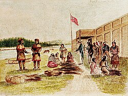
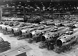
その後、19世紀後半から20世紀にかけて、シアトルなどの都市が急速に発展し、港湾都市としての地位を確立しました。また、第二次世界大戦期にはボーイング社による航空機生産が加速し、軍事・工業都市としての側面を強めました。
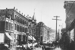
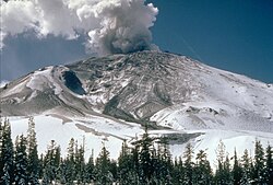
自然の猛威もこの地の歴史に刻まれています。特にセント・ヘレンズ山の噴火は、地域の地形と生態系に甚大な影響を与えた出来事として知られています。
人口統計と社会構造
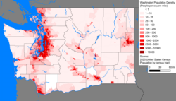
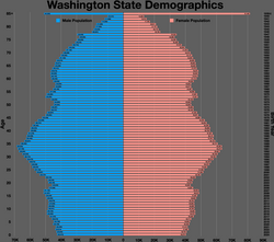
ワシントン州の人口は、2020年時点で約770万人、2025年には約800万人に達すると予測されています。人口密度はシアトルを中心としたキング郡に集中しており、都市部と農村部の格差が見られます。
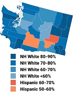
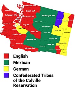
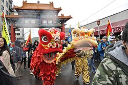
人種構成は多様化が進んでおり、非ヒスパニック系白人が多数を占める一方で、アジア系やヒスパニック・ラティーノ系の人口が増加傾向にあります。特にシアトルなどの都市圏では、多文化共生が進んでいます。
![Race and Hispanic origin of Washington by county, showing race by color, and then breaking down non-Hispanic and Hispanic origin by color tone. The county population is shown by size and by the label. The same data on the map below shows non-Hispanic and Hispanic origin first and then breaks that down by race using color tone.[142]](/images/c0/5f/c05fa9a19f989ba7afc720790055740d5467c727cb77b55343ee1c452ee12733.png)
![The same race and origin data as above, but the Hispanic origin is grouped first, then by race. The first emphasizes the racial diversity of people of Hispanic origin, while the second grouping gives a clearer indication of the total Hispanic population.[142]](/images/1e/23/1e23c3aaddbfb545935abc0d4b01837c1f579865b592f91198619312347dc0d7.png)
経済と産業
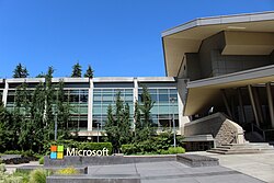
現代のワシントン州は、世界的なテック企業や航空宇宙産業の拠点として知られています。レッドモンドに本社を置くマイクロソフトなどの企業が、州の経済成長を牽引しています。
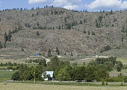
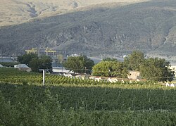
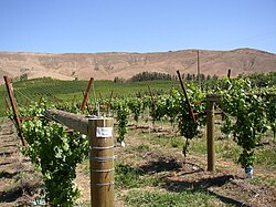
一方で、伝統的な農業も根強く、特にリンゴの生産は全米有数です。また、特定の気候条件を活かしたワイン造り(AVA:米国ブドウ栽培地域)も盛んに行われています。
インフラと交通
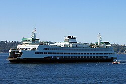
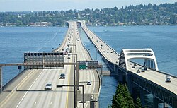
複雑な海岸線と島々を持つため、ワシントン州フェリーは全米最大規模のシステムを運用しています。また、ワシントン湖に架かる浮き橋は、世界最大級の構造物として知られています。
政治と行政
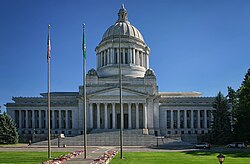
州政府はオリンピアに置かれ、知事を筆頭とする行政組織と、上院・下院からなる州議会によって運営されています。連邦政府への代表として、上院議員や下院議員を派遣しています。
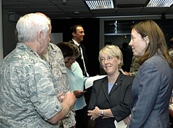
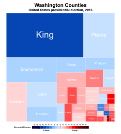
政治的な傾向としては、都市部を中心に民主党の支持が強く、選挙結果においても地域的な分断が見られる傾向にあります。
教育と文化・スポーツ
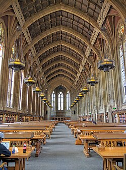
教育面では、ワシントン大学(UW)などの名門校が研究と教育の中心となっており、地域の知的基盤を支えています。
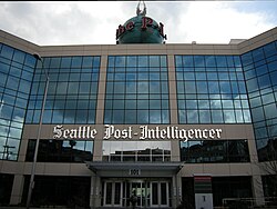
スポーツ文化も非常に盛んで、NFLのシアトル・シーホークスやMLBのシアトル・マリナーズなど、多くのプロチームがシアトルを拠点に活動しています。
| チーム名 | 競技 | リーグ | 本拠地 |
|---|---|---|---|
| シアトル・シーホークス | アメリカンフットボール | NFL | ルーメン・フィールド |
| シアトル・マリナーズ | 野球 | MLB | T-モバイル・パーク |
| シアトル・クラーケン | アイスホッケー | NHL | クライメート・プレッジ・アリーナ |
| シアトル・ストーム | 女子バスケットボール | WNBA | クライメート・プレッジ・アリーナ |
| シアトル・サウンダーズFC | サッカー | MLS | ルーメン・フィールド |
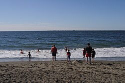
また、州の自然を象徴するウェストポートの海岸線などは、多くの観光客を惹きつけています。
Frequently Asked Questions
ワシントン州の愛称「エバーグリーン・ステート」の由来は何ですか?
州内に広がる広大な常緑樹の森林地帯に由来しています。特に西側の地域では、年間を通じて緑豊かな自然が維持されているため、この名称で呼ばれています。
州内で最も高い山はどこですか?
レニエ山(Mount Rainier)です。標高4,390メートルに達し、州の象徴的なランドマークとなっています。
ワシントン州の主要な産業は何ですか?
ハイテク産業(マイクロソフトなど)や航空宇宙産業(ボーイングなど)が世界的に有名ですが、同時にリンゴなどの農業やワイン産業も非常に重要な経済的役割を担っています。
シアトルとオリンピアの違いは何ですか?
シアトルは州最大の都市であり、経済・文化・産業の中心地です。一方、オリンピアは州都であり、州政府の行政機能が集約されている都市です。
州内の気候に大きな差があるのはなぜですか?
カスケード山脈が障壁となり、太平洋からの湿った空気が山脈に遮られるためです。これにより、西側は湿潤な海洋性気候、東側は乾燥した大陸性気候という対照的な環境が生まれています。
References
- Capitalization varies depending on whether or not "state" is considered part of the name of the state, a . The prefers the lowercase version, as does since the 18th edition in 2024. The official website (wa.gov) says it is the "official website of Washington State".
- Persons of Hispanic or Latino origin are not distinguished between total and partial ancestry.
- Including and
- The is officially nonpartisan, but Superintendent Reykdal identifies with the Democratic Party.
📸 フォトギャラリー