Đại Việt, Champa, Angkor Empire and their neighbours, late 13th century
← ホームへ戻る

ベトナム社会主義共和国歴史、地理、経済から文化までを網羅

🗓 2026年8月16日

東南アジアの東岸に位置するベトナムは、豊かな自然環境と波乱に満ちた歴史、そして急速な経済成長を併せ持つ国です。北部の政治的中心地ハノイから、南部の経済的中心地ホーチミンまで、南北に長く伸びる国土には多様な文化と景観が広がっています。

主要ファクト(Key Facts)

  • 首都: ハノイ
  • 最大都市: ホーチミン市
  • 公用語: ベトナム語
  • 政治体制: 一党制の社会主義共和国
  • 人口: 約1億230万人(2025年推計)
  • 通貨: ベトナム・ドン (VND)
  • 主要産業: 農業、水産業、製造業、観光業

歴史の変遷:独立への長い道のり

ベトナムの歴史は、紀元前7世紀のヴァンラン時代にまで遡ります。その後、長い期間にわたり中国の支配下にありましたが、939年に独立を勝ち取り、独自の王朝時代を築きました。19世紀に入るとフランスの植民地となり、「フランス領インドシナ」の一部として統治されることになります。
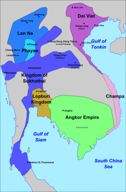
Đại Việt, Champa, Angkor Empire and their neighbours, late 13th century
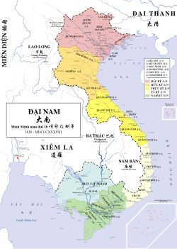
Vietnam's territories around 1838, during the Vietnamese occupation of Cambodia

20世紀半ば、ベトナムは激動の時代を迎えます。1945年に独立を宣言した後、フランスとの第一次インドシナ戦争を経て、さらに南北に分断されるという困難な状況に陥りました。その後、アメリカ合衆国が介入したベトナム戦争へと発展し、世界的な注目を集める紛争となりました。
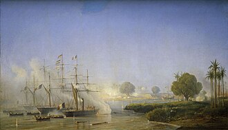
Capture of Saigon by Charles Rigault de Genouilly on 18 February 1859
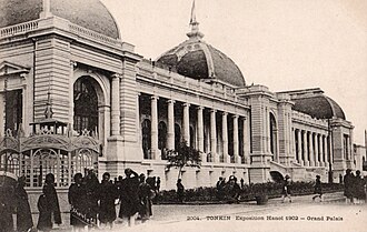
Photograph of the Grand Palais building in Hanoi
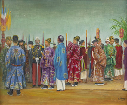
"The Mandarins and the French Authorities Awaiting the Arrival of Emperor Thành Thái", 1903 oil painting

1975年4月30日のサイゴン陥落により戦争は終結し、1976年7月2日に南北が正式に再統一され、現在のベトナム社会主義共和国が成立しました。その後、経済改革「ドイモイ」などの政策を通じて、国は近代化へと突き進んでいます。
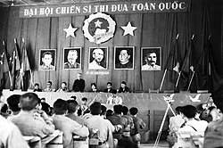
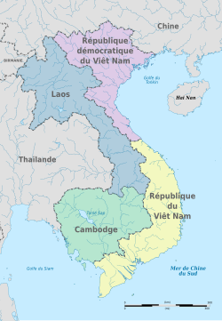
First Nationwide Congress of Emulation Fighters, Democratic Republic of Vietnam, 1952
Former French Indochina after the 1954 Geneva Conference, with Vietnam partitioned along the 17th parallel.
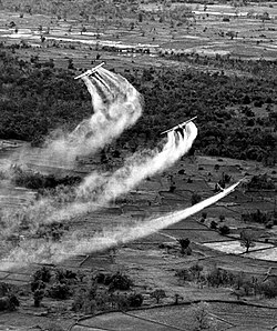
Three US Fairchild UC-123B aircraft pictured spraying Agent Orange

地理と自然環境

ベトナムの国土面積は約33万平方キロメートルで、その地形は非常に多様です。北部のファンシパン山を含むホアンリエンソン山脈のような険しい山岳地帯から、中部の美しい海岸線、そして南部の広大なメコンデルタまで、多彩な表情を持っています。
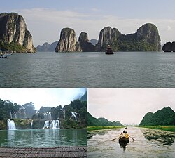
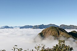
Images showing Hạ Long Bay, the Yên River and the Bản-Giốc Waterfalls
Image of the Hoàng Liên Sơn mountain range

気候は南北で大きく異なります。北部は四季がある亜熱帯気候である一方、南部は年間を通じて温暖な熱帯サバナ気候に属しています。この気候の多様性が、豊かな生物多様性を育んでおり、サオラやトンキン鼻猿といった希少種が生息しています。
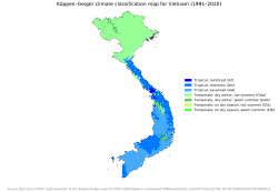
 An image of the Köppen climate classification map of Vietnam
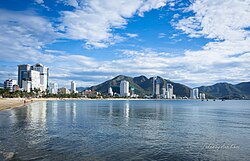
Photograph of Nha Trang beach with many high rise buildings behind it
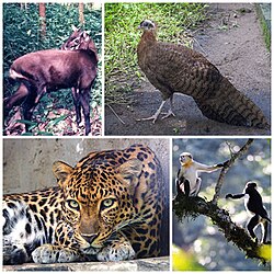
Photographs of Native species in Vietnam, the crested argus; the red-shanked douc, a monkey; the Indochinese leopard and the saola, a bovine

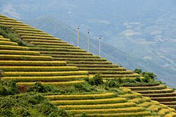
また、サパの棚田に代表される農業景観は、自然と人間が共生してきた歴史を物語っており、観光地としても高い人気を誇っています。
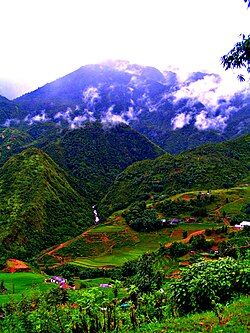
Photograph of the Sa Pa mountain hills with agricultural activity shiwn in the foreground
Photograph of terraced rice fields in Sa Pa

政治体制と社会構造

ベトナムは共産党による一党制の単一国家であり、党書記長、国家主席、首相、国会議長が国家の指導を担っています。行政区分は、ハノイやホーチミンなどの直轄市を含む省・市で構成されています。
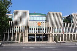
Photograph of the National Assembly of Vietnam in Hanoi
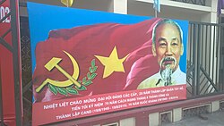
A Tay Ho Communist propaganda poster

人口構成においては、キン族(ベトナム族)が約85%を占め、その他の少数民族が約15%を構成しています。宗教面では、特定の宗教を持たない人々や民間信仰が多数派(約73%)ですが、仏教やカトリック教徒も一定の割合で存在しています。
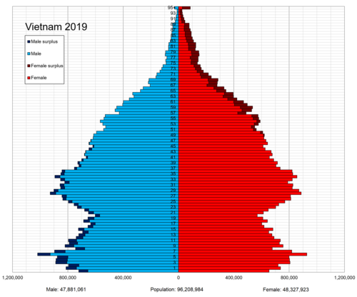
Vietnam population pyramid in 2019

経済の発展とインフラ

近年のベトナムは、世界的に見ても高い経済成長率を記録しています。名目GDPは5,000億ドルを超え、購買力平価(PPP)ベースでは2兆ドル規模に達すると推計されています。特に製造業の振興と外資の導入により、都市部の景観は劇的に変化しました。
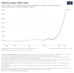
Historical GDP per capita development of Vietnam
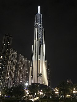
Photograph of Vietnam's tallest skyscraper, the Landmark 81, located in Bình Thạnh District in Ho Chi Minh City
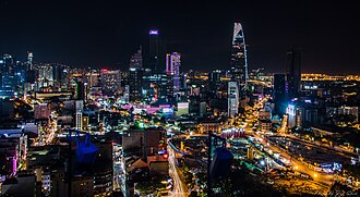
Ho Chi Minh City's District 1 skyline photographed at night

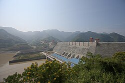
インフラ整備も加速しており、南北高速道路の建設や、ハイフォン港のような大規模なコンテナ港の運用、そして東南アジア最大級のソンラダムなどの水力発電施設が、産業の基盤を支えています。
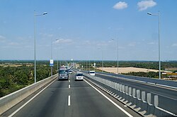
Photograph of Ho Chi Minh City's North–South Expressway
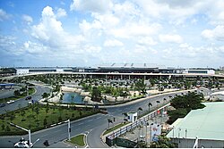
Photograph of Tan Son Nhat International Airport
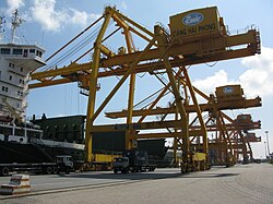
Photograph of a crane at the Port of Hai Phong
Photograph of the Sơn La Dam

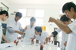
また、科学技術への投資も積極的に行われており、ロボット工学や大学での研究開発など、次世代の産業育成に注力しています。

Photograph of a TOPIO humanoid ping-pong-playing robot
Vietnamese science students working on an experiment in their university lab.

地方の生活基盤においても、多様な機関による水道システムの整備が進められており、生活水準の向上が図られています。
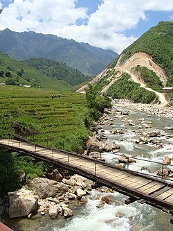
Stream flowing down a hill with a bridge crossing it

文化、教育、そしてライフスタイル

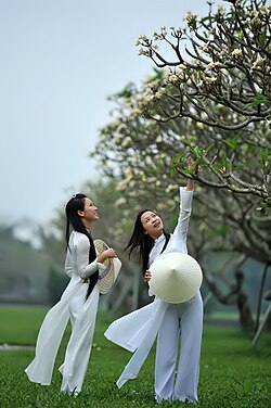
ベトナムの文化は、伝統的な価値観と現代的な感覚が融合しています。言語面ではラテン文字を用いた独自の表記法が用いられ、教育への熱意は非常に高く、学生たちは伝統的なアオザイを身にまとって登校する姿も見られます。
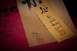
A sample of traditional Vietnamese calligraphy
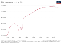
Development of life expectancy in Vietnam since 1950
Photograph of two girls wearing a traditional Vietnamese white school uniform, the áo dài—both are holding the nón lá, a conical hat

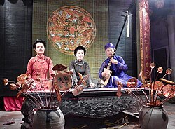
芸術面では、伝統的な歌唱形式である「カ・チュウ」や、龍をモチーフにした意匠などが受け継がれています。また、メディア環境も整備され、国営のベトナムテレビジョン(VTV)などが重要な役割を果たしています。
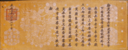
A scroll showing a Vietnamese dragon
Three musicians are performing on a stage.
Shown is the logo of the state broadcaster Vietnam Television.

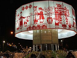
食文化は世界的に有名で、フォーやバインミーは国民的な料理として親しまれています。また、旧正月の「テト」は一年で最も重要な祝祭であり、家族が集まり特別な装飾を施す習慣があります。
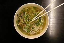
A bowl of phở in Ho Chi Minh City.
A large round white fabric band decorated with red figures and images for Tết

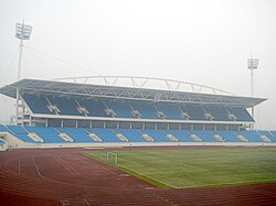
観光面では、ユネスコ世界遺産に登録されているホイアンの日本橋などが有名であり、国内外から多くの訪問者を惹きつけています。また、スポーツへの関心も高く、ミーディン国立競技場などの施設で熱狂的な応援が繰り広げられます。
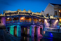
Photograph of Hội An, a UNESCO World Heritage Site and a major tourist destination
Mỹ Đình National Stadium in Hanoi

ベトナムの基本データまとめ

ベトナム社会主義共和国 基本統計
項目 詳細内容
人口 (2025年推計) 約1億230万人
GDP (名目, 2026年推計) 5,272.66億ドル
GDP per capita (名目, 2026年推計) 5,115ドル
主要民族 キン族 (85.32%)
主要宗教 無宗教/民間信仰 (73%)、仏教 (14.3%)
国土面積 331,344.82 km²

よくある質問(FAQ)

ベトナムの政治体制はどのような仕組みですか?

ベトナムは共産党による一党制の社会主義共和国です。党書記長が党の最高指導者であり、国家主席、首相、国会議長と共に国家の運営を担っています。

ベトナムの主要な経済的特徴は何ですか?

製造業や農業、水産業が盛んであり、近年は外資誘致と経済改革(ドイモイ)により急速な成長を遂げています。特に電子機器の製造やコーヒー、カシューナッツの輸出などで世界的なシェアを持っています。

ベトナムの気候は地域によってどう異なりますか?

南北に長い地形のため、北部は四季がある亜熱帯気候で冬には冷え込みますが、南部は年間を通じて暑い熱帯サバナ気候となっています。

ベトナムの代表的な文化や習慣は何ですか?

伝統衣装のアオザイや、国民食であるフォー、バインミーが有名です。また、旧正月の「テト」は家族が集まる最も重要な伝統行事として大切にされています。

ベトナムの主要都市にはどのような特徴がありますか?

首都ハノイは政治・文化の中心地であり、歴史的な街並みが残っています。一方、ホーチミン市は経済の中心地であり、近代的な高層ビルが立ち並ぶダイナミックな大都市です。

References

  1. Some cities were established or expanded after the was conducted, including Thủ Đức, Thuận An, Huế, Dĩ An, Vinh, Tân Uyên, Thanh Hóa, Thủy Nguyên, Bắc Giang, Hạ Long.
  2. Excluding converted population (including temporary residents).

📸 フォトギャラリー

Đại Việt, Champa, Angkor Empire and their neighbours, late 13th century
Vietnam's territories around 1838, during the Vietnamese occupation of Cambodia
Capture of Saigon by Charles Rigault de Genouilly on 18 February 1859
Photograph of the Grand Palais building in Hanoi
"The Mandarins and the French Authorities Awaiting the Arrival of Emperor Thành Thái", 1903 oil painting
First Nationwide Congress of Emulation Fighters, Democratic Republic of Vietnam, 1952
Former French Indochina after the 1954 Geneva Conference, with Vietnam partitioned along the 17th parallel.
Three US Fairchild UC-123B aircraft pictured spraying Agent Orange
Images showing Hạ Long Bay, the Yên River and the Bản-Giốc Waterfalls
Image of the Hoàng Liên Sơn mountain range
 An image of the Köppen climate classification map of Vietnam
Photograph of Nha Trang beach with many high rise buildings behind it
Photographs of Native species in Vietnam, the crested argus; the red-shanked douc, a monkey; the Indochinese leopard and the saola, a bovine
Photograph of the Sa Pa mountain hills with agricultural activity shiwn in the foreground
Photograph of the National Assembly of Vietnam in Hanoi
A Tay Ho Communist propaganda poster
Historical GDP per capita development of Vietnam
Photograph of Vietnam's tallest skyscraper, the Landmark 81, located in Bình Thạnh District in Ho Chi Minh City
Photograph of terraced rice fields in Sa Pa
Photograph of a TOPIO humanoid ping-pong-playing robot
Vietnamese science students working on an experiment in their university lab.
Photograph of Hội An, a UNESCO World Heritage Site and a major tourist destination
Photograph of Ho Chi Minh City's North–South Expressway
Photograph of Tan Son Nhat International Airport
Photograph of a crane at the Port of Hai Phong
Photograph of the Sơn La Dam
Stream flowing down a hill with a bridge crossing it
Vietnam population pyramid in 2019
Ho Chi Minh City's District 1 skyline photographed at night
A sample of traditional Vietnamese calligraphy
Development of life expectancy in Vietnam since 1950
Photograph of two girls wearing a traditional Vietnamese white school uniform, the áo dài—both are holding the nón lá, a conical hat
A scroll showing a Vietnamese dragon
Three musicians are performing on a stage.
Shown is the logo of the state broadcaster Vietnam Television.
A bowl of phở in Ho Chi Minh City.
A large round white fabric band decorated with red figures and images for Tết
Mỹ Đình National Stadium in Hanoi