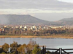
チリ南部に位置するバルディビアは、「川の街」や「チリ南部の真珠」という愛称で親しまれる美しい都市です。カレカレ川、バルディビア川、カウカウ川の3つの河川が合流する戦略的な地点にあり、豊かな自然と深い歴史が共存しています。現在はロス・リオス州の州都として、観光、林業、そしてビール醸造などの産業で発展を続けています。
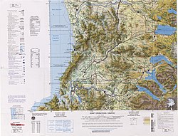
主要な事実(Key Facts)
- 設立: 1552年2月9日、征服者ペドロ・デ・バルディビアによって創設。
- 地理: ロス・リオス州の州都であり、バルディビア県の中心都市。
- 経済: 観光業、パルプ製造、林業、冶金、ビール生産が主要産業。
- 教育: 1954年設立のアウストラル大学を中心に、科学研究が盛ん。
- 気候: 西岸海洋性気候(Cfb)に属し、年間を通じて降水量が多い。
波乱に満ちた歴史の軌跡
バルディビアの歴史は、スペイン帝国による植民地化から始まります。1552年にペドロ・デ・バルディビアによって「サンタ・マリア・ラ・ブランカ・デ・バルディビア」として設立されました。
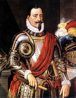
しかし、その歩みは平坦ではありませんでした。先住民族マプチェとの激しい紛争(アラウコ戦争)や、1575年の大地震による甚大な被害に見舞われました。1599年にはフイリチェ族の攻撃を受け、一時的にスペインの支配を失うという悲劇も経験しています。
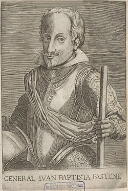
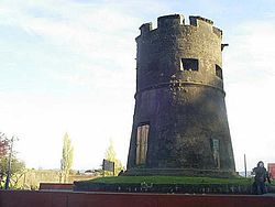
1645年にスペインが再び支配権を確立すると、ペルー副王領の資金を投じて強固な要塞システムが構築されました。これにより、バルディビアは新世界で最も要塞化された都市の一つとなりました。この時代、ペルーから送られた囚人たちが建設に従事し、彼らの中にはアフリカ系ペルー人も多く含まれていました。
19世紀半ばになると、ドイツからの移民がこの地に定住し、街の文化や建築に大きな影響を与えました。その後、20世紀前半には工業都市として発展し、観光地としても注目を集めるようになります。
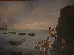
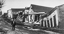
バルディビアの歴史において特筆すべきは、1960年に発生した世界最大規模のチリ大地震です。この災害は街に壊滅的な打撃を与えましたが、住民は不屈の精神で復興を果たしました。
文化と現代のバルディビア
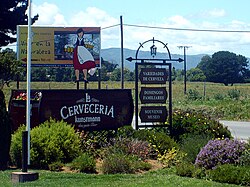
現代のバルディビアは、スペインの植民地時代の遺産とドイツ移民の文化が融合した独特の雰囲気を持っています。特にビール醸造業が盛んで、「チリのビール首都」とも呼ばれています。
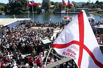
また、学術都市としての側面も強く、アウストラル大学や科学研究センター(CECS)では、生態学、氷河学、物理学などの高度な研究が行われています。政治的にも重要な役割を担っており、2007年にはミシェル・バチェレ元大統領の訪問により、ロス・リオス州の創設が確定しました。
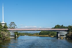
街のシンボルであるペドロ・デ・バルディビア橋や、修復されたカウカウ橋などのインフラは、都市の近代化と再生の象徴となっています。
自然と観光の魅力
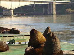
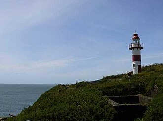
海岸線に近いニエブラやコラルといった町では、歴史的な要塞や灯台が観光客を魅了しています。また、市街地ではアシカのコロニーが見られるなど、野生動物との距離が近いのも特徴です。
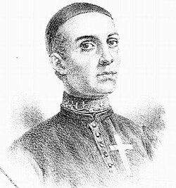
バルディビアが生んだ人物として、チリ共和国の建国父の一人であるカミロ・エンリケス修道士が挙げられ、地域の誇りとなっています。
バルディビアの基本データまとめ
| 項目 | 詳細 |
|---|---|
| 人口(2025年推計) | 110,980人(市街地人口:129,952人) |
| 総面積 | 1,015.6 km² |
| 標高 | 5 m |
| 主要産業 | 観光、パルプ製造、林業、ビール醸造 |
| 気候区分 | Cfb(西岸海洋性気候) |
| モットー | Muy Noble y Muy Leal(最も高貴で最も忠誠心ある) |
よくある質問(FAQ)
バルディビアという名前の由来は何ですか?
この都市を1552年に創設したスペインの征服者、ペドロ・デ・バルディビアの名にちなんで名付けられました。
街の経済を支えている主な産業は何ですか?
観光業のほか、豊かな森林資源を活かした林業やパルプ製造、冶金、そして有名なビール醸造業が経済の柱となっています。
1960年の大地震はどのような影響を与えましたか?
世界最大規模の地震により街は甚大な被害を受けましたが、その後の復興プロセスを経て、現在の近代的な都市へと再構築されました。
バルディビアの気候の特徴は?
年間を通じて雨が多く、穏やかな気温が続く西岸海洋性気候です。ただし、近年は降水量の減少により、河川に海水が混入する塩水化の問題が指摘されています。
教育や研究のレベルはどうですか?
アウストラル大学や科学研究センター(CECS)が存在し、特に生態学や氷河学などの自然科学分野においてチリ国内で重要な研究拠点となっています。
References
- "Asociación Chilena de Municipalidades" (in Spanish). Archived from the original on 19 April 2011. Retrieved 23 February 2011.
- "Municipality of Valdivia" (in Spanish). Archived from the original on 18 October 2000. Retrieved 23 February 2011.
- "National Statistics Institute" (in Spanish). Archived from the original on 6 January 2019. Retrieved 7 February 2010.
- "Censo 2017: Primera entrega de resultados definitivos - Cantidad de personas por sexo y edad" (in Spanish). National Statistics Institute. 2019. Archived from the original on 2 January 2018. Retrieved 1 November 2020.
- "Ciudades, pueblos, aldeas y caceríos 2019" (PDF) (in Spanish). National Statistics Institute. 2019. Archived (PDF) from the original on 13 July 2019. Retrieved 1 November 2020.
- "The Defensive Complex of Valdivia". Entry on the UNESCO Tentative List. Archived from the original on 27 December 2022. Retrieved 15 August 2007.
- U.S. Geological Survey (7 March 2006). Historic Earthquakes – Chile – 1960 May 22 19:11:14 UTC – Magnitude 9.5: The Largest Earthquake in the World. Archived 2009-10-07 at the Retrieved on 2007-01-09
- Ramirez, C., E. Carrasco, S. Mariani & N. Palacios. 2006. La desaparición del luchecillo (Egeria densa) del Santuario del Rio Cruces (Valdivia, Chile): una hipótesis plausible. Ciencia & Trabajo, 20: 79-86
- "Ley de Humedales Urbanos 21.202 y su Reglamento". Ministerio del Medio Ambiente (in Spanish). . Archived from the original on 2 March 2021. Retrieved 4 April 2021.
- Vallejos, Gabriel; Salgado, Daniela (10 December 2021). "Reconocen como humedales urbanos a Angachilla y el sector de Isla Teja en Valdivia]". (in Spanish). Archived from the original on 2 March 2022. Retrieved 3 March 2022.
📸 フォトギャラリー