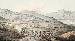
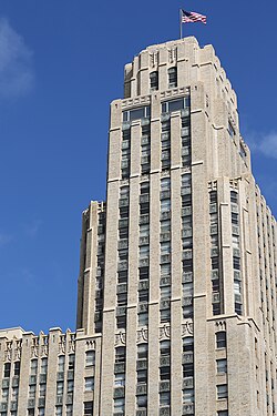
Juan Bautista de Anza established the Presidio of San Francisco for the Spanish Empire in 1776.
← ホームへ戻る
サンフランシスコカリフォルニアゴールドラッシュLGBTQサンフランシスコ歴史

サンフランシスコの歴史と文化霧の街が紡ぐ多様性の物語

🗓 2026年8月10日

アメリカ西海岸の象徴的な都市、サンフランシスコ。太平洋とサンフランシスコ湾に囲まれたこの半島都市は、独自の地理的条件と波乱万丈な歴史によって、世界でも類を見ない多様性と自由な精神を育んできました。霧に包まれた幻想的な風景から、最先端のテクノロジー、そして社会変革の先駆的な動きまで、この街の魅力は多岐にわたります。

sf.govが提供する公式情報によれば、この都市は市と郡が統合された「統合市郡(Consolidated city-county)」という特殊な行政形態をとっており、効率的な都市運営を行っています。

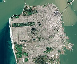
A satellite view of San Francisco

Key Facts

  • 設立: 1776年にスペイン帝国によってミッション(伝道所)とプレシディオ(要塞)が建設された。
  • 地理: 太平洋と湾に囲まれた半島に位置し、最高地点はマウント・デビッドソン(約285m)。
  • 人口: 2020年時点で約87万人。非常に人口密度が高く、多様な人種が共生している。
  • 経済: 「西のウォール街」と呼ばれる金融街や、世界的なテック企業の拠点として知られる。
  • 文化: LGBTQ+の権利擁護やカウンターカルチャーの発信地として世界的に有名。

都市の歩み:植民地時代から現代まで

スペイン・メキシコ時代からアメリカへの移行

サンフランシスコの歴史は、1776年にフアン・バウティスタ・デ・アンサがスペイン帝国のためにプレシディオ(要塞)を設立したことに始まります。

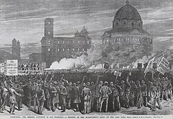
Illustration by H.A. Rodgers for Frank Leslie's Illustrated Newspaper (March 20, 1880) showing a Workingmen's Party of California anti-Chinese rally on the sand lots near San Francisco City Hall
Juan Bautista de Anza established the Presidio of San Francisco for the Spanish Empire in 1776.

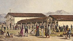
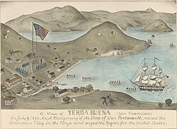
同年10月9日には、フランシスコ・パロウ神父によってミッション・サンフランシスコ・デ・アシスが創設されました。その後、街はメキシコ統治時代を経て、1846年のイエルバ・ブエナ占領というアメリカによるカリフォルニア征服の初期勝利を経て、アメリカ合衆国の領土となりました。

Mission San Francisco de Asís was founded by Padre Francisco Palóu on October 9, 1776.
The 1846 Capture of Yerba Buena was an early U.S. victory in the American conquest of California.

ゴールドラッシュと急速な発展

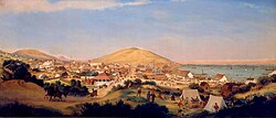
1848年に金が発見されると、世界中から人々が押し寄せる「ゴールドラッシュ」が発生しました。1849年には人口が爆発的に増加し、小さな集落だった街は瞬く間に大都市へと変貌しました。

San Francisco in July 1849 Painting by George Henry Burgess

この時期、経済基盤を支えるために1864年には米国西部初の商業銀行であるカリフォルニア銀行が設立されるなど、金融都市としての基礎が築かれました。

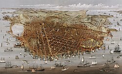
A view of the city in 1878
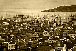
Port of San Francisco in 1851
The Bank of California, established in 1864, was the first commercial bank in Western United States.[63]

試練と再生:大地震から世界博覧会へ

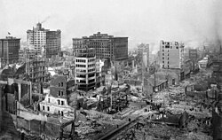
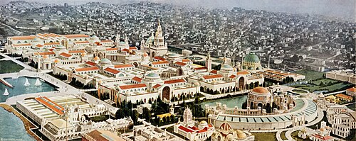
1906年、米国史上最悪の犠牲者を出したサンフランシスコ大地震が発生し、街の大部分が壊滅的な被害を受けました。しかし、市民は不屈の精神で復興に当たり、1915年にはパナマ・太平洋博覧会を開催して、世界にその復活をアピールしました。

The 1906 San Francisco earthquake was the deadliest earthquake in U.S. history.
The Panama–Pacific Exposition, a major world's fair held in 1915, was seen as a chance to showcase the city's recovery from the earthquake.

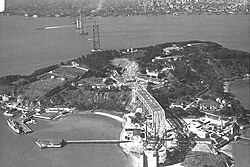
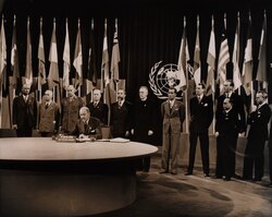
その後、1935年にはベイブリッジの建設が進み、1945年にはサンフランシスコ会議にて国際連合憲章が署名されるなど、国際的な中心地としての地位を確立しました。

The Bay Bridge under construction on Yerba Buena Island in 1935
The United Nations was created in San Francisco in 1945, when the United Nations Charter was signed at the San Francisco Conference.

多様性と社会変革の精神

カウンターカルチャーとLGBTQ+の聖地

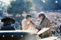
1960年代後半、サンフランシスコは自由と解放の象徴となりました。特に1967年の「サマー・オブ・ラブ」では、ヘイト・アシュベリー地区に約10万人の若者が集まり、既存の価値観に挑戦するカウンターカルチャーを展開しました。

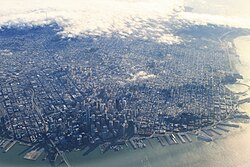
A view of San Francisco's central districts along its northeastern coastline
The Summer of Love in 1967 was an influential counterculture phenomenon with as many as 100,000 people converging in San Francisco's Haight-Ashbury neighborhood.

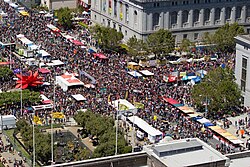
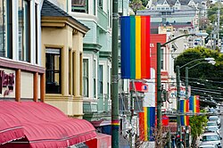
また、カストロ地区は全米最初期のゲイ・ビレッジとして知られ、現在も世界最大級のLGBTQ+プライドイベントである「サンフランシスコ・プライド」が開催されています。象徴的なレインボーフラッグも、この街で誕生しました。

The Castro is famous as one of the first gay villages in the country.[127]
San Francisco Pride is one of the oldest and largest LGBTQ pride events in the world.
The gay pride flag was originally developed in San Francisco.

多民族が織りなすコミュニティ

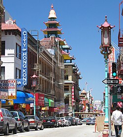
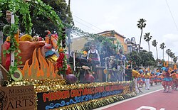
北米最古かつ世界最大級のチャイナタウンや、チカーノ(メキシコ系アメリカ人)の歴史的中心地であるミッション地区など、多様な民族的ルーツを持つ人々が独自の文化圏を形成しています。

San Francisco Chinatown, the oldest in North America and one of the world's largest.
The Mission District is the historic center of the city's Chicano/Mexican-American population and greater Hispanic and Latino community.

歴史的に重要な役割を果たした人物として、サンフランシスコの「創設の母」と呼ばれるフアナ・ブリオネス・デ・ミランダなどが挙げられます。

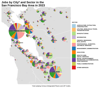
Map of Jobs in the Bay Area by City and Sector
Juana Briones de Miranda, known as the "Founding Mother of San Francisco"[46]

都市の構造と現代のライフスタイル

地理的特徴と気候

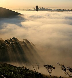
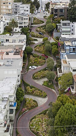
サンフランシスコは、夏に頻繁に発生する濃い霧が特徴的な気候です。また、市街地は起伏が激しく、ロシア・ヒルのロンバード・ストリートのように「世界一曲がりくねった道」として有名な場所もあります。

San Francisco fog is a regular phenomenon in the summer.
Lombard Street in Russian Hill is famed as "the most crooked street in the world".

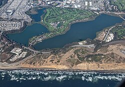
自然環境としては、南西部のレイク・マーセドや、沖合のファラロン諸島などが存在し、都市と自然が隣接しています。

Lake Merced, located in southwestern San Francisco
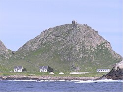
The Farallon Islands are located in the Gulf of the Farallones, off the Pacific coast of San Francisco.

経済とインフラ

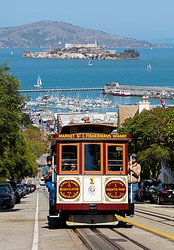
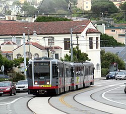
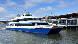
現代のサンフランシスコは、セールスフォース・タワーを筆頭とする超高層ビルが立ち並ぶ金融街(フィナンシャル・ディストリクト)と、世界的なテック企業の拠点が共存しています。交通面では、伝統的なケーブルカーから、現代的なムニ・メトロ、そして北湾や東湾を結ぶフェリーまで、多様な手段が整備されています。

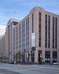
Former X headquarters on Market Street, prior to moving to Austin, Texas
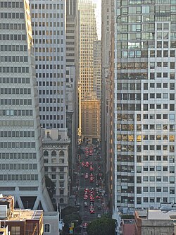
San Francisco's Financial District is considered the Wall Street of the West.
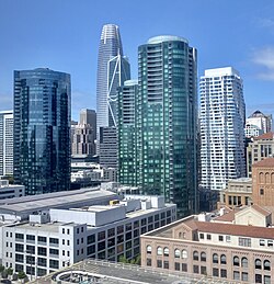
Skyline of South of Market (SoMa), including Salesforce Tower, the tallest building in San Francisco
A San Francisco cable car with Alcatraz seen behind
Muni Metro, run by SF Muni
Golden Gate Ferries connect the city to North Bay communities, while San Francisco Bay Ferry connects the city to both the North and East Bay.

観光と文化のランドマーク

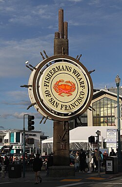
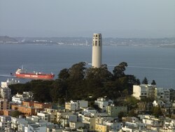
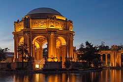
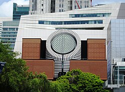
ゴールデンゲートブリッジやフィッシャーマンズワーフ、コイトタワーなどの観光名所は、世界中から訪れる人々を魅了し続けています。また、SFMOMA(サンフランシスコ近代美術館)やパレス・オブ・ファイン・アーツなどの芸術施設も充実しています。

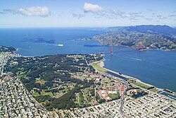
An aerial view of the Presidio of San Francisco and the Golden Gate
The Fisherman's Wharf is a popular tourist attraction.
Coit Tower on Telegraph Hill
The Palace of Fine Arts, originally built for the 1915 Panama–Pacific International Exposition
The San Francisco Museum of Modern Art, also known as SF MOMA

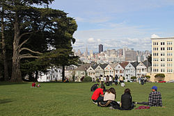
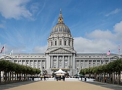
都市の象徴的な風景としては、アラモ・スクエアの「ペインテッド・レディース」と呼ばれるビクトリア様式の住宅群や、市庁舎の壮麗な建築が挙げられます。

Painted Ladies on Alamo Square.
San Francisco City Hall, built 1913–16 and designed by Arthur Brown Jr.

教育と公共サービス

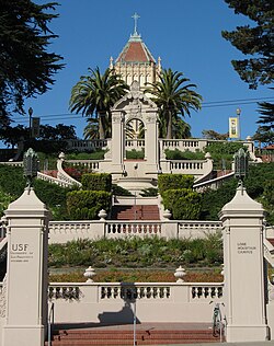
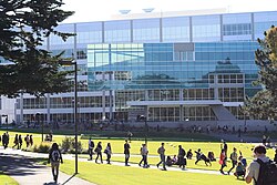
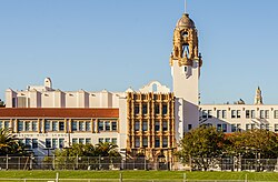
教育面では、サンフランシスコ州立大学やサンフランシスコ大学などの高等教育機関に加え、カリフォルニア州最古の学区であるサンフランシスコ統一学区が114の学校を運営しています。

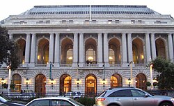
War Memorial Opera House, part of the S.F. War Memorial & Performing Arts Center, one of the largest performing arts centers in the U.S.
The University of San Francisco
The San Francisco State University library building
The San Francisco Unified School District operates 114 schools and is the oldest school district in California.

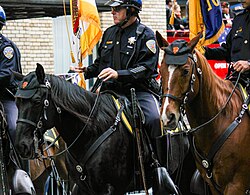
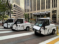
治安維持を担うSFPD(サンフランシスコ警察)は、都市の特性に合わせて騎馬警備隊や駐車取締員などの専門部署を配置しています。

SFPD mounted police officers
SFPD parking enforcement officers

現代の課題

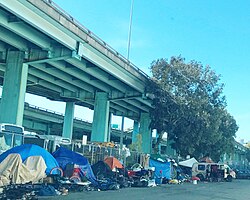
繁栄の一方で、深刻なホームレス問題や格差社会といった課題にも直面しています。フリーウェイの下に形成されたテント村などは、都市が抱える社会的な矛盾を象徴しています。

A homeless encampment under a freeway in San Francisco

サンフランシスコの概要まとめ

サンフランシスコの基本データ
項目 詳細
行政形態 統合市郡(Consolidated city-county)
人口(2020年) 873,965人
GDP(2024年) 市郡:2,683億ドル / CSA:1.408兆ドル
主要産業 金融、テクノロジー、観光
気候的特徴 夏季の濃霧、温暖な地中海性気候
象徴的建築 ゴールデンゲートブリッジ、トランスアメリカ・ピラミッド

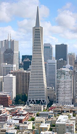
都市の景観は時代とともに変化し、1972年に完成したトランスアメリカ・ピラミッドは、70年代から80年代にかけての「マンハッタン化(高層ビル化)」の象徴となりました。

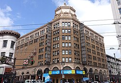
Golden Gate Theatre is located in the historic Theatre District
The Transamerica Pyramid, built in 1972, characterized the Manhattanization of the city's skyline in the 1970–80s.

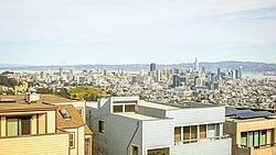
現在の街並みは、ツインピークスから見下ろすと、カストロ地区を越えてイーストベイまで広がる壮大なパノラマとして捉えることができます。

San Francisco cityscape and East Bay, from Pikes Peak, above the Castro

その他の主要施設とスポット

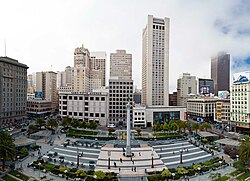
  • 商業・ショッピング: ユニオンスクエア(主要小売拠点)
    Union Square is a major retail hub for San Francisco and the Bay Area.
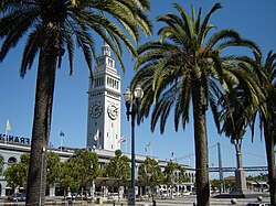
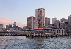
  • ウォーターフロント: エンバラカデロのフェリービルディング
    The Ferry Building, located in the Embarcadero, the city's eastern waterfront along San Francisco Bay
    Ferry Building in the Embarcadero.
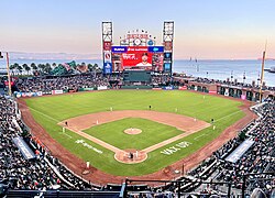
  • スポーツ: オラクル・パーク(ジャイアンツ本拠地)
    Oracle Park, home of the SF Giants
    、チェイス・センター(ウォリアーズ本拠地)
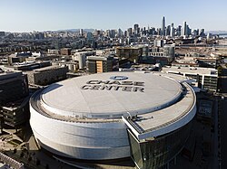
    Chase Center, home of the Golden State Warriors
  • 公園: ゴールデンゲートパーク(全米有数の訪問者数)
    Golden Gate Park is the 3rd most-visited city park in the U.S., after Central Park and the National Mall.[323]
  • 自然・景勝地: クリフハウスとオーシャンビーチ
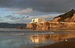
    The Cliff House over Ocean Beach
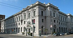
  • 公共建築: カリフォルニア州最高裁判所(アール・ウォーレン・ビル)
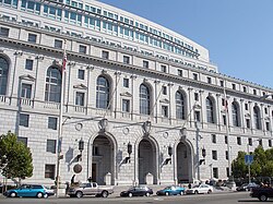
    The Supreme Court of California is based in the Earl Warren Building.
    、連邦ビル
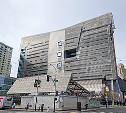
    San Francisco Federal Building
    、ブラウニング裁判所
    The historic Browning Courthouse
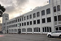
  • メディア: サンフランシスコ・クロニクル
    The San Francisco Chronicle building
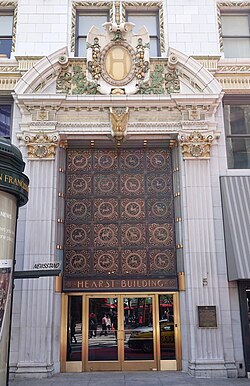
    、ハースト・ビル
    The Julia Morgan-designed Hearst Building, the western headquarters of the Hearst Corporation
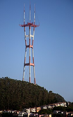
  • ランドマーク: スートロタワー
    Sutro Tower is a broadcast tower and local landmark.
  • 交通拠点: サンフランシスコ国際空港
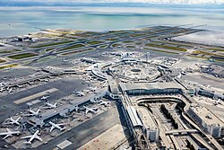
    San Francisco International Airport, one of the busiest airports in the world
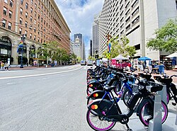
    、ベイホイールズ(シェアサイクル)
    A Bay Wheels station on Market St.
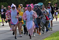
  • イベント: ベイ・トゥ・ブレイカーズ(仮装ランニングイベント)
    Bay to Breakers is an annual foot race known for colorful costumes.
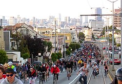
    A San Francisco cycling event

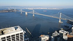
また、ベイブリッジはオークランドやイーストベイへの重要なアクセスルートとなっており、都市の経済圏を広げています。

The Bay Bridge connects the city to Oakland and the East Bay.

人口統計と人種構成

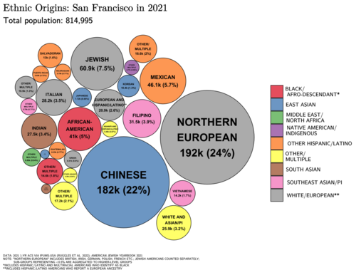
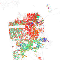
サンフランシスコの人口構成は、時代とともに大きく変化してきました。かつては非ヒスパニック系白人が圧倒的多数を占めていましたが、現在はアジア系やヒスパニック系の割合が増加し、多文化共生社会を実現しています。

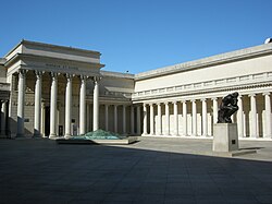
The California Palace of the Legion of Honor, part of the Fine Arts Museums of San Francisco
Ethnic origins in San Francisco
A racial distribution map of San Francisco, 2010 U.S. Census. Each dot is 25 people: ⬤ White ⬤ Black ⬤ Asian ⬤ Hispanic ⬤ Other

特にアジア系人口の増加が顕著であり、2020年時点では人口の約33.7%を占めています。また、シークリフのような高級住宅街が存在する一方で、社会的な格差も共存しています。

Sea Cliff is one of the city's most expensive neighborhoods.[174]

Frequently Asked Questions

サンフランシスコの街の名前の由来は何ですか?

アッシジの聖フランシスコ(St. Francis of Assisi)にちなんで名付けられました。

この街の気候で最も特徴的なことは何ですか?

夏季に発生する濃い霧が非常に有名で、都市の風景や気温に大きな影響を与えています。

The University of California College of the Law

サンフランシスコが「自由な街」と言われる理由は何ですか?

1960年代のカウンターカルチャー運動や、LGBTQ+の権利擁護運動の先駆的な拠点となり、多様な価値観を許容する文化が根付いているためです。

歴史的に最も大きな被害を受けた出来事は何ですか?

1906年に発生したサンフランシスコ大地震です。米国史上最悪の死者数を出しましたが、その後、街は力強く復興しました。

主要な交通手段にはどのようなものがありますか?

伝統的なケーブルカーのほか、Muni Metro、BART、Caltrain、そして北湾や東湾を結ぶフェリーなどが利用可能です。

References

    • English: English pronunciation:
    • Spanish: , lit. ''
  1. Construction of the Pacific Railroad was partially (albeit reluctantly) funded by the under the provisions of "An Act to Authorize the Board of Supervisors of the City and County of San Francisco to take and subscribe One Million Dollars to the Capital Stock of the Western Pacific Rail Road Company and the Central Pacific Rail Road Company of California and to provide for the payment of the same and other matters relating thereto." approved on April 22, 1863, as amended by §5 of the "Compromise Act of 1864" approved on April 4, 1864. The bond issue was objected to by the Mayor and the Board of Supervisors, however, and they were not delivered to the WPRR and CPRR until 1865 after Writs of Mandamus ordering such were issued by the Supreme Court of the State of California in 1864 ("The People of the State of California on the relation of the Central Pacific Railroad Company vs. Henry P. Coon, Mayor; Henry M. Hale, Auditor; and Joseph S. Paxson, Treasurer, of the City and County of San Francisco" 25 Cal 635) and 1865 ("The People ex rel The Central Pacific Railroad Company of California vs. The Board of Supervisors of the City and County of San Francisco, and Wilhelm Lowey, Clerk" 27 Cal 655)
  2. "Another positive trend for the future is San Francisco's highly entrepreneurial, flexible and innovative economy...San Francisco's very high reliance on small business and self-employment is typical of other dynamic, fast-growing, high-technology areas across the country."
  3. Station currently at the building[]
  4. The coordinates of the station are 37°46′14″N 122°25′37″W / 37.7706°N 122.4269°W / 37.7706; -122.4269. Precipitation, high temperature, low temperature, snow, and snow depth records date from October 1, 1849; June 1, 1874; January 1, 1875; January 1, 1876; and January 1, 1922; respectively.
  5. Mean monthly maxima and minima (i.e. the expected highest and lowest temperature readings at any point during the year or given month) calculated based on data at said location from 1991 to 2020.
  6. Those not born in the 50 states or D.C., excluding California, Nevada, Utah, Arizona, New Mexico, and Texas before 1850.
📸 フォトギャラリー

Juan Bautista de Anza established the Presidio of San Francisco for the Spanish Empire in 1776.
Mission San Francisco de Asís was founded by Padre Francisco Palóu on October 9, 1776.
Juana Briones de Miranda, known as the "Founding Mother of San Francisco"[46]
San Francisco in July 1849 Painting by George Henry Burgess
The 1846 Capture of Yerba Buena was an early U.S. victory in the American conquest of California.
Port of San Francisco in 1851
The Bank of California, established in 1864, was the first commercial bank in Western United States.[63]
Illustration by H.A. Rodgers for Frank Leslie's Illustrated Newspaper (March 20, 1880) showing a Workingmen's Party of California anti-Chinese rally on the sand lots near San Francisco City Hall
A view of the city in 1878
The 1906 San Francisco earthquake was the deadliest earthquake in U.S. history.
The Panama–Pacific Exposition, a major world's fair held in 1915, was seen as a chance to showcase the city's recovery from the earthquake.
The Bay Bridge under construction on Yerba Buena Island in 1935
The United Nations was created in San Francisco in 1945, when the United Nations Charter was signed at the San Francisco Conference.
The Summer of Love in 1967 was an influential counterculture phenomenon with as many as 100,000 people converging in San Francisco's Haight-Ashbury neighborhood.
The Transamerica Pyramid, built in 1972, characterized the Manhattanization of the city's skyline in the 1970–80s.
San Francisco cityscape and East Bay, from Pikes Peak, above the Castro
A satellite view of San Francisco
Lake Merced, located in southwestern San Francisco
A view of San Francisco's central districts along its northeastern coastline
San Francisco Chinatown, the oldest in North America and one of the world's largest.
The Ferry Building, located in the Embarcadero, the city's eastern waterfront along San Francisco Bay
San Francisco fog is a regular phenomenon in the summer.
The Farallon Islands are located in the Gulf of the Farallones, off the Pacific coast of San Francisco.
An aerial view of the Presidio of San Francisco and the Golden Gate
Ethnic origins in San Francisco
A racial distribution map of San Francisco, 2010 U.S. Census. Each dot is 25 people: ⬤ White ⬤ Black ⬤ Asian ⬤ Hispanic ⬤ Other
Sea Cliff is one of the city's most expensive neighborhoods.[174]
A homeless encampment under a freeway in San Francisco
SFPD mounted police officers
SFPD parking enforcement officers
San Francisco's Financial District is considered the Wall Street of the West.
Map of Jobs in the Bay Area by City and Sector
Skyline of South of Market (SoMa), including Salesforce Tower, the tallest building in San Francisco
Union Square is a major retail hub for San Francisco and the Bay Area.
Ferry Building in the Embarcadero.
Former X headquarters on Market Street, prior to moving to Austin, Texas
The Fisherman's Wharf is a popular tourist attraction.
Coit Tower on Telegraph Hill
The Palace of Fine Arts, originally built for the 1915 Panama–Pacific International Exposition
The Castro is famous as one of the first gay villages in the country.[127]
The Mission District is the historic center of the city's Chicano/Mexican-American population and greater Hispanic and Latino community.
The San Francisco Museum of Modern Art, also known as SF MOMA
San Francisco Pride is one of the oldest and largest LGBTQ pride events in the world.
The gay pride flag was originally developed in San Francisco.
War Memorial Opera House, part of the S.F. War Memorial & Performing Arts Center, one of the largest performing arts centers in the U.S.
Golden Gate Theatre is located in the historic Theatre District
The California Palace of the Legion of Honor, part of the Fine Arts Museums of San Francisco
Oracle Park, home of the SF Giants
Chase Center, home of the Golden State Warriors
Bay to Breakers is an annual foot race known for colorful costumes.
Golden Gate Park is the 3rd most-visited city park in the U.S., after Central Park and the National Mall.[323]
Painted Ladies on Alamo Square.
The Cliff House over Ocean Beach
San Francisco City Hall, built 1913–16 and designed by Arthur Brown Jr.
The Supreme Court of California is based in the Earl Warren Building.
San Francisco Federal Building
The historic Browning Courthouse
The University of San Francisco
The San Francisco State University library building
The University of California College of the Law
The San Francisco Unified School District operates 114 schools and is the oldest school district in California.
The San Francisco Chronicle building
The Julia Morgan-designed Hearst Building, the western headquarters of the Hearst Corporation
Sutro Tower is a broadcast tower and local landmark.
A San Francisco cable car with Alcatraz seen behind
Muni Metro, run by SF Muni
Golden Gate Ferries connect the city to North Bay communities, while San Francisco Bay Ferry connects the city to both the North and East Bay.
The Bay Bridge connects the city to Oakland and the East Bay.
Lombard Street in Russian Hill is famed as "the most crooked street in the world".
San Francisco International Airport, one of the busiest airports in the world
A Bay Wheels station on Market St.
A San Francisco cycling event