Full length portrait of a man in his thirties wearing a long robe, woman and child visible behind him and dog to his left
← ホームへ戻る

サンディエゴ歴史と現代が交差するカリフォルニアの宝石

🗓 2026年8月15日

カリフォルニア州の南端に位置し、「アメリカで最も素晴らしい街(America's Finest City)」と称されるサンディエゴ。太平洋に面した美しい海岸線と、年間を通じて温暖な気候に恵まれたこの都市は、単なる観光地ではなく、深い歴史と多様な文化が共存するダイナミックなメトロポリスです。メキシコとの国境に隣接し、軍事、教育、観光の拠点として発展を続けています。

主要な事実(Key Facts)

  • 人口規模: 市人口は約138万人(2020年)、都市圏では約330万人に達し、カリフォルニア州で2番目に大きな都市です。
  • 経済の柱: 米海軍基地などの国防産業、UCサンディエゴなどの教育機関、そして活発な国際貿易が経済を牽引しています。
  • 地理的特徴: 太平洋に面した港湾都市であり、最高地点のカウルズ山(約485m)から海抜0mのビーチまで多様な地形を持ちます。
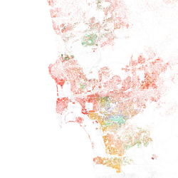
  • 多文化社会: ヒスパニック系やアジア系など、多様な人種構成を持つ国際的なコミュニティが形成されています。

サンディエゴの歩み:先住民から現代まで

先住民の時代とスペインの到来

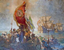
この地の歴史は、数千年前から居住していたクメヤイ族(スペイン語ではディエゲーニョスと呼ばれる)にまで遡ります。その後、1542年にポルトガル人探検家フアン・ロドリゲス・カブリロがサンディエゴ湾に上陸し、スペイン帝国のためにこの地を領有しました。
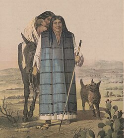
Full length portrait of a man in his thirties wearing a long robe, woman and child visible behind him and dog to his left
Portuguese explorer Juan Rodríguez Cabrillo landing in San Diego Bay in 1542, claiming California for the Spanish Empire

ミッションの設立とメキシコ時代

1769年、聖ジュニペロ・セラによってサンディエゴ・デ・アルカラ伝道所が設立されました。これはカリフォルニアで最古のスペイン伝道所であり、地域の精神的・社会的中心となりました。その後、スペインの統治からメキシコ領へと移行し、エストゥディージョ家のような有力なカリフォルニオ(カリフォルニア生まれのスペイン系住民)が台頭しました。
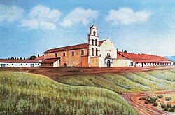
Mission San Diego de Alcalá was founded in 1769 by Saint Junípero Serra, making it the oldest of the Spanish missions in California.
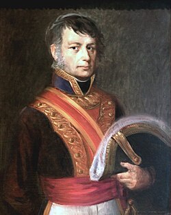
José María Estudillo served as commandant of the Presidio of San Diego and founded the Estudillo family, a powerful clan of Californios.

1827年に建てられたカサ・デ・エストゥディージョは、市内で最も古い建築物の一つであり、後の文学作品『ラモーナ』のインスピレーション源となったことでも知られています。
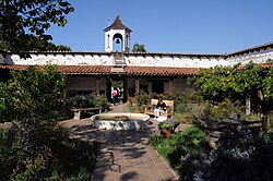
Casa de Estudillo, built 1827, is one of San Diego's oldest buildings and served as inspiration for Helen Hunt Jackson's 1884 novel Ramona.

アメリカ合衆国への編入と都市開発

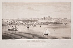
19世紀半ば、米墨戦争に伴う激動の時代を迎え、1846年にはサンパスカルの戦いという決定的な衝突が起こりました。その後、カリフォルニアはアメリカ合衆国に併合され、サンディエゴは急速な近代化へと突き進みます。1873年頃には港湾整備が進み、アロンゾ・ホートンによるダウンタウンの開発が都市の骨格を形作りました。
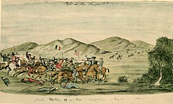
The 1846 Battle of San Pasqual was a decisive battle between American and Californio forces.
View of San Diego Bay in 1873 following the U.S. conquest of California
Oval, black and white shoulder-height portrait of a man in his forties or fifties, slightly balding wearing a suit

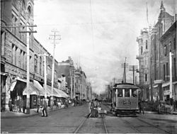
20世紀に入ると、1915年のパナマ・カリフォルニア博覧会のためにバルボアパークが整備され、文化的な象徴となりました。1900年代初頭のダウンタウンから、1980年代以降のマリーナ地区などの再開発を経て、現在の洗練されたスカイラインが完成しました。
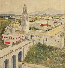
Hand drawn illustration of Balboa Park
Downtown San Diego, c. 1903
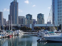
Starting in the 1980s, many areas of Downtown, such as the Marina District, underwent redevelopment.

地理と都市構造

自然環境と気候

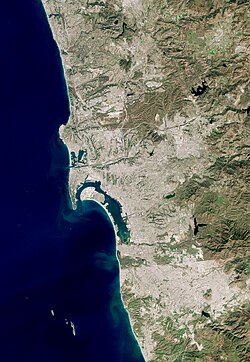
サンディエゴは、メキシコのティフアナと一体化した「国境を跨ぐ都市圏」を形成しています。自然豊かなトーリーパインズ州立自然保護区や、サーフィンの聖地であるパシフィックビーチなど、アウトドアに最適な環境が整っています。
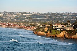
La Jolla is a highly valued real estate market in San Diego.
Satellite view of the San Diego–Tijuana area, a transborder agglomeration straddling the Mexico–United States border in the Californias
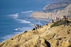
Torrey Pines State Natural Reserve
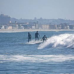
Surfers at Pacific Beach

気候は非常に安定しており、年間を通じて穏やかです。冬でも極端に冷え込むことは少なく、夏は太平洋からの涼しい風が吹き抜けます。カブリロ国立記念碑から望むコロナド島の景色は、この街の地理的な美しさを象徴しています。
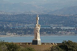
View of Coronado from Cabrillo National Monument
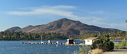
Cowles Mountain from Lake Murray

多様なコミュニティと地区

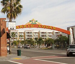
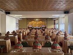
市内には、高級住宅街として知られるラホヤや、チカーノ文化の拠点であるバリオ・ロガン、そして多様な宗教施設が点在する大学高台(University Heights)など、個性の異なる地区が共存しています。
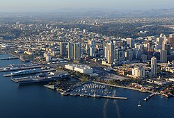
Aerial view of central San Diego
Map of racial distribution in San Diego, 2010 U.S. Census. Each dot is 25 people: ⬤ Non-Hispanic White ⬤ Black ⬤ Asian ⬤ Hispanic ⬤ Other
Barrio Logan is a Chicano cultural hub and ethnic enclave.
Hsi Fang Buddhist temple in University Heights.

経済と社会インフラ

国防と産業の拠点

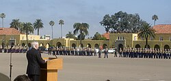
サンディエゴはアメリカの国防産業における最重要拠点の一つです。サンディエゴ海軍基地や海兵隊新兵訓練所が置かれ、軍関係者が地域経済の大きな割合を占めています。また、クアルコムのようなハイテク企業も拠点を置いています。
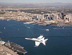
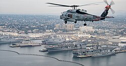
An F/A-18 Hornet flying over San Diego. The city serves as a major hub for the defense industry and U.S. military.
View of Naval Base San Diego
Marine Corps Recruit Depot

交通と物流の要衝

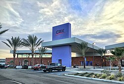
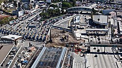
カリフォルニア州で3番目に賑わうサンディエゴ港に加え、世界で4番目に利用者の多いサン・イシドロ国境検問所は、北米における物流と人の往来の要となっています。また、ティフアナ国際空港へ直接アクセスできる「クロスボーダー・エクスプレス」などの革新的な交通インフラも整備されています。
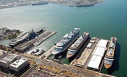
The Port of San Diego is the third-busiest port in California.
San Ysidro Port of Entry is the 4th-busiest border crossing in the world and the busiest in the Western Hemisphere.
The Cross Border Xpress, also known as the Puerta de las Californias, connects San Diego to Tijuana International Airport in Baja California.

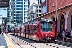
市内交通では、サンディエゴ・トロリーやアムトラック、コースターなどの鉄道網が機能しており、サンタフェ駅がその中心的な役割を担っています。
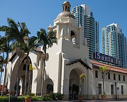
Santa Fe Depot is served by Amtrak California and Coaster trains.
San Diego Trolley is operated by the S.D. Metropolitan Transit System.

教育と文化施設

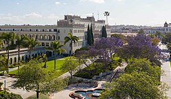
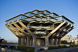
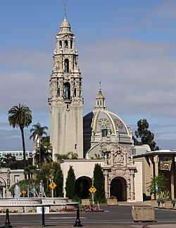
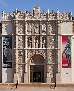
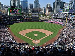
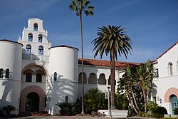
UCサンディエゴ(カリフォルニア大学サンディエゴ校)やサンディエゴ州立大学など、世界的な研究機関が集積しています。また、バルボアパーク内にあるサンディエゴ歴史センターや美術館、そしてスポーツの殿堂であるペトコ・パークなど、市民の生活を豊かにする施設が充実しています。
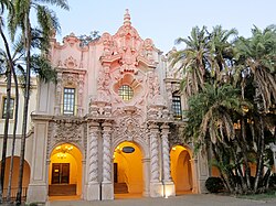
Casa de Balboa at Balboa Park is home to the San Diego History Center.
San Diego State University
University of San Diego
Geisel Library at UC San Diego
The Museum of Us
The San Diego Museum of Art
Petco Park, home of the San Diego Padres (MLB)

行政と都市管理

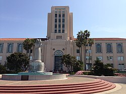
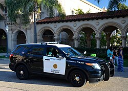
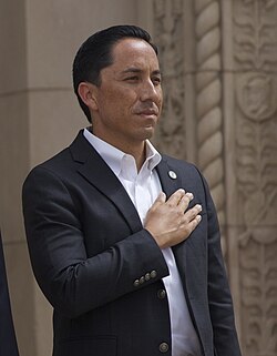
現在の市長はトッド・グロリア氏が務めており、市長・市議会制による統治が行われています。市役所や裁判所、警察本部などの行政機能はダウンタウン周辺に集約されており、効率的な都市運営が行われています。
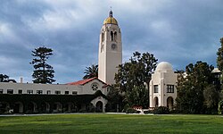
The Bishop's School in La Jolla
Todd Gloria is the current mayor of San Diego.
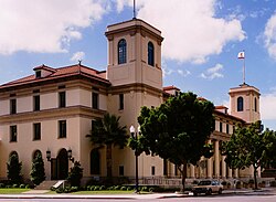
County Administration Center, seat of San Diego County Government
San Diego Hall of Justice
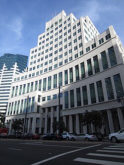
Weinberger U.S. Courthouse
Carter-Keep U.S. Courthouse
San Diego Police Department

また、世界各国の都市と姉妹都市協定を結んでおり、日本の横浜市(1957年締結)を含む多くの都市と文化・経済交流を続けています。

サンディエゴの概要まとめ

項目 詳細
設立日 1769年7月16日
人口(2020年) 1,386,932人
主要産業 国防、バイオテクノロジー、観光、国際貿易
主要ランドマーク バルボアパーク、サンディエゴ湾ラホヤ
最高地点 カウルズ山 (1,591 ft / 485 m)
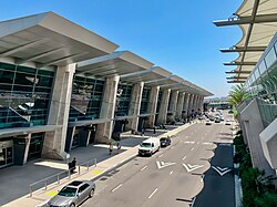
主要交通機関 サンディエゴ・トロリー、サンディエゴ国際空港

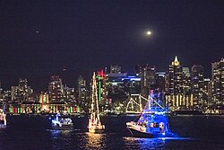
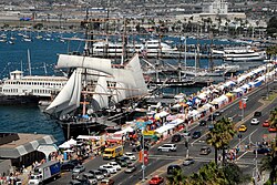
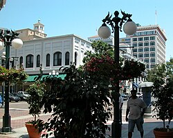
最後に、街のシンボル的な風景として、ダウンタウンの最高層ビルであるワン・アメリカ・プラザや、夜を彩るガスランプ・クォーターの街灯、そして冬の風物詩であるパレード・オブ・ライツなどが挙げられます。
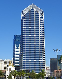
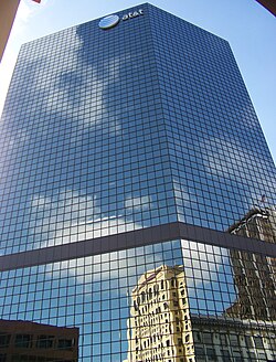
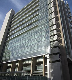
One America Plaza is the tallest building in San Diego.
The AT&T Building
San Diego Parade of Lights
San Diego International Airport
San Diego Bay Festival of Sail
Street lights in the Gaslamp Quarter
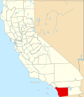
San Diego County map

歴史的な遺産であるセーラ博物館やサンパスカル戦跡記念碑は、今もなお訪れる人々にこの地の歩みを伝えています。
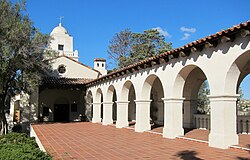
Serra Museum at Presidio Park
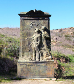
The San Pasqual Battlefield Monument commemorates the 1846 Battle of San Pasqual.

Frequently Asked Questions

サンディエゴの主な産業は何ですか?

米海軍基地を中心とした国防・軍事産業が非常に強力です。また、UCサンディエゴなどの教育機関を基盤としたバイオテクノロジーやハイテク産業、そして美しい自然を活かした観光業が経済を支えています。

気候の特徴はどのようなものですか?

地中海性気候に近く、年間を通じて温暖で穏やかです。極端な寒暖差が少なく、特に夏は太平洋からの影響で過ごしやすいため、屋外活動やビーチレジャーに最適です。

メキシコとの関係はどうなっていますか?

地理的に隣接しており、サン・イシドロ国境検問所を通じて非常に多くの人々が行き来しています。また、ティフアナ国際空港へ直接アクセスできる専用施設があるなど、経済的・文化的に密接に結びついた国境都市圏を形成しています。

おすすめの観光スポットはどこですか?

文化と自然が融合したバルボアパーク、高級感漂う海岸線のラホヤ、歴史を感じさせるオールドタウンやサンディエゴ・デ・アルカラ伝道所、そしてスポーツファンにはMLBの本拠地ペトコ・パークなどが人気です。

サンディエゴの人口構成に特徴はありますか?

非常に多様な人種構成を持っており、特にヒスパニック系住民の割合が高く、アジア系住民も増加傾向にあります。この多文化共生が、街の食文化や芸術、コミュニティの多様性を生み出しています。

References

  1. Mean monthly maxima and minima (i.e. the highest and lowest temperature readings during an entire month or year) calculated based on data at said location from 1991 to 2020.
  2. Official precipitation records for San Diego were kept at the Weather Bureau Office in downtown from October 1850 to December 1859 at the and from November 1871 to June 1939 and a variety of buildings at downtown, and at San Diego Int'l (Lindbergh Field) since July 1939. Temperature records, however, only date from October 1874. For more information on data coverage, see ThreadEx

📸 フォトギャラリー

Full length portrait of a man in his thirties wearing a long robe, woman and child visible behind him and dog to his left
Portuguese explorer Juan Rodríguez Cabrillo landing in San Diego Bay in 1542, claiming California for the Spanish Empire
Mission San Diego de Alcalá was founded in 1769 by Saint Junípero Serra, making it the oldest of the Spanish missions in California.
José María Estudillo served as commandant of the Presidio of San Diego and founded the Estudillo family, a powerful clan of Californios.
Casa de Estudillo, built 1827, is one of San Diego's oldest buildings and served as inspiration for Helen Hunt Jackson's 1884 novel Ramona.
The 1846 Battle of San Pasqual was a decisive battle between American and Californio forces.
View of San Diego Bay in 1873 following the U.S. conquest of California
Oval, black and white shoulder-height portrait of a man in his forties or fifties, slightly balding wearing a suit
Hand drawn illustration of Balboa Park
Downtown San Diego, c. 1903
Starting in the 1980s, many areas of Downtown, such as the Marina District, underwent redevelopment.
Satellite view of the San Diego–Tijuana area, a transborder agglomeration straddling the Mexico–United States border in the Californias
Torrey Pines State Natural Reserve
Surfers at Pacific Beach
View of Coronado from Cabrillo National Monument
Cowles Mountain from Lake Murray
Serra Museum at Presidio Park
Aerial view of central San Diego
Map of racial distribution in San Diego, 2010 U.S. Census. Each dot is 25 people: ⬤ Non-Hispanic White ⬤ Black ⬤ Asian ⬤ Hispanic ⬤ Other
Barrio Logan is a Chicano cultural hub and ethnic enclave.
Hsi Fang Buddhist temple in University Heights.
An F/A-18 Hornet flying over San Diego. The city serves as a major hub for the defense industry and U.S. military.
One America Plaza is the tallest building in San Diego.
View of Naval Base San Diego
Marine Corps Recruit Depot
Casa de Balboa at Balboa Park is home to the San Diego History Center.
The Port of San Diego is the third-busiest port in California.
San Ysidro Port of Entry is the 4th-busiest border crossing in the world and the busiest in the Western Hemisphere.
The AT&T Building
La Jolla is a highly valued real estate market in San Diego.
Todd Gloria is the current mayor of San Diego.
County Administration Center, seat of San Diego County Government
San Diego Hall of Justice
Weinberger U.S. Courthouse
Carter-Keep U.S. Courthouse
San Diego Police Department
The Bishop's School in La Jolla
San Diego State University
University of San Diego
Geisel Library at UC San Diego
The Museum of Us
The San Diego Museum of Art
Petco Park, home of the San Diego Padres (MLB)
The San Pasqual Battlefield Monument commemorates the 1846 Battle of San Pasqual.
San Diego Parade of Lights
Santa Fe Depot is served by Amtrak California and Coaster trains.
San Diego Trolley is operated by the S.D. Metropolitan Transit System.
The Cross Border Xpress, also known as the Puerta de las Californias, connects San Diego to Tijuana International Airport in Baja California.
San Diego International Airport
San Diego Bay Festival of Sail
Street lights in the Gaslamp Quarter
San Diego County map