私たちが日常的に利用している道路は、単なるアスファルトの道ではなく、高度な土木工学と歴史的な積み重ねによって構築された巨大なインフラシステムです。古代の歩道から現代の高速道路まで、道路の進化は人類の移動能力と経済発展に直結してきました。本記事では、道路の構造的な仕組みから、維持管理の重要性、そして世界的なネットワークの現状までを詳しく解説します。
Key Facts
- 世界最大の道路網:2009年時点で米国が世界最大の道路ネットワークを保有し、次いでインド、中国、ブラジルが続きます。
- 構造的ダメージ:道路への負荷は軸重の4乗に比例し、大型トラックは乗用車に比べて数千倍のダメージを与えることがあります。
- 設計寿命:舗装の設計寿命は一般的に8年から60年まで幅があり、英国の一部では新設舗装に40年の基準を設けています。
- 経済的損失:道路の劣化は車両の摩耗や燃料消費を早め、ドライバーに直接的な追加コストを強いることになります。
道路の歴史的変遷:古代から近代へ
人類が計画的に道を構築し始めた歴史は非常に古く、北欧では紀元前3800年頃の木製トラックウェイ(木道)が発見されています。その後、紀元前312年頃からローマ帝国が軍事目的で直線的かつ堅牢な石造りの道路を整備し、全盛期にはローマを中心に約78,000kmに及ぶ舗装路ネットワークを構築しました。
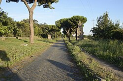
近代に入ると、道路の管理体制が変化しました。例えば16世紀の英国では管理責任が地方教区に移ったことで路面状況が悪化したため、18世紀初頭には通行料を徴収して道路を整備する「ターンパイク信託」制度が導入されました。その後、鉄道網の発達とともにこのシステムは衰退しましたが、これが現代の有料道路の先駆けとなりました。
道路の構造とエンジニアリング
現代の道路は、単に表面を固めるだけでなく、複数の層で構成される精密な構造体です。路盤(サブグレード)の上に路盤材(サブベースやベースコース)を重ね、最終的に舗装材(ペイバー)を敷くことで、車両の荷重を分散させ、地盤への負荷を軽減しています。
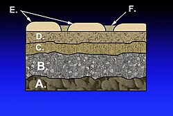
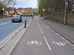
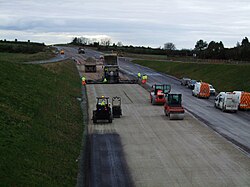
建設現場では、セメント系材料を用いた路盤の強化や、効率的な舗装作業が行われます。また、都市部では歩道や自転車専用レーンを併設することで、多様な交通手段の共存を図っています。
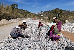
舗装の種類と特性
道路表面には、柔軟性のあるアスファルトコンクリートや、耐久性の高いコンクリート舗装などが使い分けられています。特に「永久舗装(Perpetual Pavement)」と呼ばれる設計では、構造的な寿命を50年以上と想定し、長期的な維持コストの削減を目指しています。
維持管理と劣化のメカニズム
道路は完成した瞬間から劣化が始まります。主な要因は、凍結融解による路面の隆起(フロストヒーブ)、熱によるひび割れ、酸化、そして車両による物理的な負荷です。特に雨水による浸食や急ブレーキによる衝撃は、路面の穴(ポットホール)を形成する大きな原因となります。
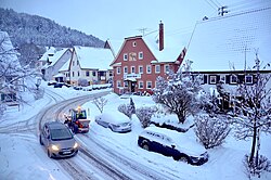

適切なメンテナンスを怠ると、社会的なコストが増大します。米国での調査では、路面状況の悪化により、都市部のドライバーは車両修理費として年間平均700ドル以上の追加負担を強いられていると報告されています。
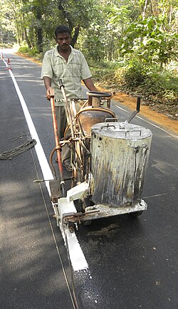
グローバルな交通システムと課題
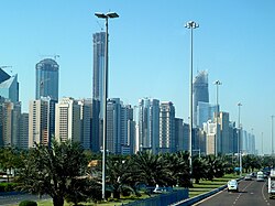
世界各国の道路網は、その国の経済規模や地理的条件を反映しています。中国の高速道路網は急速に拡大しており、2017年までに130,000kmに達しました。また、交通ルールとしての「右側通行」と「左側通行」の分断や、国境を越える大規模な橋梁・トンネルの建設など、接続性の向上が常に追求されています。

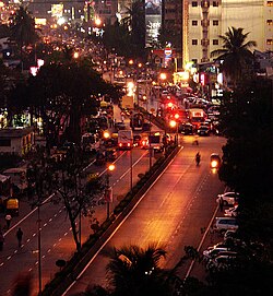
特殊な道路環境
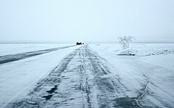
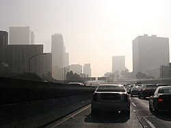
気候条件によっては、極寒の地で氷を利用した「アイスロード」が運用されるなど、環境に適応したインフラ形態が存在します。一方で、交通量の増大に伴う渋滞や、排気ガスによる大気汚染といった環境問題への対策が急務となっています。
高度な道路設計の例
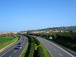
世界初の自動車専用道路であるベルリンのAVUSや、世界初の制御アクセス高速道路であるイタリアの湖畔高速道路(Autostrada dei Laghi)などは、現代の高速道路設計の基礎となりました。また、中央分離帯を広く設けた設計は、高速走行時の安全性を飛躍的に高めています。
![Part of the AVUS road in Berlin, the first automobile-only road.[19][20][21][22]](/images/45/b9/45b9d72c9f6da1ebed9c6a153afe20ec06b4cfcdfb96cea43fab2a6c6af601dd.jpg)
![The Italian Autostrada dei Laghi ("Lakes Highway" in the 1950s; now parts of the Autostrada A8 and the Autostrada A9), the first controlled-access highway ever built in the world[23][24]](/images/cb/1b/cb1b366bea902e3930eb107d3bc468b90645b63bc08306c34f2367ccb6666013.jpg)
道路インフラの概要まとめ
| 項目 | 詳細・特徴 | 主な影響要因 |
|---|---|---|
| 構造層 | 路盤 → 下層路盤 → 基層 → 表層 | 地盤の支持力、材料強度 |
| 劣化要因 | 凍結、熱、酸化、軸重負荷 | 気候変動、大型車両の通行量 |
| 設計寿命 | 8年 〜 60年(永久舗装は50年以上) | 予算、想定交通量、舗装材質 |
| 経済的影響 | 車両維持費、燃料効率、輸送時間 | 路面平坦性、渋滞状況 |
Frequently Asked Questions
道路の劣化はなぜ大型車で激しくなるのですか?
道路へのダメージは、車軸にかかる重量の4乗に比例するという経験則があるためです。これにより、重量のある大型トラックは、乗用車に比べて数千倍もの負荷を路面に与えることになります。
「設計寿命」とは具体的に何を指しますか?
舗装がその機能を維持し、大規模な修繕なしに利用できると想定された期間のことです。この期間を過ぎると、路面の再舗装や構造的な補強が必要になります。
道路の維持管理を怠るとどのような不利益がありますか?
路面の荒れにより、タイヤの摩耗や車両の故障が増え、ドライバーの維持費が増大します。また、走行性能の低下による燃料消費の増加や、事故リスクの上昇といった社会的な損失につながります。
世界で最も道路網が発達している国はどこですか?
総延長で見ると米国が世界最大であり、それに次いでインド、中国、ブラジルが大規模な道路ネットワークを保有しています。
ポットホール(路面の穴)ができる主な原因は何ですか?
主に雨水が路面に浸透して構造を弱めることや、車両の急ブレーキによる衝撃、あるいは不適切な建設工事などが複合的に作用して発生します。
References
- Lay, Maxwell G (1992). Ways of the World: A History of the World's Roads and of the Vehicles that Used Them. Rutgers University Press. .
Ways of the world Rutgers University Press, New Brunswick.
- "Glossary of Statistical Terms". OECD. 2004-02-26. Archived from the original on 2022-11-11. Retrieved 2007-07-17.
- "Illustrated Glossary for Transport Statistics" (PDF). International Transport Forum. Retrieved 2019-09-27.
- "Road Traffic Convention 1968" (PDF). unece.org. Retrieved 2019-09-27.
- "What is the difference between a road and a street?". Word FAQ. Dictionary.com (Lexico Publishing Group, LLC). 2007. Retrieved 2007-03-24.
- "Road Infrastructure Strategic Framework for South Africa; A Discussion Document". National Department of Transport (South Africa). Archived from the original on 2007-09-27. Retrieved 2007-03-24.
- Infrastructure. "National Transport Commission (Road Transport Legislation - Australian Road Rules) Regulations 2006". legislation.gov.au. Retrieved 2019-12-16.
- "Land Transport Act 1998 No 110 (as at 29 October 2019), Public Act Contents – New Zealand Legislation". legislation.govt.nz. Retrieved 2019-12-16.
- "What Is a road? | NZ Transport Agency". nzta.govt.nz. Retrieved 2019-12-16.
- "What is the legal definition of a road?". drivingtests.co.nz. Retrieved 2019-12-16.
📸 フォトギャラリー