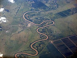
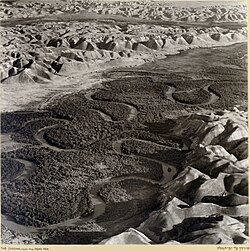
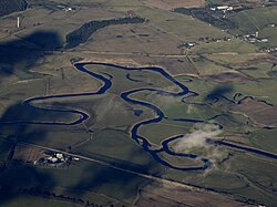
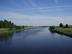
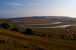
川の流れが緩やかに曲がり、うねるように流れる現象を蛇行(メアンダー)と呼びます。これは単なる偶然の形状ではなく、水の流れによる侵食と堆積というダイナミックな相互作用によって生み出される自然の造形です。河川が氾濫原を横切って移動し続けることで、風景は絶えず変化し、独特の地形が形成されます。
蛇行の度合いは「蛇行率(Sinuosity)」という指標で数値化されます。これは、実際の流路の長さと、谷の直線距離の比率で算出されます。一般的に、この比率が1.5以上の単一流路を持つ河川を「蛇行河川」と定義します。
Key Facts
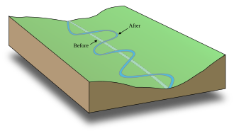
- 形成原理: 外側の岸で侵食が起こり、内側の岸で堆積が進むことで曲線が強まる。
- 三次元流: 水面付近では外側へ、河床付近では内側へ流れる「らせん流(ヘリコイダル流)」が重要な役割を果たす。
- 蛇行帯: 河道が周期的に移動する範囲のことで、通常は河道幅の15〜18倍の広がりを持つ。
- 三日月湖: 蛇行が激しくなり、流路がショートカット(切り離し)されることで取り残された湖。
蛇行を生み出す物理的メカニズム
らせん流と堆積のサイクル
蛇行の根本的な原因は、曲がった流路を流れる水と河床の相互作用にあります。ここで発生するのがらせん流(ヘリコイダル流)です。水は表面で外側の岸に向かい、そこで方向を変えて河床に沿って内側の岸へと戻るという立体的な流れを作ります。
この流れにより、外側の岸では土砂を運び去る力が強まり侵食が進む一方、内側の岸では流速が落ちて土砂が堆積します。この「外側で削り、内側で積もる」というサイクルが繰り返されることで、川のカーブは次第に大きくなっていきます。
流速と剪断応力の関係
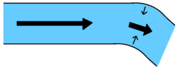
流体物理学の視点では、曲がり角の外側では流速が高くなるため、河床にかかる剪断応力(摩擦力)が増大し、激しい侵食が起こります。逆に内側では流速が低下し、運搬していた土砂が沈殿します。このプロセスにより、河道幅をほぼ一定に保ったまま、川はより複雑な曲線を描くようになります。
蛇行に伴う特徴的な地形
攻撃斜面とポイントバー
蛇行の頂点付近では、対照的な2つの地形が現れます。外側の急峻な崖のような部分は攻撃斜面(カットバンク)と呼ばれ、常に侵食にさらされています。対して、内側の緩やかな斜面には土砂が堆積してポイントバー(寄州)が形成されます。
流路の切り離しと三日月湖の誕生
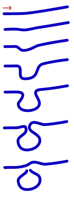
蛇行が極限まで進むと、隣り合うカーブの首の部分が非常に狭くなります。洪水などで大量の水が流れた際、水はこの狭い部分を突き破って直線的に流れようとします。これが「ネックカットオフ(首切り)」と呼ばれる現象です。
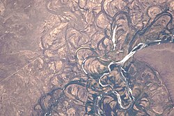
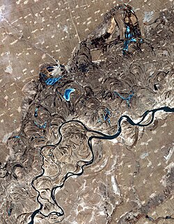
切り離された旧流路には水が残り、三日月のような形をした三日月湖(オックスボウ湖)となります。時間の経過とともに、この湖には微細な堆積物が溜まり、やがて消失して「蛇行痕(メアンダー・スカー)」として地表に残ります。
特殊な蛇行形態:嵌入蛇行
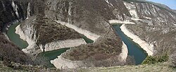
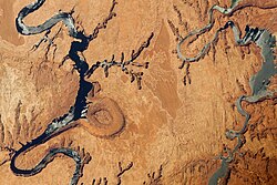
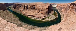
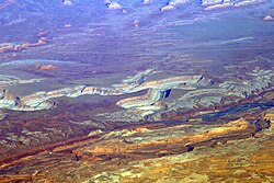
通常、蛇行は平坦な氾濫原で見られますが、地盤の隆起などにより河川が深く刻まれた場合、岩盤の中に深く切り込んだ蛇行が形成されます。これを嵌入蛇行(インサイズド・メアンダー)と呼びます。アメリカ南西部などで見られる「リンコン」と呼ばれる切り立った壁を持つ曲がり角も、この一種です。
スクロールバーの形成
ポイントバーが側方に移動し続けると、内側に平行な盛り上がりとくぼみの列ができることがあります。これをスクロールバーと呼びます。これは洪水時の高エネルギーな流れで粗い粒子が運ばれ、その後ゆっくりと細かい粒子が積もるという動的なプロセスによって形成されます。
蛇行の幾何学的特性まとめ
| 項目 | 一般的な数値・特徴 | 定義・備考 |
|---|---|---|
| 蛇行率 (Sinuosity) | 1.5 以上 | 流路長 ÷ 直線距離 |
| 蛇行長 | 河道幅の 10〜14倍 | 平均して約11倍 |
| 曲率半径 | 河道幅の 2〜3倍 | 頂点における曲がりの半径 |
| 蛇行帯の幅 | 河道幅の 15〜18倍 | 流路が変動する全範囲 |
Frequently Asked Questions
なぜ川は真っ直ぐに流れないのですか?
完全に真っ直ぐな流路であっても、わずかな不均一さによって流れに偏りが生じます。一度小さな曲がりができると、前述のらせん流による「外側侵食・内側堆積」のサイクルが加速し、自然と曲線的な形状へと発展するためです。
三日月湖は永遠に残り続けますか?
いいえ。三日月湖は本流から切り離されているため、流れが停滞します。洪水時に運ばれてきた微細な泥や有機物が底に堆積し続けるため、長い年月をかけて徐々に埋まり、最終的には湿地や陸地(蛇行痕)になります。
アインシュタインは蛇行について何を考えましたか?
アルベルト・アインシュタインは1926年、地球の自転によるコリオリの力が流速の不均衡を生み出し、それが蛇行のきっかけになるのではないかと提案しました。しかし、現在の地学的な見解では、コリオリの力よりも他の物理的な要因の方がはるかに支配的であると考えられています。
蛇行が激しいと人間社会にどのような影響がありますか?
蛇行河川は流路が絶えず移動するため、川沿いに建設された道路や橋などのインフラが侵食によって崩落したり、位置がずれたりするリスクがあります。そのため、土木工学的な対策が必要になる場合があります。
References
- Neuendorf, K.K.E., J.P. Mehl Jr., and J.A. Jackson, J.A., eds. (2005) Glossary of Geology (5th ed.). Alexandria, Virginia, American Geological Institute. 779 pp.
- Charlton, R., 2007. Fundamentals of fluvial geomorphology. Routledge, New York, New York. 234 pp.
- Leopold, L.B., Wolman, M.G., Wolman, M.G. and Wolman, M.G., 1957. River Channel Patterns: Braided, Meandering, and Straight. United States Geological Survey Professional Paper no. 282B, US Government Printing Office, Washington DC., 47 pp.
- "Meander". Merriam-Webster. Retrieved July 12, 2012.
- Leong, Goh Cheng (1995-10-27). Certificate Physics And Human Geography; Indian Edition. Oxford University Press. pp. 41–42. .
- "Meander". Online Etymology Dictionary. Retrieved July 12, 2012.
- , Geography, Book 12 Chapter 8 Section 15.
- Gürbüz, Alper; Kazancı, Nizamettin (2019). "The Büyük Menderes River: Origin of Meandering Phenomenon". Landscapes and Landforms of Turkey. World Geomorphological Landscapes. pp. 509–519. :10.1007/978-3-030-03515-0_29. . 134826361.
- Callander, R A (January 1978). "River Meandering". Annual Review of Fluid Mechanics. 10 (1): 129–158. :1978AnRFM..10..129C. :10.1146/annurev.fl.10.010178.001021.
- Weiss, Samantha Freeman. (April 2016). Meandering River Dynamics (Doctoral dissertation). Retrieved from Ideals. https://www.ideals.illinois.edu/bitstream/handle/2142/92706/WEISS-DISSERTATION-2016.pdf?sequence=1&isAllowed=y Archived 2016-12-24 at the
📸 フォトギャラリー