Map portraying ancestral Hohokam lands circa 1350
← ホームへ戻る

フェニックス太陽の谷に築かれたアリゾナ州のダイナミックな州都

🗓 2026年8月14日

アメリカ合衆国南西部の広大な大地に位置するフェニックスは、アリゾナ州の州都であり、北米でも有数の人口を誇る大都市です。「太陽の谷(Valley of the Sun)」という愛称で知られるこの街は、過酷な砂漠環境を克服し、現代的な都市機能と豊かな自然が見事に融合したユニークな景観を作り上げています。

主要な事実(Key Facts)

  • 人口規模: 市内人口は約160万人(2020年)、都市圏人口は480万人を超え、全米第10位の規模を誇ります。
  • 地理的特徴: ソノラ砂漠に囲まれ、標高は約331メートルです。
  • 経済: 2023年の都市圏GDPは約3,981億ドルに達し、医療、教育、政府機関が主要な雇用源となっています。
  • 気候: 極めて暑い夏季と穏やかな冬季が特徴の乾燥帯気候です。
  • 象徴: 都市のロゴには、不死鳥(フェニックス)が描かれています。

歴史の変遷:砂漠の集落から大都市へ

フェニックスの歴史は、1350年頃にこの地を拠点としていたホホカム族の灌漑システムにまで遡ります。彼らが築いた基礎の上に、1867年にジャック・スウィリングによって近代的な入植が始まりました。
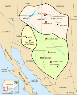
Map portraying ancestral Hohokam lands circa 1350

1881年に法人化されたこの街は、当初から農業の可能性を秘めていました。1870年に建てられたフィリップ・ダレル・ダッパのアドベ(日干し煉瓦)ハウスは、現在も市内で最古の住宅として残っており、初期の開拓時代の面影を伝えています。
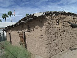
The Phillip Darrell Duppa adobe house was built in 1870 and is the oldest house in Phoenix. The homestead is named after "Lord" Darrell Duppa, an Englishman who is credited with naming Phoenix and Tempe as well as founding the town of New River.

20世紀に入ると、都市は急速な発展を遂げました。1885年頃の航空リトグラフや1908年のセントラル・アベニューの様子からは、静かな町から近代都市へと変貌していく過程が見て取れます。第二次世界大戦後には爆発的な人口増加を記録し、現在の巨大な都市圏へと成長しました。
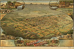
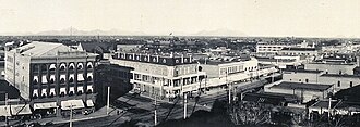
Refer to caption
Refer to caption
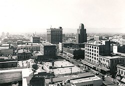
Photo of the skyline of downtown Phoenix circa 1940

地理と環境:ソノラ砂漠の生態系

フェニックスは、特有の植生を持つソノラ砂漠の真っ只中に位置しています。都市の景観は、近代的な高層ビル群と、周囲に広がる荒々しい自然のコントラストが特徴的です。
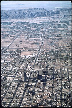
Phoenix in May 1972, with South Mountain in the background
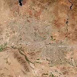
A photo taken from space of the Phoenix Area

南側にはサウスマウンテンなどの山々が連なり、都市の境界線を描いています。特にアワトゥキー地区などの住宅街からは、これらの山々の壮大な景色を望むことができます。
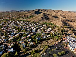
Aerial view of Ahwatukee neighborhoods and the South Mountains

都市計画においては「アーバン・ビレッジ(都市村)」という概念が導入されており、地域ごとの特性を活かした管理が行われています。
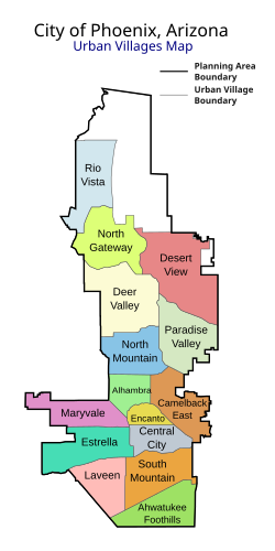
a graphic representation showing how Phoenix is broken up into 15 urban villages

周囲を囲むソノラ砂漠は、サボテンなどの乾燥地帯特有の植物が自生する貴重な生態系を保持しています。
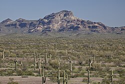
The Sonoran Desert surrounding Phoenix

気候の特徴と「ハブーブ」

フェニックスの気候は極端です。夏季の最高気温はしばしば40度を超え、年間を通じて強い日差しが降り注ぎます。また、夏季には「ハブーブ」と呼ばれる巨大な砂嵐が発生し、視界を遮るほどの砂が街を飲み込むことがあります。
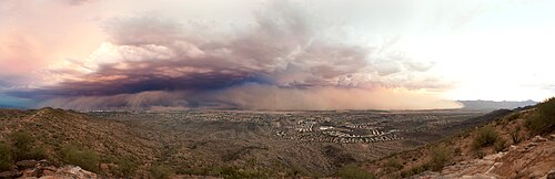
photo of a dust storm, called a haboob, sweeping in over the city of Phoenix

社会構造と経済のダイナミズム

人口構成は多様であり、特にヒスパニック・ラティーノ系の比率が高く、多文化共生社会を形成しています。所得水準や貧困率の分布には地域的な格差が見られますが、都市全体としては高い経済成長を維持しています。

Median household income across metro Phoenix; the darker the green, the higher the income.[142]
Percent of people living in poverty across metro Phoenix; the darker the red, the higher the concentration of poverty.[143]
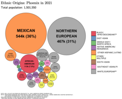
Ethnic origins in Phoenix
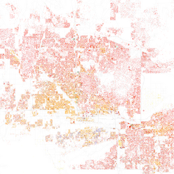
Map of racial distribution in Phoenix, 2010 U.S. census. Each dot is 25 people: ⬤ White ⬤ Black ⬤ Asian ⬤ Hispanic ⬤ Other

経済面では、バナーヘルス(Banner Health)やアリゾナ州政府、アマゾン、ウォルマート、アリゾナ州立大学などが主要な雇用主となっており、医療、行政、物流、教育の4つの柱が街を支えています。

文化・観光と都市の魅力

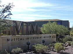
ダウンタウンには、近代的なオフィスビルと歴史的な建築物が共存しています。オルフェウム劇場のような芸術拠点や、15,000点以上の楽器を収蔵するミュージカル・インストゥルメント・ミュージアムは、世界中から観光客を惹きつけています。
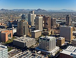
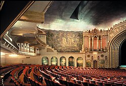
Downtown Phoenix
photo of the front entrance of the Orpheum theater, with the red marquee clearly displaying the Orpheum name, contrasted with the pale brown of the stone building
The Musical Instrument Museum features a collection of over 15,000 musical instruments

また、パブリックアートへの注力も見られ、ジャネット・エシェルマンによる巨大な吊り下げ作品などが都市に彩りを添えています。建築面では、フランク・ロイド・ライトの設計によるタリエシン・ウェストが、自然と建築の融合を示す傑作として知られています。
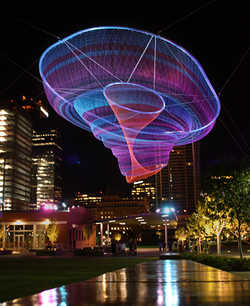
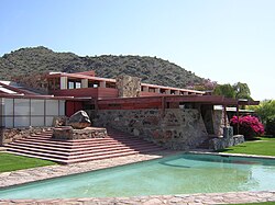
Her Secret is Patience by Janet Echelman
Taliesin West was a home and studio of Frank Lloyd Wright

自然を満喫したい人々には、砂漠植物園や動物園があるパパゴ・パーク、そしてハイキングコースとして人気のキャメルバック山が人気です。
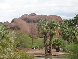
Papago Park is home to the Desert Botanical Garden, Hole-in-the-Rock butte and Phoenix Zoo
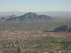
Camelback Mountain is part of the Phoenix Mountains range

スポーツの聖地として

フェニックスはスポーツ都市としても有名です。NFLのアリゾナ・カーディナルスが本拠地とするステートファーム・スタジアムは、過去に何度もスーパーボウルをホストした実績があります。また、NBAのフェニックス・サンズやMLBのアリゾナ・ダイヤモンドバックスなど、主要リーグのチームが揃っています。
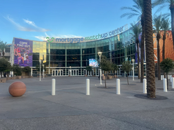
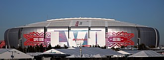
photo showing the semi-circular entrance to the Footprint Center in downtown Phoenix, blue sky in background
photo of State Farm Stadium taken from the parking lot, showing the domed stadium against an overcast sky

行政とインフラストラクチャ

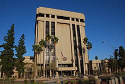
州都として、アリゾナ州議会がかつて置かれていた州議事堂(現在は博物館)や、最新の州議事堂エグゼクティブ・タワーなど、政治の中枢機能が集約されています。
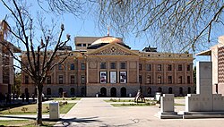
frontal view of the Arizona State Capitol, in winter, framed by the bare limbs of trees, showing the Arizona granite of the building topped by a copper dome
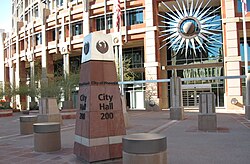
photos showing the short obelisk signage showing City Hall, and topped with the seal of the city, a stylized maroon phoenix. The semi-circular front of the building in the background, adorned with a stylized sunburst.
Arizona State Capitol Executive Tower at 1700 W. Washington St.

教育面では、アリゾナ州立大学(ASU)のダウンタウンキャンパスに位置するウォルター・クロンカイト・ジャーナリズム・スクールなどが、次世代のリーダーを育成しています。
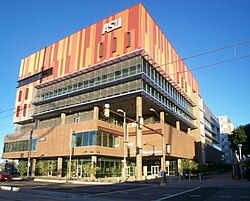
The Walter Cronkite School of Journalism and Mass Communication at the Arizona State University Downtown Phoenix campus

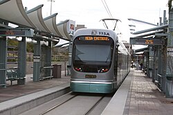
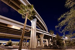
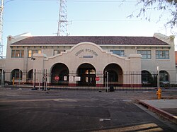
交通インフラも整備されており、スカイハーバー国際空港の管制塔や、ユニオンステーション、バレーメトロレールなどの公共交通機関が都市の血流となっています。また、州内を繋ぐI-10やI-17などの高速道路網は、物流の要となっています。
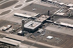
aerial view of Sky Harbor airport, showing the spoke structure of the terminals and gates, with the spike of the control tower toward the lower left of the picture.
front view of the southwestern architecture of the closed Union railroad station in Phoenix, surrounded by a chain link fence
photo of streamlined light rail car pulling into a station
photo showing the multiple levels of roadways at the interchange between Interstates ten and seventeen, called "the stack" in downtown Phoenix at night.

さらに、乾燥地帯であるこの街にとって生命線となるのが、セントラル・アリゾナ・プロジェクト(CAP)による大規模な運河システムです。これにより、遠方から水が供給され、都市の維持が可能となっています。
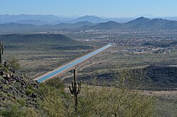
picture of a straight blue ribbon of water, the canal, running through the desert, from a vantage point of one of the mountains surrounding the city.

医療体制も充実しており、マリコパ・メディカルセンターなどの大規模施設が地域住民の健康を支えています。
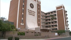
Maricopa Medical Center

また、世界的な視野を持つ都市として、日本(姫路市)を含む世界各国の都市と姉妹都市提携を結んでいます。
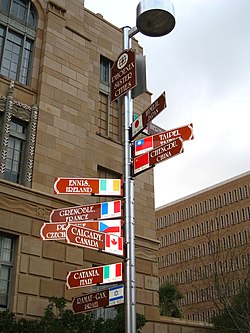
photo of signpost with ten signs pointing in the direction of Phoenix's sister cities, stating their names and distances from Phoenix.
ภาพประกอบบทความ

都市概要まとめ

項目 詳細
正式名称 フェニックス (Phoenix)
州・郡 アリゾナ州マリコパ郡
人口 (2020年) 1,608,139人
都市圏人口 4,845,832人
主要産業 医療、政府、教育、物流
気候区分 乾燥帯(ソノラ砂漠)
主要スポーツチーム Cardinals, Diamondbacks, Suns, Mercury

Frequently Asked Questions

フェニックスという名前の由来は何ですか?

ギリシャ神話に登場する、火の中から蘇る伝説の鳥「不死鳥(フェニックス)」にちなんで名付けられました。

この街の気候で特に注意すべき点はありますか?

夏季の極端な高温と、砂嵐(ハブーブ)への対策が必要です。また、非常に乾燥しているため、十分な水分補給が不可欠です。

主要な観光スポットはどこですか?

タリエシン・ウェスト、砂漠植物園、パパゴ・パーク、そして世界最大級の楽器コレクションを持つミュージカル・インストゥルメント・ミュージアムなどが有名です。

経済的にどのような産業が盛んですか?

バナーヘルスのような医療機関や、アリゾナ州政府、アリゾナ州立大学などの教育機関、そしてアマゾンのような物流拠点が経済を牽引しています。

水不足の問題にはどのように対処していますか?

セントラル・アリゾナ・プロジェクト(CAP)という大規模な運河システムを通じて、外部から水を輸送し、都市の生活用水や農業用水を確保しています。

References

  1. Mean monthly maxima and minima (i.e. the highest and lowest temperature readings during an entire month or year) calculated based on data at said location from 1991 to 2020.
  2. Official records for Phoenix kept at downtown August 1895 to September 1953, and at Sky Harbor Int'l since October 1953. For more information see ThreadEx.

📸 フォトギャラリー

Map portraying ancestral Hohokam lands circa 1350
The Phillip Darrell Duppa adobe house was built in 1870 and is the oldest house in Phoenix. The homestead is named after "Lord" Darrell Duppa, an Englishman who is credited with naming Phoenix and Tempe as well as founding the town of New River.
Refer to caption
Refer to caption
Photo of the skyline of downtown Phoenix circa 1940
Phoenix in May 1972, with South Mountain in the background
A photo taken from space of the Phoenix Area
Aerial view of Ahwatukee neighborhoods and the South Mountains
a graphic representation showing how Phoenix is broken up into 15 urban villages
The Sonoran Desert surrounding Phoenix
photo of a dust storm, called a haboob, sweeping in over the city of Phoenix
Median household income across metro Phoenix; the darker the green, the higher the income.[142]
Percent of people living in poverty across metro Phoenix; the darker the red, the higher the concentration of poverty.[143]
Ethnic origins in Phoenix
Map of racial distribution in Phoenix, 2010 U.S. census. Each dot is 25 people: ⬤ White ⬤ Black ⬤ Asian ⬤ Hispanic ⬤ Other
Downtown Phoenix
photo of the front entrance of the Orpheum theater, with the red marquee clearly displaying the Orpheum name, contrasted with the pale brown of the stone building
The Musical Instrument Museum features a collection of over 15,000 musical instruments
Her Secret is Patience by Janet Echelman
Taliesin West was a home and studio of Frank Lloyd Wright
Papago Park is home to the Desert Botanical Garden, Hole-in-the-Rock butte and Phoenix Zoo
photo showing the semi-circular entrance to the Footprint Center in downtown Phoenix, blue sky in background
photo of State Farm Stadium taken from the parking lot, showing the domed stadium against an overcast sky
Camelback Mountain is part of the Phoenix Mountains range
frontal view of the Arizona State Capitol, in winter, framed by the bare limbs of trees, showing the Arizona granite of the building topped by a copper dome
photos showing the short obelisk signage showing City Hall, and topped with the seal of the city, a stylized maroon phoenix. The semi-circular front of the building in the background, adorned with a stylized sunburst.
Arizona State Capitol Executive Tower at 1700 W. Washington St.
The Walter Cronkite School of Journalism and Mass Communication at the Arizona State University Downtown Phoenix campus
aerial view of Sky Harbor airport, showing the spoke structure of the terminals and gates, with the spike of the control tower toward the lower left of the picture.
front view of the southwestern architecture of the closed Union railroad station in Phoenix, surrounded by a chain link fence
photo of streamlined light rail car pulling into a station
photo showing the multiple levels of roadways at the interchange between Interstates ten and seventeen, called "the stack" in downtown Phoenix at night.
picture of a straight blue ribbon of water, the canal, running through the desert, from a vantage point of one of the mountains surrounding the city.
Maricopa Medical Center
photo of signpost with ten signs pointing in the direction of Phoenix's sister cities, stating their names and distances from Phoenix.
ภาพประกอบบทความ