南アメリカ大陸の最南端に位置するパタゴニアは、アルゼンチンとチリの二国にまたがる広大な地域です。険しい山脈、巨大な氷河、そして果てしなく続く草原が織りなすこの地は、地球上でも有数の野生味が残る場所として知られています。
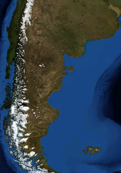
主要な事実(Key Facts)
- 地理的範囲:アルゼンチン東部とチリ西部に分かれ、総面積は約104万平方キロメートルに及びます。
- 人口密度:広大な面積に対し人口は約200万人と非常に少なく、1平方キロメートルあたり約1.9人と極めて低密度です。
- 気候の特徴:西海岸(チリ側)は冷涼な海洋性気候で降水量が多く、東側(アルゼンチン側)は乾燥した傾向にあります。
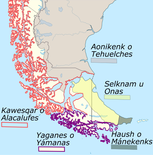
- 歴史的背景:先住民族テウェルチェなどが居住し、後にマゼランなどの欧州探検家によって世界に知られました。
パタゴニアの地理と行政区分
パタゴニアはアンデス山脈を境に、大きく二つの領域に分かれています。東側のアルゼンチン側は、ネウケン、リオネグロ、チュブ、サンタクルス、ティエラ・デル・フエゴの5つの州と、ブエノスアイレス州の一部(パタゴネス地区)で構成されています。
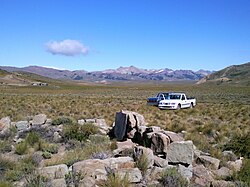
一方、西側のチリ側は、ロス・ラゴス、パレナ、アイセン、マガジャネスの4つの地域に分かれています。特に南部のアイセンとマガジャネスは「ゾナ・アウストラル(最南部地域)」と呼ばれ、さらに人口密度が低いエリアとなっています。
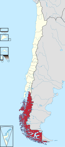
主要都市の分布
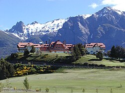
地域最大の都市の一つであるネウケン(アルゼンチン)やプエルトモント(チリ)などは、経済や交通の拠点として機能しています。また、観光地として名高いサン・カルロス・デ・バリローチェは、パタゴニア全域で最大の観光目的地となっています。
自然環境と地質学的特徴
地質学的には、フインクル断層がパタゴニアの境界を形成していると考えられています。この地の成り立ちについては、2億5千万年から2億7千万年前のペルム紀に南極から分離して南米に合流したという説や、より近隣から形成されたという説など、専門家の間でも議論が続いています。
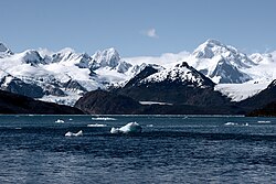
気候は地域によって劇的に異なります。チリ側の西海岸では、年間降水量が2,000mmから、局所的なマイクロクライメイト(微気候)では7,000mmを超える猛烈な雨が降る場所もあります。対照的に、北東部のアルゼンチン側では年間降水量が300mmを下回る乾燥地帯が広がっています。
豊かな野生動物
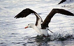
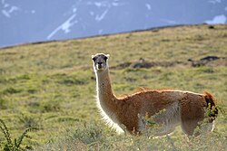
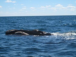
この過酷な環境には、独自の生態系が育まれています。草原ではグアナコなどのラクダ科の動物が闊歩し、海岸線付近ではクロブロウアホウドリなどの海鳥や、バルデス半島周辺ではクジラなどの海洋生物が観察できます。
パタゴニアの歴史と文化
先史時代から欧州人の到達まで
人類の居住は非常に古く、チリのモンテベルデでは約14,500年前の痕跡が見つかっています。紀元前10,000年頃からは、絶滅した巨大地上ナマケモノ(ミロドン)や野生馬(ヒッピディオン)を狩っていた文化が広がっていたと考えられています。
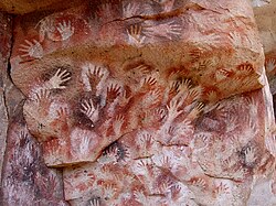
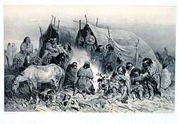
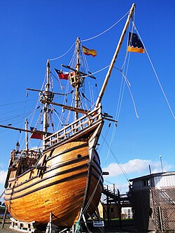
「パタゴニア」という名称は、1520年にフェルディナンド・マゼランがこの地の先住民(テウェルチェ族)を「巨人のような人々(パタゴン)」と呼んだことに由来します。彼らは当時の欧州人よりも背が高かったため、このような呼称がつきました。
植民地化と国境の変遷
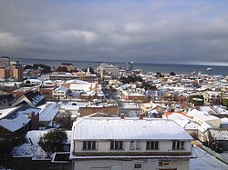
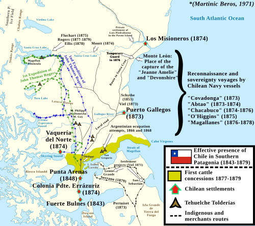
16世紀以降、スペインによる拠点作りが進みましたが、19世紀に入るとチリとアルゼンチンの両国による本格的な入植が始まりました。チリは1843年にフエルテ・ブルネスを建設し、後にプンタ・アレナスを拠点としてマゼラン海峡の支配権を確立しました。
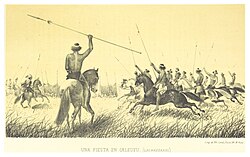
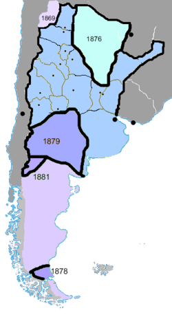
アルゼンチン側では、ロカ将軍による「砂漠の征服」作戦を通じて、内陸部への支配力を強めていきました。この過程で先住民との激しい衝突や、マプチェ族による家畜略奪などの紛争が発生しました。
経済の変遷:羊毛からエネルギーへ
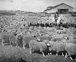
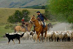
19世紀後半から20世紀にかけて、パタゴニアの主要産業は羊毛生産でした。広大な土地を利用した大規模な羊牧場が運営され、ガウチョ(カウボーイ)たちが家畜を管理する文化が根付きました。しかし、世界的なウール市場の衰退に伴い、現在は石油や天然ガスの採掘といったエネルギー産業が経済の柱となっています。
地域概要まとめ
| 項目 | アルゼンチン側(東) | チリ側(西) |
|---|---|---|
| 主な行政区分 | 5つの州(ネウケン、リオネグロ等) | 4つの地域(ロス・ラゴス、マガジャネス等) |
| 気候特性 | 乾燥・半乾燥地帯 | 冷涼な海洋性気候・多雨 |
| 主要産業 | エネルギー採掘、観光、畜産 | 漁業、観光、畜産 |
| 代表的な都市 | ネウケン、サン・カルロス・デ・バリローチェ | プエルトモント、プンタ・アレナス |
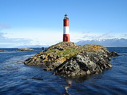
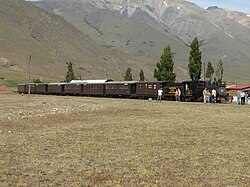
現代のパタゴニアは、その圧倒的な自然景観を活かした観光業が盛んです。ウシュアイアの灯台や、かつての輸送手段であった観光列車「ラ・トロチータ」などは、訪れる人々を魅了し続けています。
よくある質問(FAQ)
パタゴニアという名前の由来は何ですか?
1520年に探検家マゼランが、この地に住んでいた先住民(テウェルチェ族)を、当時の欧州人より背が高かったため「パタゴン(巨人)」と呼んだことが由来とされています。
アルゼンチンとチリでパタゴニアの環境はどう違いますか?
チリ側は太平洋に面しており、非常に雨が多く冷涼な海洋性気候です。一方、アルゼンチン側はアンデス山脈に遮られているため、乾燥した草原やステップ地帯が広がっています。
かつての主要産業は何でしたか?
19世紀から20世紀半ばにかけては、羊の飼育による羊毛生産が最大の産業でした。現在は、石油や天然ガスなどのエネルギー資源の開発が重要な経済的役割を担っています。
パタゴニアに住んでいた先住民は誰ですか?
主にテウェルチェ族などが居住していました。また、北部のパタゴニアではマプチェ族が移動し、独自の文化や社会を形成していました。
パタゴニアの人口密度が低いのはなぜですか?
極めて厳しい気候条件、険しい地形、そして広大な未開地が多いためです。そのため、人口は少数の主要都市に集中する傾向があります。
![Community of jurisdictions of the Governorate of La Plata and the Captaincy General of Chile between 1570 and 1661 according to Manuel Ravest Mora[74]](/images/bd/85/bd85a74cea23b6f296bce5e31bef25123fefbfc77072f12e7dbc2ea4fbb4f639.webp)
![Map of the East Patagonia, Tierra del Fuego and Strait of Magellan Dispute. In blue and green are the boundaries claimed by Argentine[83] and Chilean[84][85][86][87] historians respectably as uti possidetis iuris in Patagonia.](/images/d3/66/d3666dfa95b2594ca8e34c9e46c411d5b6517638a73666b5b854a18d136dcc27.webp)
![Territorial losses of the Republic of Chile de jure (by law) according to Chilean historiography[89]](/images/a6/4c/a64ce641608bf9d252f5951f111d67383229cc982c6c317b62d9b53fbee2c2a8.webp)
References
- "Patagonia". Encyclopaedia Britannica. Retrieved 21 November 2025.
- "South America: Patagonia Region". World Wildlife Fund. Retrieved 21 November 2025.
- Rabassa, Jorge (2008). The Late Cenozoic of Patagonia and Tierra del Fuego. Elsevier. pp. 1–12.
- The Late Cenozoic of Patagonia and Tierra del Fuego Volumen 11 de Developments in quaternary science, p. 13. Author: Jorge Rabassa. Editor: Jorge Rabassa. Editor: Elsevier, 2008. , 9780444529541
- Manuel Enrique Schilling; Richard Walter Carlson; Andrés Tassara; Rommulo Vieira Conceição; Gustavo Walter Bertotto; Manuel Vásquez; Daniel Muñoz; Tiago Jalowitzki; Fernanda Gervasoni; Diego Morata (2017). "The origin of Patagonia revealed by Re-Os systematics of mantle xenoliths." Precambrian Research, volumen 294: 15–32.
- Zunino, H.; Matossian, B.; Hidalgo, R. (2012). "Poblamiento y desarrollo de enclaves turísticos en la Norpatagonia chileno-argentina. Migración y frontera en un espacio binacional." (Population and development of tourist enclaves in the Chilean-Argentine Norpatagonia. Migration and the border in a binational space), , 53: 137–158.
- Zunino, M.; Espinoza, L.; Vallejos-Romero A. (2016) Los migrantes por estilo de vida como agentes de transformación en la Norpatagonia chilena, Revista de Estudios Sociales, 55 (2016): 163–176.
- Ciudadanía, territorio y desarrollo endógeno: resistencias y mediaciones de las políticas locales en las encrucijadas del neoliberalismo. P. 205. Authors: Rubén Zárate, Liliana Artesi, Oscar Madoery. Editor: Editorial Biblos, 2007. , 9789507866166
- Bengoa, José (2000). Historia del pueblo mapuche: Siglo XIX y XX. Lom Ediciones. pp. 25–32.
- Bridges, Lucas (1948). The Uttermost Part of the Earth. Hodder and Stoughton. pp. 37–45.
📸 フォトギャラリー