北米の最北端から南米の南端まで、地球上の二つの大陸を縦断する壮大な道路ネットワークが存在します。それがパンアメリカンハイウェイです。総延長は約30,000キロメートルに及び、カナダ、アメリカ、メキシコを含む北米から、中米、そして南米のアルゼンチンやチリに至るまで、計14カ国を繋ぐ世界最大級の道路システムです。
主要な事実(Key Facts)
- 総延長:約30,000km(19,000マイル)
- 接続国数:14カ国(カナダ、アメリカ、メキシコ、グアテマラ、エルサルバドル、ホンジュラス、ニカラグア、コスタリカ、パナマ、コロンビア、エクアドル、ペルー、チリ、アルゼンチン)
- 北端:アメリカ合衆国 アラスカ州 プルドーベイ
- 南端:アルゼンチン ウシュアイア
- 最大の中断点:パナマとコロンビアの間に位置する「ダリエン・ギャップ」
構想から建設までの歴史
大陸の端から端までを陸路で結ぶというアイデアは、もともと鉄道として計画されていました。1884年に米国議会で鉄道システムの構築案が可決され、1889年の第1回パンアメリカン会議でも議論されましたが、実現には至りませんでした。その後、1903年のパナマ独立とパナマ運河の建設開始に伴い、鉄道構想は放棄されました。
その後、道路による接続へと方向転換し、1937年7月29日に「パンアメリカンハイウェイ条約」が締結されました。これにより、北米および中南米の諸国が迅速な建設に合意しました。ラテンアメリカ諸国の中で最初に自国区間の整備を完了させたのは、1950年のメキシコでした。
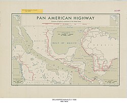
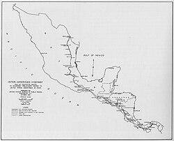
北米セクション:アラスカからパナマまで
アラスカとカナダのルート
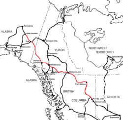
北端のプルドーベイから始まるルートは、アラスカハイウェイを経由してカナダへと至ります。カナダ国内には「パンアメリカンハイウェイ」として公式に指定された単一の道路はありませんが、国道システムやトランスカナダハイウェイなどが実質的な役割を果たしています。ブリティッシュコロンビア州のハイウェイ97号線や、アルバータ州のハイウェイ2号線などが、米国境へと繋がる重要な経路となっています。
アメリカ合衆国本土の経路
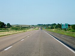
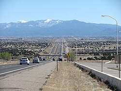
米国本土では、州間高速道路(インターステート)が公式なルートとして組み込まれています。特に、テキサス州ラレドからミネソタ州デュルースまでを結ぶ州間高速道路35号線(I-35)は、メキシコの連邦道路85号線の延長線上にあり、実質的な幹線ルートとなっています。また、ニューメキシコ州の州間高速道路25号線(I-25)の一部は「パンアメリカン・フリーウェイ」と称され、歴史的なカミノ・レアルの経路を辿っています。
メキシコと中米の走行
メキシコでは、メキシコシティを経由するルートのほか、米国境へ向かう複数の支線(ノガレス、エルパソ、イーグルパス、ファー、ブラウンズビル方面)が整備されています。メキシコシティ以南では、プエブラ州やオアハカ州を経て、山岳地帯やジャングルを通りグアテマラへと向かいます。
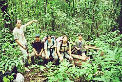
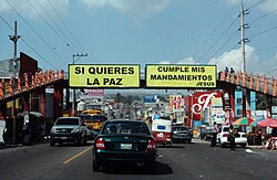
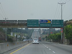
中米セクション(インターアメリカンハイウェイ)は、グアテマラ、エルサルバドル、ホンジュラス、ニカラグア、コスタリカを経てパナマに至ります。この区間では、マヤ遺跡の近くを通るルートや、中米最大のニカラグア湖を望む景色、コスタリカのタラマンカ山脈などの多様な地形を走行します。
パナマの終着点と「ダリエン・ギャップ」
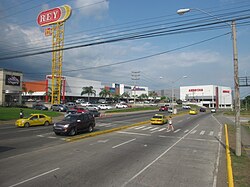
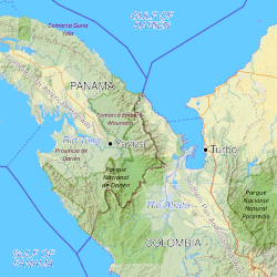
北米セクションの公式な終点は、パナマのヤビザです。ここから南東方向には、ダリエン・ギャップと呼ばれる約100kmの険しい山岳ジャングル地帯が広がっています。このエリアは自然環境が極めて厳しく、道路が途切れているため、車両で南米へ渡ることは不可能です。
南米セクション:コロンビアからアルゼンチンまで
南米セクションはコロンビアのトゥルボから再開します。コロンビア国内では、メデジンや首都ボゴタを結ぶ複雑な道路網(国道40号線や25号線など)が構成されており、多くの区間で有料道路が導入されています。
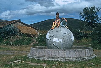
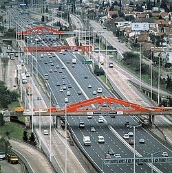
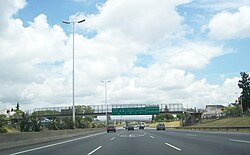
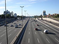
その後、ルートはエクアドル、ペルー、チリを経て、南端のアルゼンチン・ウシュアイアへと至ります。エクアドルのカイアンベ付近では赤道記念碑を通過し、チリのアタカマ砂漠などの極限環境を走行します。アルゼンチン国内では、ブエノスアイレス周辺の近代的な高速道路網へと接続されます。
ルート概要まとめ
| セクション | 主要通過国 | 特徴・備考 |
|---|---|---|
| 北米セクション | カナダ、アメリカ、メキシコ、中米諸国、パナマ | アラスカからパナマのヤビザまで。州間高速道路などが利用される。 |
| 中断区間 | パナマ 〜 コロンビア間 | ダリエン・ギャップ(未舗装のジャングル地帯)により分断。 |
| 南米セクション | コロンビア、エクアドル、ペルー、チリ、アルゼンチン | トゥルボからウシュアイアまで。アンデス山脈や砂漠を縦断。 |
挑戦の記録
この途方もない距離に挑む人々もいます。2025年には、カナダのアシュリー・マイルズ氏が、女性として初めて自転車でパンアメリカンハイウェイ全線を走破しました。彼女はこの快挙を118日間で成し遂げました。
よくある質問(FAQ)
パンアメリカンハイウェイは一本の道で繋がっていますか?
いいえ、完全に繋がっているわけではありません。パナマとコロンビアの間にある「ダリエン・ギャップ」という未開のジャングル地帯で道路が途切れているため、車両で移動する場合は船などで迂回する必要があります。
世界で最も長い道路と言われる理由は?
アラスカのプルドーベイからアルゼンチンのウシュアイアまで、南北アメリカ大陸のほぼ全域をカバーする約30,000kmという圧倒的な総延長を持つためです。
ルート上の公式な指定はどうなっていますか?
国によって異なります。アメリカでは州間高速道路が公式ルートとして組み込まれていますが、カナダのように特定の道路を「パンアメリカンハイウェイ」として公式指定していない国もあります。
建設の目的は何でしたか?
もともとは鉄道として計画されていましたが、最終的には道路網として、南北アメリカ諸国間の交通、貿易、および外交関係を促進し、大陸全体の連結性を高めることを目的として建設されました。
References
- Schwartz, Max (November 19, 2021). "The birth of the Pan-American Highway in Costa Rica". . Archived from the original on September 23, 2023. Retrieved November 20, 2021.
- Cortina, José Manuel (1957) [1954]. La Carretera Panamericana y el circuito del Caribe: Pinar del Río, puente de América: conferencia pronunciada en la sesión celebrada por el Club de Leones de la Habana, en el Hotel Sevilla, el martes 15 de septiembre de 1953 (2nd ed.). Havana. 27001400.
- Dent, David W. (2008). Hot spot: Latin America. Westport, Connecticut: . p. 84. .
- "U.S. Gives Road Building Tips at Pan-American Meet", Chicago Daily Tribune, October 4, 1925, p.2
- Text of the Convention Archived February 16, 2022, at the .
- "Highway Run". Harper's. July 2006. pp. 70–80.
- Alikpala, Gidget (April 11, 2023). "Where does the Pan-American Highway start and finish? How long is it?". AS USA. Archived from the original on December 2, 2024. Retrieved December 2, 2024.
- "Yukon road map" (PDF). www.hpw.gov.yk.ca. Archived from the original (PDF) on April 26, 2017. Retrieved August 6, 2017.
- "Road map of British Columbia". www.hellobc.com. Archived from the original on September 2, 2017. Retrieved August 6, 2017.
- (c. 1974). American Motorist.
📸 フォトギャラリー