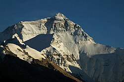
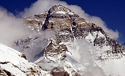
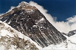
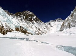
North Face of Everest as seen from the path to North Base Camp
← ホームへ戻る

エベレスト世界最高峰の地理、歴史、そして登頂への挑戦

🗓 2026年8月11日

地球上で最も高い地点、エベレスト。ネパールと中国(チベット自治区)の国境にそびえ立つこの山は、単なる地理的な最高点ではなく、人類の限界への挑戦と自然の畏怖を象徴する場所です。地元ではネパール語で「サガルマータ(空の頭)」、チベット語で「チョモランマ(聖なる母)」と呼ばれ、古くから信仰の対象となってきました。

標高8,848.86メートルという圧倒的な高さを持つこの山は、ヒマラヤ山脈のマハラングル・ヒマルに属しています。その険しい山容は、世界中の登山家を惹きつけて止みません。
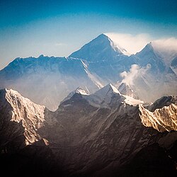
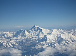
View from the south (Nepal) shows Everest rising behind the ridge connecting Nuptse and Lhotse; in the foreground are Thamserku, Kangtega, and Ama Dablam

Key Facts

  • 最高標高: 8,848.86メートル(世界第1位)
  • 所在地: ネパール(コシ州)および中国(チベット自治区)の国境
  • 別名: サガルマータ(ネパール名)、チョモランマ(チベット名)
  • 初登頂: 1953年5月29日(エドモンド・ヒラリーとテンジン・ノルゲイ)
  • 世界遺産: サガルマータ国立公園の一部として1979年に登録

地理的特徴と過酷な環境

エベレストは、北面、南面、そして東面のカングシュン・フェイスという3つの主要な側面に分かれています。地形は極めて複雑で、氷河や急峻な岩壁が連続しています。
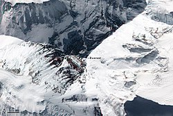
Top down view showing the location of the summit, and its three main faces/sides

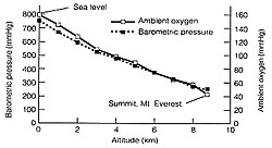
特に登頂ルート上の「クンブ・アイスフォール」は、絶えず崩落の危険がある氷の迷宮として知られ、登山者にとって最大の難所の一つです。また、標高8,000メートルを超える領域はデスゾーン(死の地帯)と呼ばれます。ここでは気圧が海面下の約3分の1まで低下し、酸素濃度が極端に低いため、人体は徐々に衰弱していきます。
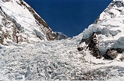
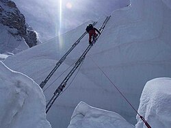
The Khumbu Icefall in 2005
Climber traversing Khumbu Icefall

気候は極めて厳しく、山頂付近の平均最低気温は1月から2月にかけてマイナス36度まで下がります。このような極限状態の中、登山者は酸素マスクなどの補助設備を頼りに頂上を目指します。
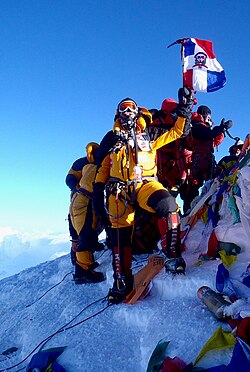
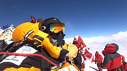
Climber at the summit wearing an oxygen mask
Available oxygen at Everest

登頂の歴史と記録

エベレストの正体が世界最高峰であると確認されたのは19世紀半ばのことでした。1856年の演説で初めて「エベレスト」という名称が提案され、その後正式に採用されました。
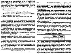
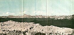
The name "Mount Everest" was first proposed in this 1856 speech, later published in 1857, in which the mountain was first confirmed as the world's highest.
1890 graphic with the Himalayas, including Gaurisankar (Mount Everest) in the distance

その後、数多くの遠征隊が挑みましたが、1953年にイギリス遠征隊のエドモンド・ヒラリーとシェルパのテンジン・ノルゲイが人類として初めて山頂に到達しました。この快挙は世界中に衝撃を与え、登山史における金字塔となりました。

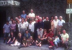
Edmund Hillary and Tenzing Norgay
Reunion of the 1953 British team

1970年代以降は、さらなる限界への挑戦が続きました。1978年にはラインホルト・メスナーとペーター・ハーベラーが、補助酸素なしでの初登頂に成功。その後、冬季登頂やソロ登頂、さらには視覚障害を持つ登山家による登頂など、多様な記録が塗り替えられてきました。
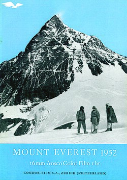
1952 documentary

現代の登山とルート

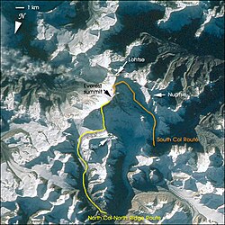
現在、最も一般的なルートはネパール側からの「南東稜ルート」です。登山者はベースキャンプから始まり、複数のキャンプを経由して山頂を目指します。
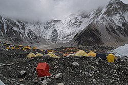
Everest Base Camp
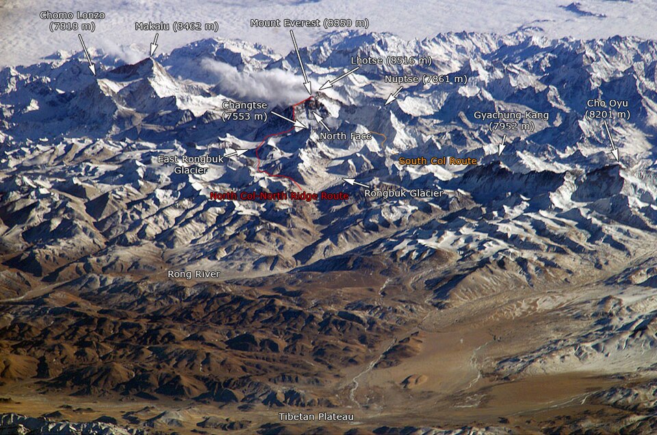
Overview South Col route and North Col/Ridge route

ルート上の重要なポイントに「ヒラリー・ステップ」と呼ばれる岩壁がありますが、近年の地殻変動や崩落によりその形状が変化したと報告されており、登山コミュニティで議論を呼んでいます。
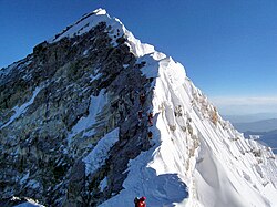
Looking up along the southern ridgeline in 2010, the face of the Hillary Step is visible. The top of the Southwest Face is on the left in shadow, and to the right is the top of the East/Kangshung Face. In 2016 and 2017 there were reports the Hillary Step was changed, which triggered discussion in the climbing community.

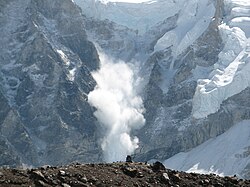
一方で、商業登山ツアーの普及により、登頂者数は増加傾向にあります。しかし、それに伴いルートの混雑やゴミ問題、そして雪崩による悲劇的な事故も後を絶ちません。2014年や2015年には大規模な雪崩が発生し、多くの命が失われました。
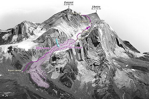
The location of the fatal ice avalanche on the 2014 route, and the revised 2015 route through the Khumbu
Small avalanche on Everest, 2006

また、近年ではヘリコプターによる高高度への輸送や、最新の気象観測技術の導入など、登山環境は変化し続けています。
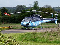
Photo of a Eurocopter AS350 B3 "Squirrel"

エベレストの概要まとめ

エベレストの基本データ
項目 詳細
標高 8,848.86 m
主要ルート 南東稜(ネパール側)、北稜(中国側)
主要キャンプ標高 ベースキャンプ(5,400m) 〜 キャンプ4(8,000m)
気圧(山頂) 約33.7 kPa(海面下の約33%)
管理団体 ネパール政府、中国政府

山麓にはロンブク僧院などの宗教施設があり、今もなお多くの人々が精神的な拠り所としてこの山を仰いでいます。
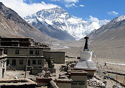
The Rongbuk Monastery, with Mount Everest in the background
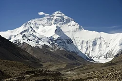
Mount Everest North Face from Rongbuk in Tibet
The summit of Mount Everest from the North side
North Face of Everest as seen from the path to North Base Camp
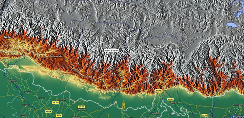
Mount Everest relief map
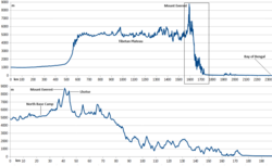
Profiles of the full elevation of Mount Everest
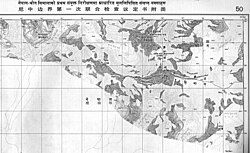
Published by the Survey of Nepal, this is Map 50 of the 57 map set at 1:50,000 scale "attached to the main text on the First Joint Inspection Survey, 1979–80, Nepal-China border." At the top centre, a boundary line, identified as separating "China" and "Nepal", passes through the summit contour. The boundary here and for much of the China–Nepal border follows the main Himalayan watershed divide.
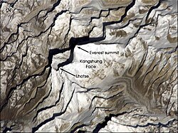
Kangshung Face (the east face) as seen from orbit
ภาพประกอบบทความ
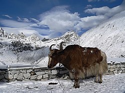
A yak at around 4,790 m (15,720 ft)
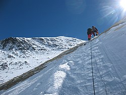
Climbers below the Geneva Spur
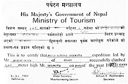
Confirmation of the summit obtained by Nepal's Ministry of Tourism
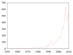
Ascents of Mount Everest by year through 2010
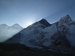
The sun rising on Everest in 2011
Selfie on the summit, 2012
Gorak Shep is about a three-hour walk to South EBC (Everest Base Camp).[233]
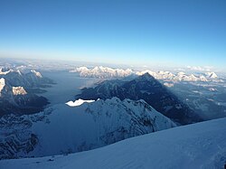
A view from the summit of Mount Everest in May 2013
From Kala Patthar, Nepal
Everest in September 2006
The Western Cwm ("Coom"), with Everest on the left and Lhotse to the right

Frequently Asked Questions

エベレストの標高はなぜ変動するのですか?

地殻変動や地震などの地質学的な要因により、標高はわずかに変化します。最新の公式標高はネパールと中国の合意により8,848.86メートルとされています。

デスゾーン」とは具体的にどのような場所ですか?

標高8,000メートル以上の領域を指します。酸素濃度が極めて低いため、補助酸素なしでは人体が維持できず、意識混濁や高山病などの深刻なリスクが急増する危険なエリアです。

登頂にはどのような許可が必要ですか?

ネパール政府などの当局から登山許可(パーミット)を取得する必要があります。発行数は年によって異なりますが、近年では数百件の許可が出されています。

補助酸素なしで登頂することは可能ですか?

可能です。1978年にラインホルト・メスナーらが初めて成功させましたが、極めて高度な身体能力と精神力が必要であり、非常にリスクの高い挑戦となります。

エベレストに登るのに最適な時期はいつですか?

一般的に、天候が比較的安定し、登頂のチャンス(ウィンドウ)が現れやすい5月頃が最も多くの登山者が山頂を目指す時期です。

References

  1. From
  2. Based on the 2020 surveys of elevation of snow cap, i.e. the highest point of permanent snow ice on the summit—as opposed to the highest point of rock, which was measured at roughly 8,844 metres. For more details, see .
  3. The position of the summit of Everest on the international border is clearly shown on detailed topographic mapping, including official Nepali mapping.
  4. It remains unclear whether and reached the summit in 1924 or not. For more details, see .
  5. The "base" of a mountain is a problematic notion in general with no universally accepted definition. However, for a peak rising out of relatively flat terrain, such as Mauna Kea or Denali, an "approximate" height above "base" can be calculated. Everest is more complicated since it only rises above relatively flat terrain on its north (Tibetan Plateau) side. Hence the concept of "base" has even less meaning for Everest than for Mauna Kea or Denali, and the range of numbers for "height above base" is wider. In general, comparisons based on "height above base" are somewhat suspect.
  6. In the table below, the temperature given is the average lowest temperature recorded in that month. So, in an average year, the lowest recorded July temperature will be −18 degrees Celsius, and the lowest recorded January temperature will be −36 degrees Celsius.

📸 フォトギャラリー

North Face of Everest as seen from the path to North Base Camp
View from the south (Nepal) shows Everest rising behind the ridge connecting Nuptse and Lhotse; in the foreground are Thamserku, Kangtega, and Ama Dablam
The name "Mount Everest" was first proposed in this 1856 speech, later published in 1857, in which the mountain was first confirmed as the world's highest.
1890 graphic with the Himalayas, including Gaurisankar (Mount Everest) in the distance
Mount Everest relief map
Profiles of the full elevation of Mount Everest
Published by the Survey of Nepal, this is Map 50 of the 57 map set at 1:50,000 scale "attached to the main text on the First Joint Inspection Survey, 1979–80, Nepal-China border." At the top centre, a boundary line, identified as separating "China" and "Nepal", passes through the summit contour. The boundary here and for much of the China–Nepal border follows the main Himalayan watershed divide.
Kangshung Face (the east face) as seen from orbit
ภาพประกอบบทความ
A yak at around 4,790 m (15,720 ft)
Climbers below the Geneva Spur
Reunion of the 1953 British team
1952 documentary
Edmund Hillary and Tenzing Norgay
Confirmation of the summit obtained by Nepal's Ministry of Tourism
Small avalanche on Everest, 2006
Ascents of Mount Everest by year through 2010
The sun rising on Everest in 2011
Selfie on the summit, 2012
The location of the fatal ice avalanche on the 2014 route, and the revised 2015 route through the Khumbu
Looking up along the southern ridgeline in 2010, the face of the Hillary Step is visible. The top of the Southwest Face is on the left in shadow, and to the right is the top of the East/Kangshung Face. In 2016 and 2017 there were reports the Hillary Step was changed, which triggered discussion in the climbing community.
Top down view showing the location of the summit, and its three main faces/sides
Everest Base Camp
Gorak Shep is about a three-hour walk to South EBC (Everest Base Camp).[233]
Overview South Col route and North Col/Ridge route
Climber traversing Khumbu Icefall
Mount Everest North Face from Rongbuk in Tibet
A view from the summit of Mount Everest in May 2013
The summit of Mount Everest from the North side
From Kala Patthar, Nepal
Climber at the summit wearing an oxygen mask
Available oxygen at Everest
Everest in September 2006
The Khumbu Icefall in 2005
The Western Cwm ("Coom"), with Everest on the left and Lhotse to the right
Photo of a Eurocopter AS350 B3 "Squirrel"
The Rongbuk Monastery, with Mount Everest in the background