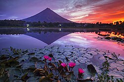
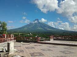
フィリピンのビコール地方、アルバイ州にそびえ立つマヨン山は、その類まれなる左右対称の美しいシルエットで世界的に知られています。しかし、この完璧な円錐形を形作っているのは、数千年にわたる激しい噴火の積み重ねです。標高2,463メートルに達するこの山は、単なる観光名所ではなく、現在も活動を続ける非常に危険な活火山として厳重に監視されています。
主要な事実(Key Facts)
- 山型: 成層火山(Stratovolcano)
- 標高: 2,463メートル(フィリピンの最高峰ランキング28位)
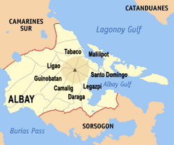
- 所在地: フィリピン、アルバイ州(3つの市と5つの町にまたがる)
- 地質学的特徴: 2万年以上前から活動しており、ビコール火山弧の一部を構成している
- 最新の状況: 2026年1月よりマグマ噴火が発生し、現在も活動が継続中
地質学的背景と地理
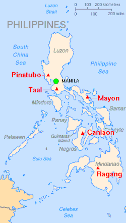
マヨン山は、典型的な成層火山であり、溶岩と火山灰が交互に積み重なることでその美しい形状が維持されています。この火山はビコール火山弧という火山帯に位置しており、周囲にはかつての活動を示す不活性なシンダーコーン(小規模な火山丘)が点在しています。
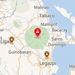
地理的には、アルバイ州のレガスピ市やタバコ市など、多くの自治体に影響を及ぼす範囲に位置しています。フィリピン国内では「ウルトラピーク」の5位に数えられるほど際立った存在感を放っています。
噴火の歴史と甚大な被害
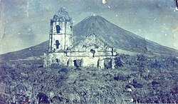
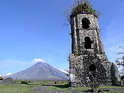
マヨン山の歴史は、美しさと破壊の繰り返しです。記録に残る中で最も壊滅的な出来事の一つが1814年の大噴火です。この際、当時のカグサワ教会がほぼ完全に破壊され、現在はその鐘楼だけが当時の惨劇を伝える遺構として残っています。
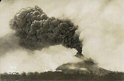
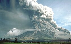
その後も、1984年や1993年、2018年など、頻繁に噴火を繰り返してきました。特に2018年の活動では、高さ3kmに達する噴煙や溶岩噴水、そして高速で山を流れ下る火砕流(高温のガスと火山砕屑物の混合流)が発生し、大規模な避難措置が取られました。
近年の活動推移
21世紀に入っても、マヨン山は絶えず活動しています。2009年から2010年にかけての噴火では、多くの住民が避難し、国際的な支援が行われました。また、2020年には火口内でマグマが地表近くに存在することを示す「火口の輝き(Crater Glow)」が観測され、当局を緊張させました。
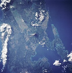
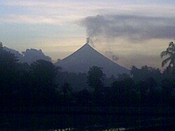
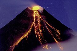
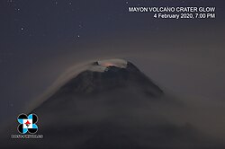
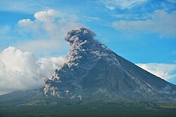
直近では、2024年の水蒸気噴火を経て、2026年1月には再び警戒レベルが引き上げられました。マグマ噴火に伴う火砕流が南東斜面を流れ下り、タバコ市では災害事態宣言が出されるなど、深刻な影響を及ぼしています。
監視体制と警戒レベル
フィリピン火山学地震研究所(PHIVOLCS)は、GPS、傾斜計、二酸化硫黄(SO2)の放出量などのデータを駆使して、24時間体制でマヨン山を監視しています。警戒レベルは0から5まで設定されており、レベルが上がるにつれて噴火の可能性が高まり、危険区域の拡大や避難勧告が行われます。
| 開始日 | 終了日 | VEI(火山爆発指数) | 備考 |
|---|---|---|---|
| 2026年1月6日 | 継続中 | - | マグマ噴火、火砕流の発生 |
| 2018年1月13日 | 2019年7月31日 | 3 | ストロンボリ式噴火、大規模避難 |
| 2009年9月15日 | 2010年1月1日 | 2 | 溶岩流と灰の放出 |
| 1993年2月2日 | 1994年4月4日 | 2 | 79名の死者を記録 |
| 1984年9月9日 | 1984年10月6日 | 3 | 激しい噴火活動 |
よくある質問(FAQ)
マヨン山が「完璧な円錐形」と言われるのはなぜですか?
成層火山特有の性質により、噴火のたびに粘性の高い溶岩と火山灰が山頂付近に均等に積み重なり、長い年月をかけて左右対称の美しい形が形成されたためです。
カグサワ教会とは何ですか?
1814年の大噴火で破壊された教会の跡地です。現在は鐘楼のみが残っており、マヨン山の絶景と共に、自然の猛威を伝える象徴的な観光スポットとなっています。
現在の警戒レベルはどうなっていますか?
2026年1月6日にレベル3に引き上げられ、現在も活動が続いています。最新の情報はPHIVOLCSの公式発表を確認してください。
火砕流とはどのような現象ですか?
噴火に伴い、高温の火山ガスと岩石、灰などが混ざり合い、斜面を猛烈な速度で流れ下る現象です。逃げることがほぼ不可能なため、極めて危険とされています。
登山は可能ですか?
活動状況により厳しく制限されています。特に警戒レベルが上がっている際は、危険区域への立ち入りが禁止されており、安全が確保されていない限り登山はできません。
References
- de Ferranti, Jonathan; Aaron Maizlish. "Philippine Mountains – 29 Mountain Summits with Prominence of 1,500 meters or greater". Retrieved January 31, 2011.
- Mirabueno, M. H. T.; Okuno, M.; Nakamura, T.; ; Kobayashi, T. (2006). "AMS Radiocarbon Dating of Paleosols Intercalated with Tephra Layers from Mayon Volcano, Southern Luzon, Philippines: A Preliminary Report". Bulletin of the Volcanological Society of Japan. 36 (2). Volcanological Society of Japan: 23–28. 0386-118X.
... the oldest eruptive event must have taken place shortly before 20 cal kyr BP.
- "Mayon Volcano Bulletin 6 January 2026 01:20 PM". PHIVOLCS-LAVA. Retrieved January 6, 2026.
- "Encyclopædia Britannica, Vol. 18, 9th Ed.", pg. 749. Henry G. Allen & Company, New York.
- "Ancient Bicolano Pantheon of Deities and Creatures – Philippine Mythology". The Aswang Project. February 8, 2016. Retrieved August 28, 2019.
- "Protected Areas in Region 5" Archived December 19, 2013, at the . Protected Areas and Wildlife Bureau. Retrieved on October 15, 2011.
- "Albay | United Nations Educational, Scientific and Cultural Organization".
- "Mayon Volcano". Philippine Institute of Volcanology and Seismology. Archived from the original on December 2, 2008. Retrieved December 14, 2009.
- "Mayon Volcano, Philippines". Philippines Department of Tourism. Volcano.und.edu. Archived from the original on October 12, 2007. Retrieved November 20, 2007.
- David, Lee (2008). "Natural Disasters", pp. 416–417. Infobase Publishing.
📸 フォトギャラリー