Components of MRO
← ホームへ戻る
Mars Reconnaissance OrbiterMRO火星探査機NASAHiRISE

Mars Reconnaissance Orbiter (MRO) が解き明かす赤い惑星の深層

🗓 2026年8月11日

火星の表面をかつてない解像度で捉え、その地質学的歴史を塗り替えてきたのが、NASAのMars Reconnaissance Orbiter (MRO)です。2005年に打ち上げられたこの探査機は、単なる観測機にとどまらず、火星表面の精密なマッピングや、後続の着陸機・ローバーの通信中継局としての重要な役割を担ってきました。

MROは、高度な光学カメラや分光計、地中レーダーを搭載し、火星の地表だけでなく地下にまでその視線を伸ばしています。これにより、かつて水が存在した証拠や、現在の気象変動など、火星のダイナミックな姿を明らかにし続けています。
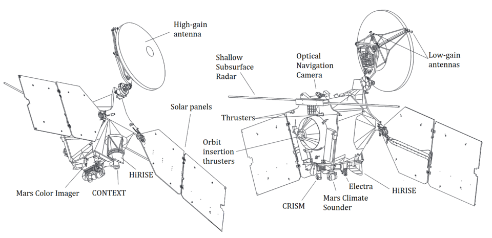
Components of MRO

Key Facts

  • ミッション期間: 2005年8月12日の打ち上げから20年以上にわたる長期運用を実現。
  • 主要目的: 火星の地質、気候、および水が存在した可能性のある場所の特定。
  • 驚異的な解像度: HiRISEカメラにより、地表の極めて詳細な画像を提供。
  • 多機能な役割: 科学観測に加え、CuriosityやPerseveranceなどのローバーのデータ転送を支援。
  • 地下探査: SHARADレーダーを用いて、地表下に隠れた氷や構造を検出。

火星の姿を変えた観測機器の数々

MROの最大の強みは、目的の異なる複数の科学計器を搭載している点にあります。これにより、視覚的な画像から化学組成、地下構造までを統合的に分析することが可能です。

高解像度カメラと広域観測

HiRISE(高解像度撮像装置)は、火星表面の岩石や砂丘を詳細に捉えることができる最強のカメラです。また、CTX(コンテクストカメラ)が広範囲の画像を撮影し、HiRISEが注目すべき地点を絞り込むための「地図」を提供します。
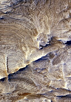
Tectonic fractures within the Candor Chasma region of Valles Marineris, Mars, retain ridge-like shapes as the surrounding bedrock erodes away.
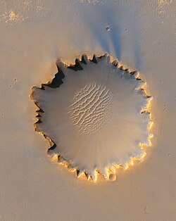
High-resolution image of Victoria crater from HiRISE on October 3, 2006. The rover Opportunity can be seen at roughly the "ten o'clock" position along the rim of the crater.

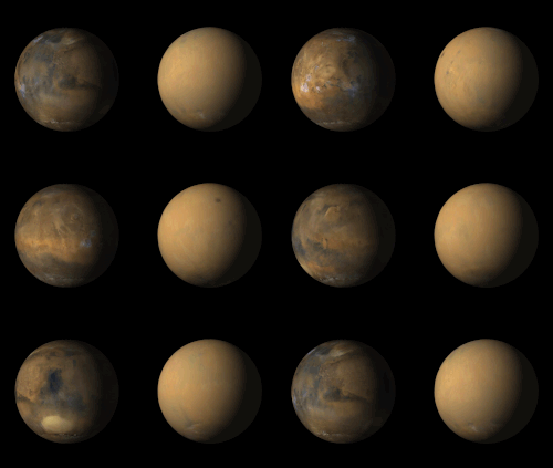
さらに、MARCI(火星カラー撮像装置)は、惑星全体の色の変化を日常的に監視しており、火星全土を覆う巨大な砂嵐の発生や推移を捉えることに成功しています。
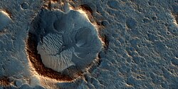
Image taken by HiRISE of Acidalia Planitia on May 17, 2015, where the novel The Martian and its film adaptation take place
Comparison of Mars with and without the dust storm that caused the end of the Opportunity rover, taken by MARCI in 2018

化学組成と地下の秘密

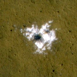
CRISM(コンパクト探査分光計)は、鉱物の組成を分析することで、過去に水がどのように作用したかを調査します。一方、SHARAD(浅層レーダー)は電波を用いて地表下を「透視」し、氷の層や地層の重なりを明らかにします。
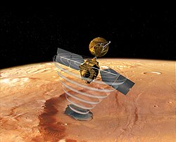
An artist's concept of MRO using SHARAD to "look" under the surface of Mars
Water ice excavated by an impact crater that formed between January and September 2008. The ice was identified spectroscopically using CRISM.

また、MCS(火星気候サウンド装置)が、大気の温度や水蒸気量の垂直分布を測定し、火星の気象メカニズムの解明に寄与しています。

機体性能とミッションの軌跡

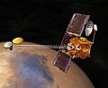
MROは、アトラスVロケットによって打ち上げられ、2006年3月に火星軌道への投入に成功しました。機体重量は約2,180kgで、太陽電池パネルによって電力を供給しています。
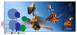
Size comparison of MRO with predecessors
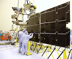
The MRO solar panel

通信システムには高利得アンテナが採用されており、膨大な観測データを地球へ送信すると同時に、火星表面の探査機からの信号を中継するハブとして機能しています。
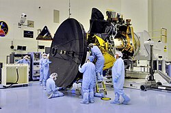
MRO High Gain Antenna installation
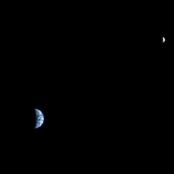
MRO views Earth and the Moon roughly to scale from Mars orbit.

また、MROは火星の衛星であるフォボスなどの近接撮影も行っており、惑星系全体の理解を深める活動も展開しています。

An image of Phobos taken by HiRISE on March 23, 2008, from a distance of around 6,800 kilometres (4,200 mi)[88]

ミッションの成果と発見

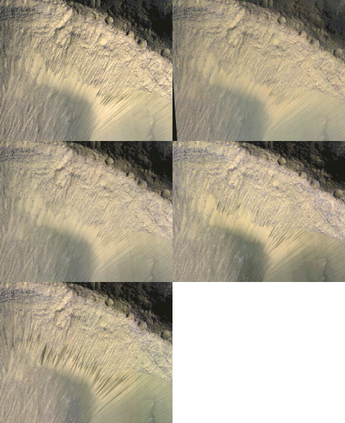
MROの観測により、中緯度地域に埋もれた水氷の存在や、塩化物堆積物の発見など、水に関連する重要な証拠が次々と見つかりました。特に、季節によって変化する暗い筋状の模様(RSL:Recurring Slope Lineae)の発見は、現在も火星に液体の塩水が存在する可能性を示唆し、大きな議論を呼びました。
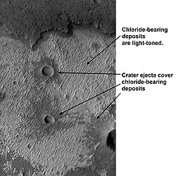
Chloride deposits in Terra Sirenum
Images from HiRISE showing the appearance of dark marks on the floor of Valles Marineris. Images taken at various times in the year.

また、Curiosityローバーが火星大気に突入した際の決定的な瞬間を捉えるなど、後続ミッションの成功を支える「目」としても活躍しました。
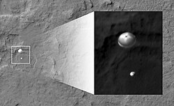
The Curiosity rover during atmospheric entry as seen by HiRISE on August 6, 2012. Supersonic parachute and backshell visible

MROミッション概要まとめ

Mars Reconnaissance Orbiter 基本スペック
項目 詳細内容
打ち上げ日 2005年8月12日
運用主体 NASA / ジェット推進研究所 (JPL)
打ち上げ質量 2,180 kg
軌道周期 約111分
主要搭載機器 HiRISE, CRISM, SHARAD, MARCI, CTX, MCS
主な発見 地下氷の検出、塩化物堆積物の特定、RSLの観測

開発および初期ミッションにかかったコストは、年度ごとに詳細に管理されており、長期的な科学的リターンに見合う投資であったことが証明されています。

MRO development and prime mission costs, by fiscal year

Frequently Asked Questions

MROの主な役割は何ですか?

火星の地表を極めて高い解像度で撮影し、地質や気候を調査することです。また、火星表面のローバーと地球との間の通信を中継する重要なインフラとしての役割も担っています。

HiRISEカメラで何が見えるのですか?

地表の岩石や砂丘などの詳細な構造を捉えることができます。これにより、着陸地点の選定や、地表で起きている地質学的な変化を詳細に分析することが可能です。

火星に水があることをどうやって突き止めたのですか?

CRISMによる鉱物分析で水に関連する鉱物を特定し、SHARADレーダーで地表下の氷の層を検出することで、過去および現在の水の存在を裏付けています。

MROは現在も活動していますか?

はい。2005年の打ち上げ以来、設計寿命を大幅に超えて運用されており、現在も火星の観測とデータ中継を続けています。

RSL(Recurring Slope Lineae)とは何ですか?

火星の斜面に見られる、季節によって現れたり消えたりする暗い筋のことです。これが液体の塩水によるものである可能性が研究されており、生命存在の可能性を探る重要な手がかりとなっています。
ภาพประกอบบทความ
ภาพประกอบบทความ
ภาพประกอบบทความ

References

  1. Due to the coldness of space, spacecraft instruments need to be "warmed up" to operate properly.
  2. Various figures are given for the power, ranging from 600 W to 2000 W at the to 1000 W at an unspecified location in the MRO's orbit. Due to the conflicting information from , a range has been used, instead of an exact number.

📸 フォトギャラリー

Components of MRO
Tectonic fractures within the Candor Chasma region of Valles Marineris, Mars, retain ridge-like shapes as the surrounding bedrock erodes away.
The Curiosity rover during atmospheric entry as seen by HiRISE on August 6, 2012. Supersonic parachute and backshell visible
Image taken by HiRISE of Acidalia Planitia on May 17, 2015, where the novel The Martian and its film adaptation take place
Comparison of Mars with and without the dust storm that caused the end of the Opportunity rover, taken by MARCI in 2018
An artist's concept of MRO using SHARAD to "look" under the surface of Mars
An image of Phobos taken by HiRISE on March 23, 2008, from a distance of around 6,800 kilometres (4,200 mi)[88]
Size comparison of MRO with predecessors
The MRO solar panel
MRO High Gain Antenna installation
MRO views Earth and the Moon roughly to scale from Mars orbit.
High-resolution image of Victoria crater from HiRISE on October 3, 2006. The rover Opportunity can be seen at roughly the "ten o'clock" position along the rim of the crater.
MRO development and prime mission costs, by fiscal year
Water ice excavated by an impact crater that formed between January and September 2008. The ice was identified spectroscopically using CRISM.
Chloride deposits in Terra Sirenum
Images from HiRISE showing the appearance of dark marks on the floor of Valles Marineris. Images taken at various times in the year.
ภาพประกอบบทความ
ภาพประกอบบทความ
ภาพประกอบบทความ