地球の隣人である火星は、古くから人類の想像力を刺激し続けてきました。かつて水が存在し、生命を育んでいた可能性のあるこの「赤い惑星」を解明するため、世界各国の宇宙機関が数多くの探査機を送り込んできました。初期のフライバイ(接近通過)から、高度な自律走行を行うローバー、そして将来の有人探査計画まで、火星探査は絶え間ない進化を遂げています。
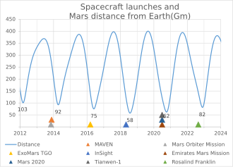
火星への旅は容易ではありません。地球と火星の距離は常に変動しており、効率的な航行のためには特定の「打ち上げウィンドウ」を待つ必要があります。
Key Facts
- 探査の多様性:フライバイ、周回機(オービター)、着陸機(ランダー)、移動機(ローバー)の4つの形態で探査が行われてきた。
- 主要な成果:水が存在した証拠の発見や、地質学的組成の分析により、過去の環境変化が明らかになった。
- 国際的な競争と協力:NASA(米国)だけでなく、旧ソ連/ロシア、ESA(欧州)、ISRO(インド)、CNSA(中国)、JAXA(日本)などが参画している。
- 最新の技術:火星での初飛行に成功したヘリコプター「インジェニュイティ」など、航空技術も導入されている。
火星探査の歩み:黎明期から黄金時代へ
初期の挑戦とソ連の試み
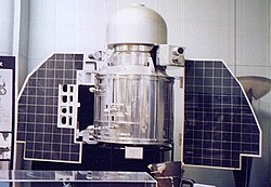
1960年代、宇宙開発競争の中で旧ソ連が先駆的に火星への挑戦を開始しました。Mars 1からMars 7までのシリーズが打ち上げられ、一部のミッションで周回や接近に成功しましたが、着陸機の運用には多くの困難が伴いました。
NASAによる詳細な観測の開始
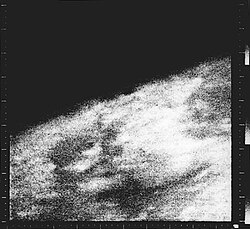
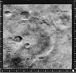
1960年代半ば、NASAのマリナー計画が火星の姿を劇的に変えました。特にマリナー4号が撮影した近接画像は、地球上の人々が初めて目にする火星のクレーターだらけの表面であり、大きな衝撃を与えました。
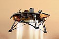
その後、1970年代にはバイキング計画が始動し、人類史上初めて火星表面からの写真送信に成功しました。これにより、火星の土壌や環境に関する直接的なデータ収集が可能となりました。
![Taken by the Viking 1 lander shortly after it touched down on Mars, this image is the first photograph ever taken from the surface of Mars. It was taken on July 20, 1976.[61]](/images/37/a7/37a70e33bb1d1a3cc5fd8a9d6b29ed70945efbea732bdeb705be19fea7e32a7e.png)
![Surface of Mars taken by Viking 1, large rock to the right was nicknamed 'Big Joe' by NASA scientists[64][65]](/images/76/9f/769fc1af0b001a6d1b62e420bbb8a8a5aa0616c78abbe481661e0939bce5fe44.jpg)
ローバー時代の到来と地質調査
1990年代後半から、火星表面を移動して調査する「ローバー」が主役となります。パスファインダーに搭載された小型ローバー「ソジャーナ」の成功は、その後の大型ローバー開発の礎となりました。
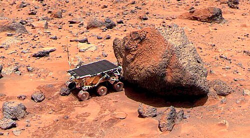
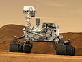
2000年代に入ると、スピリットとオポチュニティという2機の双子ローバーが投入され、火星に水が存在した決定的な証拠を探索しました。さらに、2012年に着陸したキュリオシティは、より高度な化学分析装置を搭載し、生命が存在し得た環境であったかを詳細に調査しています。
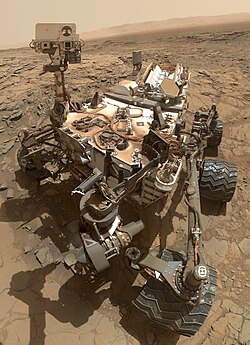
現代の探査と最新ミッション
現在の火星探査は、単なる観測から「サンプル回収」という次のステージへ移行しています。2021年に着陸したパーサヴィアランスは、将来的に地球へ持ち帰るための岩石サンプルを収集しています。また、同ミッションでは小型ヘリコプターのインジェニュイティが、地球以外の惑星で初めて動力飛行を実現しました。
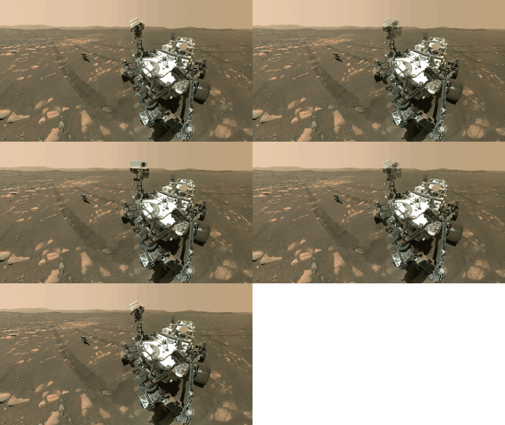
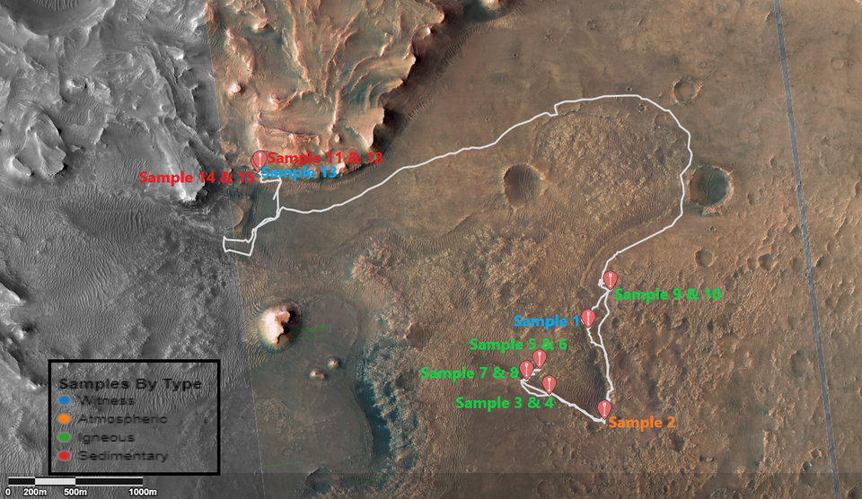
また、中国の「祝融」ローバーやアラブ首長国連邦の周回機「ホープ」など、新たなプレイヤーの参入により、火星探査は真に国際的なプロジェクトとなっています。
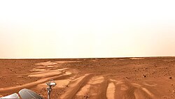
軌道上からの監視と地形分析
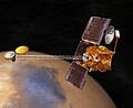
表面探査を支えるのが、強力なカメラとセンサーを備えた周回機です。マーズ・グローバル・サーベイヤーやマーズ・リコネッサンス・オービターは、火星全体の高精度な地図を作成し、洪水のような大規模な地質現象の痕跡を捉えました。
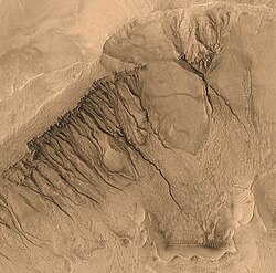
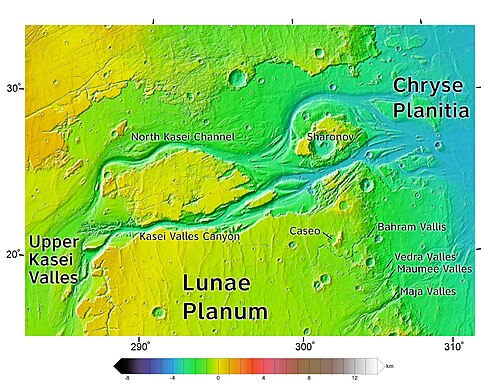
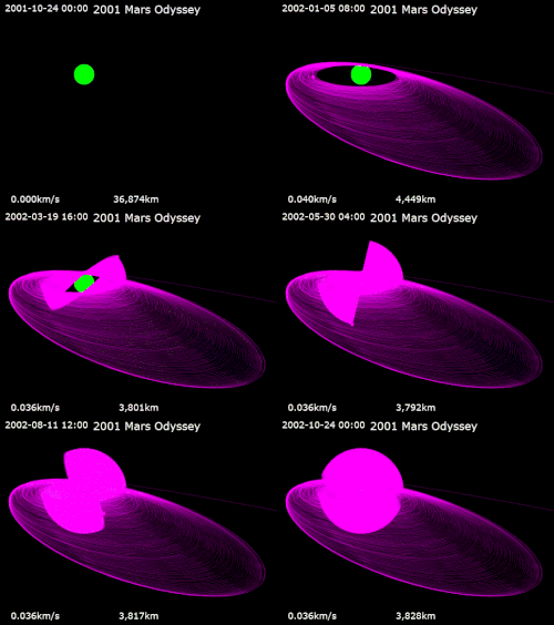
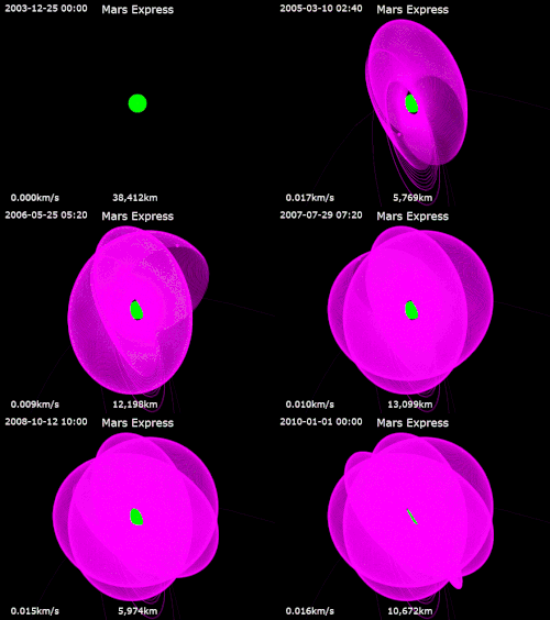
また、2001年以降のオデッセイやマーズ・エクスプレスなどのミッションにより、火星の地下構造や大気の組成に関する理解が深まりました。
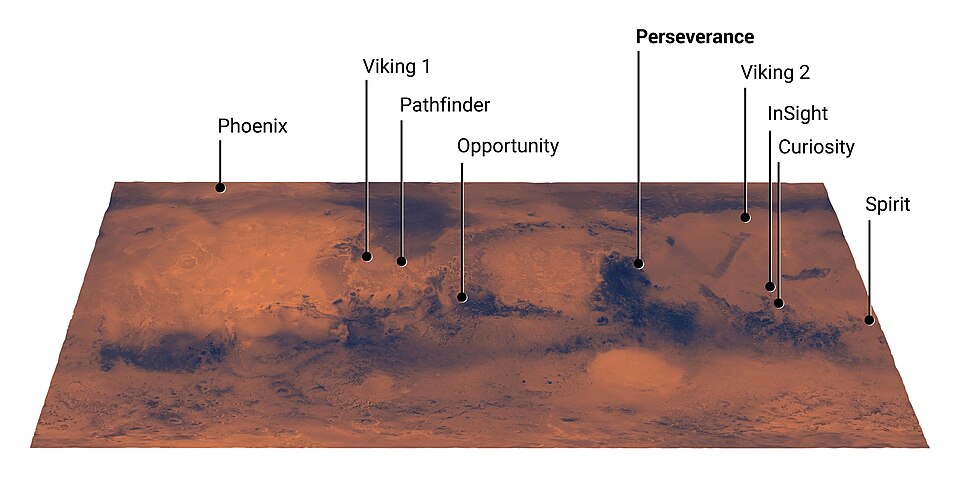
火星探査の現状まとめ
これまでの主要なミッションとその役割を以下の表にまとめます。
| ミッション名 | 主な形態 | 主な目的・成果 |
|---|---|---|
| マリナー計画 | フライバイ/周回 | 初の近接写真撮影と表面観測 |
| バイキング計画 | 着陸機 | 初の表面着陸と生物学的実験 |
| パスファインダー | 着陸機/ローバー | 移動型探査(ソジャーナ)の実証 |
| MER (スピリット/オポチュニティ) | ローバー | 水の存在を示す地質学的証拠の探索 |
| MSL (キュリオシティ) | 大型ローバー | 居住可能性の調査と化学分析 |
| Mars 2020 (パーサヴィアランス) | ローバー/ヘリ | 古代生命の痕跡探索とサンプル収集 |
未来への展望:有人探査と新時代
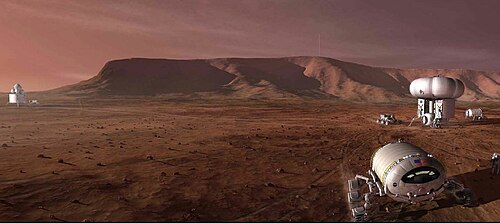
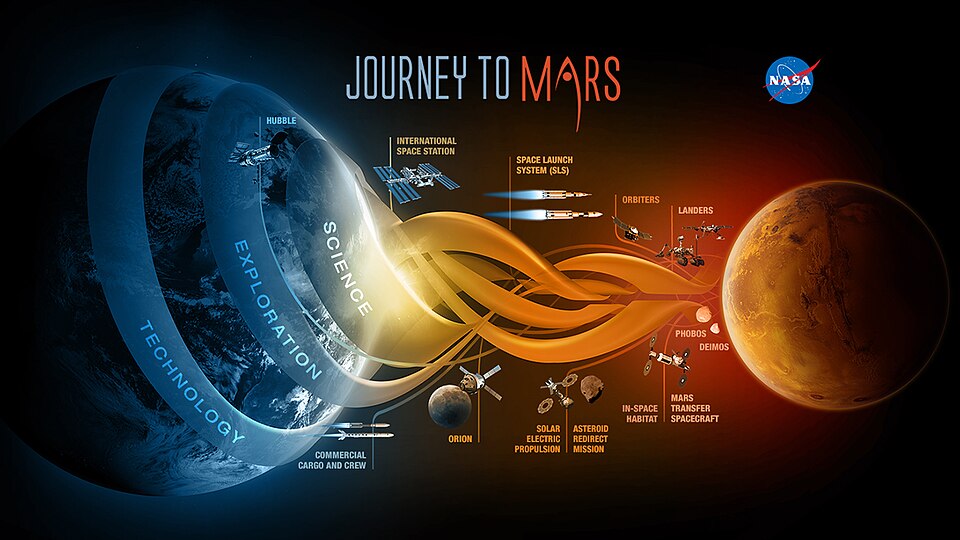
今後の火星探査は、無人機による調査から、人類が実際に足を踏み入れる「有人ミッション」へと向かっています。NASAやSpaceXなどの民間企業が、居住区の建設や輸送システムの開発を計画しています。
また、2026年には日本のMMX(Martian Moons eXploration)による火星衛星フォボスのサンプルリターン計画が予定されており、火星系の成り立ちを解明することが期待されています。
一方で、過去には多くのミッションが失敗に終わった歴史もあります。大気圏突入時のトラブルや通信途絶など、火星探査の困難さは今なお続いています。
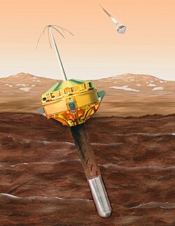
しかし、これらの失敗から得た教訓が、現在の高い成功率を支えています。サイキなどの探査機が火星をスイングバイ(重力利用)して加速するなど、火星は太陽系深部へのゲートウェイとしての役割も担っています。
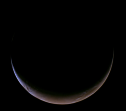
現在も多くの探査機が火星の空と大地で活動を続けており、人類の知的好奇心は止まることがありません。
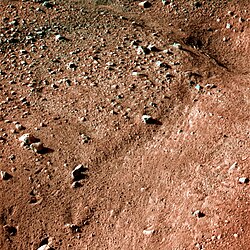
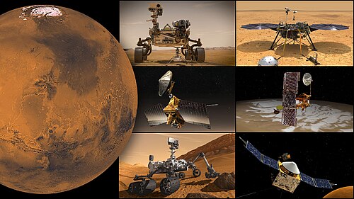
![Slope streaks as seen by HiRISE[111]](/images/f8/68/f868d572e485011d8c29cf88de626b7dba2772c4035aa0253bd84bc31309edaa.jpg)

Frequently Asked Questions
なぜ火星探査には「打ち上げウィンドウ」があるのですか?
地球と火星はそれぞれ異なる速度で太陽の周りを公転しているため、両者の距離が最も近づくタイミングが約2年ごとに訪れます。燃料消費を最小限に抑え、効率的に到達するために、この最適なタイミングに合わせて打ち上げを行う必要があります。
火星に水が存在したことは分かっているのですか?
はい。多くのローバーや周回機が、過去に川や湖が存在したことを示す地形(谷や堆積物)や、水によって形成される鉱物を発見しています。現在は地下に氷の形で存在していると考えられています。
火星に人間が行くことは可能なのか?
技術的な課題は多いものの、NASAやSpaceXなどが計画を進めています。放射線対策、長期滞在のための食料・酸素の確保、そして地球への帰還方法など、解決すべき課題は山積みですが、21世紀中の実現を目指しています。
火星探査で最も困難なことは何ですか?
特に「EDL(進入・降下・着陸)」と呼ばれるプロセスが困難です。火星の大気は地球よりも非常に薄いため、パラシュートだけでは減速しきれず、かといって大気が全くないわけではないため、激しい摩擦熱と複雑な空気力学への対応が求められます。
日本はどのような火星探査に関わっていますか?
JAXAは、火星の衛星フォボスからサンプルを持ち帰るMMX計画を推進しています。また、他国のミッションに観測機器を提供するなど、国際的な協力体制の中で火星の謎に迫っています。
References
- Grotzinger, John P. (24 January 2014). "Introduction to Special Issue – Habitability, Taphonomy and the Search for Organic Carbon on Mars". . 343 (6169): 386–387. :2014Sci...343..386G. :10.1126/science.1249944. 24458635.
- Changela, Hitesh G.; Chatzitheodoridis, Elias; Antunes, Andre; Beaty, David; Bouw, Kristian; Bridges, John C.; Capova, Klara Anna; Cockell, Charles S.; Conley, Catharine A.; Dadachova, Ekaterina; Dallas, Tiffany D. (1 December 2021). "Mars: new insights and unresolved questions". International Journal of Astrobiology. 20 (6): 394–426. :2112.00596. :2021IJAsB..20..394C. :10.1017/S1473550421000276. 1473-5504. 244773061.
- Society, National Geographic (2009-10-15). "Mars Exploration, Mars Rovers Information, Facts, News, Photos – National Geographic". National Geographic. Archived from the original on 2017-11-02. Retrieved 2016-03-04.
- Loeffler, John (2021-08-17). "NASA's Mars helicopter is now scouting new sites for Perseverance rover to study". TechRadar. Archived from the original on 2021-10-01. Retrieved 2021-10-01.
- Stein, Vicky (8 February 2021). "Tianwen-1: China's first Mars mission". Space.com. Archived from the original on 2021-02-25. Retrieved 2021-02-24.
- "China lands its Zhurong rover on Mars". . 2021-05-14. Archived from the original on 2021-05-15. Retrieved 2021-05-14.
- Pappas, Stephanie (27 April 2023). "China finally admits its hibernating Mars rover may never wake up". livescience.com. Retrieved 2023-08-29.
- "NASA Selects Commercial Service Studies to Enable Mars Robotic Science". NASA Jet Propulsion Laboratory (JPL). Retrieved 2024-05-01.
- Sheehan, William (1996). "The Planet Mars: A History of Observation and Discovery". The University of Arizona Press, Tucson. Archived from the original on 2017-09-11. Retrieved 2009-02-15.
- "ESA Science & Technology – Using iMars: Viewing Mars Express data of the MC11 quadrangle". sci.esa.int. Archived from the original on 29 December 2021. Retrieved 29 December 2021.
📸 フォトギャラリー