ニューヨーク市を構成する5つの区の一つ、マンハッタンは、単なる都市の一画を超え、世界的な金融、文化、そしてメディアの象徴として君臨しています。「ザ・シティ」という愛称で親しまれるこの地域は、限られた土地に超高層ビルが密集し、世界で最も人口密度の高い自治体の一つとして知られています。
地理的には、西をハドソン川、北をハーレム川、東をイースト川に囲まれた島であり、南端はニューヨーク港に面しています。この独特の地形が、効率的な都市開発と世界的な港湾都市としての発展を後押ししました。
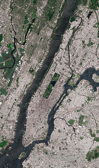
主要データと基本概要
マンハッタンは、経済的な影響力が極めて強く、2024年時点のGDPは1兆ドルを超え、米国の郡単位でトップの規模を誇ります。一人当たりのGDPも非常に高く、世界有数の富が集積するエリアです。
| 項目 | 詳細データ |
|---|---|
| 総面積 | 約87.69平方キロメートル |
| 人口(2020年) | 1,694,251人 |
| GDP(2024年) | 1.007兆米ドル |
| 最高標高 | 80.79メートル |
| 主要産業 | 金融、観光、不動産、メディア、教育 |
Key Facts
- 世界的な経済拠点:ウォール街を中心とした金融街があり、米国の郡で最大のGDPを記録しています。
- 極めて高い人口密度:2020年の国勢調査において、米国で最も人口密度が高い自治体となりました。
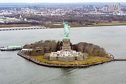
- 多様な島々:メインのマンハッタン島以外に、自由の女神が立つリバティ島やエリス島、ルーズベルト島などが含まれます。
- 文化の集積地:ブロードウェイの劇場街やメトロポリタン美術館など、世界最高峰の文化施設が集中しています。
都市の構造と象徴的なエリア
ミッドタウンと超高層ビル群
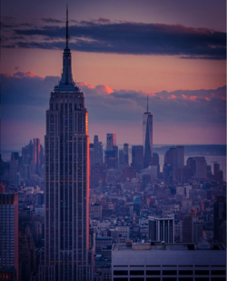
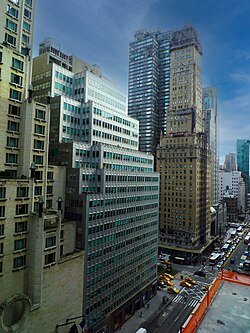
マンハッタンの中央部に位置するミッドタウンは、エンパイアステートビルやクライスラービルなどの歴史的建築物と、最新の超高層ビルが共存するエリアです。特に1916年のゾーニング条例(建築制限法)により、日照権を確保するための「セットバック(階段状の壁面後退)」という独特の建築様式が生まれました。
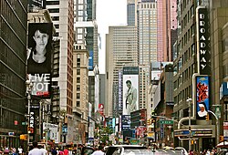
また、タイムズスクエアは年間5,000万人の観光客が訪れる世界的なハブであり、ブロードウェイの劇場街の中心として文化的な役割を担っています。
![Times Square is the hub of Broadway's theater district and a major Manhattan cultural venue with 50 million tourists annually, making it one of the world's most popular tourist destinations.[28]](/images/50/b0/50b0e9639c134bc830c9f546b806942688d7e4c414cc1febf959ca15183f0ceb.jpg)
ロウアーマンハッタンと金融の歴史
島の南端に位置するロウアーマンハッタンは、米国の経済を牽引する金融街として知られています。連邦ホールは、1789年にジョージ・ワシントンが初代大統領に就任した歴史的な場所です。
![Statue of George Washington in front of Federal Hall on Wall Street, where in 1789 he was sworn in as the first U.S. president.[55]](/images/a7/06/a706109e089541356796ca138bc0c4c99cd442ec218ee71e510916d29bb1d755.jpg)
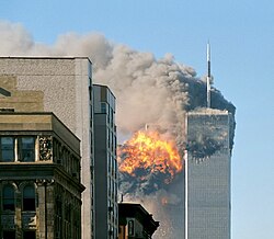
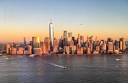
このエリアは、2001年9月11日のテロ攻撃という悲劇に見舞われましたが、現在はワンワールドトレードセンターを中心とした再開発が進み、復興と再生の象徴となっています。
都市のオアシスと教育・文化施設
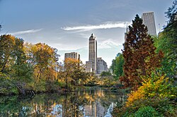
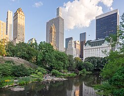
コンクリートジャングルの中で、セントラルパークは市民と観光客にとって不可欠な憩いの場となっています。秋には紅葉が美しく、都市計画における緑地の重要性を示しています。
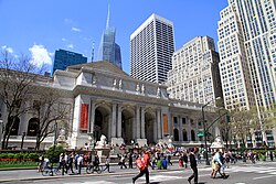
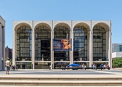
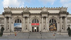
さらに、コロンビア大学のようなアイビーリーグの教育機関や、ニューヨーク公共図書館、リンカーンセンター、メトロポリタン美術館などの施設が、この街を世界的な知性と芸術の拠点へと押し上げています。
![The notable architectural design of Butler Library at Columbia University, an Ivy League university in Manhattan[259]](/images/79/4c/794c75b7693012bb5229a846731abbc80c6cd3a0a339c4943e15db2f3da72862.jpg)
インフラと交通ネットワーク
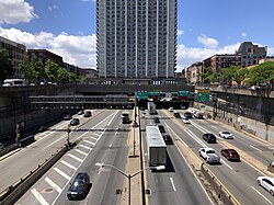
マンハッタンの移動を支えるのは、世界で最も多忙なバスステーションの一つであるポートオーソリティ・バスターミナルや、複雑に張り巡らされた地下鉄網です。また、州外からのアクセスには州間高速道路95号線(I-95)が重要な役割を果たしています。
![The Port Authority Bus Terminal, at Eighth Avenue and 42nd Street, is the world's busiest bus station.[384][385]](/images/ba/2f/ba2f100cefba87b303232811b8f8dfa1a033a1fc1f1f92ab5a82d4393e6ae0bb.jpg)
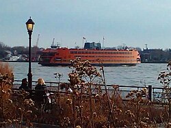
水上交通も盛んで、スタテンアイランド・フェリーは無料の公共交通機関として多くの人々を運び、バッテリーパークシティからは様々なフェリーやヘリコプターが発着しています。
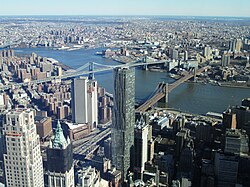
また、ブルックリン橋やマンハッタン橋などの巨大な橋が、イースト川を挟んで隣接するブルックリン地区とこの島を強固に結びつけています。
気候と環境
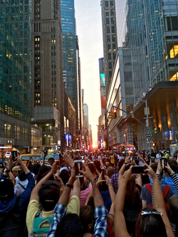
マンハッタンの気候は四季がはっきりしており、夏は高温多湿、冬は寒冷となります。年間の平均降水量は約1,258ミリメートルで、冬には降雪も見られます。近年では、都市部のビル群の間から太陽が一直線に並ぶ「マンハッタンヘンジ」という現象が、観光客や写真家の間で注目を集めています。
多様なコミュニティと社会
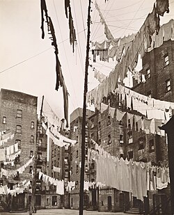
マンハッタンは、歴史的に多くの移民を受け入れてきました。かつてのテネメント(多世帯住宅)が立ち並んでいたロウアーイーストサイドなどは、多様な民族が混在し、独自の文化を形成した場所です。現在は、シリコンアレーと呼ばれるテック産業の集積地(フラットアイアン地区など)が登場し、伝統的な金融業から先端技術産業へと経済構造が多様化しています。
![The Flatiron District, the birthplace and center of Silicon Alley[218]](/images/d5/62/d562c6a1a19ce0b6844d3c77e80cd89230863809270b59159cbc6e448fe1031c.jpg)
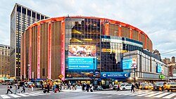
また、スポーツ面ではマディソン・スクエア・ガーデンが、NBAのニックスやNHLのレンジャーズの本拠地として、熱狂的なスポーツ文化を支えています。
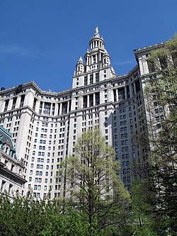
行政面では、マンハッタン区長(現在はブラッド・ホイルマン=シガル氏)が区の運営を担い、ニューヨーク市全体の行政と連携して都市管理を行っています。

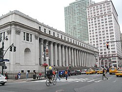
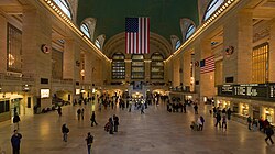
さらに、ジェームズ・A・ファーリー郵便局のような歴史的建造物や、グランドセントラルターミナルなどの国家歴史登録財が、近代的な街並みの中に歴史の奥行きを与えています。
その他の注目スポット
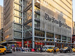
マンハッタンには、ニューヨーク・タイムズの本社ビルや、トライベッカ地区にある名門のスタイベサント高校など、各分野のトップレベルの施設が点在しています。
![Stuyvesant High School in Tribeca[255]](/images/46/a9/46a9046e5b66c683e2823a045b1f5f814b5ae927a5774d93dce645cba6a8edf5.jpg)
また、マンハッタンの管轄には、ニュージャージー州の海域に囲まれたリバティ島などの飛び地も含まれており、地理的な特異性を持っています。
Frequently Asked Questions
マンハッタンで最も人口密度が高い理由は?
限られた島という地理的制約の中で、世界的な経済・文化の中心地として発展したため、土地利用を最大化させる超高層ビルが密集し、非常に高い人口密度となりました。
「マンハッタンヘンジ」とは何ですか?
都市の格子状の街路(グリッド)に沿って、日の出や日の入りの太陽がビル群のちょうど真ん中に一直線に並んで見える現象のことです。
マンハッタンの経済的な特徴は?
ウォール街に代表される金融業だけでなく、不動産、メディア、観光、そして近年では「シリコンアレー」に象徴されるテクノロジー産業など、多角的な産業が集積していることが特徴です。
マンハッタン島以外にどのような島が含まれますか?
行政的にマンハッタンの一部として管理されているリバティ島や、エリス島、ガバナーズ島、またイースト川にあるルーズベルト島などが挙げられます。
建築に見られる「セットバック」とは何ですか?
1916年のゾーニング条例に基づき、建物が高くなるにつれて壁面を後退させる設計のことです。これにより、地上階に日光が届きやすくなるよう工夫されています。
References
- are used in .
- Mean monthly maxima and minima (i.e. the expected highest and lowest temperature readings at any point during the year or given month) calculated based on data at said location from 1991 to 2020.
- Official weather observations for Central Park were conducted at the Arsenal at Fifth Avenue and 64th Street from 1869 to 1919, and at Belvedere Castle since 1919.
- The presidential election results for the years 1876–1912 are not strictly comparable with the earlier and later ones because New York County included the after 1874 and all of what is now the Borough of (Bronx County, New York) from 1895 until The Bronx became a separate borough in 1914.
📸 フォトギャラリー