アメリカ合衆国中西部に位置するインディアナ州は、「アメリカの十字路(Crossroads of America)」というモットーが示す通り、交通と物流の要衝として発展してきました。豊かな農業地帯と近代的な工業都市が共存し、独自のアイデンティティを持つ「フーージャー(Hoosier)」と呼ばれる人々が暮らすこの州は、深い歴史と情熱的なスポーツ文化で知られています。
主要な事実(Key Facts)
- 州都・最大都市: インディアナポリス
- 愛称: フーージャー州(The Hoosier State)
- 州への加入: 1816年12月11日(第19番目の州)
- 主要産業: トウモロコシ生産(全米5位)、エネルギー産業、製造業
- 象徴的なスポーツ: インディ500(モータースポーツ)、バスケットボール
- 地理的特徴: 北はミシガン湖に接し、南はオハイオ川に囲まれている
歴史の変遷:先住民から近代国家へ
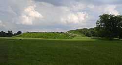
インディアナの地には、古くから多様な先住民が居住していました。特にミシシッピ文化の影響を受けた集落は、高度な社会構造を持っていたことが分かっています。
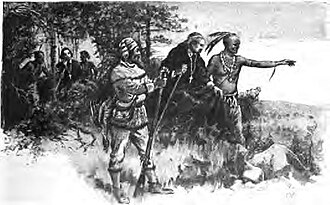
その後、フランス人探検家たちがこの地を訪れ、毛皮貿易などを通じて影響力を広げました。彼らは先住民の案内を得て、未知の領土を切り拓いていきました。
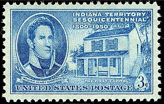
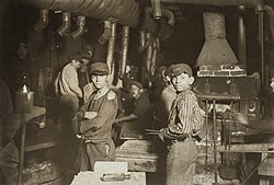
1816年に合衆国の一州として認められた後、州政府の拠点は当初コーリドンに置かれ、その後インディアナポリスへと移されました。19世紀後半には南北戦争を経て、工業化が急速に進展し、ガラス工業などの製造業が発展しましたが、同時に児童労働などの社会的な課題も抱えていた時代がありました。
![Indiana's Capitol Building in Corydon served as the state's seat of government from 1816 until 1825.[38]](/images/78/c2/78c2885a5973ac024817b2e87f808e088b26e5bcfa29c78dc0e376c4e699d694.jpg)
地理と自然環境
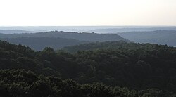
州の地形は、北部の平原から南部の起伏のある丘陵地帯まで多様です。特に南部には広大な森林地帯が広がっており、豊かな自然環境が維持されています。
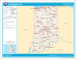
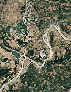
水系においては、ワバシュ川が重要な役割を果たしており、その合流点であるオハイオ川との境界付近は州の最南端にあたります。
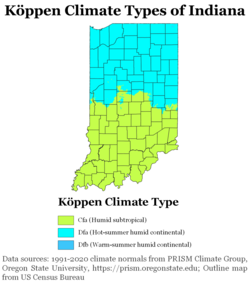
気候は、季節ごとの変化がはっきりしており、夏季は高温多湿、冬季は寒冷となる傾向があります。地域によってわずかに異なりますが、全体として農業に適した気候条件を備えています。
人口統計と社会構造
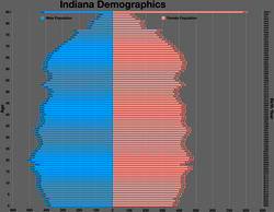
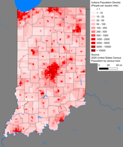
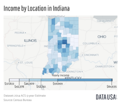
2025年の推定人口は約697万人に達し、全米で17位の規模を誇ります。人口密度は州全体で比較的均一に分布していますが、インディアナポリスを中心とする都市圏に集中しています。
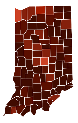
![Largest alone or in any combination ethnic origin by county in Indiana, per the 2020 census[131]](/images/c7/25/c72552daa6d641635c3299093a60cd62ddcae52cf11538f5d2c0f1f8b0fdf857.jpg)
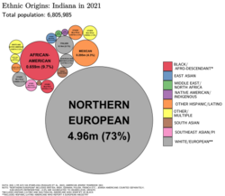
人種構成は非ヒスパニック系白人が多数を占めていますが、アフリカ系アメリカ人やヒスパニック系、アジア系の人口も増加傾向にあります。また、全米で3番目に多い規模のアミッシュコミュニティが存在することも、この州の文化的な多様性を象徴しています。
![Indiana is home to the third largest population of Amish in the U.S.[167]](/images/1b/a0/1ba0c1a87f5e4ae39e2e3fedb364879f0512b487084b5c3677ca1ea2f4c6d878.jpg)
政治と統治機構
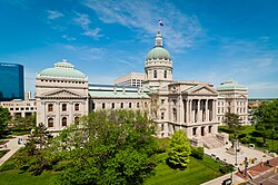
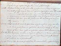
州政府はインディアナポリスの州議事堂に置かれ、知事、副知事、および二院制の州議会(上院・下院)によって運営されています。司法の最高機関はインディアナ州最高裁判所です。
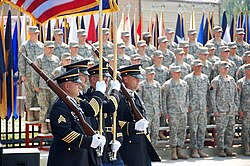
また、国防の観点から州兵などの軍事施設も整備されており、地域の安全保障に寄与しています。

スポーツと文化の情熱
インディアナ州においてスポーツは単なる娯楽を超えた文化的な象徴です。特にモータースポーツの聖地であるインディアナポリス・モーター・スピードウェイで開催される「インディ500」は世界的に有名です。
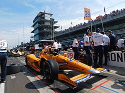
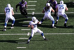
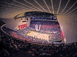
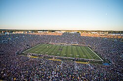
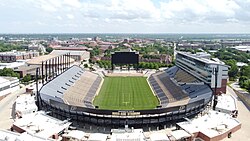
プロスポーツでは、NFLのインディアナポリス・コルツやNBAのインディアナ・ペイサーズが絶大な人気を誇ります。また、大学スポーツ、特にバスケットボールへの情熱は凄まじく、インディアナ大学やパデュー大学、ノートルダム大学などのチームが州民に深く愛されています。
経済基盤とインフラ
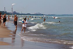
経済の柱の一つは農業であり、特にトウモロコシの生産量は全米トップクラスです。一方で、北部のミシガン湖沿岸では重工業が盛んであり、自然と産業が隣り合わせに存在しています。
![Indiana is the fifth largest corn-producing state in the U.S., with over a billion bushels harvested in 2013.[213]](/images/cc/33/cc33a02d6f58c208fcbfc96f8b83927ad4733682727ed3eb011025b38d4b1ba2.jpg)
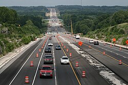
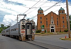
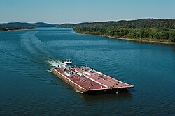
エネルギー供給の多くは石炭火力発電に依存してきましたが、近年はインフラの近代化が進んでいます。交通網においては、州を縦断する高速道路や鉄道、そしてオハイオ川を利用した河川輸送が物流の要となっています。
![Coal-fired electric plants, like Clifty Creek Power Plant in Madison, produced about 85 percent of Indiana's energy supply in 2014.[232]](/images/c1/6c/c16c8674ce6c60193f7bbfaba085ed5fc6d59d7e195592c352247c6a75c13c8a.jpg)
教育面では、歴史ある公立高校から世界的な研究大学まで幅広く整備されており、人材育成に力を入れています。
![Established in 1864, Shortridge High School in Indianapolis is Indiana's oldest free public high school.[244]](/images/19/ef/19ef150ad5ee94a7169550a42d9b8530dd2b8d497e26922e7028e4791ac66fb3.jpg)

インディアナ州の概要まとめ
| 項目 | 詳細 |
|---|---|
| 面積 | 約94,321 km²(全米38位) |
| 人口(2025年推計) | 約6,973,333人(全米17位) |
| 主要都市 | インディアナポリス、フォートウェイン、エバンズビル |
| 州の象徴(鳥・花) | ショウジョウコウカンチョウ / シャクヤク |
| 主要産業 | 農業(トウモロコシ)、製造業、エネルギー |
Frequently Asked Questions
「フーージャー(Hoosier)」とはどういう意味ですか?
フーージャーはインディアナ州の住民を指す愛称です。語源には諸説ありますが、州のアイデンティティを象徴する言葉として親しまれています。
インディアナ州で最も有名なスポーツイベントは何ですか?
世界的に有名な自動車レース「インディアナポリス 500(インディ500)」です。また、州全体でバスケットボールが非常に盛んなことでも知られています。
州の経済において農業はどの程度重要ですか?
非常に重要です。特にトウモロコシの生産量は全米5位にランクされており、農業は州の経済基盤を支える主要な産業の一つです。
インディアナ州の気候の特徴は?
典型的な中西部の気候で、夏は暑く冬は寒い四季の変化が明確な地域です。年間を通じて適度な降水量があり、農業に適しています。
州の主要な都市はどこですか?
州都であり最大都市のインディアナポリスをはじめ、フォートウェイン、エバンズビル、サウスベンドなどが主要な都市として挙げられます。
References
- Elevation adjusted to
- An earlier use of the name dates to the 1760s, when it referenced a tract of land under control of the Commonwealth of Virginia, but the area's name was discarded when it became a part of that state. See Hodgin, Cyrus (1903). "The Naming of Indiana" (PDF transcription). Papers of the Wayne County, Indiana, Historical Society. 1 (1): 3–11. Retrieved January 23, 2014.
- A portion of the Northwest Territory's eastern section became the state of in 1803. The was established in 1805 from part of the Indiana Territory's northern lands and four years later, in 1809, the Illinois counties were separated from the Indiana Territory to create the . See Barnhart, John D.; Riker, Dorothy L. (1971). Indiana to 1816: The Colonial Period. The History of Indiana. Vol. I. Indianapolis: Indiana Historical Bureau and the Indiana Historical Society. pp. 311–13, 337, 353, 355, 432.
- In a 2008 report, Indiana was listed as one of the most tornado-prone states, ranking sixth, while South Bend was ranked the 14th most tornado-prone U.S. city, ahead of cities such as , Texas, and . See Mecklenburg, Rick (May 1, 2008). "Is Indiana the new Tornado Alley?". SouthBendTribune.com. Archived from the original on January 17, 2013. Retrieved August 13, 2012.
- In a published list of the most tornado-prone states and cities in April 2008, Indiana came in first and South Bend ranked 16th. See Henderson, Mark (May 2, 2008). "Top 20 Tornado Prone Cities and States Announced". . Archived from the original on November 9, 2008. Retrieved August 17, 2009.
- A 2008 news report indicated there were 13 metropolitan areas in Indiana. See Dresang, Joel (July 30, 2008). "Automaking down, unemployment up". . Retrieved August 14, 2009.
- Indiana's territorial capitals were and later , which also became Indiana's first when it became a state.
- Over the previous decade, Indiana's population center has shifted slightly to the northwest. In the 2000 U.S. Census, Indiana's was located in , in the town of . See "Population and Population Centers by State". United States Census Bureau. Archived from the original on May 8, 2013. Retrieved November 21, 2006.
- Persons of Hispanic or Latino origin are not distinguished between total and partial ancestry.
📸 フォトギャラリー