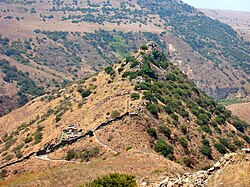
Gaulanitis in its 1st-century context.
← ホームへ戻る
ゴラン高原イスラエルシリア中東紛争領土問題

ゴラン高原の歴史と現状地政学的対立と文化遺産の交差点

🗓 2026年8月10日

中東の戦略的要衝に位置するゴラン高原は、豊かな自然と深い歴史を持つ一方で、現代に至るまで激しい領土争いの中心となってきました。シリア領として国際的に認識されながらも、1967年以来イスラエルによる実効支配が続いており、その地位を巡る議論は絶えません。

この地域は、古代の都市遺跡から近代の軍事境界線まで、重層的な歴史が刻まれています。本記事では、ゴラン高原の地理的特性、古代から現代に至る変遷、そして現在も続く複雑な政治状況について詳しく解説します。

主要な事実(Key Facts)

  • 現状: 国際的にはシリア領とされるが、1967年以降イスラエルが占領・管理している。
  • 面積: 全体で約1,800km²(イスラエル管理区域の面積については諸説あり)。
  • 人口: 約63,000人(イスラエル入植者とドゥルーズ派住民で構成)。
  • 最高点: ヘルモン山(標高2,814m)。
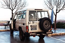
  • 監視体制: 国連軍事監視団(UNDOF)が停戦監視を行っている。

古代から中世までの歴史的変遷

ゴラン高原は古くから多くの文明が交差する地でした。1世紀頃のガウラニティス(Gaulanitis)時代には、ユダヤ人と異民族が共存する地域として知られていました。
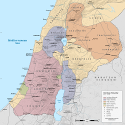
Gaulanitis in its 1st-century context.

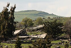
この地には、初期のシナゴーグ(ユダヤ教礼拝堂)を持つ古代都市ガムラなどの重要な遺跡が点在しています。ガムラは紀元71年、第一次ユダヤ・ローマ戦争においてローマ軍に包囲され、破壊されました。
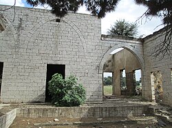
The palace of Emir Mahmoud Al Faour of the Al Fadl tribe in the Golan Heights.
Ruins of the ancient Jewish city of Gamla, home to one of the earliest known synagogues. The city was besieged and destroyed by the Romans in 71 CE, during the First Jewish–Roman War.

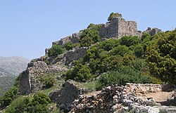
その後、ビザンチン時代にはキリスト教の影響が強まり、デイル・ケルー教会のような宗教施設が建設されました。また、イスラム教の台頭、十字軍、アイユーブ朝、そしてマムルーク朝へと支配者が変わり、ニムロド要塞のような堅固な軍事拠点も築かれました。
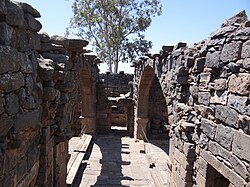
Church of Deir Qeruh
Nimrod Fortress, built by the Ayyubids and hugely enlarged by the Mamluks

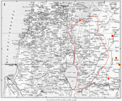
オスマン帝国時代を経て、19世紀後半には地域の詳細な地図が作成されるなど、近代的な地理把握が進みました。当時の地図からは、現在の国境線とは異なる地域の広がりが見て取れます。
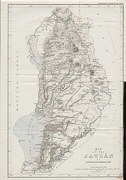
Gottlieb Schumacher’s 1885 map of the Golan region
Rene Dussaud's map of Jawlān, with his proposed borders and markers for the cities in Jawlan mentioned by medieval writers.

現代の紛争と領土問題

20世紀に入ると、イギリスとフランスの委任統治を経て、ゴラン高原はシリアの一部となりました。しかし、1948年の第一次中東戦争後、イスラエルとシリアの間で激しい国境紛争が勃発します。

Sykes–Picot Agreement map, signed 8 May 1916, showing the Golan Heights in area "A", an independent Arab state in the French sphere of influence[164]

決定的な転換点となったのは1967年の第三次中東戦争(六日戦争)です。イスラエルはこの戦争でゴラン高原を占領し、戦略的な高地を確保しました。その後、1973年の第四次中東戦争(ヨム・キプル戦争)でも激戦地となりました。
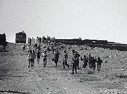
Forced transfer and displacement. Syrian civilians, hands raised, before Israeli soldiers, leave their homes in the Golan Heights.
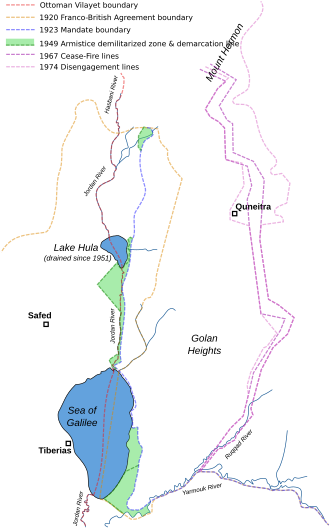
Boundary changes in the area of the Golan Heights in the 20th century

イスラエルはその後、この地域を事実上併合しましたが、国際社会の多くはこれを認めていません。一方で、2019年にアメリカ合衆国はイスラエルの主権を正式に承認する方針を打ち出しました。
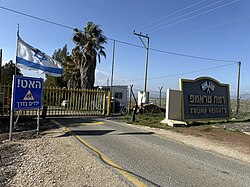
The entrance to the Israeli settlement of Trump Heights, founded in 2019, and named after Israeli settlers in tribute to US President Donald Trump

かつてのシリア最大の町クネイトラは、1967年の占領時に破壊され、1974年の兵力分離合意に基づきシリア側に返還されましたが、街の多くは廃墟のままとなっています。
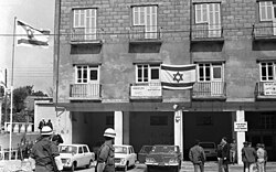
Military police headquarters in Quneitra under Israeli occupation, 1969.
Destroyed buildings in Quneitra

地理的特性と経済活動

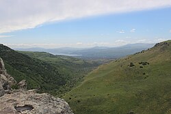
ゴラン高原は、標高2,814mのヘルモン山から、海抜マイナス212mのガリラヤ湖まで、極めて激しい高低差を持つ地形が特徴です。この地形は軍事的な監視に最適であるため、戦略的価値が非常に高く評価されています。
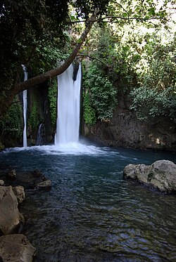
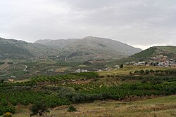
Banyas waterfall at the foot of Mount Hermon
View of Mount Hermon from the road to Masaade
The Sea of Galilee as seen from the Golan

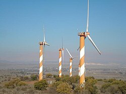
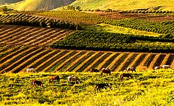
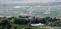
自然環境に恵まれたこの地では、農業、特にブドウ栽培(ワイン造り)が盛んです。また、近年では風力発電などの再生可能エネルギーへの取り組みも見られます。
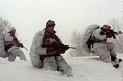
Israeli soldiers of the Alpinist Unit are dispatched to Mount Hermon.
Golan Heights wind farm on Mount Bnei Rasan
Israeli farms in the Golan Heights
The vineyard behind the Israeli settlement of Ma'ale Gamla.

一方で、過去の紛争の遺産として、依然として多くの地雷原が残されており、住民や訪問者に危険を及ぼしています。
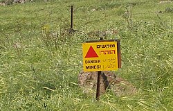
A minefield warning sign in the Golan

多様な住民と社会構造

現在のゴラン高原には、イスラエルからの入植者と、もともとこの地に住んでいたドゥルーズ派(一神教の一派)の住民が共存しています。ドゥルーズ派の町マジュダル・シャムスなどは、独自の文化とアイデンティティを維持しています。
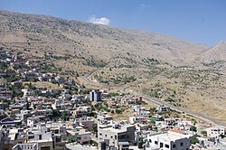
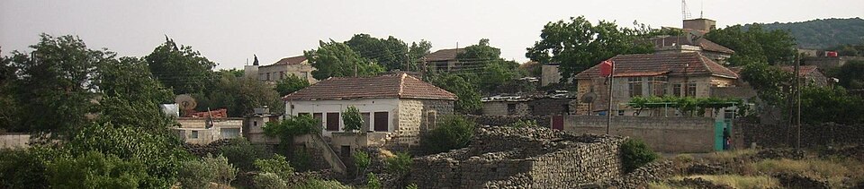
The Druze town of Majdal Shams
Beer Ajam (بئرعجم), a Syrian Circassian village in the province of Quneitra, founded in 1872

住民の間では、イスラエル国籍の取得を巡る葛藤や、シリアへの帰属意識など、複雑な感情が入り混じっています。また、地域内にはキリスト教の教会なども点在し、宗教的な多様性が見られます。
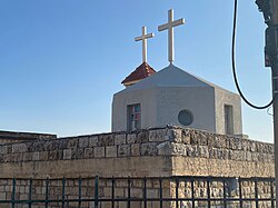
Christian church in Ein Qiniyye

地域概要まとめ

ゴラン高原の基本データ
項目 詳細
国際的な地位 シリア領(イスラエルが占領・管理)
主要住民 イスラエル入植者、ドゥルーズ派
主要産業 農業(ブドウ栽培)、観光、エネルギー
主要ランドマーク ヘルモン山、ガリラヤ湖、ニムロド要塞
監視機関 UNDOF(国連軍事監視団)

文化・歴史的ランドマーク

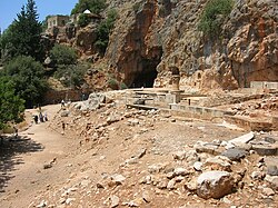
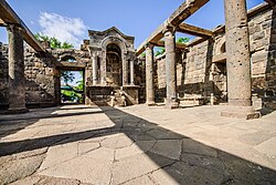
ゴラン高原には、数千年にわたる人類の足跡が残っています。バニアスのパン神殿や、再建されたウム・エル・カナティールのシナゴーグなどは、かつての多文化共生の証です。
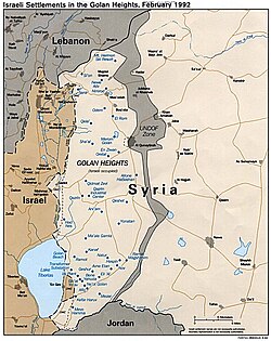
Map of the Israeli settlements in the Golan Heights, 1992
Temple of Pan at Banias and the white-domed shrine of Nabi Khadr in the background
Reconstructed synagogue at Umm el-Qanatir

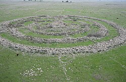
また、ヒッポスのオデオンやルジュム・エル・ヒリのような巨石記念物など、ヘレニズム時代から先史時代に至るまでの多様な遺跡が、この地の歴史の深さを物語っています。
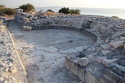
Hippos odeon
Rujm el-Hiri

現代においても、ガリラヤ湖を望む絶景ポイントや、歴史的な境界線を示す地点は、訪れる者にこの地の緊張感と美しさを同時に伝えています。
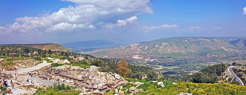
Sea of Galilee and southern Golan Heights, viewed from Umm Qais and the ruins of Gadara in Jordan
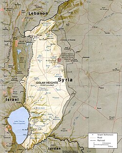
1994 CIA map of Golan Heights and vicinity
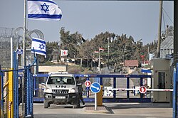
Golan ceasefire line crossing, 2012
A UN Toyota Land Cruiser parked near Majdal Shams displaying UNDOF plates and a UN flag, January 2012
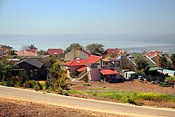
The Israeli settlement of Ma'ale Gamla

Frequently Asked Questions

ゴラン高原は現在どこの国が支配していますか?

現在はイスラエルが実効支配しています。1967年の第三次中東戦争で占領し、その後事実上の併合を行いました。ただし、国際社会の大部分はこれを認めず、シリア領であるとみなしています。

UNDOFとは何ですか?

国連軍事監視団(United Nations Disengagement Observer Force)の略称です。1974年の兵力分離合意に基づき、イスラエルとシリアの間の停戦監視および緩衝地帯の管理を行うために設置されました。

ドゥルーズ派の人々とはどのような人々ですか?

中東に居住する独自の宗教的コミュニティです。ゴラン高原に住むドゥルーズ派の住民は、イスラエルの支配下にあってもシリアへの忠誠心を持つ人々や、現実的にイスラエル国籍を選択する人々など、多様な立場に分かれています。

この地域の経済的な特徴は何ですか?

肥沃な土壌と気候を活かした農業が盛んで、特に高品質なワインの生産地として知られています。また、戦略的な立地を活かした軍事施設や、近年では風力発電などのインフラ整備が進んでいます。

クネイトラという町はどうなりましたか?

かつては人口27,000人を抱える地域の中心地でしたが、1967年の戦争末期にイスラエル軍によって破壊されました。その後、1974年にシリア側に返還されましたが、街の多くは破壊されたままの状態です。

References

  1. In 2008, a plenary session of the voted by 161–1 in favour of a motion on the "occupied Syrian Golan" that reaffirmed support for .
  2. see
  3. The United States Israeli sovereignty over the Golan in March 2019, becoming the first country besides Israel to do so.
  4. Roughly 40% of Druze across the four main Druze towns in the Golan Heights have taken Israeli citizenship as of March 2026
  5. The resolution stated: "the Israeli decision to impose its laws, jurisdiction, and administration in the occupied Syrian Golan Heights is null and void and without international legal effect".
  6. The of the numbers this as chapter 6 verse 56 of 1 Chronicles, while the and other Christian texts lists it as verse 71
  7. EusArm: գալիլեացի, "the Galilean".
  8. This spelling may reflect the ketiv at Joshua or an equivalent version of LXX, possibly by influence of Eusebius' Jewish assistants. See Urman, Dan (1985). The Golan. p. 14.
  9. Maps from the early 19th century show Wadi or Nahr Ruqqad to the east of Nawa. On modern maps like Dussaud's, Ruqqad corresponds to the former Wadi Hamy Sakhar.

📸 フォトギャラリー

Gaulanitis in its 1st-century context.
Gottlieb Schumacher’s 1885 map of the Golan region
Rene Dussaud's map of Jawlān, with his proposed borders and markers for the cities in Jawlan mentioned by medieval writers.
Temple of Pan at Banias and the white-domed shrine of Nabi Khadr in the background
Ruins of the ancient Jewish city of Gamla, home to one of the earliest known synagogues. The city was besieged and destroyed by the Romans in 71 CE, during the First Jewish–Roman War.
Church of Deir Qeruh
Reconstructed synagogue at Umm el-Qanatir
Nimrod Fortress, built by the Ayyubids and hugely enlarged by the Mamluks
The palace of Emir Mahmoud Al Faour of the Al Fadl tribe in the Golan Heights.
Sykes–Picot Agreement map, signed 8 May 1916, showing the Golan Heights in area "A", an independent Arab state in the French sphere of influence[164]
Boundary changes in the area of the Golan Heights in the 20th century
A minefield warning sign in the Golan
Forced transfer and displacement. Syrian civilians, hands raised, before Israeli soldiers, leave their homes in the Golan Heights.
Military police headquarters in Quneitra under Israeli occupation, 1969.
Golan Heights wind farm on Mount Bnei Rasan
Israeli soldiers of the Alpinist Unit are dispatched to Mount Hermon.
Sea of Galilee and southern Golan Heights, viewed from Umm Qais and the ruins of Gadara in Jordan
1994 CIA map of Golan Heights and vicinity
Banyas waterfall at the foot of Mount Hermon
View of Mount Hermon from the road to Masaade
The entrance to the Israeli settlement of Trump Heights, founded in 2019, and named after Israeli settlers in tribute to US President Donald Trump
Golan ceasefire line crossing, 2012
A UN Toyota Land Cruiser parked near Majdal Shams displaying UNDOF plates and a UN flag, January 2012
Beer Ajam (بئرعجم), a Syrian Circassian village in the province of Quneitra, founded in 1872
Destroyed buildings in Quneitra
Christian church in Ein Qiniyye
The Druze town of Majdal Shams
Map of the Israeli settlements in the Golan Heights, 1992
The Israeli settlement of Ma'ale Gamla
Israeli farms in the Golan Heights
The Sea of Galilee as seen from the Golan
Hippos odeon
Rujm el-Hiri
The vineyard behind the Israeli settlement of Ma'ale Gamla.