Adobe buildings in "Franklin" c. 1850. Thought to be one of the earliest depictions of the settlement
← ホームへ戻る

エルパソテキサス州の太陽の街とその歴史的魅力

🗓 2026年8月15日

テキサス州の最西端に位置するエルパソは、「サンシティ(太陽の街)」や「エル・チュコ」という愛称で親しまれる、活気あふれる国境都市です。メキシコのシウダー・フアレスと隣接し、文化的な融合とダイナミックな歴史が交差するこの街は、北米でも有数の人口規模を誇る重要な拠点となっています。

主要な事実(Key Facts)

  • 地理的特徴:テキサス州最西端に位置し、リオグランデ川を挟んでメキシコと接する。
  • 人口規模:2020年時点で市人口は約67.8万人。テキサス州内で6番目に大きな都市。
  • 気候:乾燥した砂漠気候で、年間を通じて日照時間が非常に長い。
  • 経済:軍事拠点であるフォート・ブリスが最大の雇用主であり、教育や医療産業も盛ん。
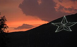
  • 象徴:フランクリン山脈に設置された巨大な星のオブジェが街のシンボルとなっている。

歴史の変遷:入植から現代まで

エルパソの歴史は古く、最初の入植は1680年にまで遡ります。1849年には「フランクリン」という名称で再入植が進み、その後1852年に現在の「エルパソ」へと改称されました。1873年に法人化されたことで、都市としての基盤が整い、急速な発展を遂げました。
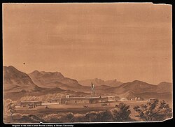
Adobe buildings in "Franklin" c. 1850. Thought to be one of the earliest depictions of the settlement

19世紀後半から20世紀初頭にかけて、鉄道の開通や商業の発展により、街の景観は大きく変化しました。かつての adobe(日干しレンガ)造りの建物から、近代的な商業ビルへと移行し、国境貿易の要衝としての地位を確立しました。
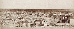
El Paso, c. 1880
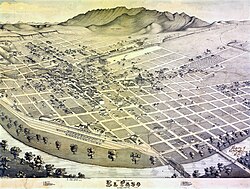
Map of the city in 1886
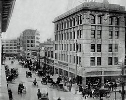
Downtown El Paso in 1908

20世紀に入ると、交通インフラの整備が進み、路面電車の導入などが都市の利便性を高めました。また、軍事的な重要性から、国境付近での軍事キャンプの設置など、国家安全保障の拠点としての役割も担ってきました。
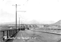
El Paso Electric Railway traveling from Smeltertown in 1912
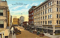
Mesa Avenue, the heart of El Paso, Texas (postcard, c. 1917)
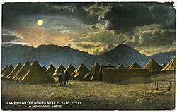
General Pershing's punitive expedition camp near the border, El Paso, Texas (postcard, c. 1916): Franklin Mountains, left-to-right (i.e., south-to-north) are: Ranger Peak, Sugarloaf Mountain, and part of South Franklin Mountain

地理と都市景観

エルパソは、雄大なフランクリン山脈とチワワ砂漠に囲まれた独特の地形にあります。市街地はリオグランデ川沿いに広がり、メキシコのシウダー・フアレスと共に巨大な国境都市圏を形成しています。
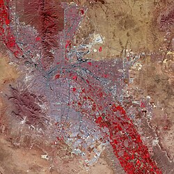
False-color satellite image of El Paso (upper right) and Ciudad Juárez (lower left): Paved streets and buildings appear in varying shades of blue-gray, and red indicates vegetation.

都市のランドマークと建築

ダウンタウンには近代的な高層ビルが立ち並び、中でも2021年に完成したWestStar Tower(高さ96m)は市内で最も高い建物です。一方で、歴史的なホテルや公共建築も大切に保存されており、新旧の建築様式が共存しています。
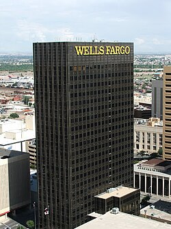
Wells Fargo Plaza
A large, illuminated star on Franklin Mountains has become an informal symbol of El Paso.

多様な地域特性

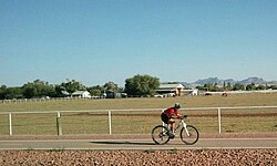
街は北西部の豊かな谷あいの地域から、歴史的なミッション(伝道所)が残るミッション・バレーまで、多様なエリアに分かれています。東部にはヤシの木が並ぶ風景が見られ、西部では冬に山々に雪が積もるなど、地域によって異なる表情を見せます。
El Paso's upper valley in northwest El Paso
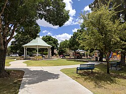
Madeline Park in Kern Place
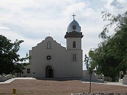
Ysleta Mission
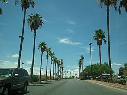
Palm trees in East El Paso
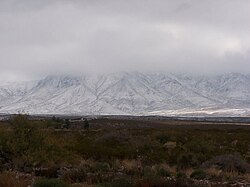
Snow in the Franklin Mountains in west El Paso
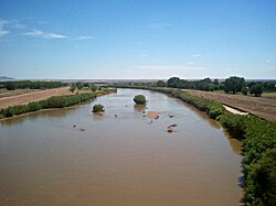
The Rio Grande in west El Paso, near New Mexico–Texas state line

気候と自然環境

エルパソの気候は典型的な乾燥帯に属し、夏は非常に高温になります。年間の平均最高気温は6月から9月にかけて40度を超える日が多く、一方で冬は冷え込み、最低気温が氷点下になることもあります。降水量は非常に少なく、特に春から初夏にかけては極めて乾燥します。
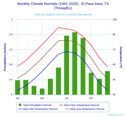
Climate chart for El Paso

文化・芸術とレクリエーション

この街は、豊かな芸術文化と多彩なイベントで知られています。毎年恒例の「グレート・リバー・ラフト・レース」や、ダウンタウンで開催される様々なフェスティバルが市民に親しまれています。
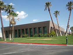
Helen of Troy Limited corporate office
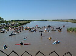
Great River Raft Race held annually on the Rio Grande in El Paso's upper valley
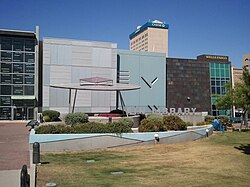
Cleveland Square in downtown El Paso is where many of the festivals are held annually.

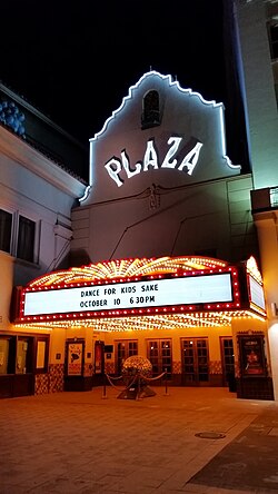
パフォーマンスアートも盛んで、マケリゴン・キャニオンの野外劇場では「Viva! El Paso」などの公演が行われています。また、プラザ・シアターのような歴史的な劇場は、夜になると美しいライトアップで街を彩ります。
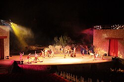
Viva! El Paso performance at the McKelligon Canyon Amphitheatre
Plaza theater at night

博物館と教育施設

エルパソ考古学博物館では、地域の古代文明に関する展示が行われており、歴史への理解を深めることができます。また、動物園のアジア展示エリアなど、教育的な施設も充実しています。
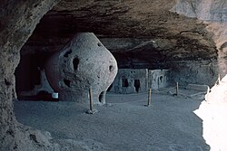
El Paso Museum of Archaeology, diorama shows Cueva de la Olla (cave of the pot – a large pot-shaped storage container for grain), Paquimé, Sierra Madre of Chihuahua
Asia exhibit entrance at the El Paso Zoo

スポーツと屋外活動

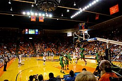
スポーツへの情熱も高く、特に大学スポーツが盛んです。テキサス大学エルパソ校(UTEP)のマイナーズは、サンボウル・スタジアムやドン・ハスキンス・センターを拠点に活躍しています。
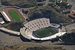
Aerial view of Sun Bowl Stadium and Kidd Field
Don Haskins Center at the UTEP campus

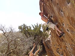
自然を活かしたアクティビティも豊富です。フランクリン山脈にあるワイラー・エアリアル・トラムウェイはテキサス州唯一の商業用ロープウェイであり、絶景を楽しむことができます。また、ウエコ・タンクなどの地域ではボルダリングなどのアウトドアスポーツが人気です。
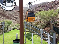
The Wyler Aerial Tramway in the Franklin Mountains is the only commercial tramway in the state of Texas.
Bouldering on North Mountain at Hueco Tanks

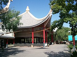
さらに、チワワ砂漠庭園のような植物園では、乾燥地帯特有の植物を鑑賞できる静かな空間が提供されています。
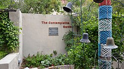
The Contemplative Garden at the Chihuahuan Desert Gardens

経済と教育の基盤

エルパソの経済は、軍事、教育、医療の3つの柱で支えられています。最大雇用主であるフォート・ブリスに加え、UTEPやテキサス工科大学のポール・L・フォスター医学部などの高等教育機関が、高度な人材と技術を街に提供しています。
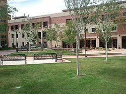
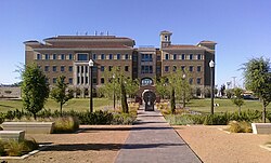
UTEP's College of Engineering building
Paul L. Foster School of Medicine within Texas Tech University HSC at El Paso's campus

医療分野でも、エルパソ子供病院を含む大規模な医療センターが整備されており、地域住民のみならず国境を越えた医療ニーズに対応しています。
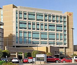
El Paso Children's Hospital at the Medical Center of the Americas

インフラと交通ネットワーク

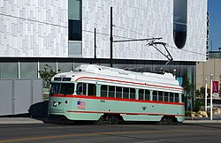
交通の要衝として、エルパソ国際空港やユニオン・デポ(中央駅)が機能しています。また、都市内部ではストリートカーが運行されており、観光客や通勤者の足となっています。
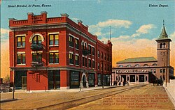
Hotel Bristol and the Union Depot at El Paso, Texas (postcard, c. 1912)
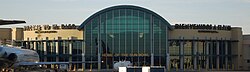
Airport Security Concourse at the El Paso International Airport
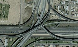
IH-10–US-54 Interchange
El Paso Streetcar on Santa Fe Street

メキシコとの国境を繋ぐ「アメリカの橋(Bridge of the Americas)」などの国際橋は、人々の往来と物流を支える極めて重要なインフラです。
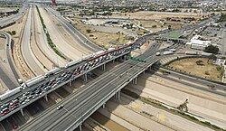
The Bridge of the Americas as seen from El Paso, Texas, in June 2016

市全体の地理的構成は、エルパソ郡の広大なエリアに及び、周辺の衛星都市やコミュニティを含めた広域的なネットワークを形成しています。
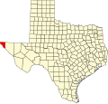
El Paso County map

都市概要まとめ

項目 詳細
人口(2020年) 678,815人
面積 約259平方マイル
標高 3,888フィート(約1,185m)
主要産業 軍事、教育、医療、貿易
主要教育機関 テキサス大学エルパソ校 (UTEP)
時間帯 山岳標準時 (MST)

Frequently Asked Questions

エルパソの主な愛称は何ですか?

「サンシティ(太陽の街)」や「エル・チュコ」という愛称で広く知られています。

市内で最も高い建物は何ですか?

2021年に建設されたWestStar Towerで、高さは314フィート(約96メートル)、20階建てです。

エルパソの気候の特徴は?

非常に乾燥した砂漠気候で、夏は極めて高温になり、冬は冷え込みます。年間を通じて日照時間が非常に長いのが特徴です。

街のシンボルとなっているものはありますか?

フランクリン山脈に設置された巨大な光る星のオブジェが、非公式ながら街のシンボルとして親しまれています。

主要な交通手段は何がありますか?

エルパソ国際空港や鉄道のユニオン・デポのほか、市内ではストリートカーやバスなどの公共交通機関が利用可能です。

最大の雇用主はどこですか?

米軍の拠点であるフォート・ブリス(Fort Bliss)が、市内で最大の雇用規模を誇っています。

References

  1. Official records for El Paso kept January 1879 to June 1947 at downtown and at El Paso Int'l since July 1947. For more information, see Threadex
  2. From 15% sample

📸 フォトギャラリー

Adobe buildings in "Franklin" c. 1850. Thought to be one of the earliest depictions of the settlement
El Paso, c. 1880
Map of the city in 1886
Downtown El Paso in 1908
El Paso Electric Railway traveling from Smeltertown in 1912
Mesa Avenue, the heart of El Paso, Texas (postcard, c. 1917)
General Pershing's punitive expedition camp near the border, El Paso, Texas (postcard, c. 1916): Franklin Mountains, left-to-right (i.e., south-to-north) are: Ranger Peak, Sugarloaf Mountain, and part of South Franklin Mountain
False-color satellite image of El Paso (upper right) and Ciudad Juárez (lower left): Paved streets and buildings appear in varying shades of blue-gray, and red indicates vegetation.
Wells Fargo Plaza
A large, illuminated star on Franklin Mountains has become an informal symbol of El Paso.
El Paso's upper valley in northwest El Paso
Madeline Park in Kern Place
Ysleta Mission
Palm trees in East El Paso
Snow in the Franklin Mountains in west El Paso
The Rio Grande in west El Paso, near New Mexico–Texas state line
Climate chart for El Paso
Helen of Troy Limited corporate office
Great River Raft Race held annually on the Rio Grande in El Paso's upper valley
Cleveland Square in downtown El Paso is where many of the festivals are held annually.
Viva! El Paso performance at the McKelligon Canyon Amphitheatre
Plaza theater at night
El Paso Museum of Archaeology, diorama shows Cueva de la Olla (cave of the pot – a large pot-shaped storage container for grain), Paquimé, Sierra Madre of Chihuahua
Asia exhibit entrance at the El Paso Zoo
Aerial view of Sun Bowl Stadium and Kidd Field
Don Haskins Center at the UTEP campus
The Wyler Aerial Tramway in the Franklin Mountains is the only commercial tramway in the state of Texas.
Bouldering on North Mountain at Hueco Tanks
The Contemplative Garden at the Chihuahuan Desert Gardens
UTEP's College of Engineering building
Paul L. Foster School of Medicine within Texas Tech University HSC at El Paso's campus
El Paso Children's Hospital at the Medical Center of the Americas
Hotel Bristol and the Union Depot at El Paso, Texas (postcard, c. 1912)
Airport Security Concourse at the El Paso International Airport
IH-10–US-54 Interchange
El Paso Streetcar on Santa Fe Street
The Bridge of the Americas as seen from El Paso, Texas, in June 2016
El Paso County map