アメリカ合衆国オハイオ州のモンゴメリー郡に位置するデイトンは、「航空の誕生地(Birthplace of Aviation)」として世界的に知られる都市です。また、「Gem City(宝石の街)」や「The Land of Funk」という愛称でも親しまれており、歴史的な革新性と現代的な都市機能が融合した魅力的な地域です。
1796年に設立され、ジョナサン・デイトンの名にちなんで命名されたこの街は、かつて運河や鉄道の要衝として発展しました。現在は、教育、医療、そして航空宇宙産業の遺産を継承する中西部の重要拠点となっています。
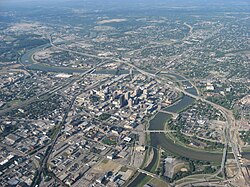
主要な事実(Key Facts)
- 航空の聖地: 世界初の動力飛行を実現したライト兄弟の功績により、航空史における最重要都市の一つとされる。
- 人口規模: 市内人口は約13.7万人(2020年)、都市圏人口は80万人を超える規模。
- 経済の柱: 医療ネットワーク(Premier Health Partnersなど)や教育機関が主要な雇用主となっている。
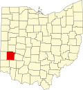
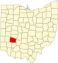
- 地理的特徴: オハイオ州西部に位置し、モンゴメリー郡の郡庁所在地である。
歴史と革新の軌跡
航空産業の黎明と発展
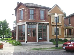
デイトンを象徴するのが、航空技術への多大な貢献です。ライト兄弟の精神は今も街に根付いており、航空遺産国立歴史公園などの施設がその歴史を伝えています。また、第二次世界大戦中にも重要な役割を果たし、戦後の技術革新へと繋がりました。
都市を襲った大洪水と復興
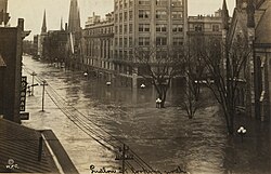
1913年に発生した「デイトン大洪水」は、街に甚大な被害をもたらしました。しかし、この悲劇を乗り越えるために構築された治水システムは、後の都市計画のモデルとなりました。
産業の変遷と初期の街並み
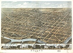
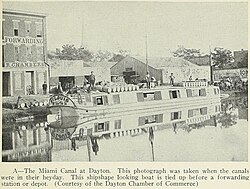
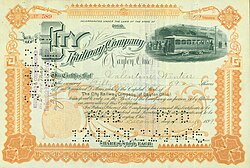
19世紀後半から20世紀初頭にかけて、デイトンは運河や鉄道による物流の拠点として急速に成長しました。当時の面影を残す歴史的建造物や、かつての運河の跡が街のあちこちに見られます。
都市の構造とライフスタイル
建築と景観
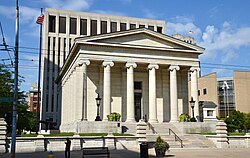
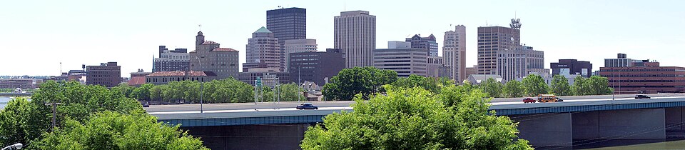
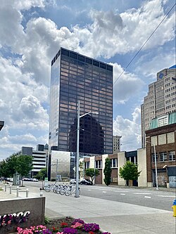
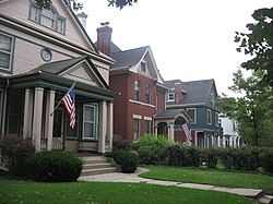
デイトンの街並みは、歴史的な地区と近代的な高層ビルが共存しています。ストラタキャッシュ・タワーのような現代的なランドマークがある一方で、グラフトン・ヒルのセントラル・アベニュー歴史地区のような、伝統的な建築様式が保存されているエリアもあります。
文化・芸術とエンターテインメント
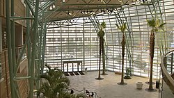
芸術面では、ベンジャミン&マリアン・シュスター・パフォーミングアーツセンターなどの施設が充実しており、バレエや音楽などのハイカルチャーが市民に親しまれています。また、毎年開催されるデイトン・エアショーは、街のアイデンティティである航空への情熱を象徴するイベントです。

食文化とスポーツ
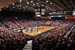
地元で愛される「デイトン・スタイル・ピザ」などのユニークなグルメが楽しめます。スポーツ面では、デイトン・ドラゴンズ(野球)や、大学スポーツのデイトン・フライヤーズなどが地域を盛り上げています。

社会基盤と教育・医療
高度な医療ネットワーク
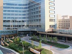
デイトンは医療産業が非常に盛んであり、プレミア・ヘルス・パートナーズやケタリング・ヘルス・ネットワークといった大規模な医療機関が、地域住民のみならず広域から患者を受け入れています。
教育機関の充実
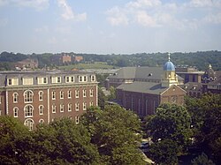
デイトン大学(University of Dayton)をはじめとする高等教育機関が、街の知的基盤を支えています。公立学校から私立、チャータースクールまで多様な教育選択肢が提供されており、次世代の育成に注力しています。
交通インフラ
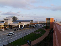
交通面では、デイトン国際空港が空の玄関口となり、I-75などの主要高速道路が都市間移動を円滑にしています。また、地域を網羅する自転車道(バイクトレイル)も整備されており、環境に配慮した移動手段が推奨されています。
![Dayton Regional Bike Trail Map[159]](/images/c1/1f/c11fdce41a923baa8cb618df1612ad76ef19abab32f35446ec9d680769d93673.jpg)
地域データまとめ
デイトンの基本情報を以下の表にまとめます。
| 項目 | 詳細 |
|---|---|
| 設立年 | 1796年(市制は1841年) |
| 人口(2020年) | 137,644人 |
| 面積 | 約56.96平方マイル |
| 主要産業 | 医療、教育、航空宇宙 |
| 愛称 | Gem City, Birthplace of Aviation |
| 主要雇用主 | Premier Health Partners, Kettering Health Network |
よくある質問(FAQ)
デイトンが「航空の誕生地」と呼ばれるのはなぜですか?
世界で初めて動力による有人飛行に成功したライト兄弟が、この地で活動し、航空技術の基礎を築いたためです。
街の主要な産業は何ですか?
現在は医療サービス(Premier Health Partnersなど)や教育(デイトン大学など)が最大の雇用を生み出しており、経済の柱となっています。
観光で訪れるべきおすすめの場所はどこですか?
航空遺産国立歴史公園や、近代的なシュスター・パフォーミングアーツセンター、歴史的なグラフトン・ヒル地区などが代表的です。
デイトンの気候の特徴は?
四季がはっきりしており、夏は高温多湿、冬は降雪を伴う寒冷な気候となります。年間の平均降水量は約1,050mm程度です。
どのようなスポーツが盛んですか?
マイナーリーグのデイトン・ドラゴンズ(野球)や、NCAAディビジョンIに所属するデイトン・フライヤーズのバスケットボールなどが非常に人気です。
References
- This is far less than the snowbelt regions of due to distance from the and slightly less than the generally warmer .
- Mean monthly maxima and minima (i.e. the expected highest and lowest temperature readings at any point during the year or given month) calculated based on data at said location from 1991 to 2020.
- Official records for Dayton were kept at the Dayton COOP from June 1893 to July 9, 1911, alternating between the Weather Bureau Office and from July 10, 1911, to December 1947, and at Dayton Int'l since January 1948. For more information, see Threadex
- Mean monthly maxima and minima (i.e. the expected highest and lowest temperature readings at any point during the year or given month) calculated based on data at said location from 1991 to 2020.
- The station location is 39°45′49″N 84°11′29″W / 39.7636°N 84.1915°W / 39.7636; -84.1915, less than 100 m (330 ft) from the banks of the .

📸 フォトギャラリー